February 2016 Was Warm and Dry for Colorado

The NCDC released February's climate summary Tuesday morning showing Colorado was 5-degrees warmer than average and was 0.26-inches drier than average. This probably isn't too surprising following our last update reading: "Colorado's Mountains Have Driest February in 30 Years."
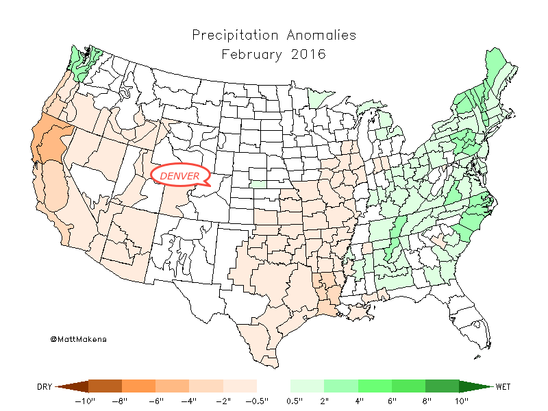
The map below shows the precipitation anomalies (below/above average) for February across the country. Note the very dry conditions across California, the southwest, and south-central United States.

Drilling down into the Denver climate region, which is the Platte River Basin, the temperature was nearly 6-degrees warmer than average and was 0.26-inches above average. The notable moisture came from the two-day system to start the month that covered Denver in roughly a foot of snowfall.
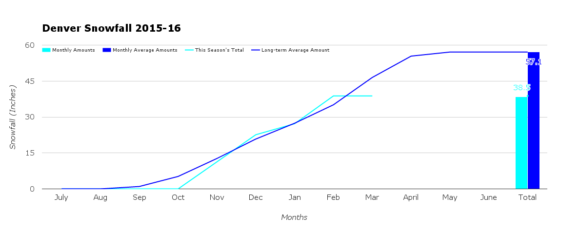
Speaking of which, Denver's February was 5.1-degrees warmer than average with 0.11-inches above average precipitation (0.48-inches total). Of that moisture, 11.6-inches was snowfall and that is 3.9-inches more than an average February snowfall.
This chart shows you Denver's snowfall this season as it has compared to average:
End of meteorological winter
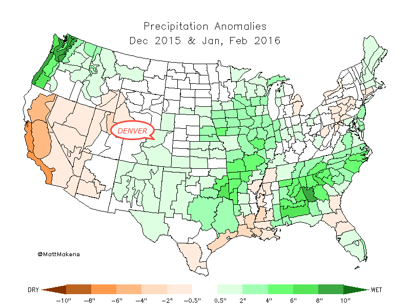
March 1st also marks the end of winter in the meteorological community. The winter was just over 2-degrees warmer than average for the state and was nearly average with 0.07-inches more precipitation than average.
This map shows the precipitation anomalies (below/above average) for the winter months across the country:
The outlook for March "appears" to remain more active than February. However, in the end, we may be banking on one good storm just as February did. By comparison, we do see a few more systems to form and pass through the region in March, as we've mentioned numerous times at this point. Should one or more align itself just right we could end up with a wet month.
Quick outlook
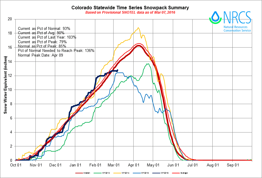
There is the potential for a system this weekend and another next week. Both could bring valuable moisture to the state, and likely will. The mountains really need whatever they can get as the snowpack is below average statewide now, as you can see below. The little uptick at the end of the dark blue line is yesterday's snowfall:
The first of these two systems will move through this weekend and the GFS/Canadian ensemble model runs show some accumulation. Note, this is not a forecast for the weekend's snowfall but rather a simple visual of snowfall potential (as clearly there is not much consensus just yet):
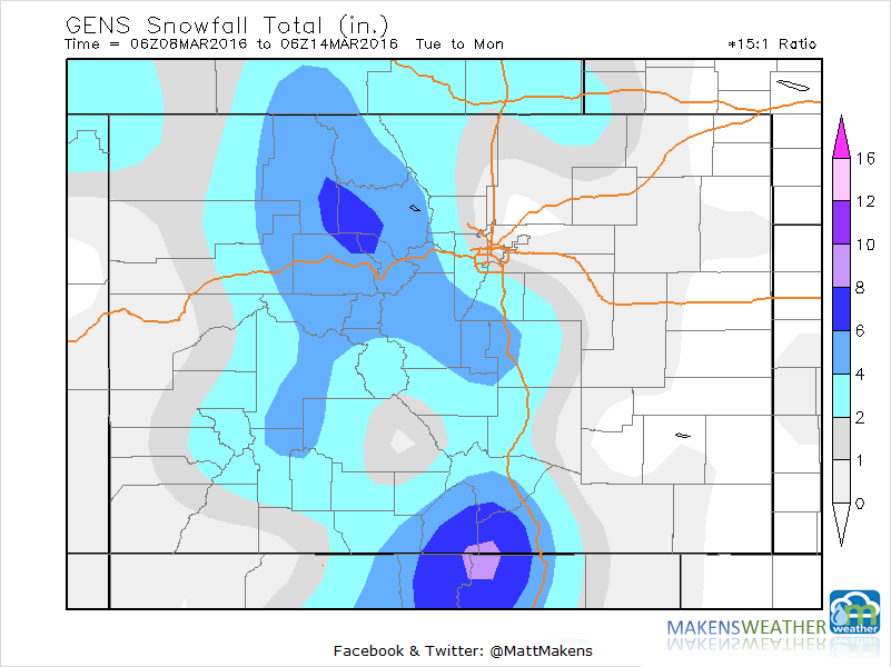
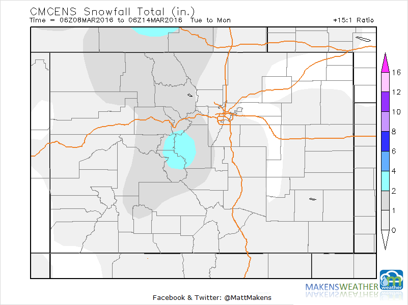
So, please don't take these snowfall accumulation forecasts to heart just yet. Weather5280 will provide you forecasts in another post. We need the moisture, do your snow dances!