Tuesday PM Update: Good Snow for Northern Mountains; Update on Late Week System

You'll recall from our last system (many weeks ago...) that the Canadian was out front in forecasting snow, and by the time the GFS caught up, the Canadian had backed off nearly completely for the metro area. The main energy associated with that system ended up too far west as it dropped south out of the northern Rockies, leaving most of Denver with little snow, but dropping a good amount on the Front Range foothills.
We've seen a similar process with our system due in later this week. The Canadian was going bananas with snow last week, GFS wanted nothing to do with it, and then we saw them both flip late this last weekend. Today, they're in better agreement, both showing minimal snowfall Thursday and Friday across northeast Colorado.
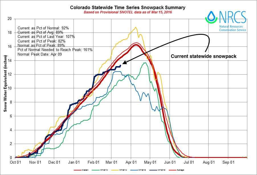
The problem is, we need snow. Our snowpack continues to run below normal after several weeks of mild weather has dominated the state. As of today, statewide snowpack was estimated at 92% of normal, just slightly better than where we were at this time last year. You can see in the chart below how this compares to recent years, the slight uptick at then end of this year's line is last night's snowfall:
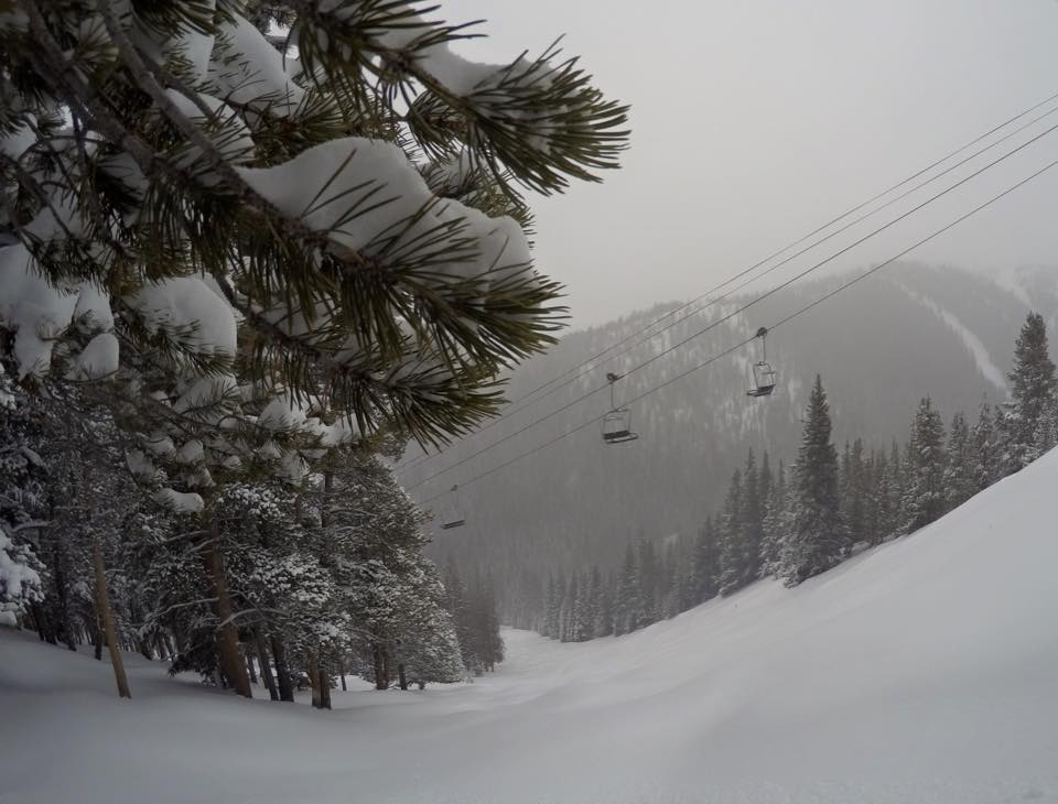
Fortunately the northern mountains did see some good snowfall over the last 24 hours, and will see some more snow through the remainder of the week. The forecast looks less promising for those living in southern Colorado, and east across the Plains.
Late week system update
All that being said, our next system due in Thursday and on into Friday will indeed bring some changes to the lower elevations of northeast Colorado, and at least the chance for some snowfall. So far this week we've seen our fair share of wind, and today some much cooler temperatures as well.
At this point it looks like most locations at lower elevations won't see more than a few slushy inches of snow, with many locations seeing little to no snowfall at all. Of course this could all change, if we see a slightly more favorable setup take place than is currently progged. Model agreement right now would suggest about Trace - 4" of snow across the urban corridor is possible, but doesn't factor in things very well like surface temperatures (melting), and any early onset rainfall that may occur.
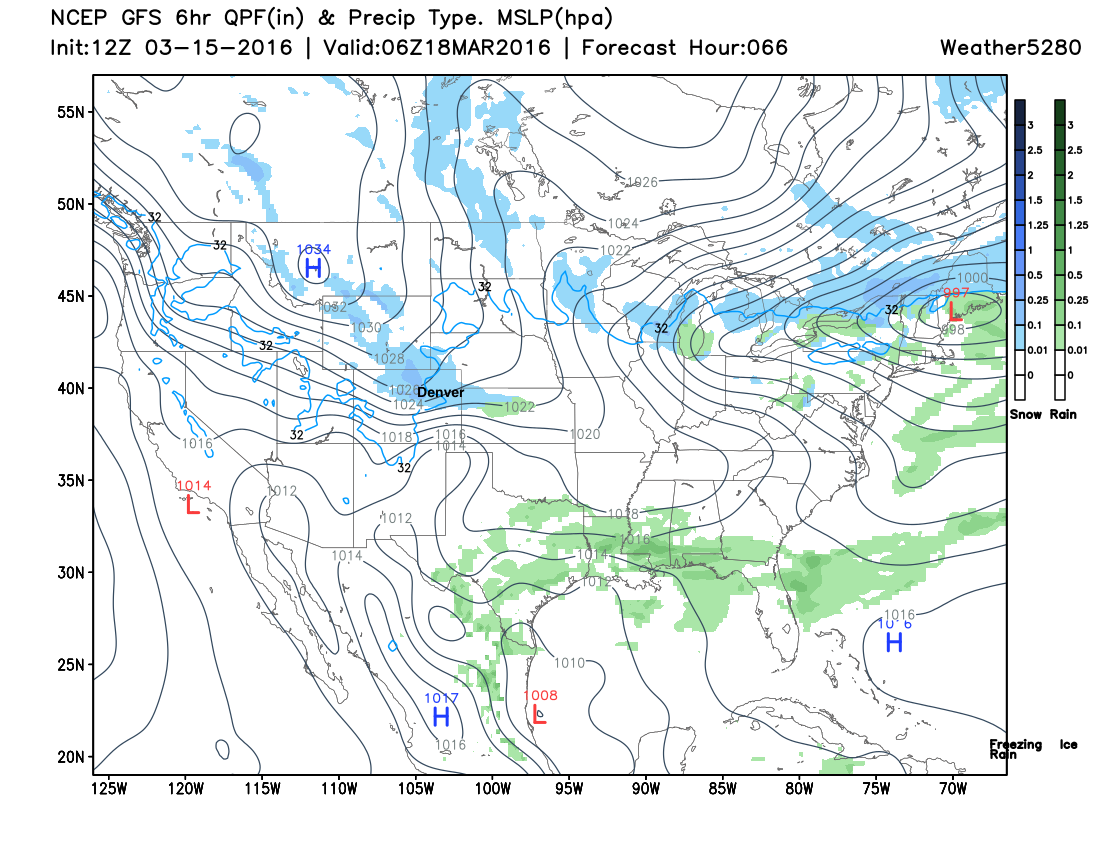
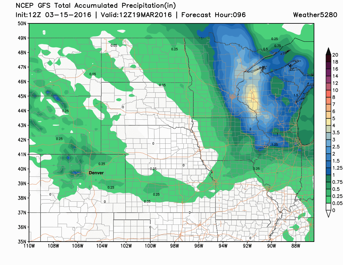
Unfortunately, it's not looking like a huge amount of precipitation with this event at this time. The latest GFS shows 0.10 - 0.5" of QPF across northeast Colorado, with heaviest totals focused across the northern border. This will largely depend on where the heaviest banded snowfall is able to setup Thursday night, for where the greatest moisture will be found. The EURO deterministic remains a bit more gung-ho with more widespread moisture/snow, but for KDEN matches pretty will with its ensemble mean, producing about 0.3" QPF.
Still some time to see how this system will progress. A bit better track would mean a better chance at accumulating snow at lower elevations, a continued trend in how things have gone early this week would mean a much lower chance for seeing any accumulating snow at lower elevations. Time will tell.
As we discussed this last weekend, likely not a huge storm for us, but at this point we'll take any moisture we can get. Great to see the northern mountains getting some snow, but we'll need more than that and a better setup for southern/eastern Colorado if we want don't want to continue losing precious snowpack.