The State of the Atmosphere: Sunday, April 3, 2016

What a spectacular first weekend of April we just had. Highs both Saturday and Sunday were mostly in the 60s (we did hit 72° at our station this afternoon) and at times there was not a cloud in the sky. Spring fever is in full force after a wintry end to March.
The week ahead
The week ahead will feature more of the same, with generally above normal temperatures and mostly dry conditions across the greater metro area.
There will be one disturbance, as we discussed on Friday, that will roll through Monday night and Tuesday which will reintroduce a better chance for snow showers at higher elevations, and possibly some rain and thunder across the plains. For the urban corridor, it looks like this will translate mostly into a bit of a cool-down Tuesday, but may not produce much precipitation here as downsloping winds will likely dominate off the Rockies.
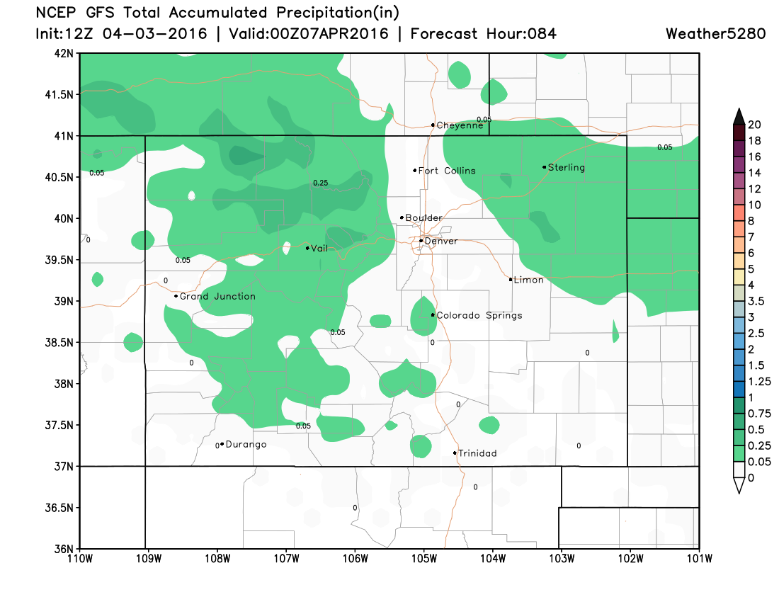
The GFS shows this quite nicely, with some precipitation (in the form of snow) for the north-central mountains through Wednesday, and some rain chances northeast of Denver. Overall pretty dry along the I-25 corridor through midweek, with likely breezy conditions and cooler temperatures being the biggest impact from this first system Monday night and Tuesday.
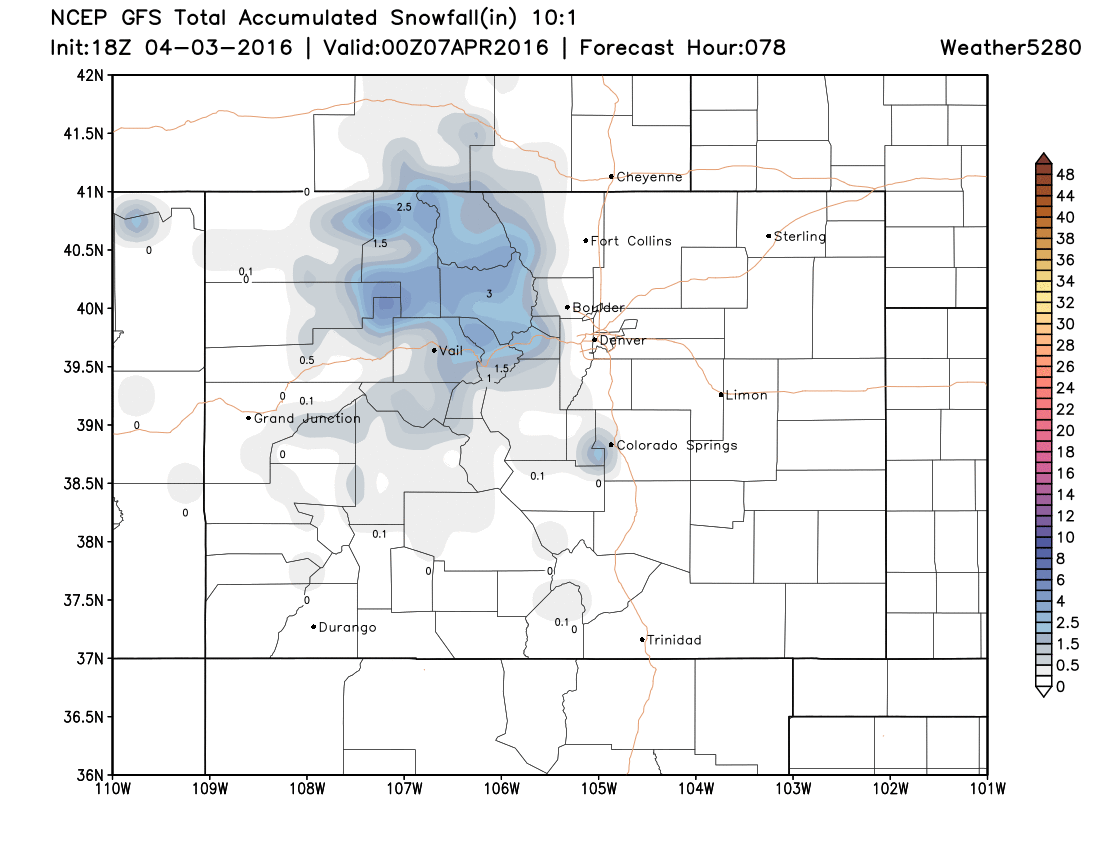
And here's a look at projected snowfall through Wednesday:
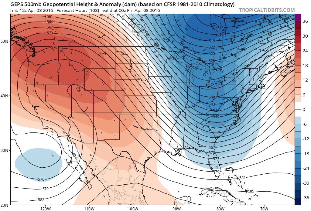
By Wednesday the ridge reestablishes itself across the region, which will lead to another handful of beautiful days to end the work week. By Thursday highs will be back in the mid to upper 60s, with temperatures near or even breaking 70 for Friday and again possibly Saturday.
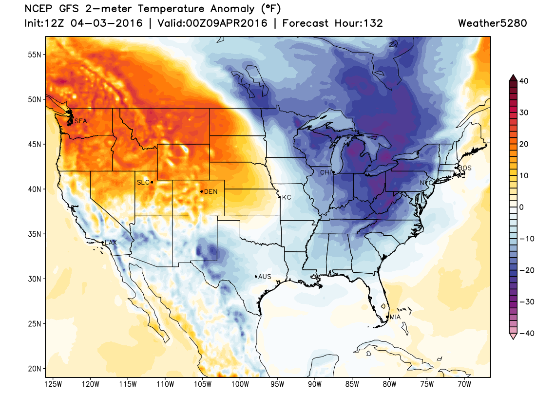
Here's a look at the temperature anomaly forecast for Friday afternoon – it'll be much warmer than average across the northwestern U.S. and High Plains, with chilly air focused over the eastern seaboard.
By next weekend we need to start paying attention again as there's at least decent agreement between the models that moisture will return to the region. Timing, impact, how much cold air will be available... you know the drill, those are all open ended questions at this point.
There will be a strong cutoff low that will moving into the west by late this week, and eventually will likely start to impact our weather as well. While models are producing quite a bit of QPF next weekend, there's a lot of disagreement on where that QPF ends up, due largely to a great deal of uncertainty surrounding how this low will progress, and how the northern branch will play into it.
The GFS has been pretty wet over recent days for Colorado from late Saturday through Monday, while the EURO has generally been drier and faster to move the energy east. Both show some good mountain snowfall for the weekend, but what happens east remains a bit more in question.
For now, will introduce cooler temperatures by late Saturday and certainly for Sunday, as well as a mention of rain and snow. For the time being, most of the various solutions would be more rain than snow at lower elevations, but moisture nonetheless.
Of course, April is Denver's second snowiest month on average, so we certainly need to pay close attention to these systems. There's a great deal of uncertainty with how this pattern will evolve for next weekend, so no reason to get too excited (or concerned) with it just yet. For now, focus on enjoying a beautiful first full week of April, and keep an eye out for some showers and storms on Tuesday.