Weekend Outlook: Mountain Snow Returns, Rain Chances For Eastern Colorado

We are approaching another weekend and as spring fever sets in for you, we are happy to report an overall nice weekend for cleaning up the yard, hikes, etc. That is, for the low country and cities.
If you are headed into the mountains there will be some snow coming down at times this weekend. The southern mountains will see the snow first, and that snowfall will move northward into the northern ranges through Sunday.
The Setup
There is a storm system that is off the California coast that will "spin" moisture toward the southwestern US the next several days. That moisture will creep into the state, again from the south to the north, but so much of the moisture will stay over the southwestern US that the state itself won't have a ton to spread around.
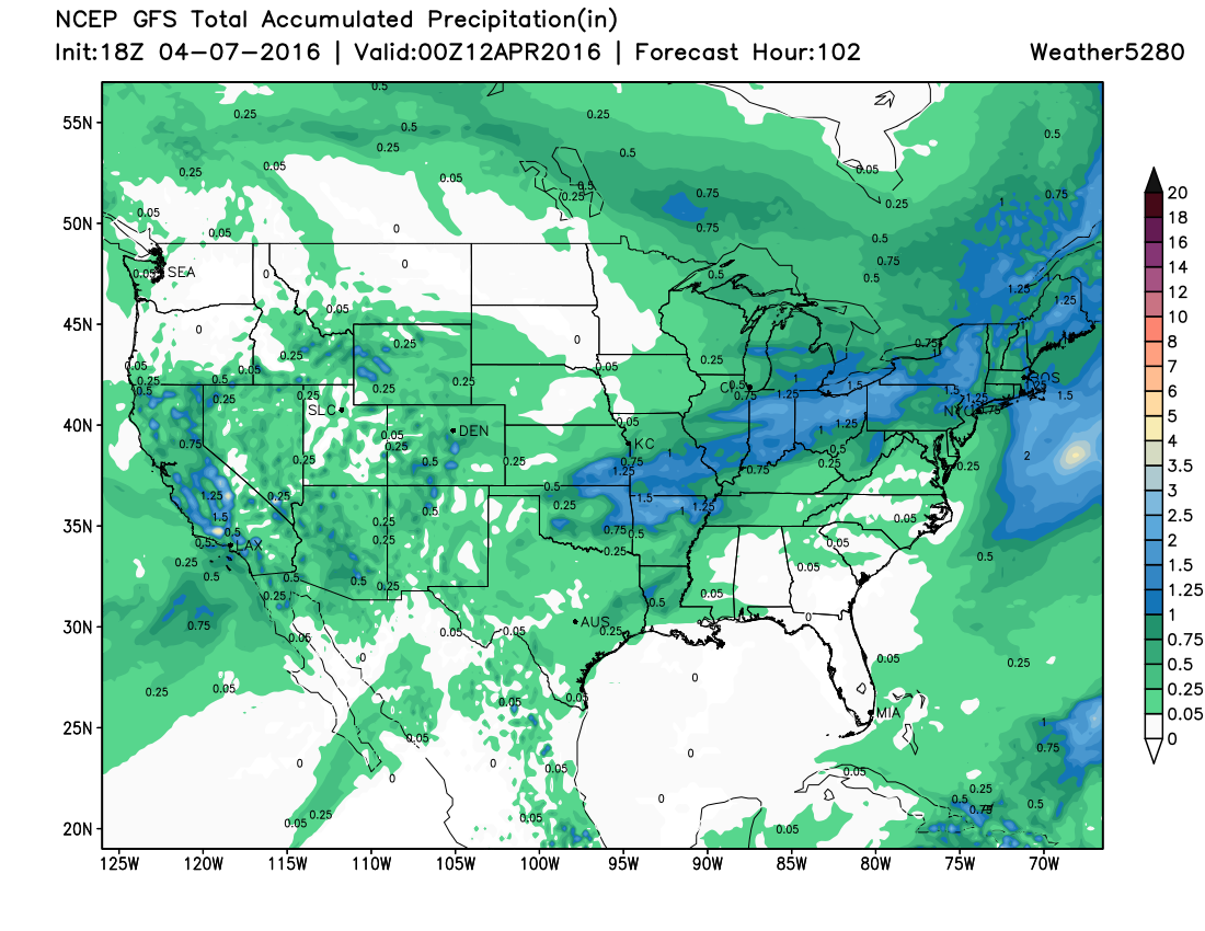
You can see here, the total moisture spreading out showing you both rain/snow/thunderstorms/etc. now through Monday night.
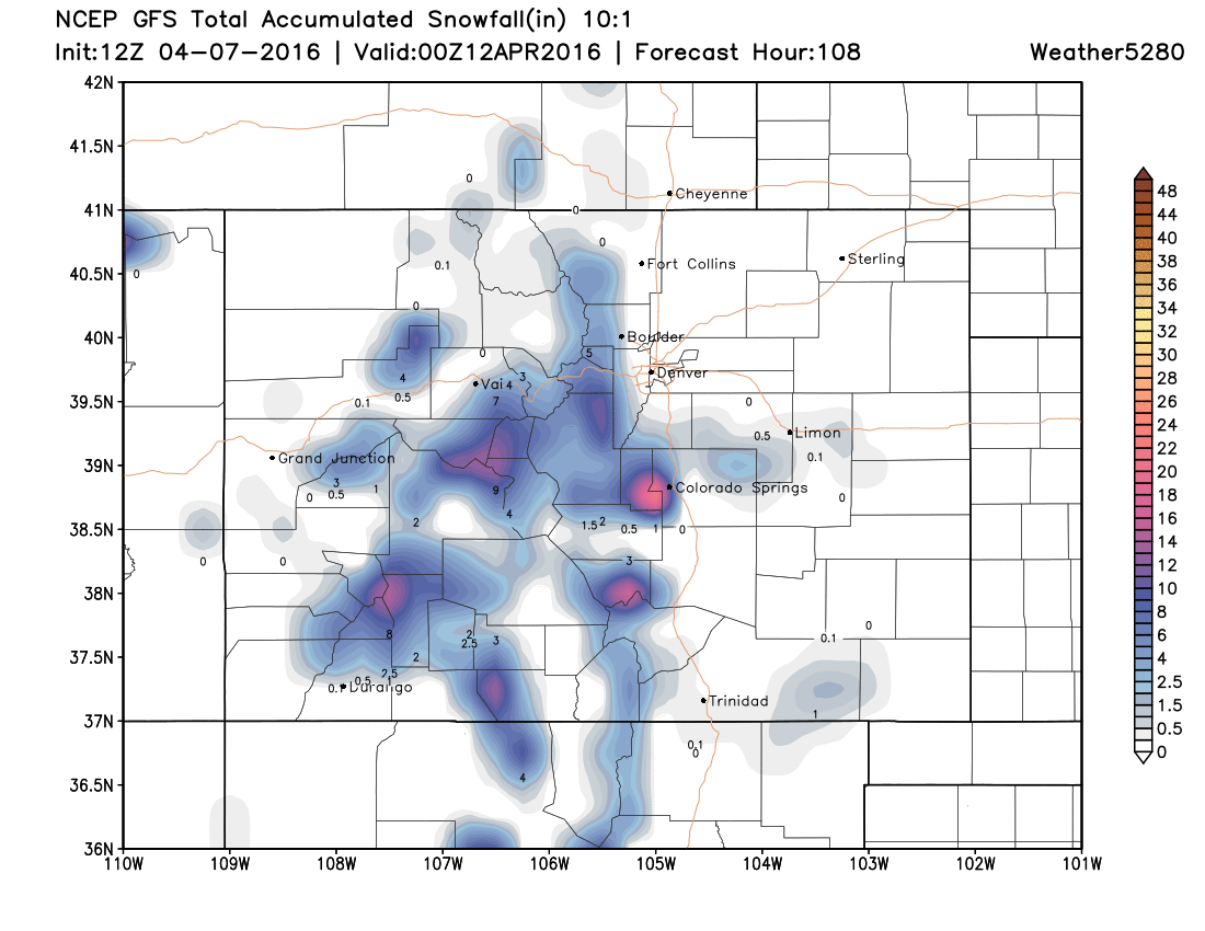
Mountain Snow
Let's take that moisture and look at just the snowfall to come. You can see that snowfall spreading in a narrow band from south to north across our mountains. Good fresh snow for late-season skiers.
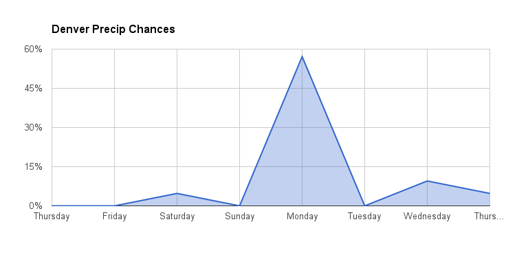
Front Range Rain
The moisture that is left over after this long track will move over Denver and some of the plains as rain showers and thunderstorms. There is a slight chance to see something late Saturday but the better chance is later Sunday and on into Monday. Here you can see that chance for precipitation for the city.
Warm Temperatures
The 60s will feel great for the Rockies' opening day at Coors Field. Those 60s and some 70s will continue Saturday and Sunday. Again, that is a slight chance for rain/thunder Saturday and better chance into Monday. With Monday's higher rain chance temperatures will cool into the 50s.
We'll track rain and snow chances closely over the next several days, and offer another update on Sunday and Monday's forecast if needed. Enjoy your weekend, and go Rockies!