In the Weekend Battle of Rain vs Snow, Snow Likely Wins in Many Locations

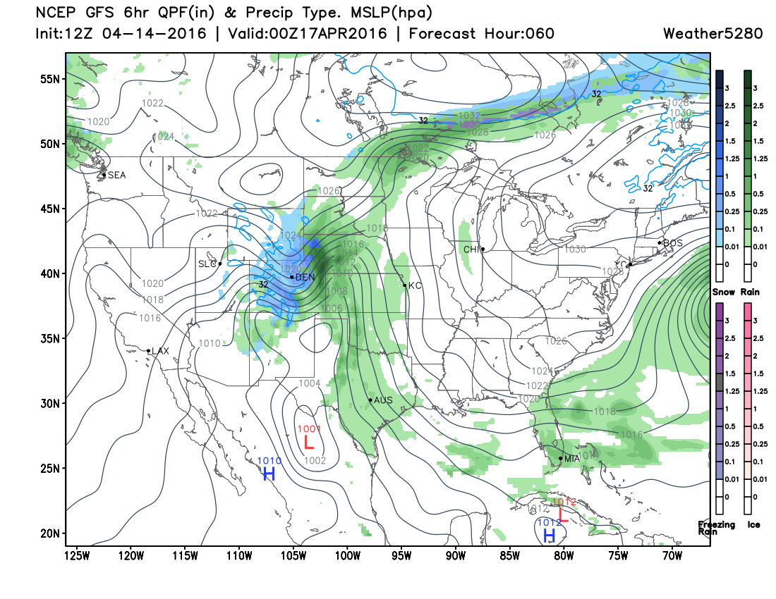
So many ingredients have come together to make this weekend's storm a significant one in terms of how much moisture will fall. The Front Range has been consistently projected to receive 1.5" to 3" of total water by Monday when the storm slowly winds down. It has become increasingly clear that the majority of that water will fall as a heavy, slushy snow over the greater metro area and portions of the eastern plains.
What remains to be seen at this point is where does the system ultimately stall (if in a different location than the 4-Corners) and how big of a role do eastern plains thunderstorms play in robbing or saving the water that is to fall over the Denver area.
Timing
Thursday is "the warm before the storm"; there is an isolated chance for a thunderstorm too, but highs across eastern Colorado will be very warm, with 70s to near 80 degrees for highs and a Red Flag Warning out across the plains.
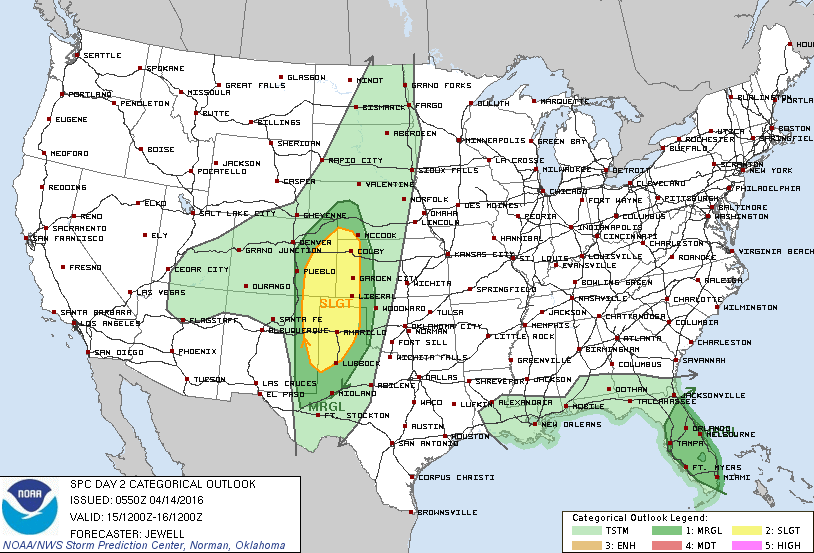
Friday, the storm system enters the region near the Four Corners, where it will stay throughout the weekend continuing to pump moisture over us. With that, Friday will become stormy, especially east of Denver and Colorado Springs where severe weather is possible. Hail, damaging wind, even a chance for tornadoes exists on the plains Friday afternoon and night:
Denver has a chance for rain Friday into Friday evening, but it appears that it will not take long for any rain to change to snow later Friday and then stay as a wet snow through Saturday, Sunday, and into Monday.
Tuesday, the storm will likely be much weaker and slowly dying out over the area as it struggles to move east of here.
Total precipitation
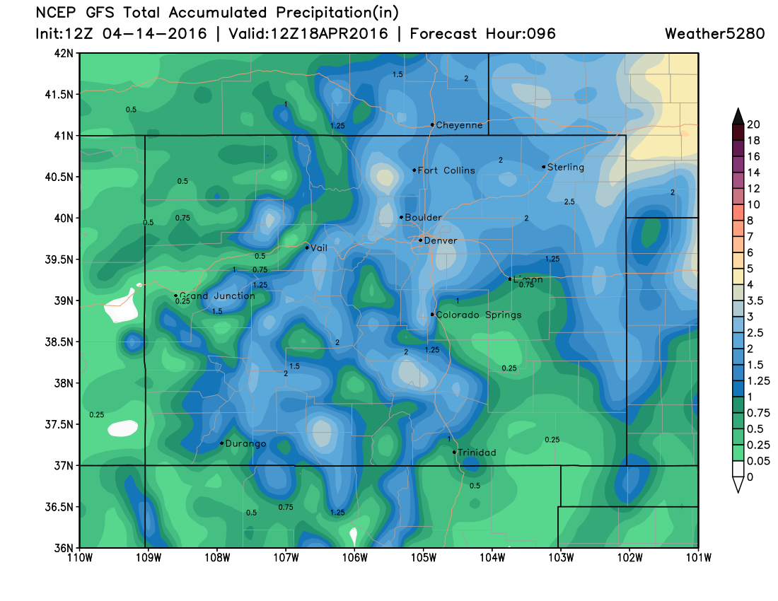
As you can see from this image, a lot of moisture will be falling from late Friday through Monday. This is showing you the total water that is to fall by Monday morning - 1.5 to nearly 4" of water is possible across the Front Range. More will fall over Nebraska and Kansas.
Significant snowfall for many
Now to the big question, how much snow? First, realize that this is April and we are coming out of warm days and nights and there will be a lot of melting of this snowfall. It's not as though we will have every inch of this storm stick around. This is going to be a classic slush-fest of a snowstorm, and your trees will be a victim if they've leafed already. Furthermore, this storm will cause power outages in the usual areas, plus any area that has hard-hit trees.
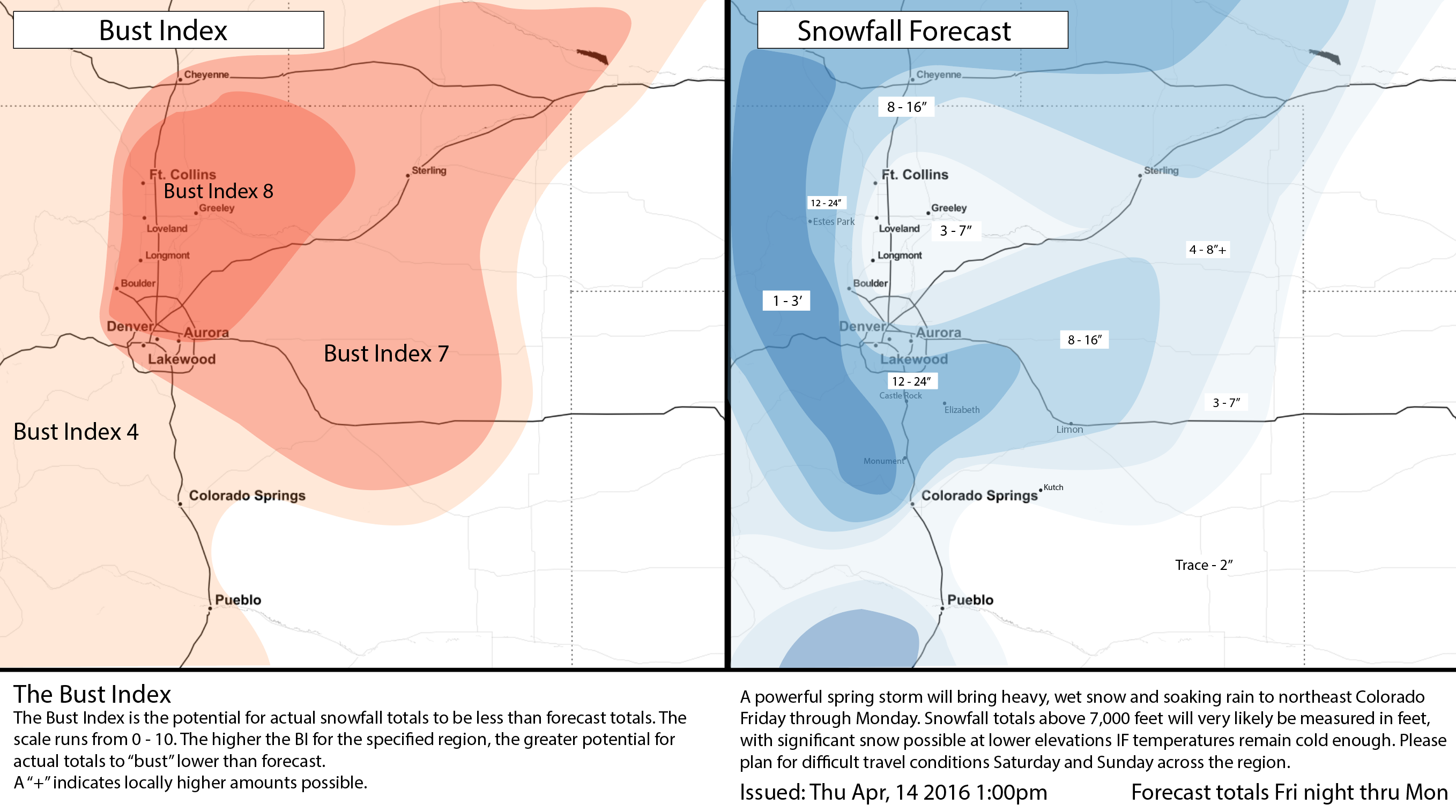
Okay, on with the snow talk. Well, let's assume that the rain only amounts to a small amount and the rest is snowfall. That 2 to 3" will fall at a snowfall ratio around 7:1, meaning there's potential for one to two feet of snowfall to come from all that water. Higher totals will be above 7,000 feet west of the city and on the Palmer and Cheyenne Ridges. Lower totals will be below 5,000 feet – those near Greeley and elsewhere along the Platte River Valley north of Denver may come away with far less than that which falls on the west and south side of Denver.
There's also a high likelihood of very strong wind along with this snow event, particularly Saturday. Blizzard conditions may certainly be possible in spots, especially along the Palmer Ridge.
Travel Impact
Wind and snow will be the big impactors, along with thunderstorms early on in the storm.
Friday travelers, the zone to watch out for is that thunderstorm zone over the plains.
Assuming the timing of the system does not change, those flying out of DIA may have a tough time at the airport anytime after early Saturday morning. Drivers on I-25, I-76, I-70 (both east and west) and Hwy 287 will all have to deal with less than ideal roadways.
Wyoming and the Nebraska Panhandle will have some heavy snow this weekend, too, so slow going in those areas.
By the time Monday gets here, the intensity of the system will likely (again, if the storm doesn't change between now and then) be weak enough that we will see a quick improvement to the major roads.
A lot to track over the coming days, we'll pass along any updates to the forecast as needed. Please subscribe to Weather5280 if you haven't already and stay ahead of the storm!