A Chilly, Wet End to the Week for Colorado; Heavy Snow for Some

If you caught Brian's update last night you'll know the sunshine we've seen for much of the day today around town will be short-lived as more wet weather is set to return to end the week.
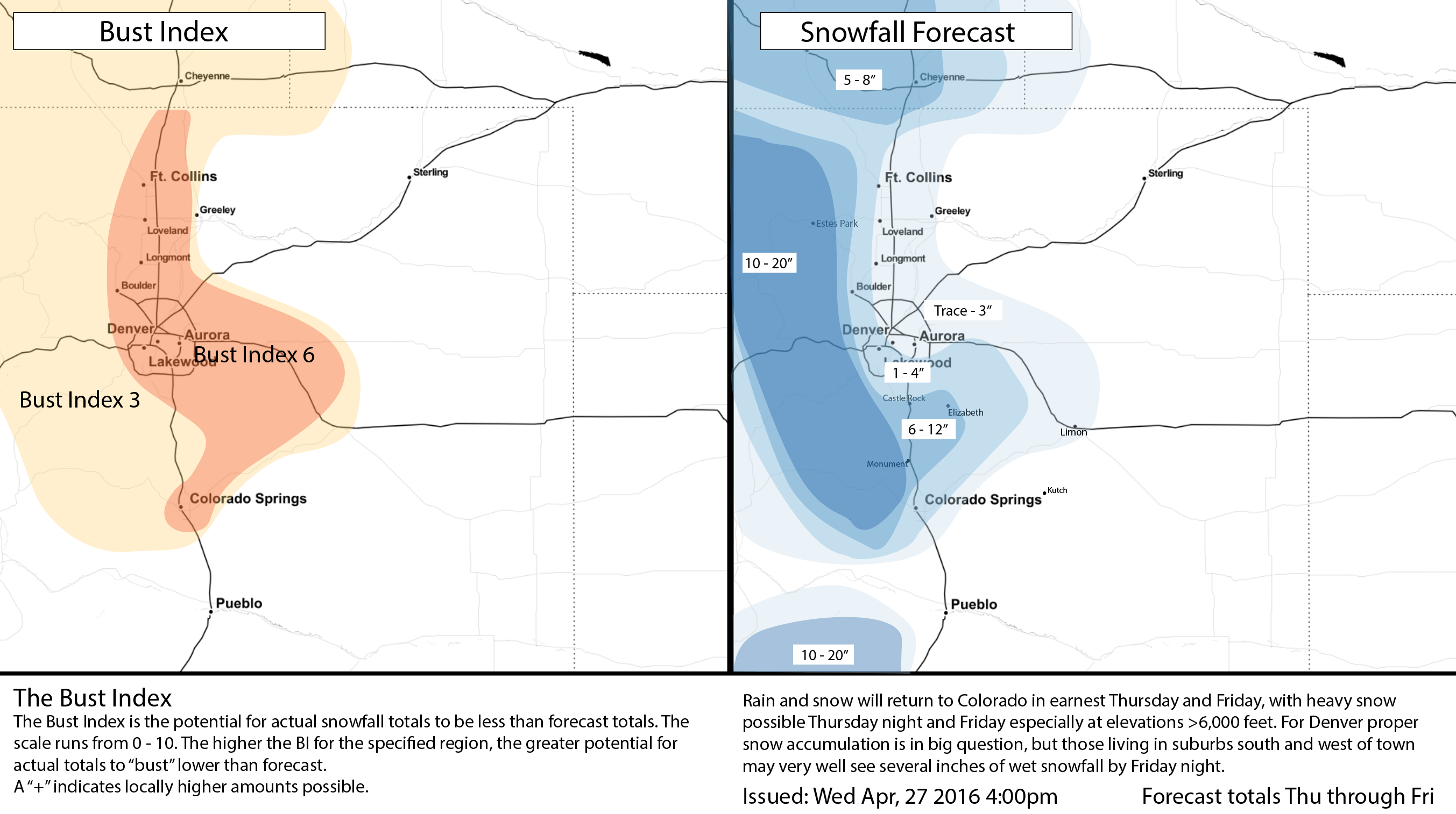
Today the National Weather Service issued a Winter Storm Watch for the Front Range mountains where upwards of 10 - 20" of snow will be possible from Thursday afternoon through Friday. For now, the Watch is focused on locations >6,000 feet, with the NWS leaning toward more of a rain/snow mix at lower elevations at this time.
This, of course, is the million dollar question: where will that rain snow line set up? Many models today are showing the potential for some slushy accumulation below 6,000 feet, with likely the best chance for this to occur coming Thursday night into Friday. During the day Friday precipitation will continue for the region, but we'd expect to see rain mixing in at lower elevations.
So, the big picture is... it's going to be pretty soggy next several days, with possibly rain and snow lingering well into Monday for many locations across the state. For the metro area, the biggest push of moisture looks to arrive Thursday night and hang around through Friday before letting up a bit for the weekend, though even the weekend forecast doesn't look completely dry. A look at the national precipitation forecast from the GFS shows a very wet period for Colorado from today through Monday:
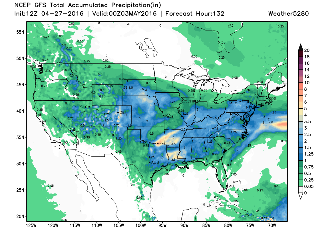
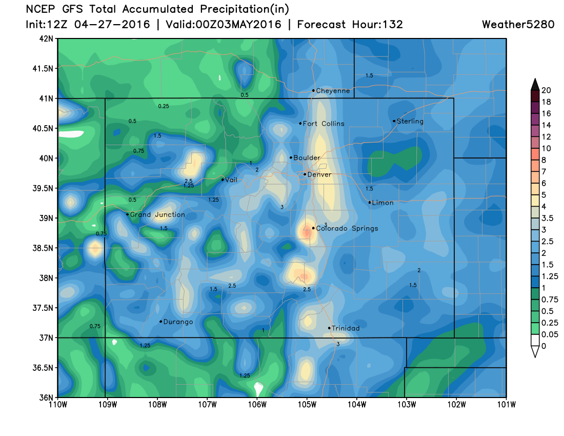
A closer look at Colorado shows the potential for several inches of liquid through the weekend around Denver, but in the form of rain and snow. FWIW, it's shown that max of ~4 inches of the east side of Denver for several days now...
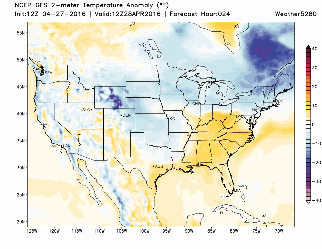
Along with the wet weather will be continued below-normal temperatures. In fact, the GFS doesn't have our temperatures warming to above normal until the middle-to-latter half of next week. You'll note in the GIF below a lot of blues centered over Colorado. This indicates temperature forecast below normal, with just a hint of yellow showing up in the last frame next Wednesday:
So, we know it'll be wet, we know it'll be chilly, but what about the snow... That's the tricky question that is still a big unsolved. We're feeling pretty good about seeing some heavy snow at higher elevations Thursday night through Friday, but what happens below about 6,000 feet remains a bit more of a gamble. The EURO/CMC/NAM are all showing snow at lower elevations, with the CMC going bananas (likely too bananas) with snowfall across Denver and Colorado Springs. Meanwhile, the GFS really keeps snow confined to higher elevations, but then again often has a warm bias. Considering much of this snow would likely come during daylight hours Friday, and they we're now in the last days of April, we'll lean low end for snow <6,000 feet, and adjust our forecast tomorrow if necessary.
With that, below is our initial snowfall forecast for tomorrow afternoon through Friday night. For Denver, we'll go with a high BI, with the greatest chance for accumulating snow being for those on the city's west, south, and southeast sides, with lower chances downtown. From Downtown northeast, we'll go with just a Trace to 3" of snow, with 1 - 4" as you head south and southwest. We'll give a similar forecast for Colorado Springs, with 1 - 4" on the east side, and the potential for 2 - 6"+ on the west/northwest side. We'll track things closely tonight, and offer any changes to this forecast we think necessary tomorrow.