Thursday PM Update: Rain and Snow Set to Bring Wintry End to April

Our storm system remains on track to bring plentiful moisture to Colorado over the next several days, with a good chance for snow for many of us as well. While we've seen some rain and snow already this morning across much of the region, our main weather maker for the next several days remains southwest of Colorado at this time, with widespread rain and snow holding off until Thursday night and Friday for northeast Colorado.
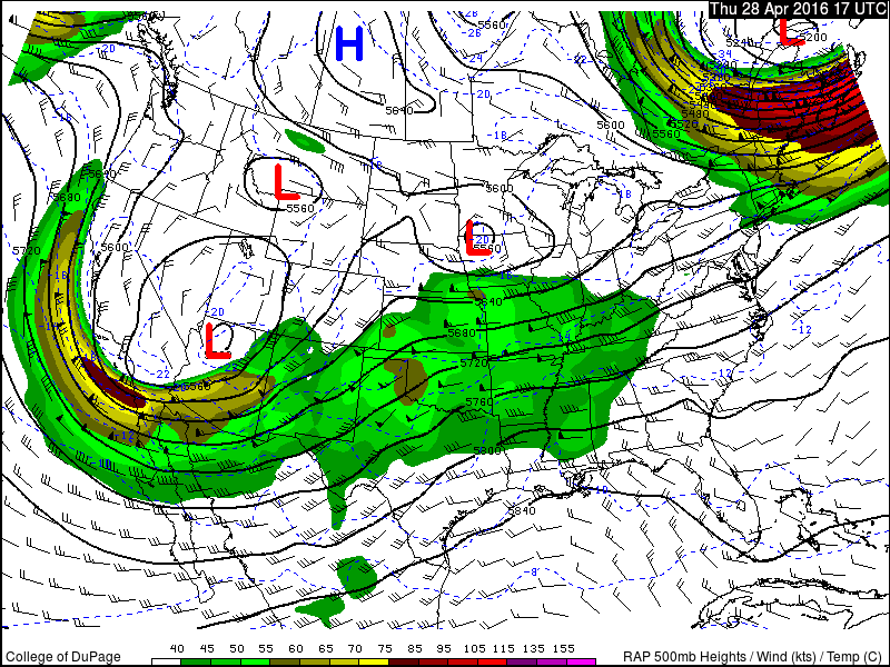
This Low (storm system) will eventually track into the Four Corners region Thursday overnight into Friday. With that, our chance of rain and snow will increase Thursday night and we'll continue to see a good chance for precipitation all day Friday into Friday night. By early Saturday, the main disturbance finally moves east of the area, which will mean our rain and snow chances will be lower (but still exist) as we head into what looks like a chilly weekend.
As we discussed yesterday, where exactly the rain/snow line – and possibly more importantly – where the accumulating snow vs non-accumulating snow line ends up will remain tricky to pin down. Trends over the last several model runs have been toward a bit colder temperatures, thus indicating more snowfall potential at lower elevations. However... much of that snow may fall during daylight hours Friday which would limit accumulation especially across the Denver area (remember our last system!).
Timing
Rain and snow showers will continue off and on through the remainder of the day, with mostly spotty coverage through Thursday evening. As our system track east overnight our rain and snow chances will increase, with heavy snow becoming possible overnight (especially south of Denver) then becoming likely along the I-25 corridor early Friday morning, continuing off and on all day Friday.
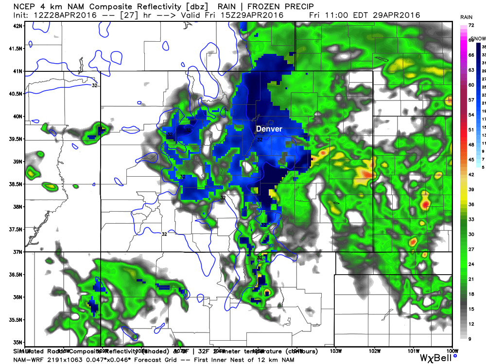
If we look at the latest 4km NAM (high-resolution model) simulated radar we see where it thinks the rain vs snow will be around 9am Friday morning. You'll note it's indicating all snow for the metro area, but also has the 32-degree line west and south (over the Palmer Divide), with temperatures likely near or slightly above freezing in Denver. Precipitation across the eastern Plains should at least initially begin as rain, though even out east we may see some snow Friday.
The heaviest rain and snow should eventually work northeast of the Front Range as we head into Friday night but rain and snow chances will continue off and on through the upcoming weekend.
Precipitation totals
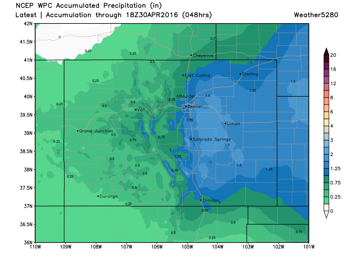
Models are in decent agreement producing about 0.8" to 1.8" of liquid through Friday evening across most of eastern and central Colorado. The GFS remains a bit wetter than some of the other models, but it too has sliced its QPF in its most recent run to be better aligned with the other models. The latest WPC precipitation forecast shows this pretty nicely, though they may be a little light of liquid across some of the higher terrain west of Denver and Colorado Springs. Great moisture!
Snowfall totals
And here's the part of the forecast that remains tricky. It seems like in recent years we've had some pretty wet springs but with each storm we were a degree or two too warm at lower elevations to see much snow. So far this spring it's been quite the opposite. Models are producing some pretty hefty snow totals with this thing, but we'll continue to try and play terrain, temperatures, daytime snowfall, sun angle, and warm surface temperatures a bit stronger than they may be. With that, we'll go ahead and make some adjustments to our snowfall forecast that we issued yesterday, but largely ignore the 30" of snow the GFS is trying to print "somewhere" across the plains.
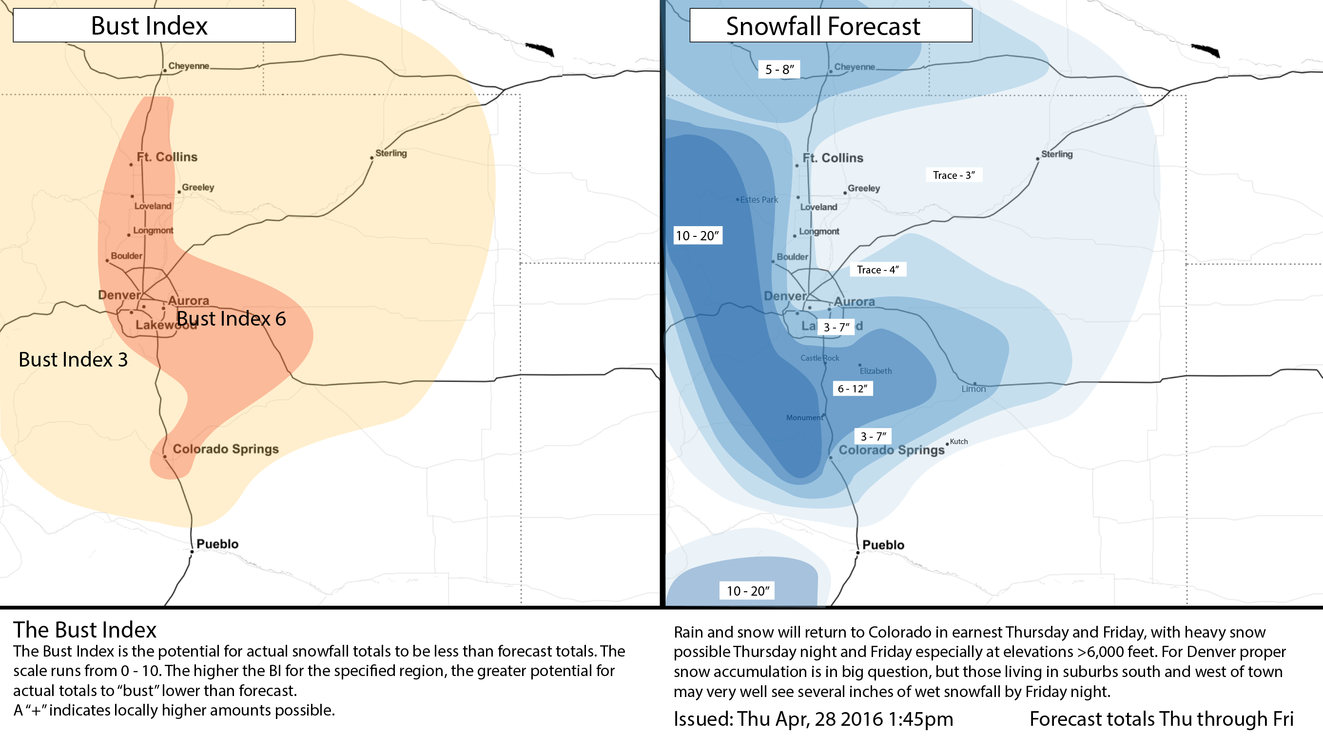
As you can see, we've upped totals a bit for Denver, especially those living in southern and western portions of the city and metro area. For those north/northeast of downtown those totals will likely be lower but certainly a few slushy inches will be possible by Friday night. The hardest hit areas will be at higher elevations just to the west of town and again south/southeast of town where upwards of 6 - 12" is not out of the question. A Winter Storm Warning remains in effect for the Front Range foothills and portions of the Palmer Divide as well as a Winter Weather Advisory for the Castle Rock area. As of this posting, no winter weather highlights have been issued for the Denver area though that may change IF it looks like high-end snowfall totals are achievable come tonight.
Lastly, although the heaviest rain and snow will diminish Friday night we'll be dealing with chilly temperatures and unsettled weather likely through the weekend, with even the potential to see another round or two of more widespread precipitation Saturday night, and again possibly Sunday into early next week. Temperatures Saturday morning may very well drop into the 20s across the metro area, with highs both Saturday and Sunday in the 40s. Brr!
Stay tuned, and please share all your weather reports in the comments below in the days to come!