Warmth Fills Remainder of Week; Scattered Storms by Friday

After 100 hours of clouds were logged at Denver International Airport from late last week through the weekend our weather has finally taken a turn toward warm and sunny! Highs today will top out in the 60s across the metro area, but we could see 80 degrees by Thursday in Denver!
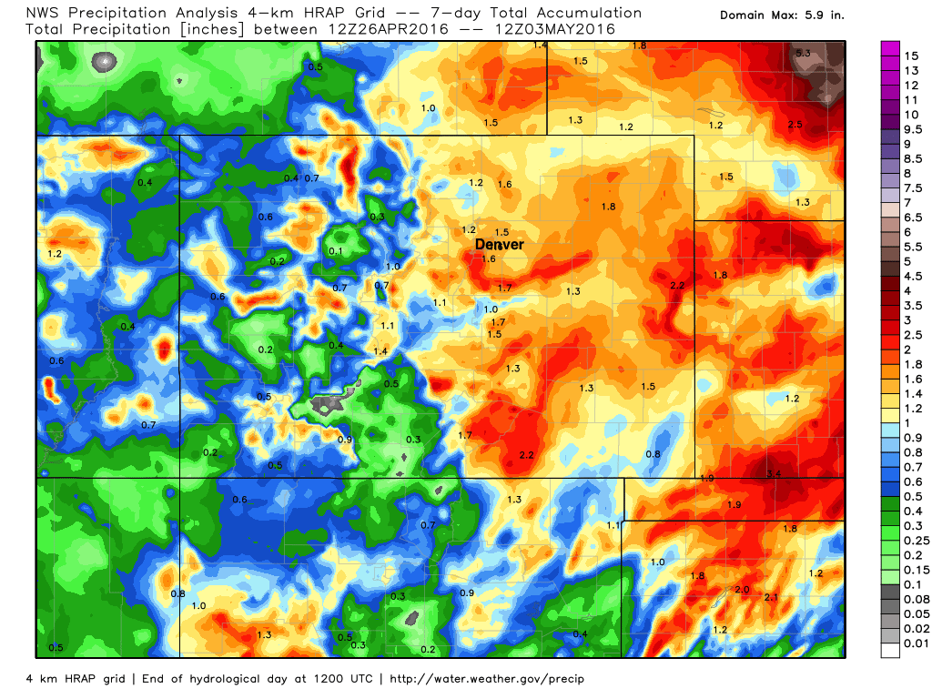
First, here's a look at precipitation totals for the last seven days. It may have been cold and wet longer than many of us are used to around here, but the moisture is always welcome. Nearly all of eastern Colorado saw more than an inch of precipitation over the last week:
The remainder of the work week will be mostly dry across eastern Colorado, the exception maybe being Friday when a chance of afternoon storms will return to the forecast.
A look at the latest GFS shows this, minimal precipitation across the states (more in western Colorado than eastern) through Friday, with maybe some spotty storms delivering some rain Friday afternoon to the northeast plains. This may even mean the potential for a few severe storms to fire, with the greatest likelihood for those being across far eastern Colorado, with lower chances along the Front Range.
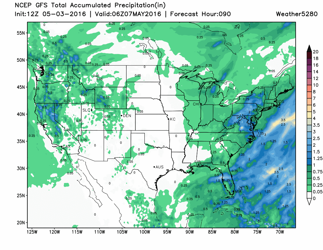
By later in the weekend we may see a better chance of rain and snow across the state, but today most of the models try to take the bulk of the energy too far north for much of that to fall over the greater Denver area. Still plenty of time to watch how this system will progress, so we'll see what trends set up in the coming days.
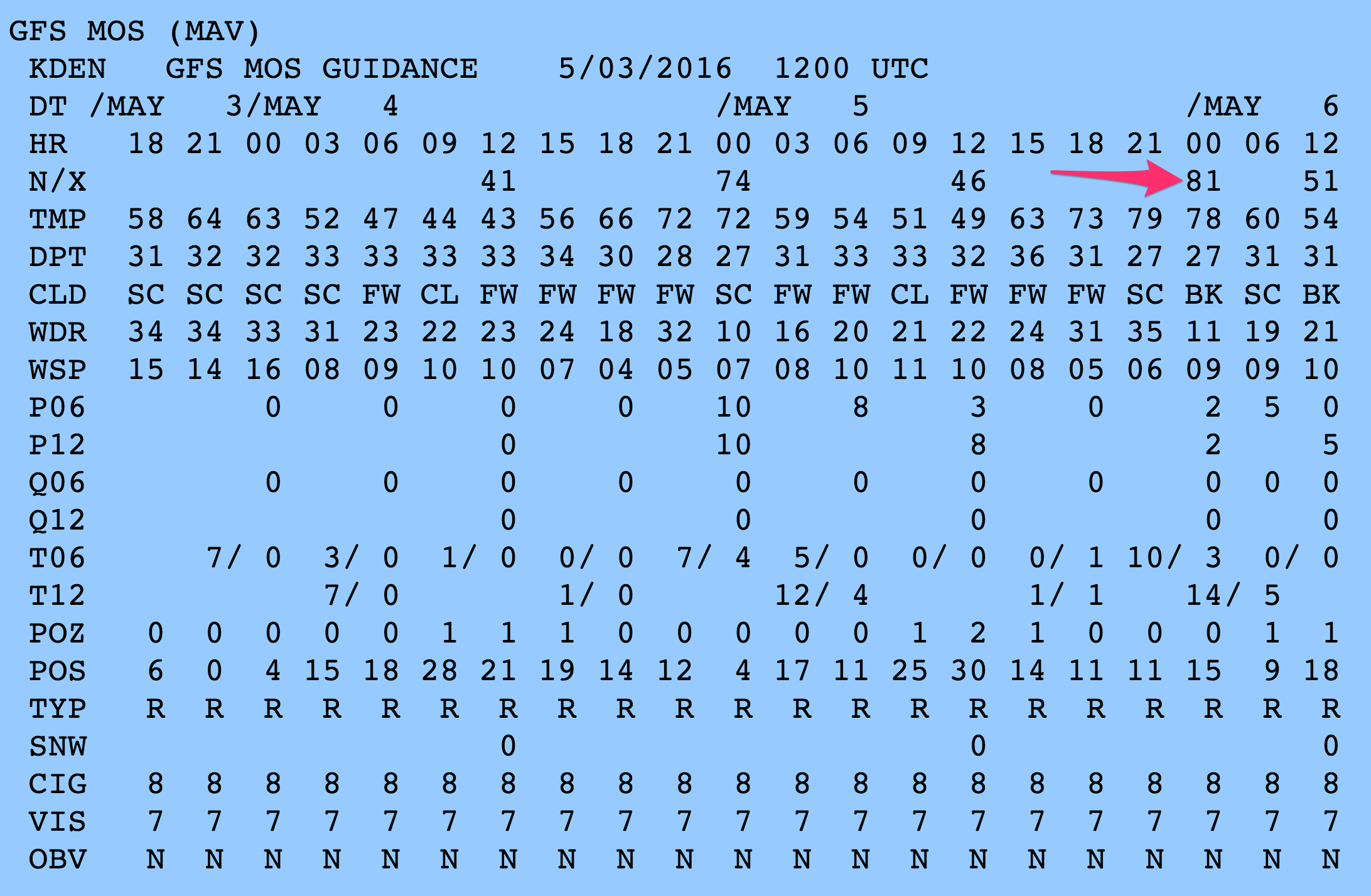
As for temperatures... expect highs to climb into the mid 70s on Wednesday, with afternoon highs possibly reaching the 80 degree mark on Thursday. The latest GFS MOS guidance has a high of 81 degrees Thursday afternoon, and so too does the NAM.
We'll keep an eye on the late week storm potential, and of course on your Mother's Day forecast as well. In the meantime, enjoy the warm temperatures and sun, we've earned it!