The State of the Atmosphere: Sunday, May 15, 2016

We've really been on the wrong schedule of late, with yet another cool cloudy weekend across the region following several beautiful warm, sunny days late last week.
Today's shower chances will spill into Monday and Tuesday, with daytime highs becoming quite chilly to start the work week.
We're tracking a cold front that will move through overnight and in the morning – around daybreak for Denver. You won't mistake this front as it will be bringing rather cold air with it.
See here for Tuesday midday, within the red circle is Colorado and the colors over the state are the deep blues to purples, that corresponds to temperatures 20 to 30-degrees colder than average as seen within the red rectangle on the legend.
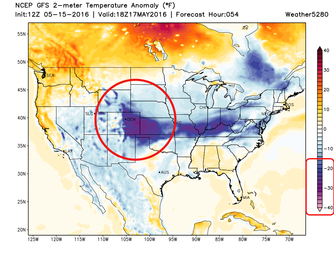
Average high temperatures for this week are in the lower 70s, yet Monday will be in the 50s and Tuesday in the 40s. Temperatures will moderate by the end of the week; we'll be into the 70s again starting Thursday.
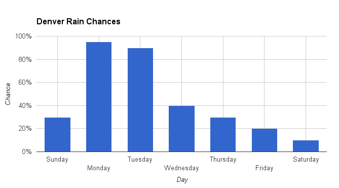
The cool air is coming with some moisture too. Here are the rain chances for the week, notice Monday and Tuesday. You can more likely than not keep your irrigation systems off for another week as we will be getting a decent amount of precipitation the next couple of days, particularly late Monday through Tuesday with additional rainfall Wednesday through part of Thursday.
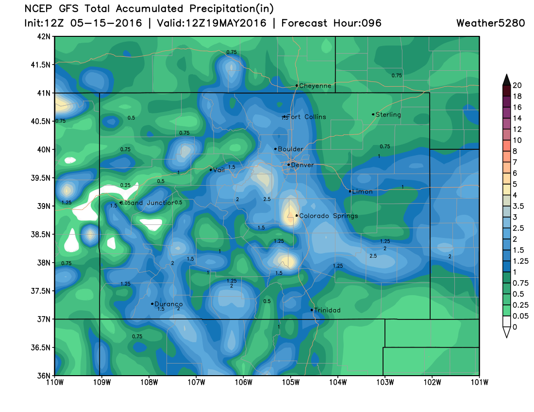
That's the timeline of heaviest rainfall for the Denver area. In total we are looking at more than an inch of water, some areas more than two inches according to the American GFS model shown here. These totals are through Thursday morning:
I mentioned that'll be as rain, most likely, for Denver but there are areas of the state that will catch some late season snow – some of those areas as close as Douglas and Jefferson Counties. This is the snowfall accumulation as depicted from the same GFS model, notice it trying to pick up on some snow across the Palmer:
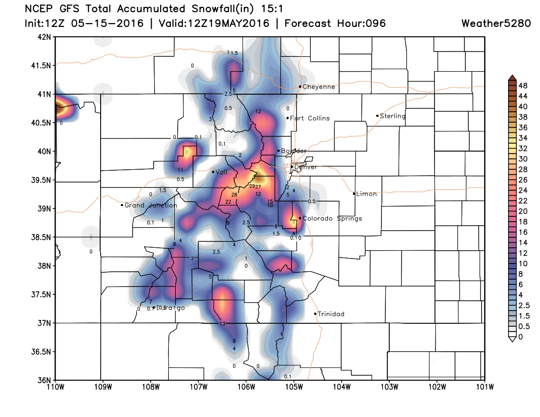
We may have an update Monday on the snow potential for those higher elevation metro area locations. Monday night is the most likely time for snowfall accumulation over the Palmer Divide and in the hills just west of Denver.
We hope you enjoyed your weekend!