Rainfall Deficit Climbing for Denver

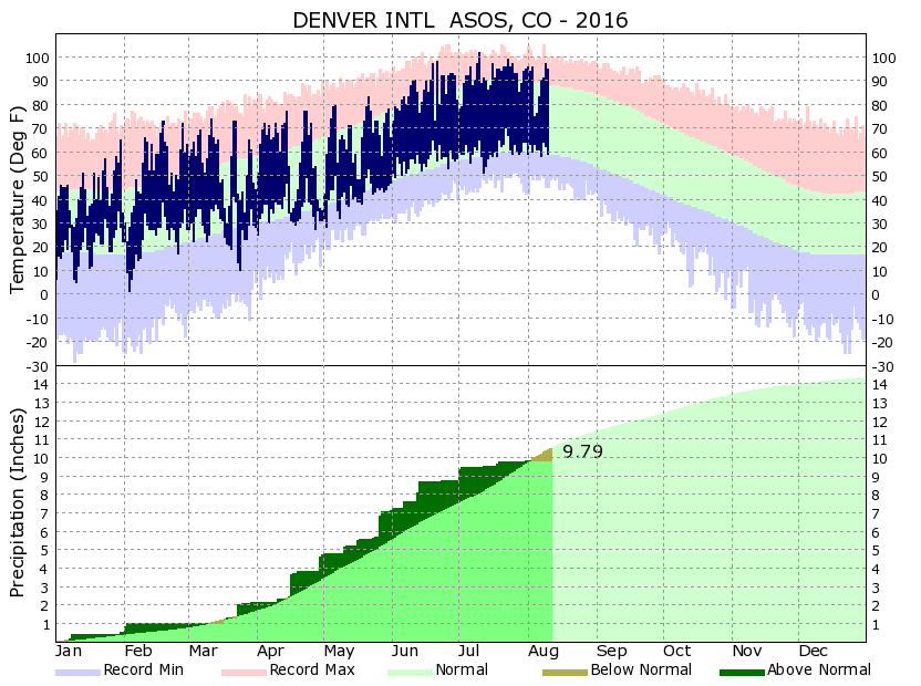
For many of us, summer conditions have dried us out greatly. Denver is now over 2" drier than average this summer, and nearly 1" drier than average for the year. This is not only the case for Denver but much of Colorado.
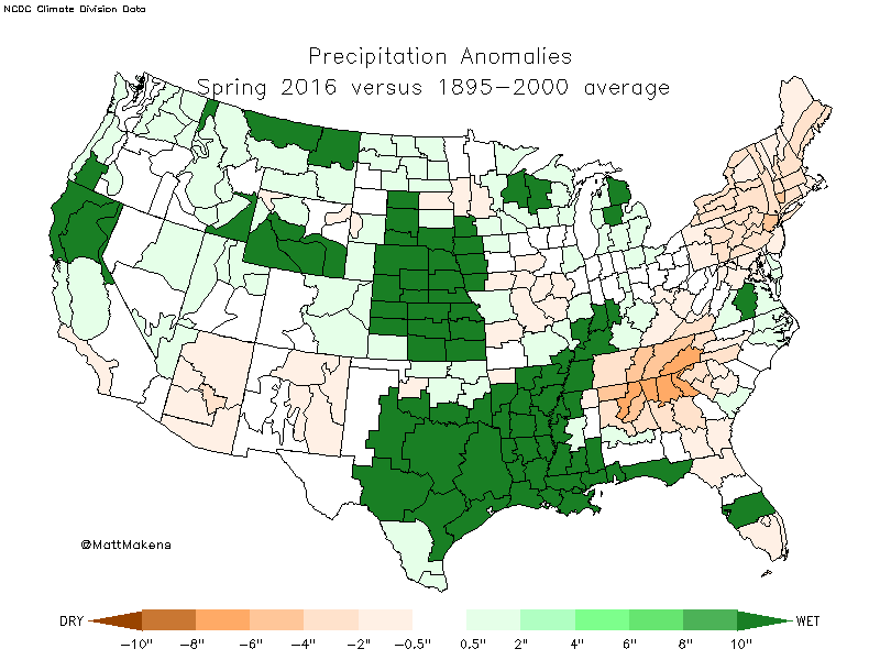
Coming into summer there was a nice moisture surplus thanks to our heavy snowfalls to end winter and this spring. Here is the spring-time moisture across the country (we will focus on Colorado and Denver for the purpose of this post). Three of the five climate divisions of the state had a surplus of 0.5 to 2".
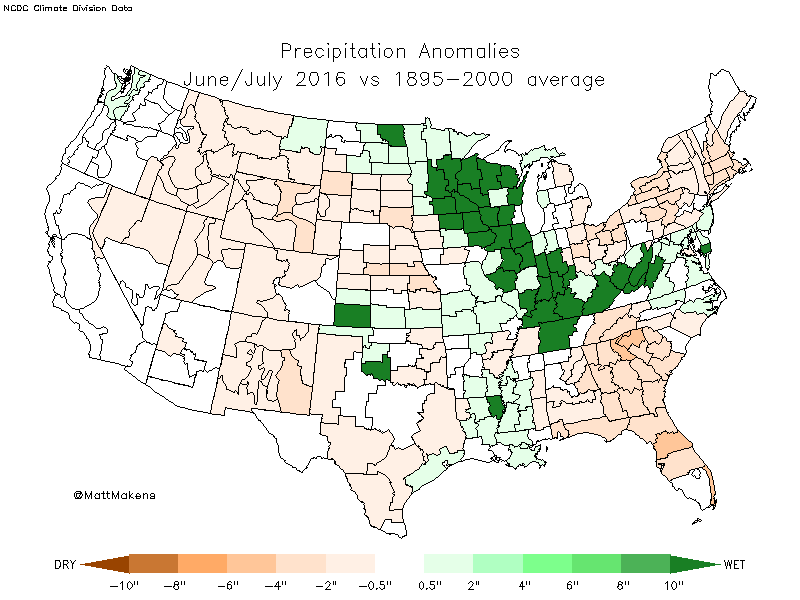
Let's compare that to the same map, but for this summer, so far. You can see now that 3 of 5 climate divisions are in a deficit 0.5 to 2". Rainfall from this last week won't do much to change this map – southern/southeastern Colorado saw the best precipitation for this period, and their climate divisions remain near-normal.
It can be hard to visualize just how much water we are talking about when we say a '2-inch deficit'. If two inches of rain fell right now on an average sized vehicle, that's about 120 gallons of water. If 2" of rain fell at Mile High Stadium that's about 4.8 million gallons of water.
We aren't talking about an isolated car or stadium drought, though. The city of Denver is over 2" drier than average this summer. 2" equates to 5.4 billion gallons of water for the city itself, not the metro area.
For further perspective, the climate division over north-central Colorado including Denver, Boulder, Fort Collins, etc. is roughly 20,000 square miles in need of 2" of rainfall to break even. That's a staggering 695 billion gallons of water.
Simply, we need rain. Of course we do not want it all at once, however, just some rain would be nice.
We do have increasing rain chances for the end of the week and this weekend but nothing to shake a stick at in the perspective of this post. Further, next week looks to be boring in the rain department too, at least at the moment.
Here's the American GFS model precipitation forecast through the 17th of August:
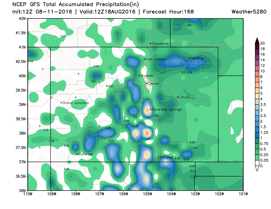
Note how dry many areas will be. However, as they say, "every drop counts", and it looks like at least few locales will see some moisture in the coming days. Additionally, our temperatures will cool too, with daytime highs in the low 80s for the next few days.
Perseid Meteor Shower
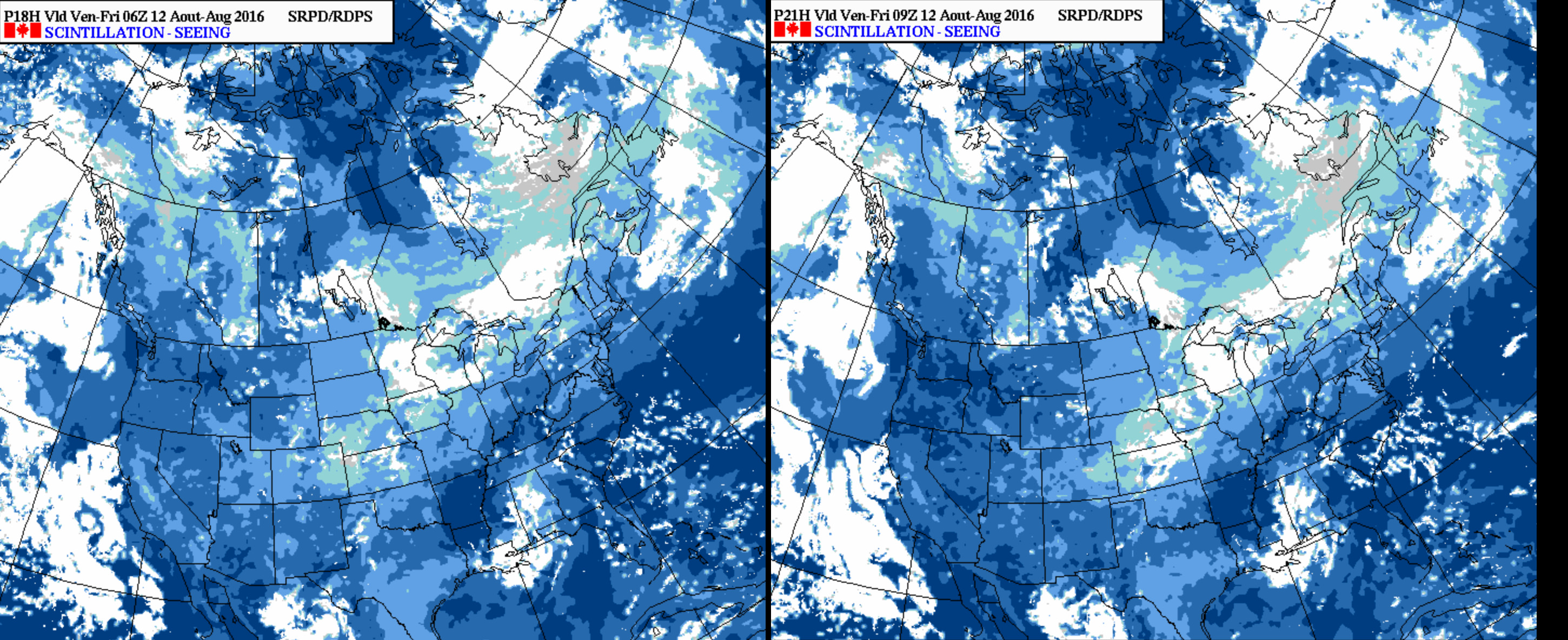
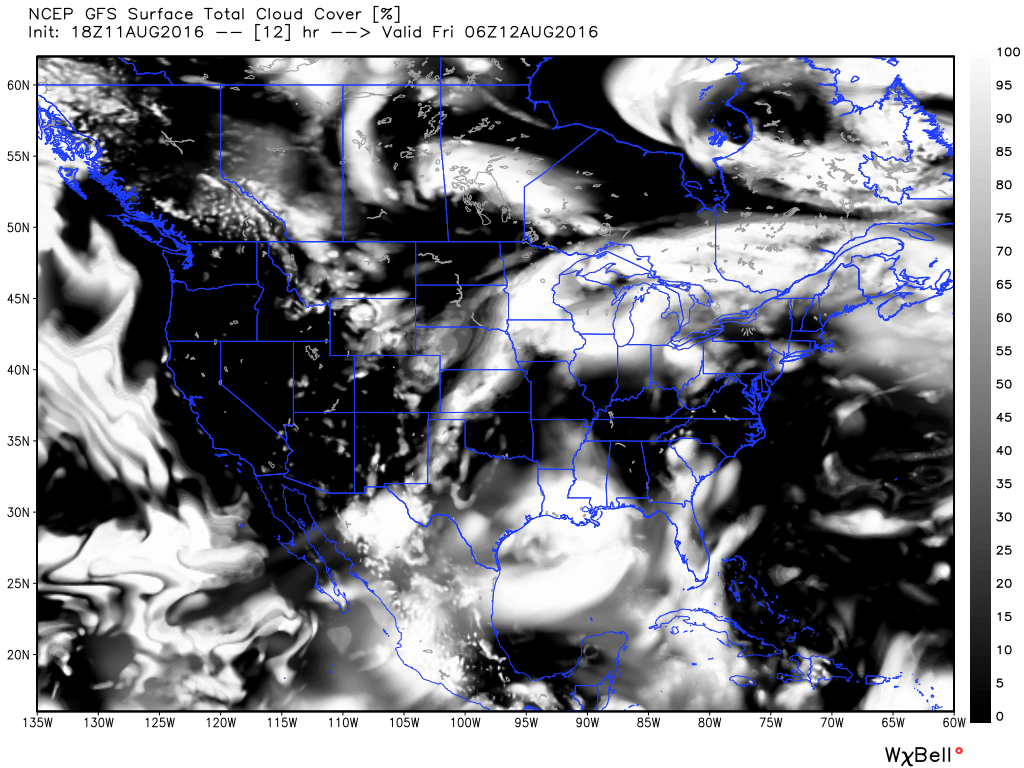
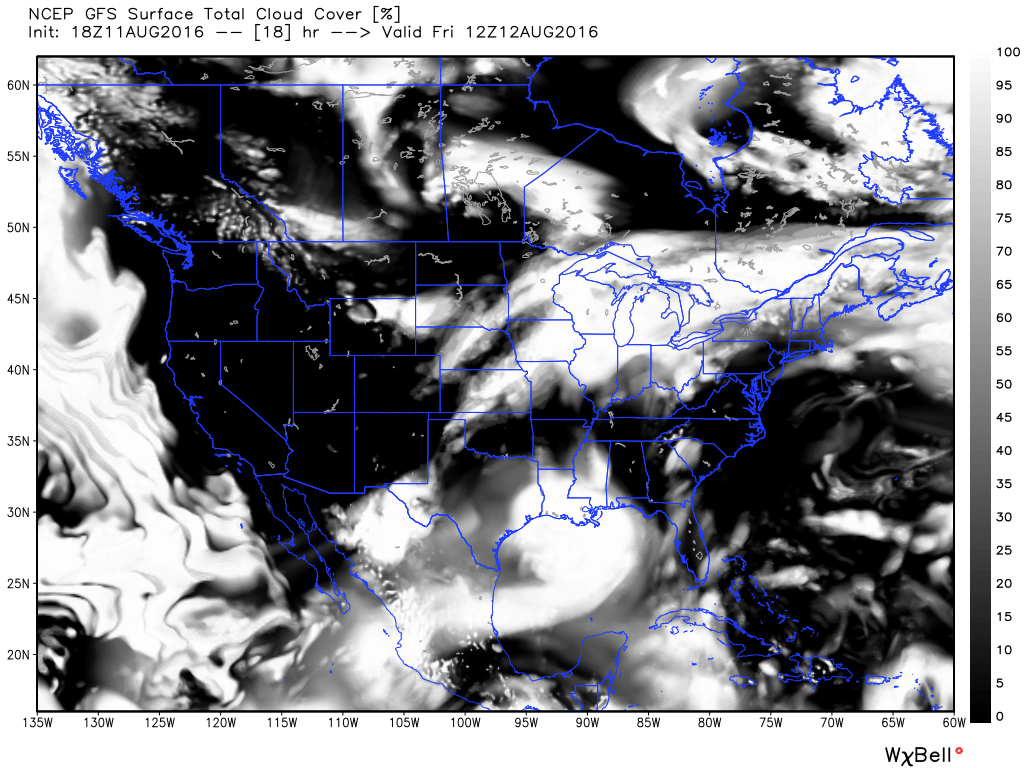
Lastly, if you're headed out tonight to watch meteors, it looks like you'll have some clouds to contend with, at least initially. The latest GFS cloud forecast has things clearing out toward early morning, so hopefully this process takes place quicker than forecast and we clear skies out for those prime 12am to 4am viewing hours! At the moment, it looks like those living across northern Colorado have the best chance at the clouds clearing in time... but we'll see.
The forecast from Environment Canada is similar, with the dark blues indicating best star viewing, and greens to grey/white poor viewing. Note in the image to the right (3am) there are some blues showing over northeast Colorado. Hoping this is the case!