Another Shot of Cool Air on the Way, but How About Some Rain?

Another week is set to end much cooler than it began, a pattern we've been in for some time now. Like previous weeks, the big question is if we'll score some moisture at the same time – for many, the answer the last several weeks has been no.
While we will increase rain chances across northeast Colorado to end the week, this'll likely be a boom for some and bust for others, leaving many wanting more. For many locations, the big weather story will once again be the cooler temperatures and less so the rain, while others will see some decent rainfall Friday and Friday night.
Taste of fall?
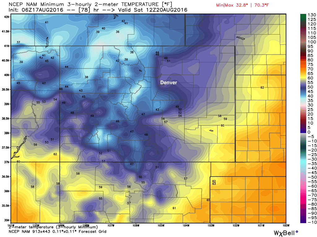
Latest MOS guidance for Saturday morning suggests lows in the Denver area may drop into the upper 40s! If that happens, that'll be the first time since June 2nd the temperature has dipped below 50°, so a remarkable cool shot to be sure.
Here's a look at the 12km NAM forecast for min two meter temperatures Saturday morning. Lows in the 40s are forecast for most locations along and west of I-25 and across the Palmer Ridge south of Denver, with low 50s across the northeast plains:
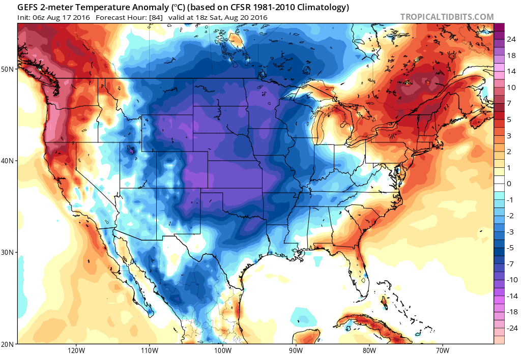
By midday Saturday cool air will be well established all across the middle of the country, with the only warm temperature anomalies for the U.S. focused on both coasts. This taste of fall will equate to highs in the 60s and low 70s across eastern Colorado for Saturday.
As for precipitation...
Like our last few cool shots we'll see increased chances for showers and storms through the end of the week, but at the moment those odds don't look overly impressive – at least not for everyone.
The GFS is showing as the wettest model today, favoring the Front Range mountains, foothills, and along and east of I-25. The EURO, which had shown quite a bit of moisture for northern Colorado in recent runs came in much more progressive and far less deep with the disturbance Friday, and therefore today keeps the best moisture north of the state. A deeper solution would be great, and would again put those who-need-it-most (Fort Collins et al) in line for some beneficial moisture to end the week.
Others, like the 12km NAM are even less excited about rainfall chances across the plains, with a small bullseye east/northeast of Denver, but otherwise mostly dry for the northern I-25 corridor.
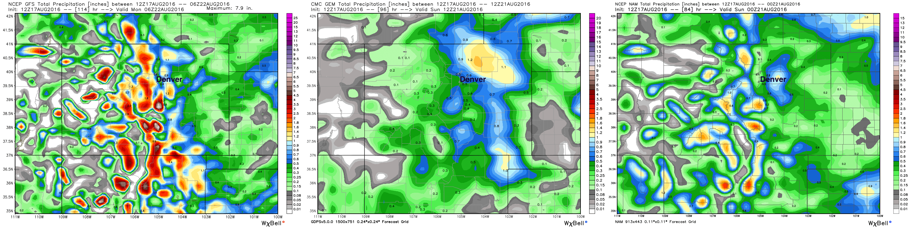
We'll go with 30 to 40% chances for showers an storms both Thursday and Friday across northeast Colorado and hope for the best. After the last few systems rolling through here with only a drop of water here and there... it's hard to be too excited here. That said, it could be we have a bit more instability around Friday than with those last systems, so hopefully we can get something going – at the very least up north. Those that do see rain have the potential to pick up some good – much needed – moisture, with 1 - 2"+ possible for some.
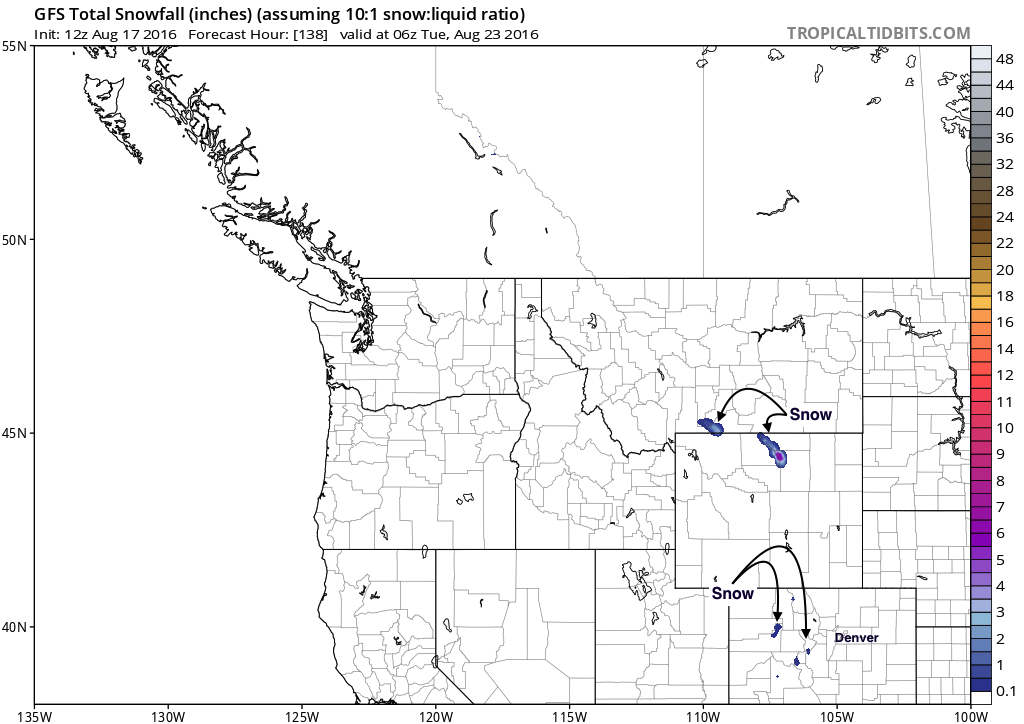
Given how chilly this system is, expect to see some snowflakes up high. In fact, a few of the tallest peaks may even see some light accumulation Friday night, with mountains across northern Wyoming really getting a nice taste of fall:
After the hot, dry summer we've had lets savor these cool (and hopefully wet!) few days we have ahead. Saturday will certainly be a reminder of what season is just around the corner...