The State of the Atmosphere: Sunday, October 16, 2016

Is it really October right now? It sure doesn't feel like it, with yet another day of well-above average temperatures across Northeastern Colorado. Similar to yesterday, Denver hit 86°F this afternoon, which is an impressive 21 degrees above our average high of 65°F. Some locations on the Southeastern Plains soared into the mid 90s! Check out the surface map from 2:23 PM MDT:
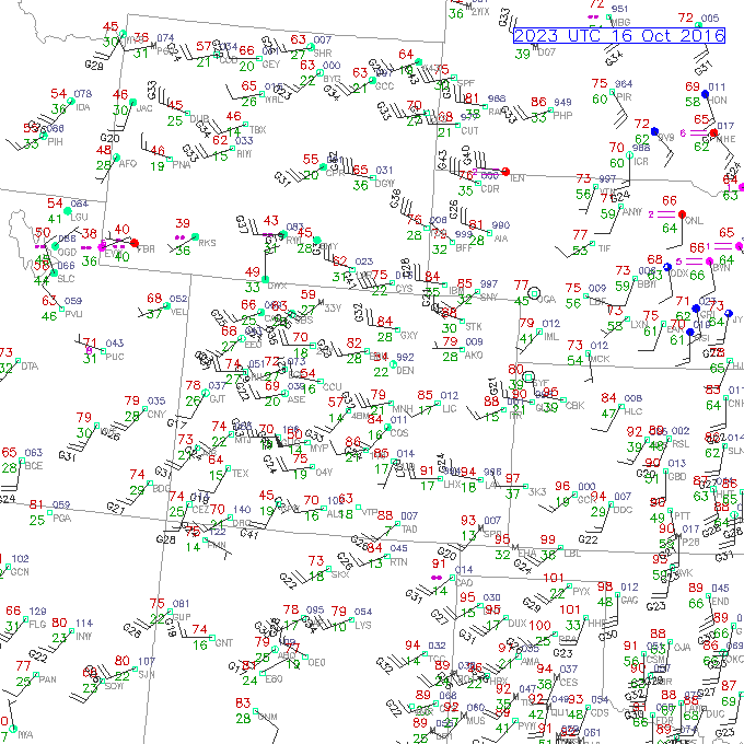
Note how the flow at the surface is primarily out of the west. As we look at this morning's sounding out of Denver, we can see that westerly flow is dominating the large-scale pattern.
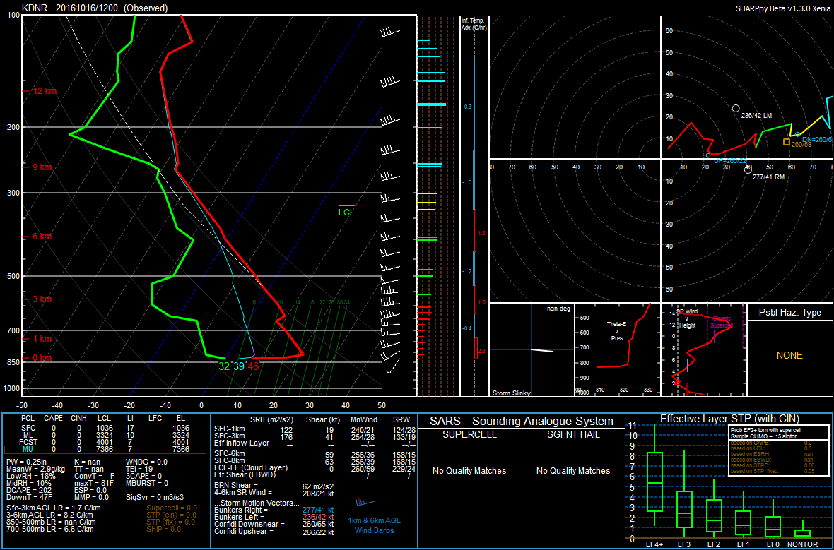
As we know, westerly flow results in downsloping east of the Front Range. This has kept us well-above average in the temperature department for the past few days. We have also seen gusty winds across Eastern Colorado (which can be seen on the surface map above), which has contributed to a high fire danger across the eastern half of the state. These dry, warm, and breezy conditions will continue through Monday, hence the Red Flag Warnings that are currently being issued. The Red Flag Warning will take effect from 11AM MDT Monday to 9:00 PM MDT on Monday for the Denver Metro.
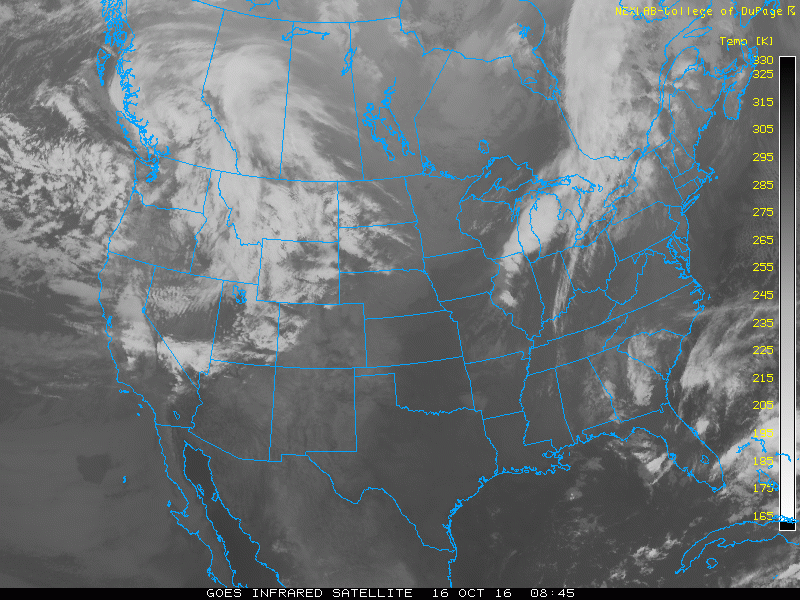
Looking at satellite imagery, we can see the strong Pacific system that brought very heavy rain, damaging winds, and high surf to parts of the Pacific Northwest, over Saskatchewan. Unfortunately, this won't mean much in the way of moisture for us in Denver, since it is well to our north.
Despite the balmy weather, there is a brief cool down in sight (luckily). There will be a weak cold front that will push through tomorrow (Monday) evening. Depending on how quickly the front drags south, temperatures will likely be slightly cooler on Monday compared to what we saw today, with highs likely in the 75-80°F range. High clouds will limit our temperatures tomorrow afternoon.
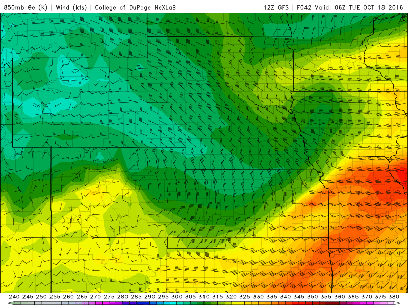
On Tuesday, the flow will quickly turn more southerly as winds rotate clockwise around a high centered over Northern Kansas:
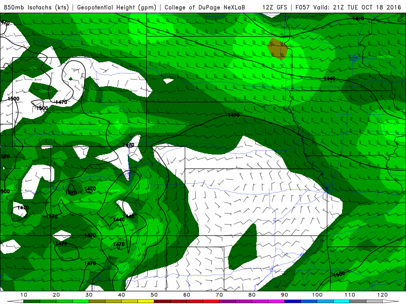
With the surface flow remaining out of the south and mid-level flow primarily out of the west (also a veering wind profile, which indicates warm air advection), we should manage to see seasonal temperatures on Tuesday, despite also seeing some clouds ahead of the next trough digging down from the northwest:
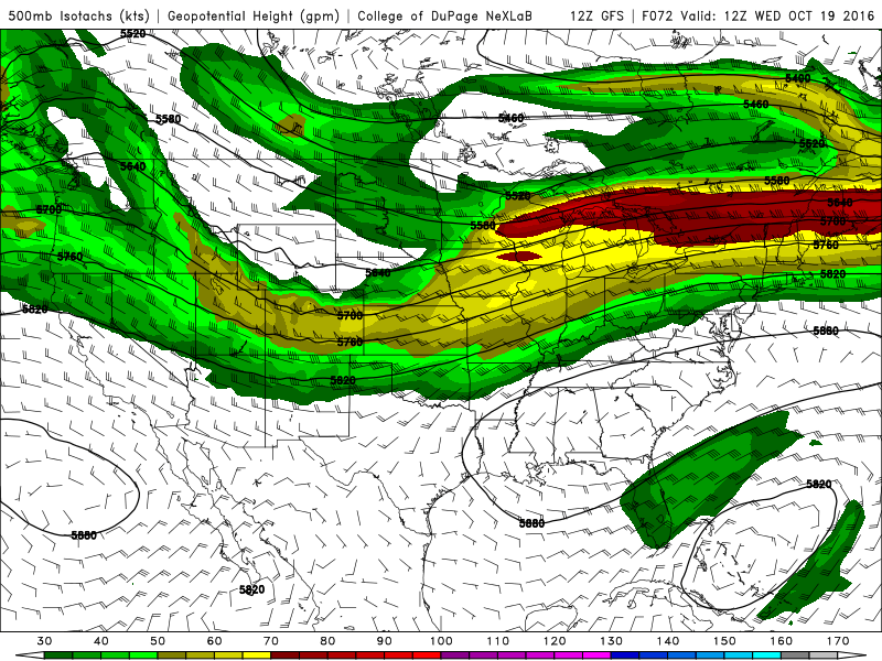
As you can see the trough is relatively shallow. However there will be a 80-90 knot jet streak overhead, which may be able to initiate a few showers if we happen to remain in the right-entrance region of the jet.
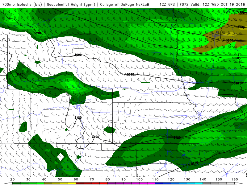
Looking at 700mb vertical velocity, the stronger lift primarily remains in the mountains. There are some warmer colors over Larimer and Weld Counties which is probably a reflection of any jet-induced precipitation. Overall, precipitation chances will remain rather low over the Plains, as 700mb flow will likely be out of the northwest. This would result in downsloping east of the Front Range. A true precipitation killer for us.
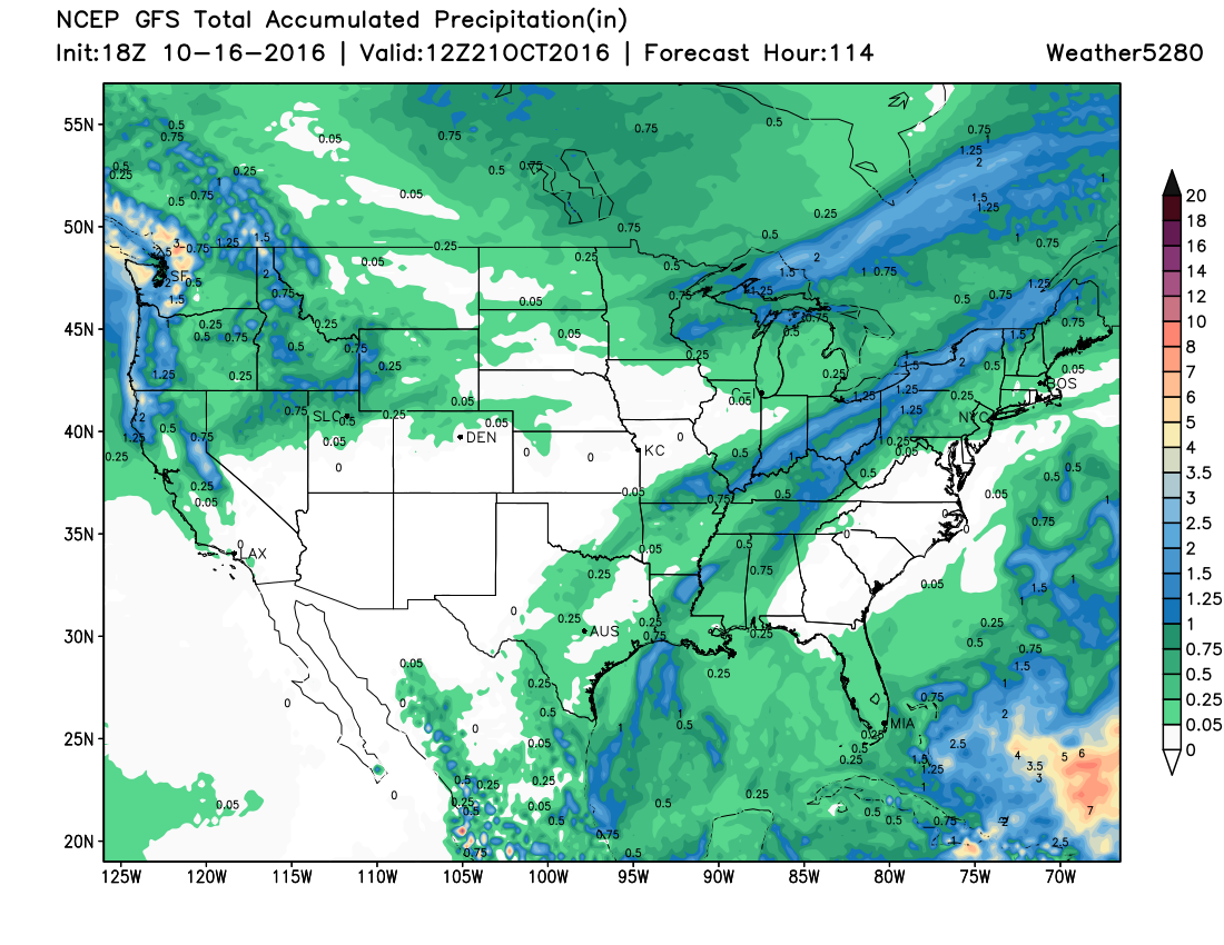
And with that, we see some precipitation for the northern mountains, a bit over the northeast Plains, but many won't see any at all over the next five days:
TL;DR
Plan for another warm day on Monday, followed by a few cooler days Tuesday through Thursday. Wednesday will be the coolest day of the week, with highs possibly not making it out of the 50s for highs.
Similarly to our last several systems, there will be a chance for precipitation
with this one (mainly Tuesday night into Wednesday) but those chances look low across the greater Denver area.
We'll begin to warm things up again toward the end of the week, with highs back in the 70s by the weekend.
We have some changes coming to the site tomorrow as well as a first look at our winter outlook – so, be sure to check back on Monday!