Wednesday PM Update: It's Been a Long Time, but Snow May Fly on Thursday

To reiterate the headline, 'First Snow of Season', note that I did not say snowfall of the season. To me, seeing flakes is snow. Snowfall implies, to me, that we must head out with shovels or at least a broom. In most cases, this will not be much of an accumulating snowfall for the city, but surrounding areas may have enough to call it a snowfall.
Brian Bledsoe described the system's synoptics in detail in Tuesday's post so I'll spare you that now. There are some subtle shifts northward to this systems path that are coming out of Wednesday morning's modeling. Keeping that in our mind, let's focus on impacts as the storm has appeared over the past several days worth of modeling.
Thursday morning through midday, clouds increase as temperatures continue the steady drop on the strong wind. By midday through the afternoon and early evening, there will be rain - for some - and snow developing. This will be a quick hitting storm that will rely heavily on slope and elevation - determines ground and air temperatures to which snow can or can't stick to.
We have a detailed storm timeline and a number of Snowfall Gambler Charts provided in our Insider section.
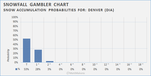
Based on compiling my Snowfall Gambler Charts, here's one for Denver (DIA) we have the following snowfall forecast:
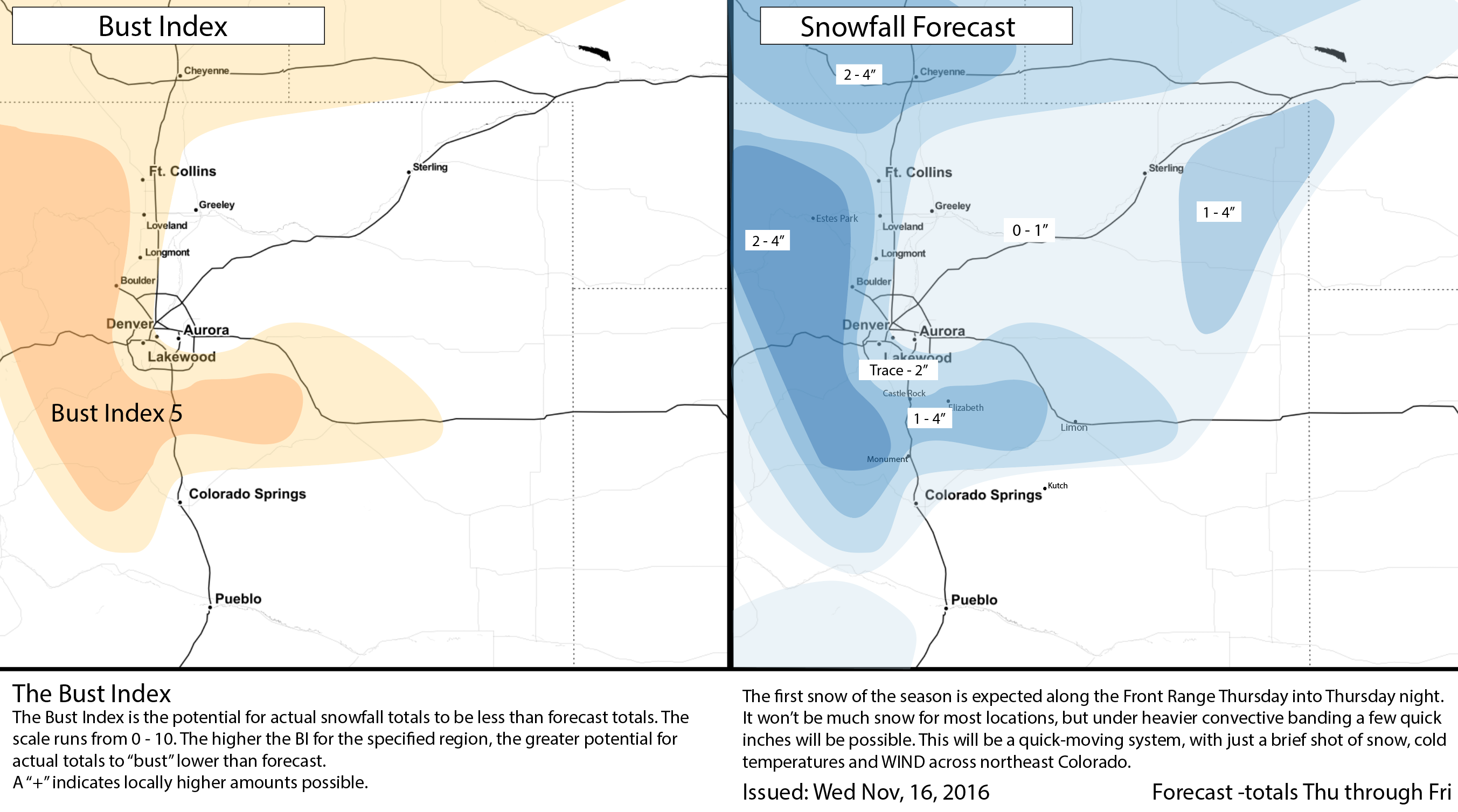
Some caveats to this. We are not accounting for the possibility that a snow band develops to overdeliver snowfall to isolated few in the metro area. Hwy 36 is a popular one for just such activity in these storm patterns. We also are including snowfall totals that may suffer a quick melt due to warm surface temperatures. The map reflects my feelings that Douglas, Elbert, and Jefferson Counties will come away with the higher moisture totals. This map does not display to you the potential for icing which will be area wide with the initial rain chance becoming a snow chance on rapidly dropping temperatures and stout winds.