Monday PM Update: Morning Commute Will be Slick for Some

Quick update this evening following up on the snow potential we discussed in yesterday's State of the Atmosphere. Our next push of chilly air remains on track, and should usher in at least a brief period of snow (perhaps heavy at times) Tuesday morning across the greater urban corridor as well.
We're watching some of the latest hi-resolution models producing a short period of heavy snowfall tomorrow morning, especially on Denver's south side and east of there. Trends tonight are for a bit more snowfall than previously thought – and while not a done deal, with timing during the morning commute we want you to be prepared for winter driving conditions in the morning, especially south and southeast of Denver proper.
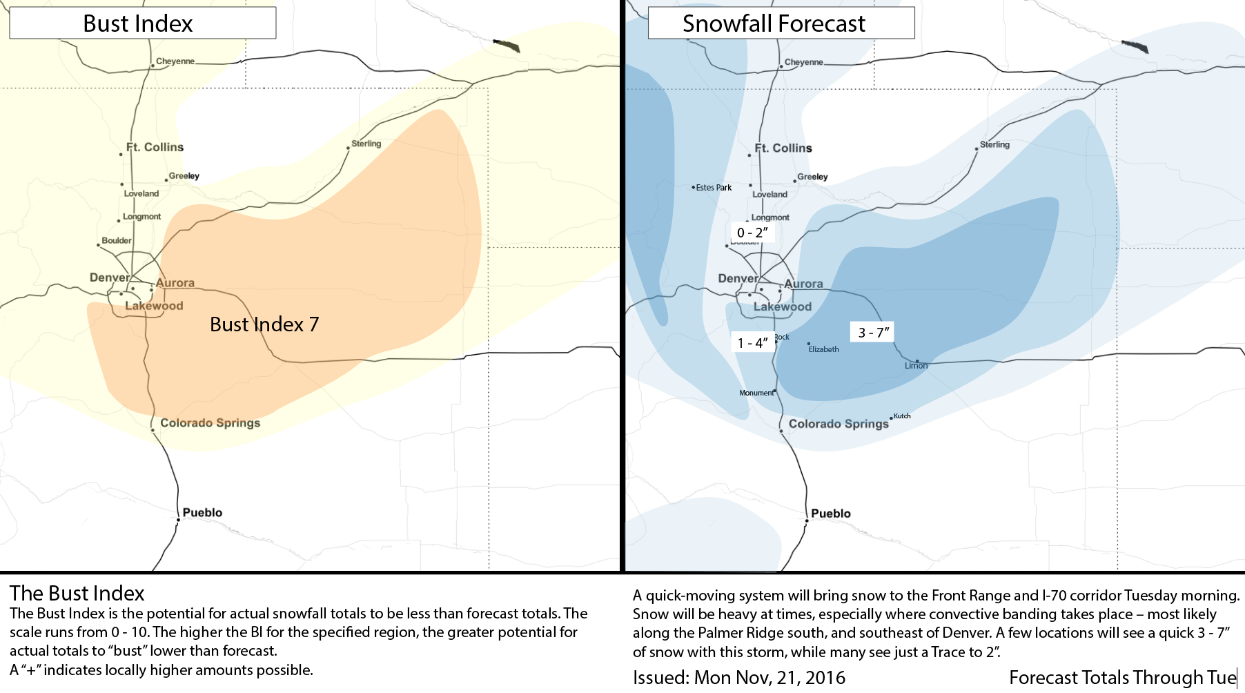
Why the high Bust Index? This is mainly due to it being virtually impossible to forecast exactly where some of those heavier convective bands will set up. Thus, the snow totals may vary wildly over a short distance. However, per the forecast map we feel that these heavier bands have the best chance to set up mainly to the south and east of Denver. But keep in mind, a little shift either way will make a huge difference. Heck, if a heavier band moves through Denver, we could see some spots pick up more than 2" in town too.
Join us on Facebook: Bledsoe gives an update on the storm on Facebook LIVE
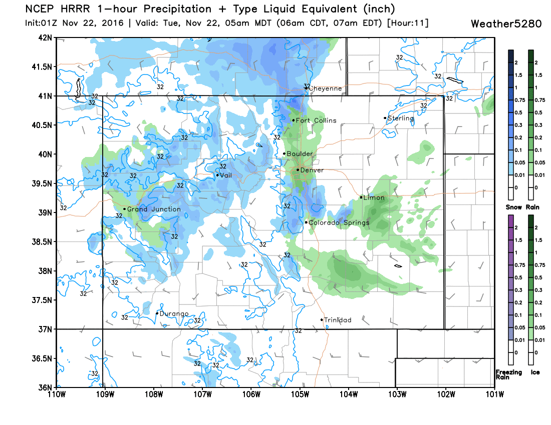
Precipitation will begin later tonight, and likely start initially as rain along the I-25 corridor. Temperatures won't be all that cold with this system – though eventually it should get cold enough for snow by Tuesday morning. Here's a look at the HRRR forecast for 5am, it still has some rain for Denver, with rain turning to snow for elevations south of town. Despite the HRRR showing precipitation start off as rain over the Palmer Divide, we believe that areas such as Castle Rock and Parker will see snow from the get go, despite temperatures hovering right above freezing.
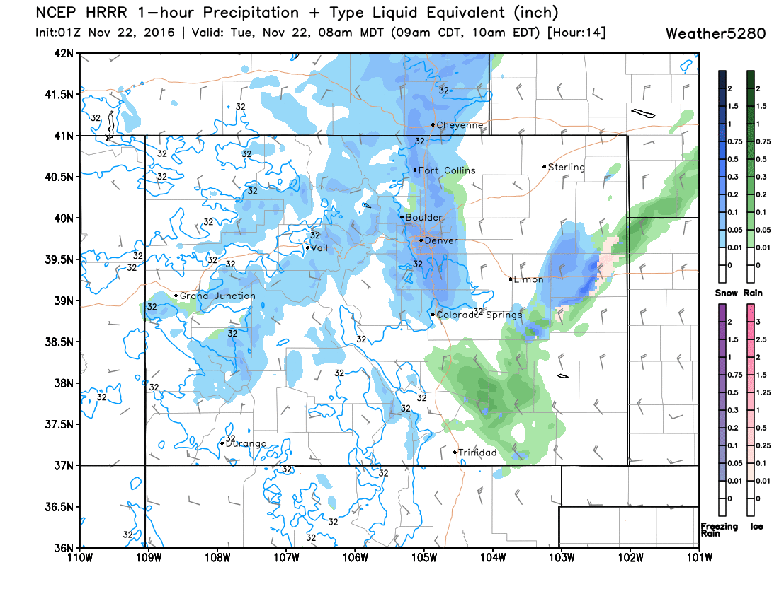
By 8am Tuesday we see it's all snow. Notice the darker blues up and down I-25. Depending on eventual timing, this could lead to a very slow morning commute along the Front Range.
In addition to the rain and snow, we'll have some wind to contend with. Especially for folks just east of Denver:
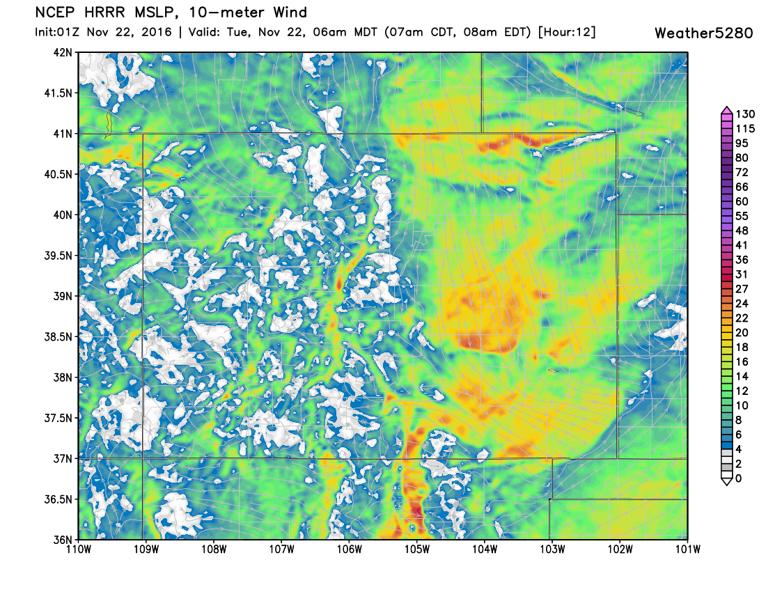
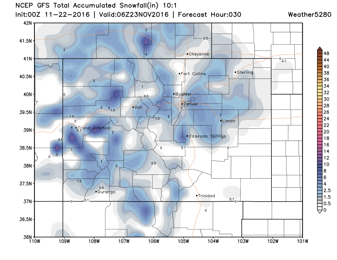
Lastly, here's a look at the latest GFS forecast model for snow. Note it has heavier totals a bit further west into Denver than we have above, but still has focus of heavier snow east of the city overall. The GFS is also very windy with this system, especially across El Paso County, with 30 - 40mph winds, if it is to verify.
So, overall a trend toward a possibly more impactful system tonight – that is if models are catching onto this thing correctly. With timing coming during the morning commute, and the potential to see some heavier snow bands as this system pushes through, please plan accordingly and give yourself extra time in the morning.