As La Niña Fades, is El Niño on Deck?

The recent weak La Niña episode that prevailed since last fall, has been all but erased. The animation below shows the sea surface temperature anomaly trend during the past several weeks. Blue colors mean colder than average sea surface temperature anomalies, while orange/red means warmer than average sea surface temperature anomalies.
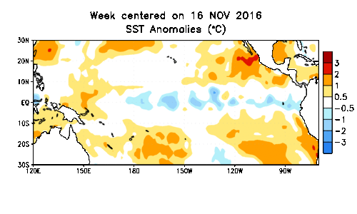
Notice how all of the blue color in the ENSO regions has pretty much disappeared. At the same time, we have seen some much warmer than average water build off the west coast of South America. That trend is happening at the surface. Let's look below the surface...
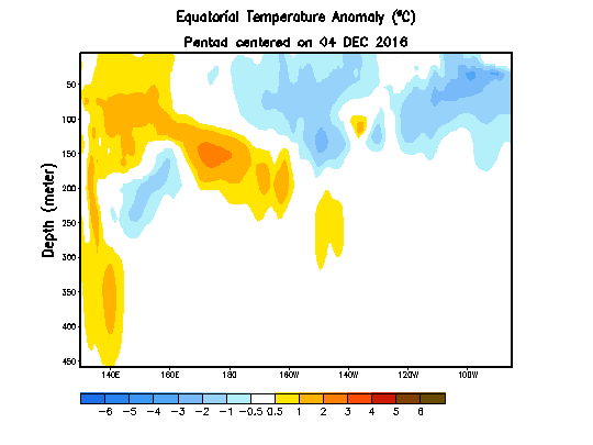
The animation above shows a vertical slice of the ocean temperature anomaly, that runs from west to east across the Equatorial Pacific Ocean. It shows that the thermocline (a steep temperature gradient in a body of water such as a lake, marked by a layer above and below which the water is at different temperatures) is very much suppressed. Warm water is building beneath the surface just to the east and north of Australia. That suppressed thermocline is just one sign, that an El Niño COULD be thinking about developing.
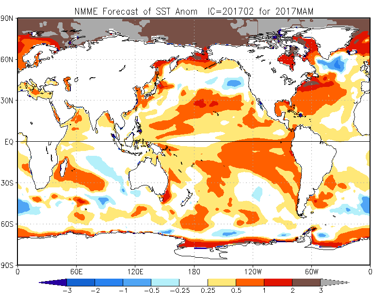
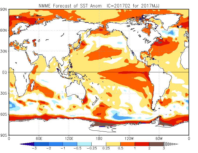
What do the models say about this? Well, the NMME Model and many others reflect the tip toward El Niño late this spring and summer. The maps below are the sea surface temperature anomaly forecast from the NMME Model.
March-May
May-July
July-September
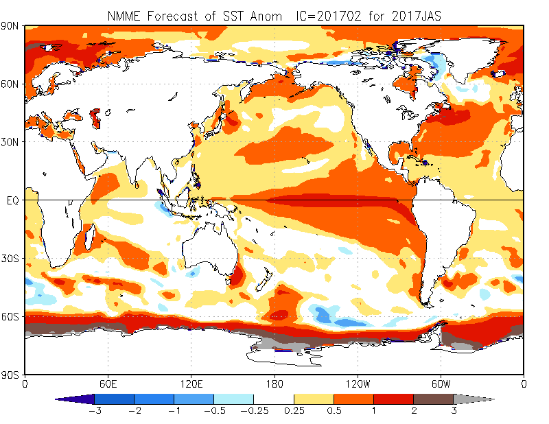
You can clearly see the expansion of "red" (warmer than average sea surface temperatures anomalies) along the Equator to the west of South America. While other models may not be as robust with the El Niño onset, the trend toward a weak "warm event" (El Niño) is apparent:
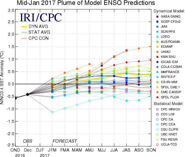
The yellow line in the above graphic is the mean forecast of all the models shown on the right. Anything between 0.5 and -0.5 is technically considered "neutral" or neither El Niño or La Niña.
Three things...
- The least likely scenario going forward is for any redevelopment of La Niña to occur. This event is coming to an end, or has already ended.
- The chances for El Niño development toward late spring and summer are increasing. This is not based off of model trends, but off of current Pacific Ocean trends.
- It should be noted that model outlooks that span the spring period tend to have lower accuracy than outlooks issued at other times of the year. This means outlooks beyond May should be used with some caution.
What does this mean? Well, this could mean better chances for wetter than average conditions east of the mountains this spring. Most of the time, if the Pacific is in a warm state (which it is now) and could get warmer, the drought threat decreases for Eastern Colorado. Given the dry winter so far for many areas east of the hills, this would be good news. However, it is still a bit early to get excited.