Storm Summary; Quick Look Ahead to Next Week

Overall we're very happy with how the forecast turned out, and even happier to see some long-awaited moisture across much of eastern Colorado. Our station, located on the south side of downtown, picked up 0.78" of rain from this event, with Denver International Airport recording 0.53" of liquid and a Trace of snow.
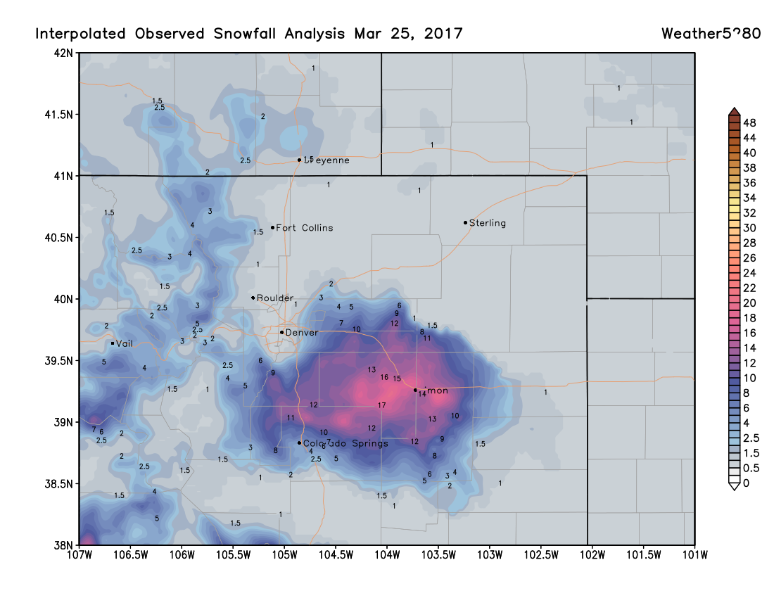
For snowfall, things worked out just about as expected. Our forecast called for 0 - 3" in Denver, lower than many other forecasts for the city, as temperatures were a big concern heading into the event. Temperatures never did cool enough for snow in the city, wit the rain snow line ending up somewhere along Orchard road and south/southeast. Across the Palmer Divide? A completely different story, with blizzard conditions Friday morning, and upwards of a foot of snow for some locales. Here are the snowfall totals for this event, pretty good across higher elevations to Denver's south and southeast:
As for precipitation, for those that saw some, this was a very good storm. A few things to note in the image below... first you'll see that very sharp gradient across northwest Denver that we talked about at length over the last week. From Denver south across the Palmer, extending east across the plans, totals from 0.5" to 1"+ were common. The further southeast you go precipitation again drops off.

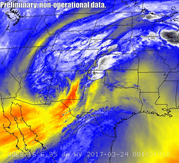
Lastly, take a look at this spectacular imagery from the new GOES-16 satellite of our storm. That circulation over southeast Colorado is a classic look for good March storm around here.
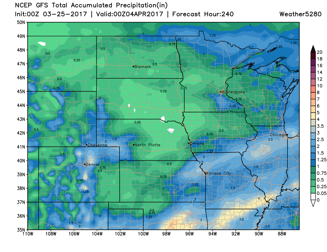
We try to keep the pattern going this next week, with several chances of seeing some wet weather across eastern Colorado once more.
Tonight and Sunday
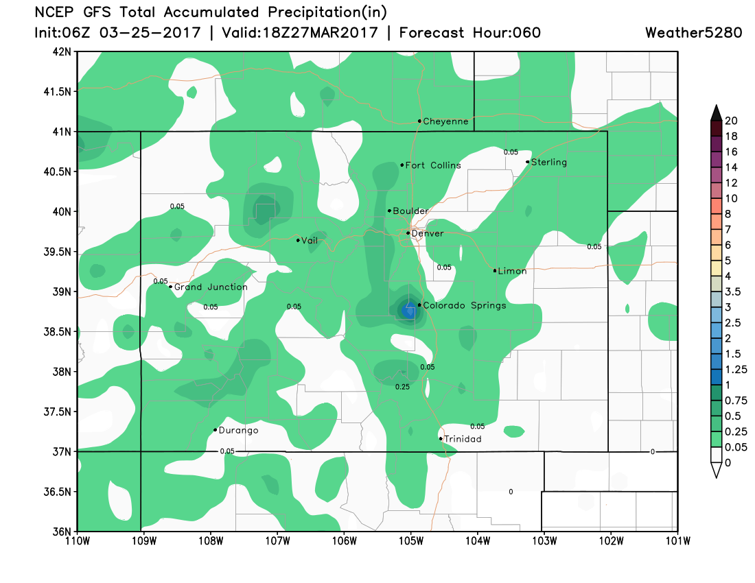
Scattered rain and snow showers will be possible tonight and Sunday as another weaker trough skirts the area to the south over night. The latest GFS precipitation forecast shows this potential, with most areas that do see any precipitation, only seeing very light totals. While today will feel warm at times (especially in the sun) Sunday will be a be cooler and unsettled, with highs in the 50s for Denver.
As we head into next week we will be keeping an eye on two more bigger systems. The first of which moves through late Monday night through Tuesday night, and another possibly to end the week into next weekend.
We'll focus in on the details a bit more in this week's SOTA, but for now plan on more unsettled weather over the next 10 days across eastern Colorado: