Wednesday PM Update: Here Comes the Heat

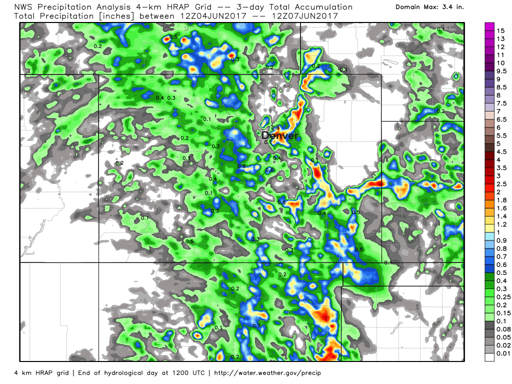
We saw some pockets of heavy rain in recent days, but unfortunately showers were widely scattered in nature, and not everyone was able to capitalize on the moisture. Here's a look at precipitation totals over the last three days, with areas on Denver's east side doing pretty well, as well as pockets of southeast Colorado:
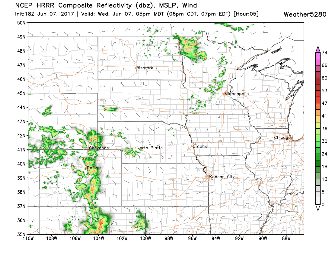
We'll see another round of showers and storms today, so perhaps a few locales that haven't seen anything in recent days have a bit better luck later this afternoon? We're already seeing storms develop in the foothills this early afternoon, and those should slowly progress east through early evening. Here's what the latest HRRR thinks the radar will look like around 5pm:
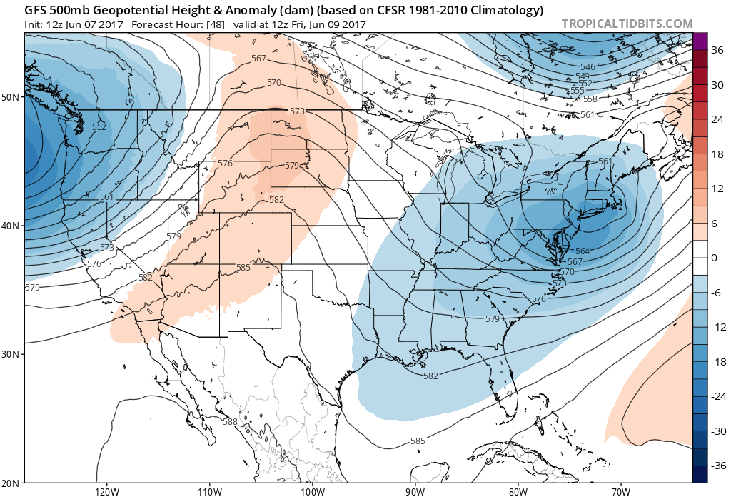
After today our focus shifts to some much hotter weather set to move in to end the week and likely stick around through the weekend. Upper level ridging will dominate the weather around here for the next several days, which should limit rainfall potential and really help to warm temperatures along the Front Range.
Latest GEFS two meter temperature forecast for the coming days have highs in the low to mid 90s for Denver, which is in pretty good agreement with MOS guidance as well.
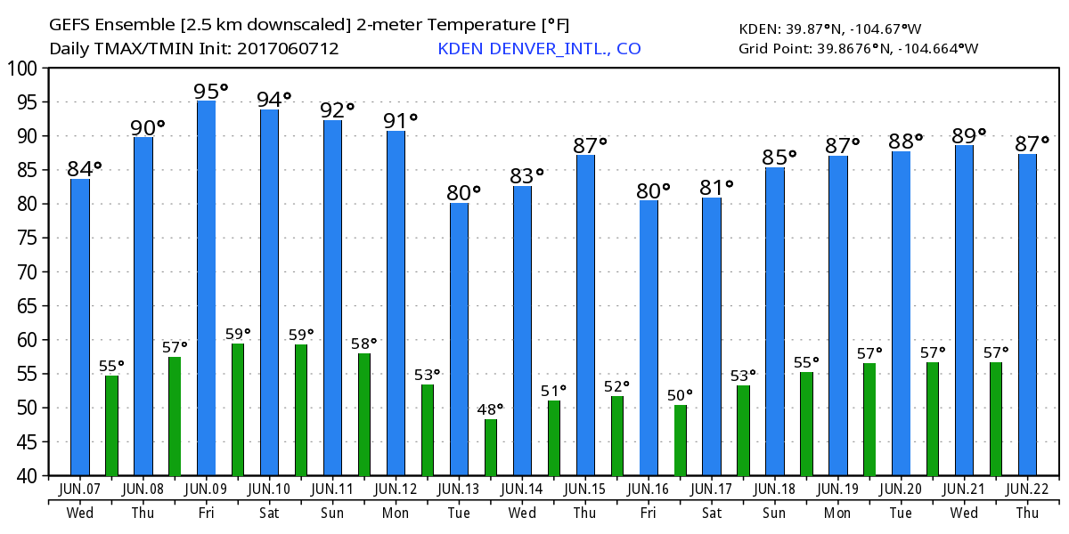
Will we see record heat? Perhaps. Friday will stand the best chance at hitting the record of 95°F for the date (last tied in 2012), but Saturday will likely be out of reach as the record is 99°F for Denver, set in 2013. Both NAM and GFS MOS have 95°F for Friday at Denver, so the record will certainly be in jeopardy!
Temperatures should cool a bit to start next week as ridging eventually flattens out then is nudged east with a strong upper level trough set to move into the west to start the week.