Severe Storms Take Aim at High Plains Today, Including Portions of Northern Colorado

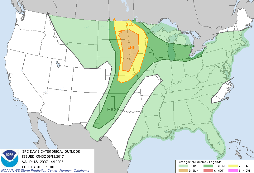
Severe weather to hit portions of Colorado, Wyoming, Montana, South Dakota, and Nebraska Monday. Below are the outlook areas, showing the highest likelihood of damaging storms to be in Wyoming (red):
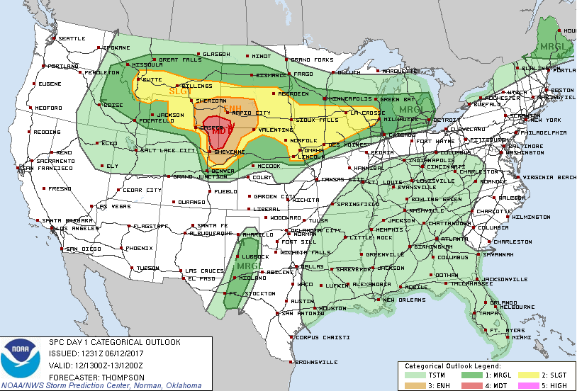
Notice that there is a slight and elevated risk that covers portions of Northern Colorado from Denver to the north. An elevated risk for Colorado is not common, although we do see slight risk categories often this time of year.
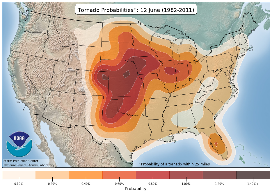
Here's today's historical climatology for tornadoes, suggesting tornado outbreaks are not uncommon for today's date:
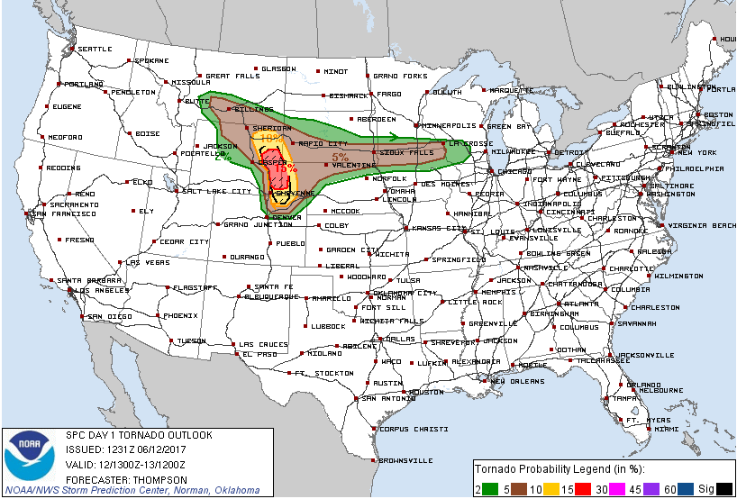
Tornadoes, wind, and hail will all be possible across these northern High Plains. For the areas, tornadoes are quite possible and the risk is much higher than climatology suggests for today – particularly north of Cheyenne:
SETUP
There's a system out near Nevada that will swing through the region, aided by a very strong 700mb jet that will push over these risk areas. That strong jet coupled with the natural rotation of the approaching system will be the perfect combination for storm development. There is low-level moisture in the areas too that rounds out a tornado producing trifecta.
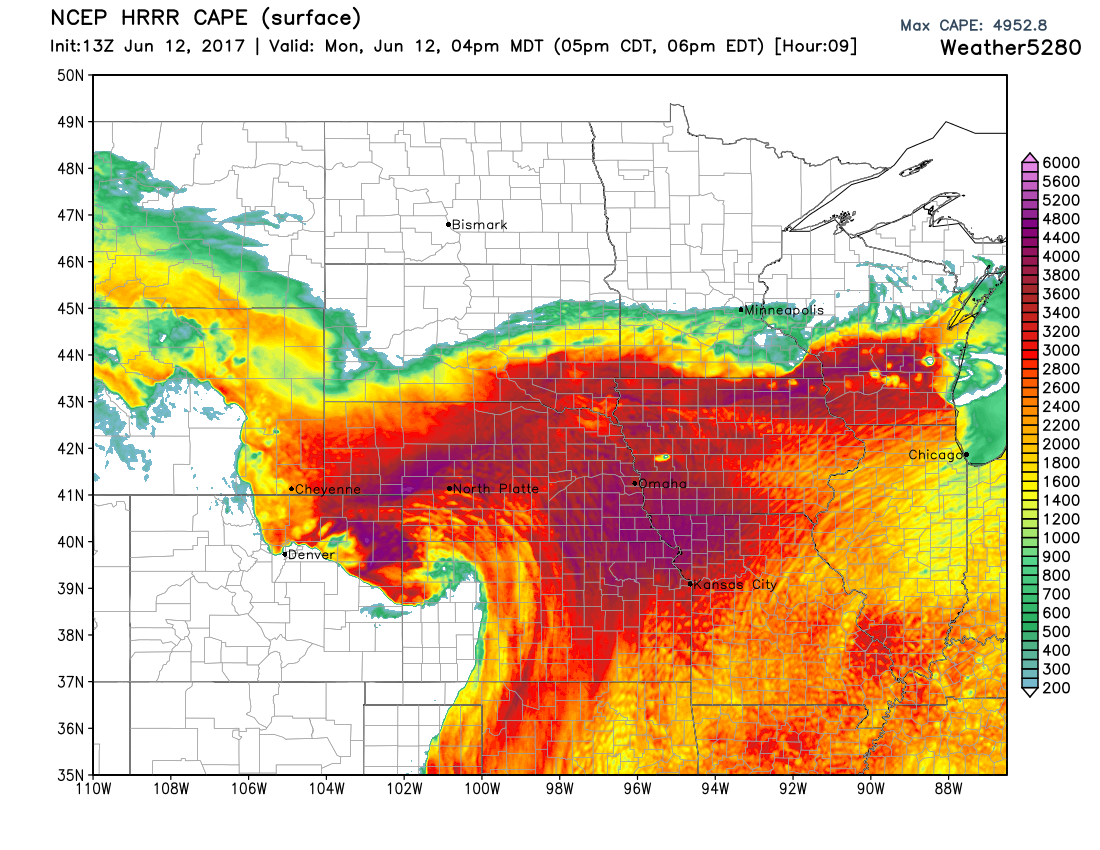
Here's a look at the total available energy in the atmosphere late in the afternoon:
And, some of the localized rotation for the same time:
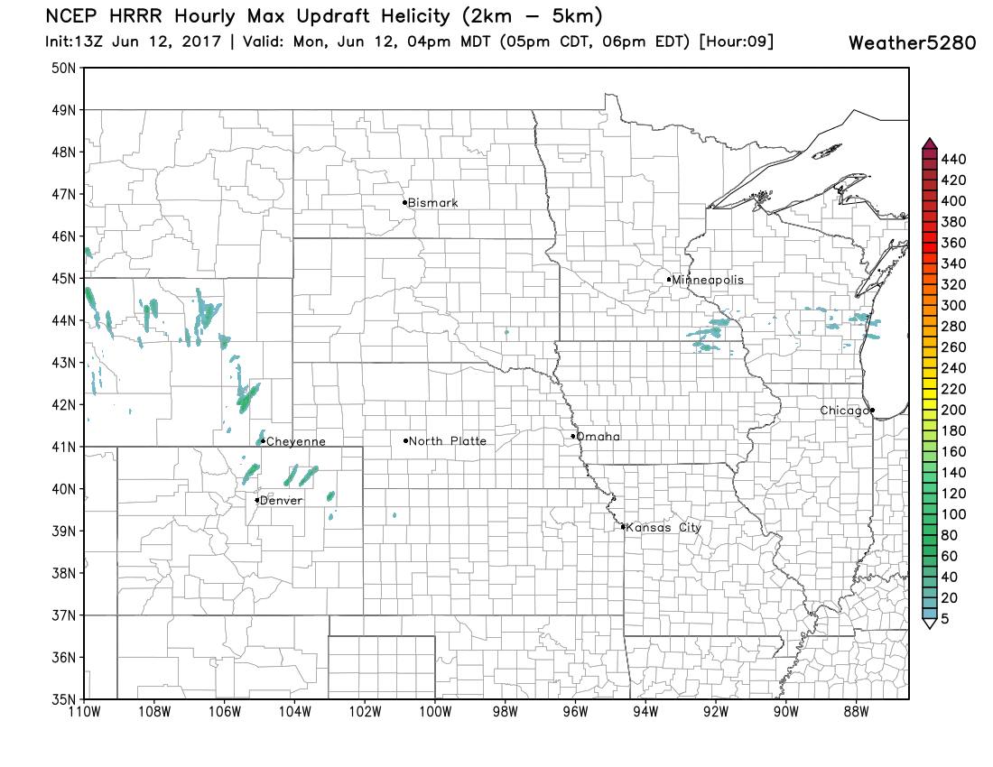
TIMELINE
The dynamics of the setup are most energetic in Wyoming and Northern Colorado as you'll see in this timeline. NOTE, this is just one computer model simulation of the day and may or may not correctly place the storms' exact locations, however, this should be used as a timeline reference for potential near your area. The tornado potential will likely depend on whether or not storms manage to stay discrete. There is some concern that large scale forcing for ascent will cause storms to grow upscale shortly after initiation.
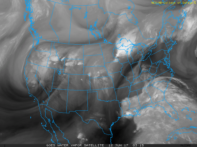
We can see a speed max on water vapor imagery (denoted by the darker swath crossing into eastern Utah. This will provide a source for lift later today over the High Plains.
First the regional view:
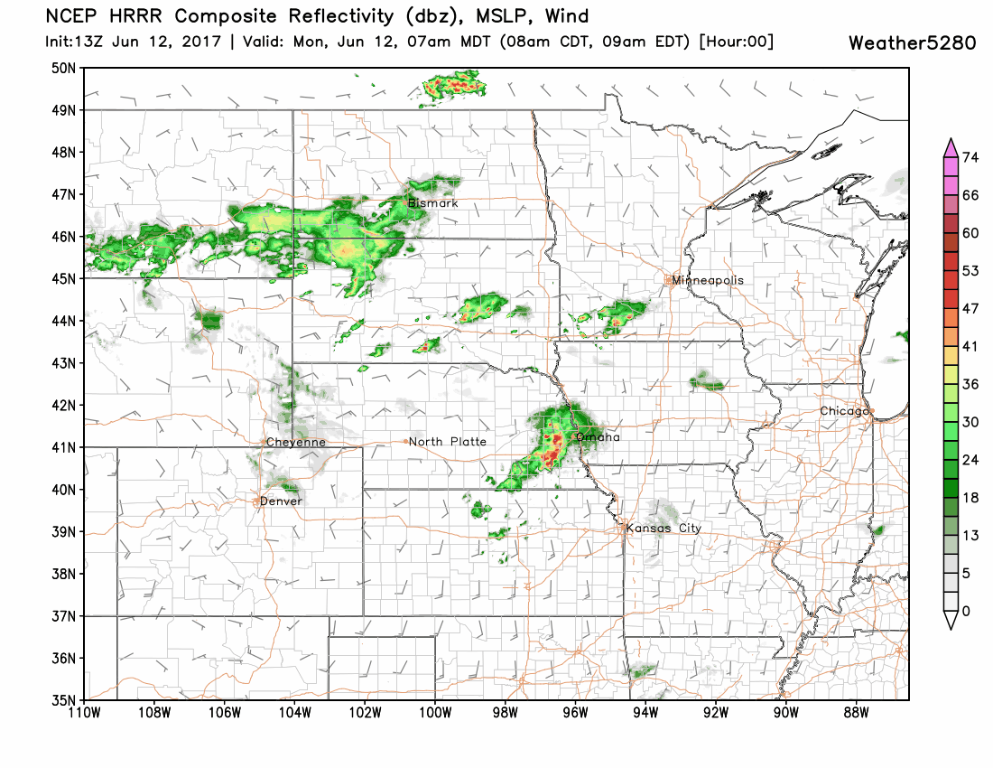
And, Colorado's view:

You can check back for hourly updates to these model runs by clicking the HRRR link on our models page.
TUESDAY
The system creating Monday's severe weather will scoot east for Tuesday leaving Colorado behind.
Please stay weather aware today. This post is meant to grab your attention to the fact that weather will become quite dangerous in the aforementioned areas.