The State of the Atmosphere: Sunday, February 18th, 2018

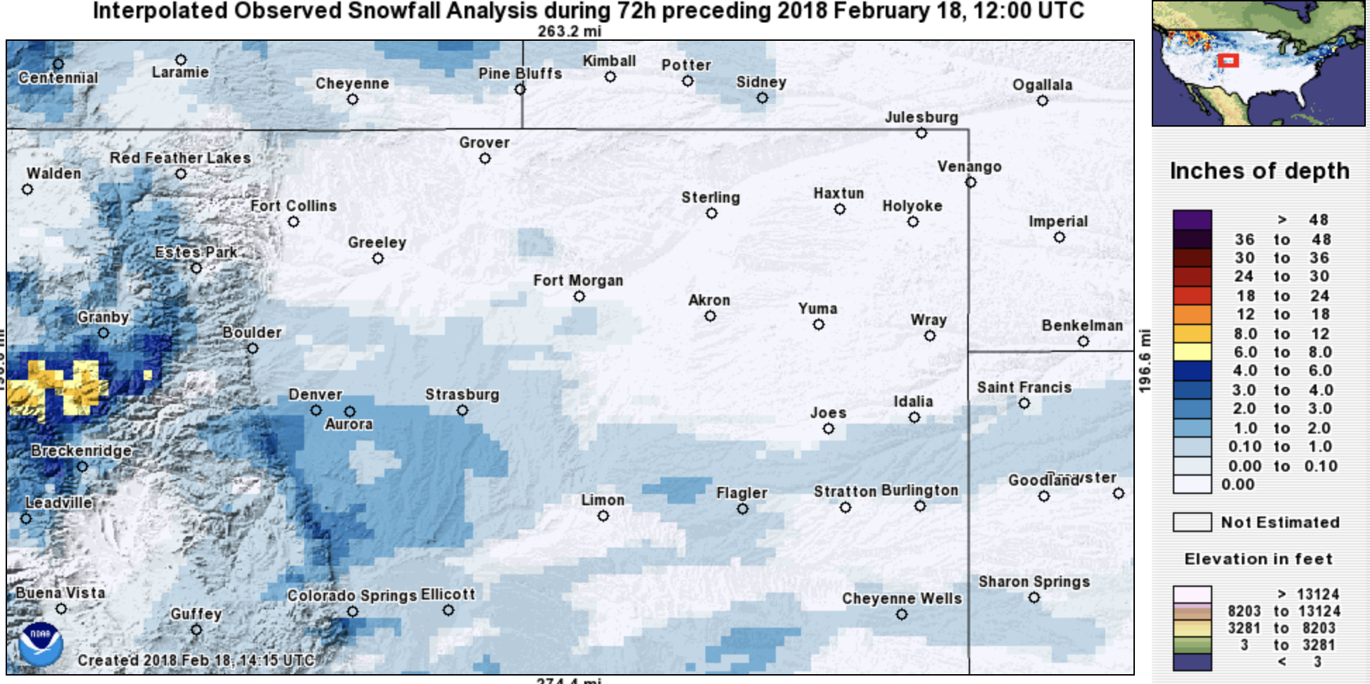
First a quick look back at our beautiful, albeit brief, snow on Thursday. It really came down for a time, with the convective nature of Thursday's snow reminding us of the seasonal change that is on our doorstep.
We picked up a quick 1.5" at our station downtown (forecast was 0 - 2") with Denver's southwest suburbs and the western Palmer Divide doing a bit better in spots with snow totals from 3 to 4" reported in a few locations there. As you can see in the map below, that was about it for snow totals across the region... as expected, those to the north really didn't see much of this snow at all.
The week ahead
With midday temperatures well into the 60s across the region, it's hard to believe our next system arrives tonight and tomorrow and brings with it another chance of snow for northeast Colorado. In addition to the chance of snow, look for temperatures to take a big time tumble... from highs in the 60s today, to teens by Tuesday.
Greatest snowfall probabilities with this next system look to be along and west of I-25 from Denver north to the state line.
There will be a couple main bands with this next snow, the exact placement of which will be difficult to pin down. Right now it looks like the favored axis will stretch from Boulder county northeast through Loveland, Fort Collins, and on into southeast Wyoming. But obviously, if that shifts a little north or a little south, it'll have big implications on any snowfall forecast.
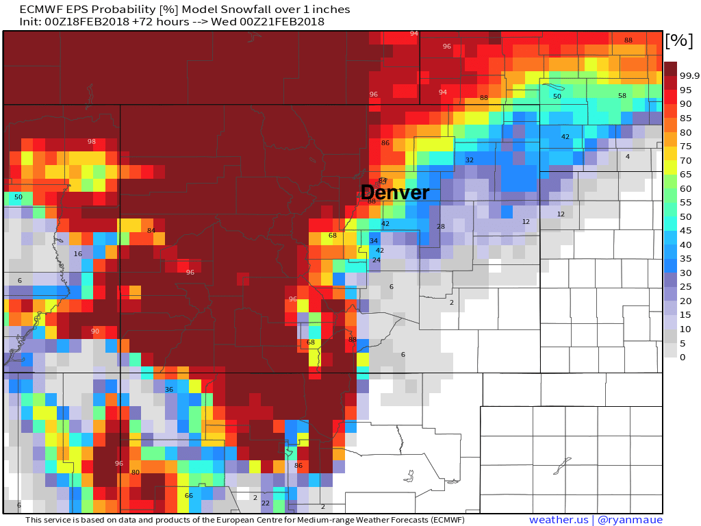
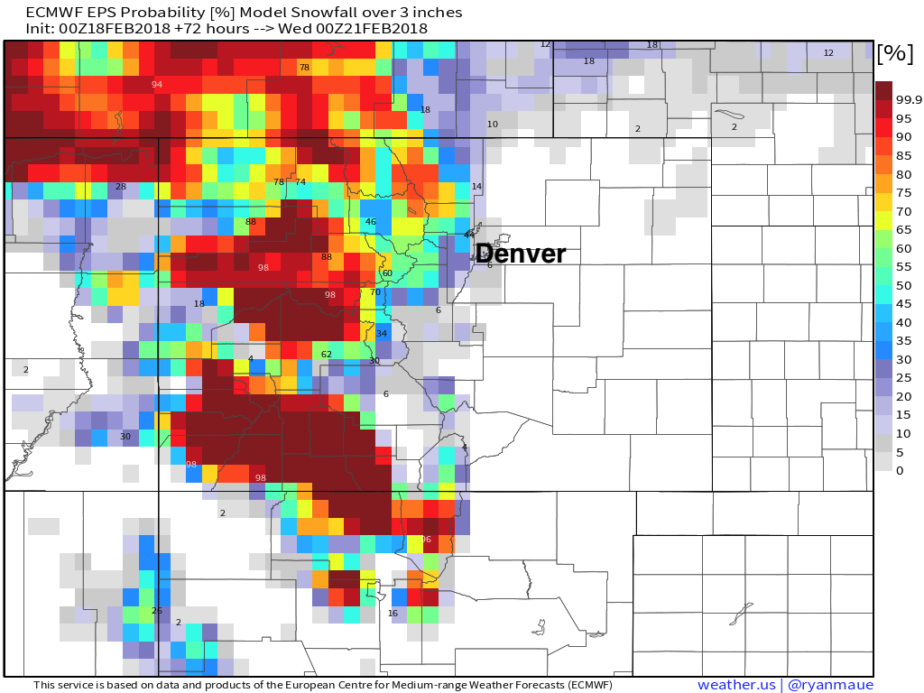
Snowfall probabilities from the EURO reflect this... if we look at probabilities for 1" or more through Wednesday we see the likelihood is greater than 90% from northwest Denver north/west to the state line. The further south/east you get, those numbers drop quickly:
If we look at the probability of 3" or more, we see odds drop quite a bit. Still, the greatest probability of that occurring looks to be north and northwest of Denver at this time:
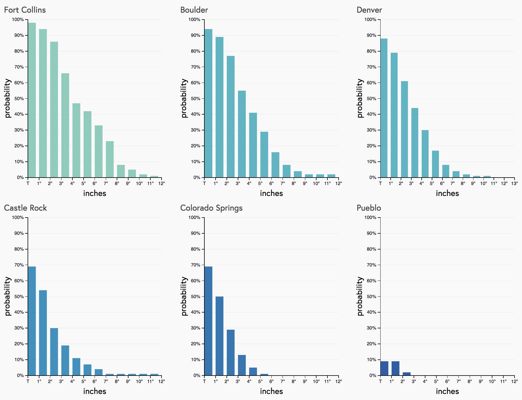
And, if we look at our gambler charts we see a similar story. Boulder and Fort Collins both with >50% probabilities of seeing 3" or more of snow, with those probabilities dropping quickly from Denver south:
This, of course, all goes out the window when a band sets up a few miles further south than currently forecast (the 3km NAM was parking it over Denver this morning), but probabilistically this would be the less likely scenario.
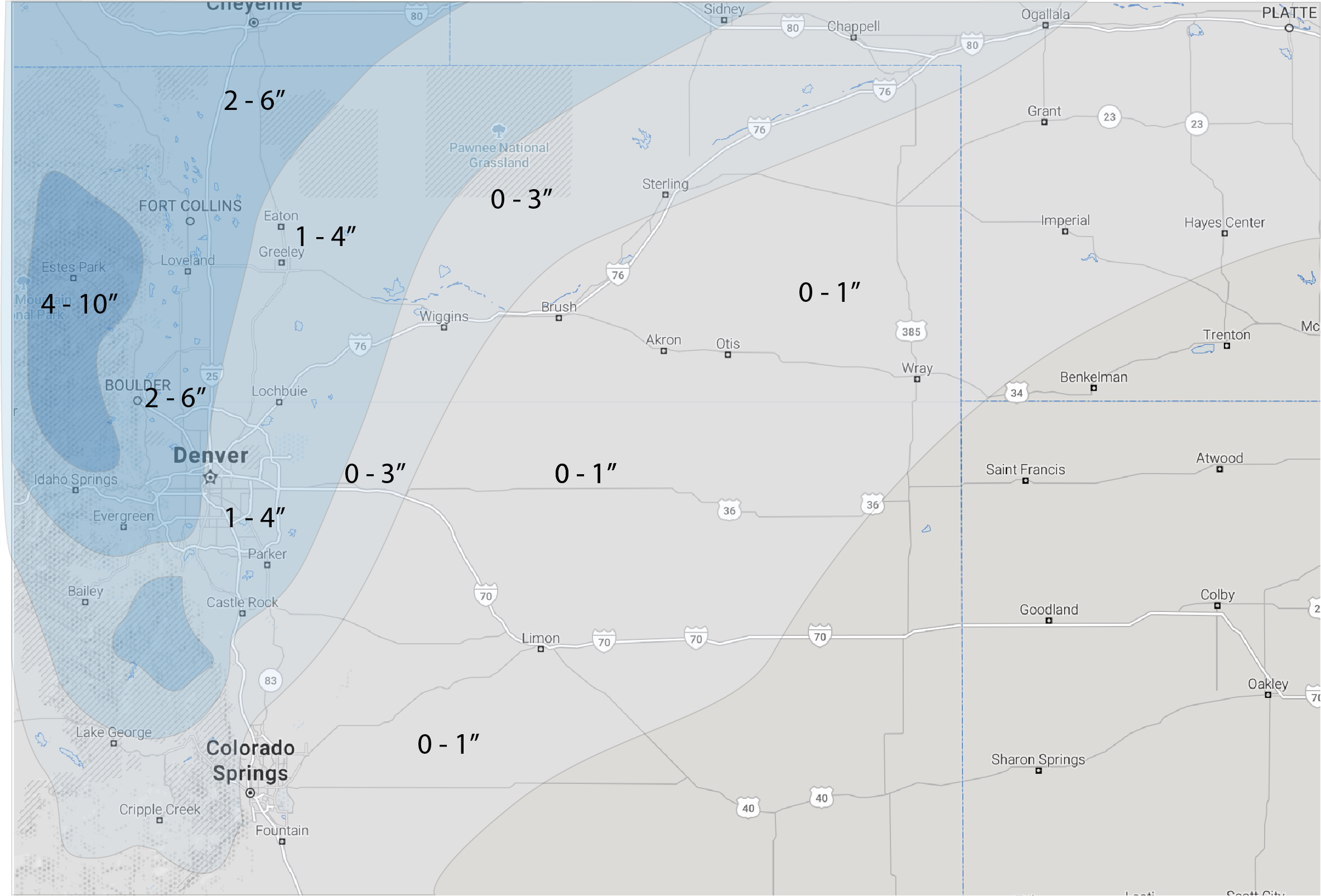
With that, our snowfall forecast is as follows. For Denver we are going 1 - 4" over most of the city, with 2 - 6" for northwest Denver and northwest suburbs. Higher-end totals are possible in the city should that band end up a bit further south... and low-end totals if not. For the northern urban corridor will go with a general 2 - 6" range, with certainly a "boom" scenario at play if that band parks over your house. While we realize that's a pretty big range... we think most folks here end up in the 2 - 4" range, but have included the 6" high-end to try to accommodate for whoever ends up under that heavier swath of snow. For most people along the urban corridor this may end up being more about the cold than snow, but let's see who gets lucky!
Snowfall totals are from Monday morning through Tuesday evening:
Timing and impacts
There will be plenty of cold air associated with this next round of snow... so if you see snow, roadways will almost certainly become snow packed and icy.
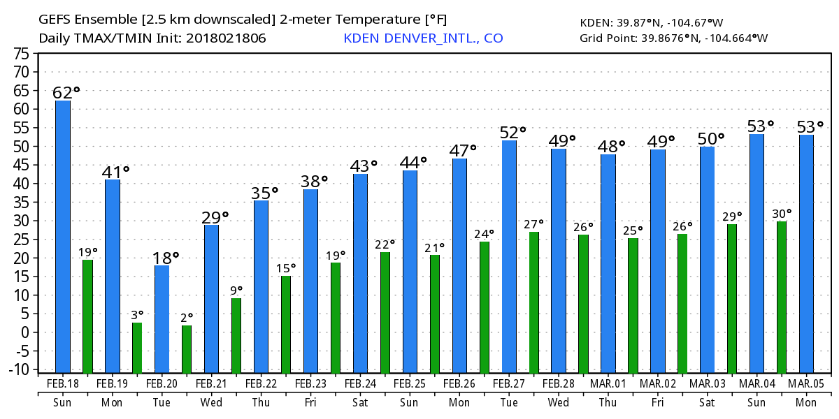
Don't be fooled by today's warm weather, daytime highs Monday will likely be in the 20s across northeast Colorado, with overnight lows Monday into Tuesday dropping into the single digits. Tuesday will be the coldest day of the week, with highs only in the teens for Denver.
As you can see, the GEFS shows 41°F for Denver on Monday, but that likely comes early if we even do warm that much. It has a high of 18°F for Tuesday which seems reasonable, MOS guidance is generally in the 18 to 22°F range for Tuesday.
As for snow... we could see some light mixed precipitation tonight, but otherwise, the main mix/snow holds off until Monday and Monday night. Best accumulating snowfall potential in Denver is likely between midday Monday and early Tuesday morning.
We should see some light snow lingering from time to time across northeast Colorado on Tuesday with the cold air in place, but the main snow event should come to an end in most locations. Additional light snow accumulation will be possible, especially given the light fluff that would fall if any does.
Expect roads to remain impacted through the day Tuesday where we do see snow, as temperatures won't allow for much melting – especially on the side roads.
Remainder of the week
Beyond Tuesday temperatures moderate a bit, but overall stay pretty chilly with lots of cold air pooled in the west.
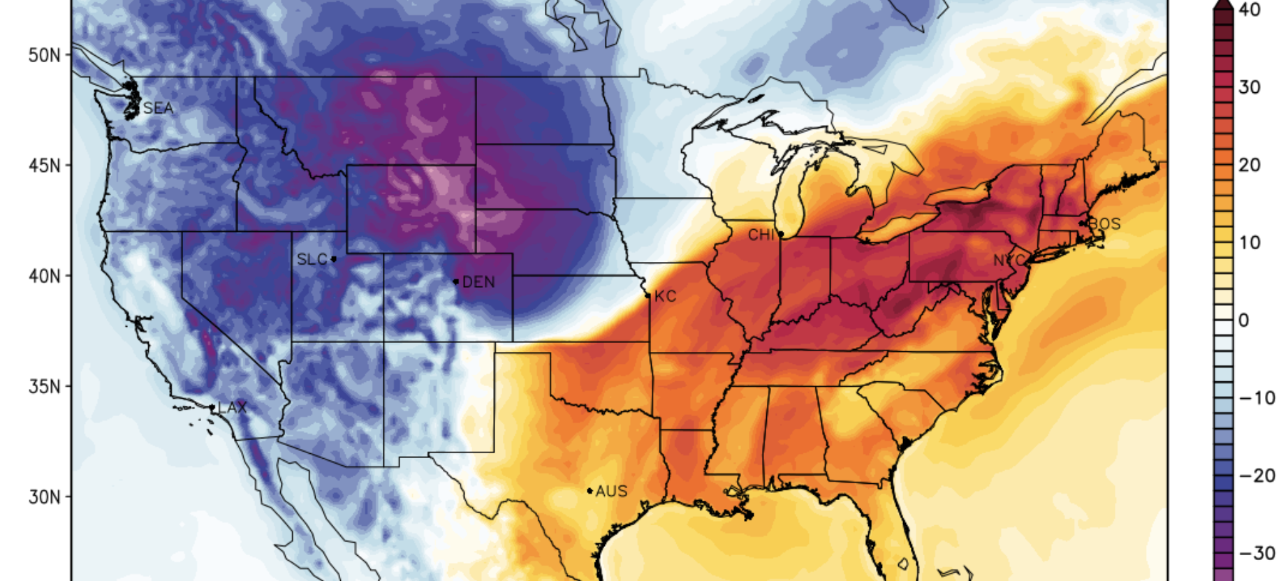
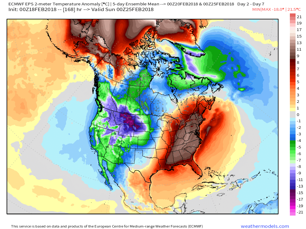
If we look at the five-day average temperature forecast valid next Saturday, we see all that cold that will be in place across the intermountain west this coming week, while the east coast really warms up:
So, while the coldest air of the week settles in for Monday and Tuesday, we should see highs in the 30s and 40s for the remainder of the week – with no 60s in play for awhile.
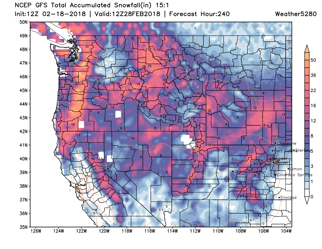
As for snow... the mountains will see several more chances through the remainder of the week, so that good pattern continues up there. For Denver the snow chances are quite low through next weekend... but we'll next to watch these systems closely. It could be a little something tries to blow through Thursday into Friday.
The 10 day from the GFS looks quite nice across the hurting west. Ski conditions are likely the best of the season to round out February: