Snowfall Totals and Quick Look at Remainder of Week

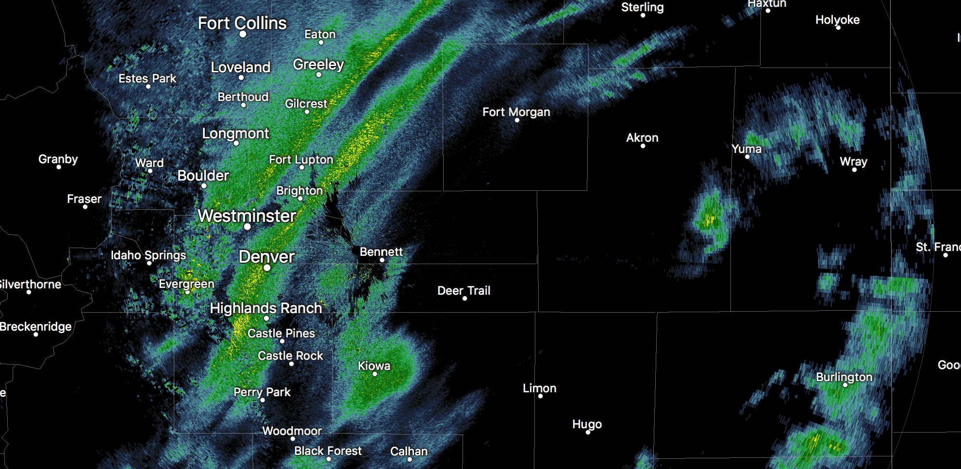
Never underestimate jet induced snow bands! Yesterday we saw the power of banded snowfall in full swing across the Front Range, with snowfall rates in excess of 2" an hour at times. The high-ratio banded snowfall led to some impressive snowfall totals in a few areas, with lighter snow but plenty of cold elsewhere.
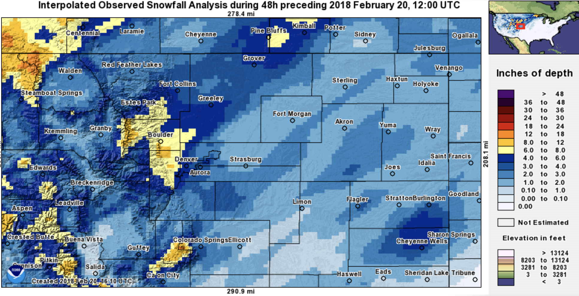
In all, very happy with how the forecast panned out. We highlighted the zone from Denver's western suburbs north and northwest for the greatest potential for the heavier snowfall and totals of 6 - 8" (or more) possible. Sure enough, that's where we saw the greatest totals, with a few 9" reports coming in from the Louisville area:
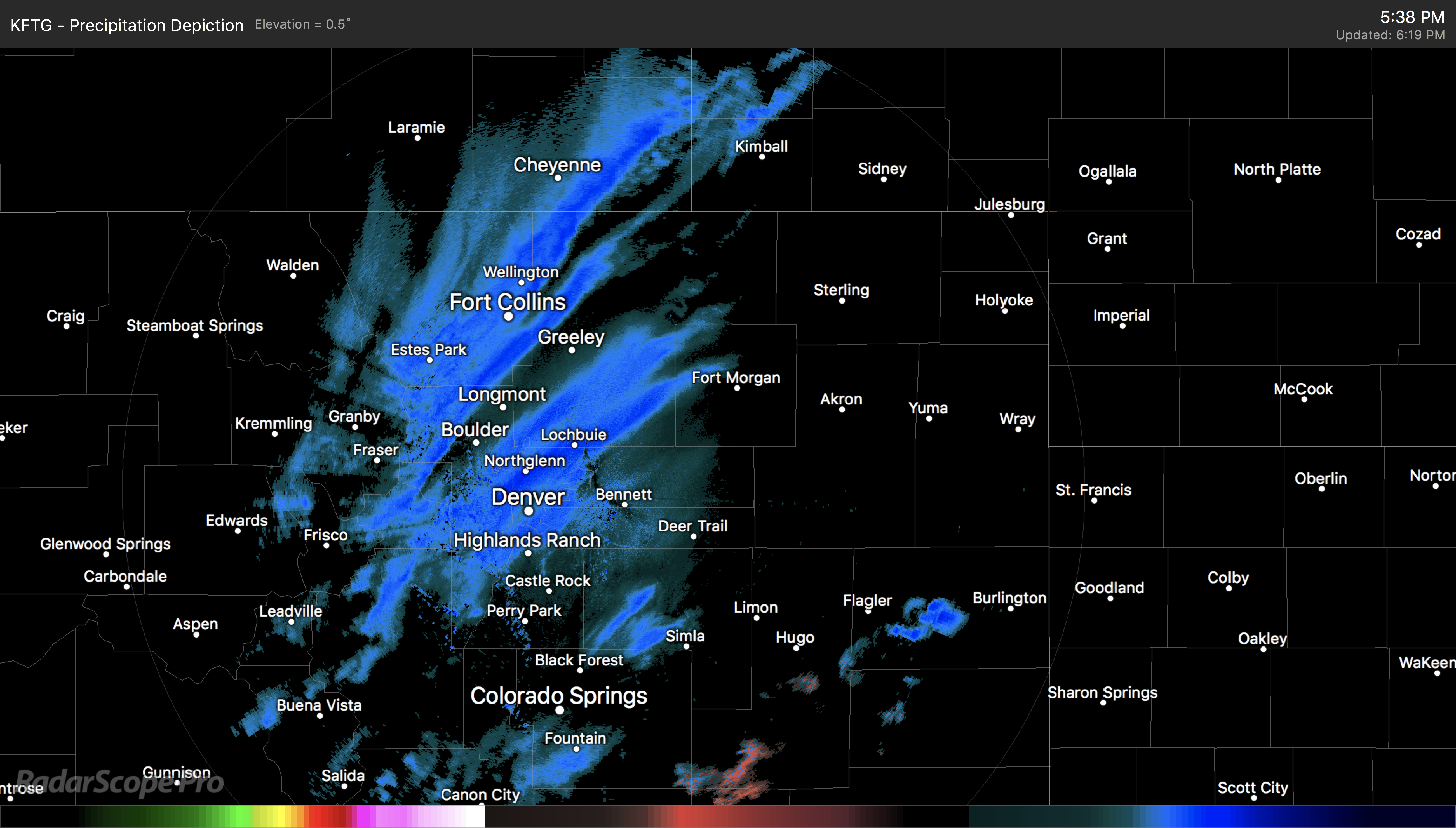
At times these bands of heavy snowfall were very narrow, hence the difficulty in forecasting them with precision. Here's a look at the radar just before 9pm last night, one heavy band draped over Denver, and another (the one responsible for some of the greatest totals) starting to push east to the north and west of the city. Both were producing near whiteout conditions under the heaviest snowfall (yellow) but really only for a narrow/elongated strip:
At our station on the south side of downtown Denver we recorded 4.2" from yesterday's storm (we were in right on the 1 - 4"/2 - 6" line that split Denver east/west). Denver International Airport recorded 2.9" for Denver's official total, sitting very comfortably into the 1 - 4" range we had for DIA.
Again, the greatest totals were on Denver's west side and north of the city. The Fort Collins area reported 4 - 6" of snow, Loveland saw 4 - 5" of snow, Boulder recorded 8.8" of snow, with the western Denver suburbs seeing 4 - 7" of snow.
Remainder of the week
Big story today is the cold. And really, much of the rest of the week will remain on the chilly side.
This morning DIA bottomed out at -2°F this morning, and should stay in the teens maybe low 20s through the remainder of the day.
By Wednesday temperatures "rebound" into the low 30s, but overall it'll be another chilly day across the region.
Not much better in the temperature department through the remainder of the week as we watch another system due to arrive Thursday into Friday. Right now this doesn't look like a huge snow producer for the urban corridor, but we'll need to keep an eye on it, as at least some light snow will be possible. The best chance of heavier snow may stay locked up in the mountains and then east across the plains.