Wednesday PM Update: Additional Chances for Snow to Round Out the Week
There are additional chances for snowfall over the coming days with the cold air that will stay in place through the end of the week.
In all, we aren't looking at a big surge of snowfall. We are looking at occasional hit-and-miss snow showers around the greater metro area through late Friday.
Here's a look at a snowfall timeline from the short-range ensemble models. From left to right we have the timeline going through Thursday, Friday, and Saturday. We can see some spikes tonight and Thursday, and then again late Friday into Friday night.
Those spikes aren't all that compelling. It appears (eye-balling it) we have a roughly 1 in 3 chance of snowfall over the coming days.
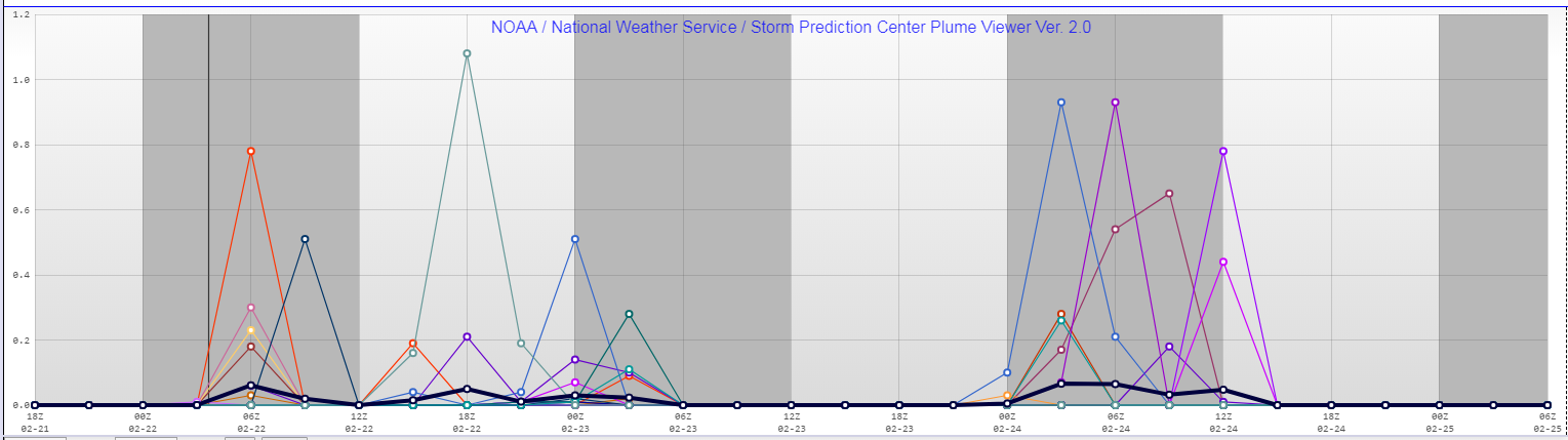
Basically, just don't be surprised to see a snow shower move over your area, and similarly... don't be surprised if you don't see one at all.
As far as totals, it will be 0-2" and quite "patchy" for the metro area. Meanwhile, higher totals of more widespread snowfall will be on the plains and in the mountains.
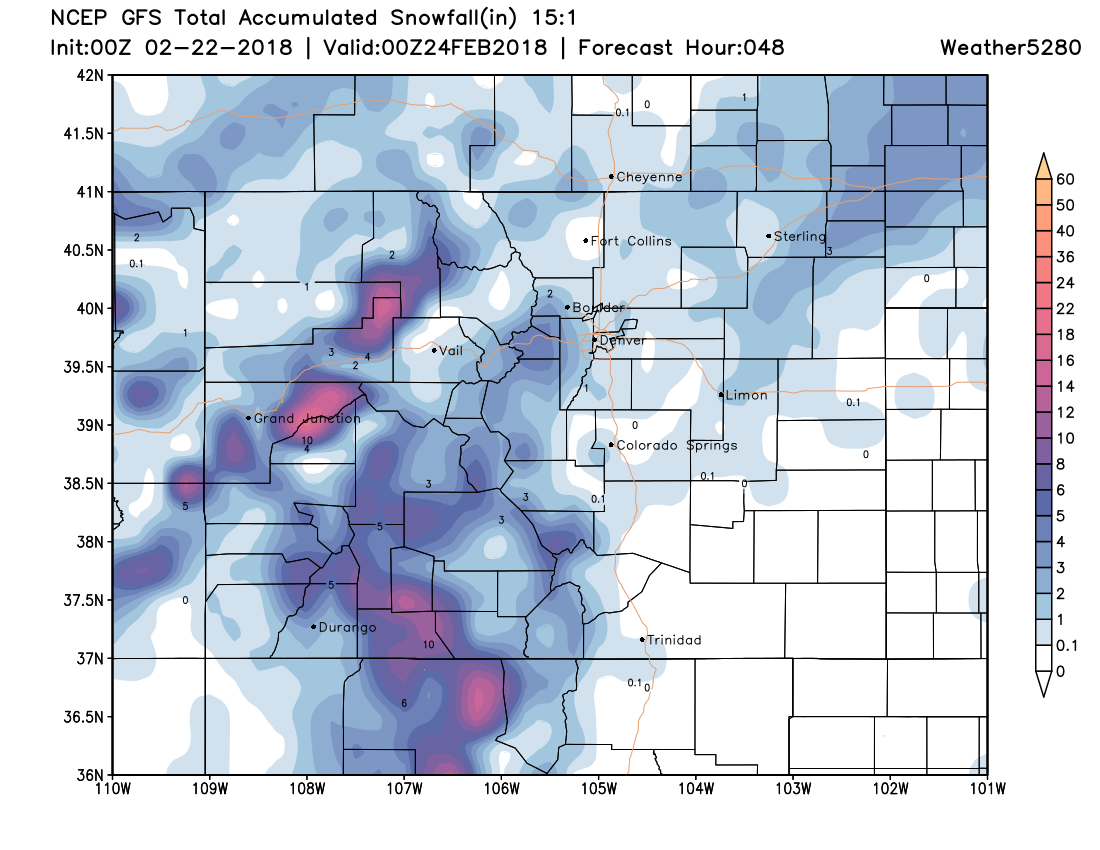
I'm just showing you one computer model here representing the potential amount. KNOW THIS, these snow showers will be hit-and-miss so the location depicted on the model may not necessarily be accurate. In other words, if you don't see your area colored for snowfall don't be surprised to actually see some.
Temperatures
After a record cold start to Wednesday, the temperatures warmed into the 20s. We will be back into the 20s and potentially some lower 30s Thursday. 30s with some isolated 40s are possible Friday, Saturday, and Sunday.
It does appear that early next week this active weather pattern will quiet some meaning we will go back to warmer, drier days.