The State of the Atmosphere: Monday, February 26th, 2018
After seven days of colder than average temperatures, we will feel warmer for the week ahead. You should feel free to wash your car and put away the snow shovels through the end of the work week at least.
Last Monday's high was only 20º, we will be much warmer than that today with many areas hitting 50º and warmer, thus ending the cold stretch.
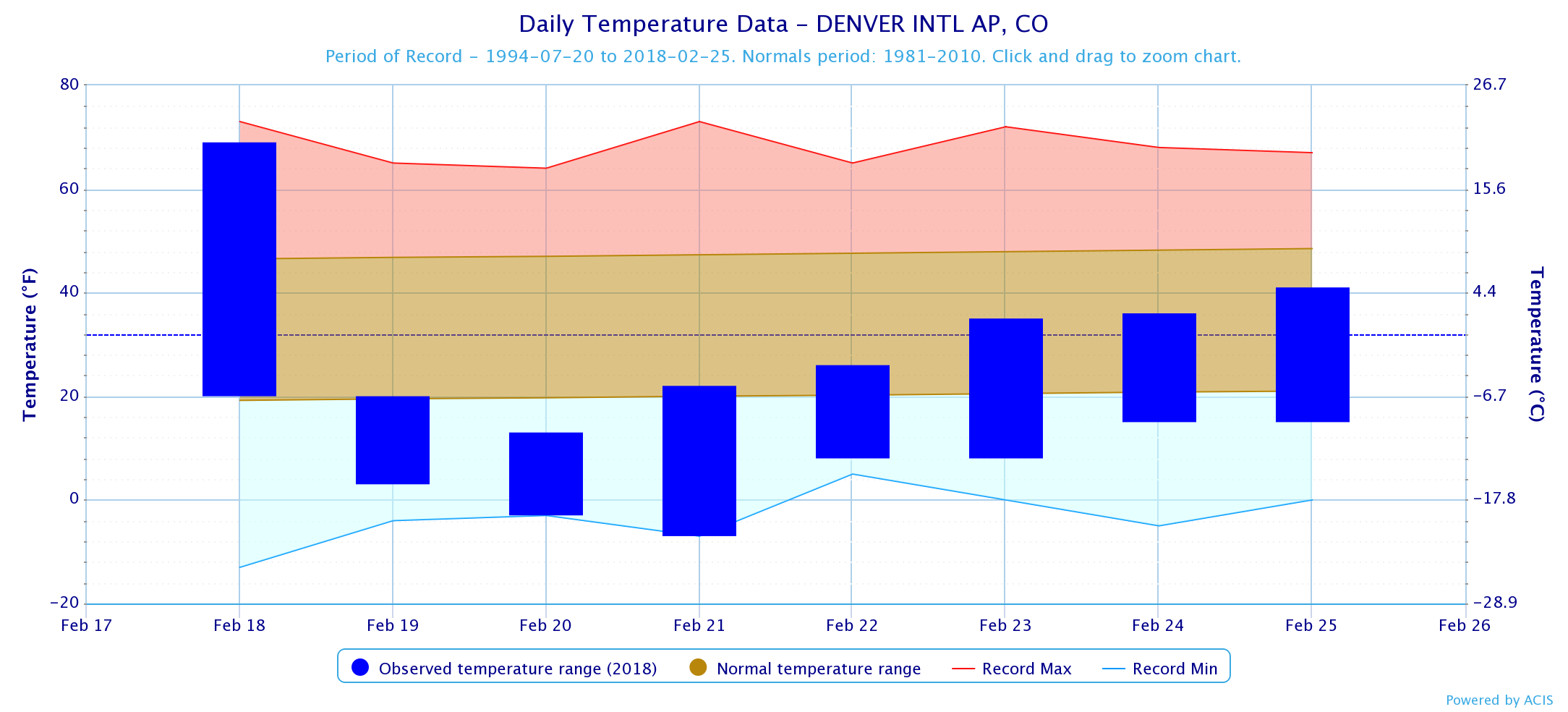
Not only are colder temperatures clearing, our storm pattern is drying also. Not that last week was all that snowy for Denver officially; 3.8" (Just over 19" on the season with an average to date of closer to 35"), but some of the surrounding areas did very well.
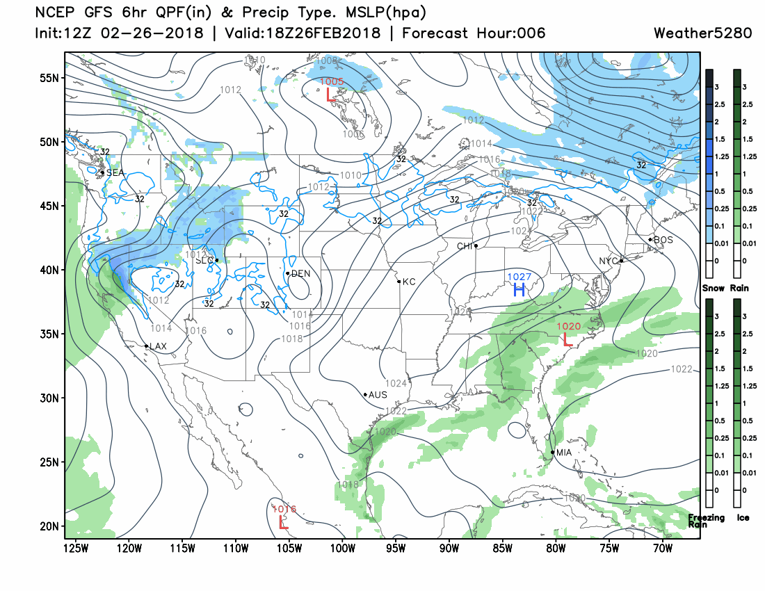
Here is a look at the week. We aren't devoid of storm systems, in fact, a couple come out of the northwest and dig over the southern plains before turning toward the northeastern US. The problem is that these systems lose most of their moisture over the Pacific Northwest and Northern Rockies and don't regain any moisture until they push east of the state.
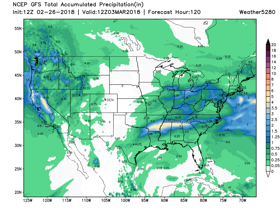
With that said, take a look at the total precipitation expected this week. The lee side of the Rockies will be mostly dry, bookended by the moisture.
About the only chance for even a little bit of precipitation, this week will come Tuesday through Wednesday. The mountains will have a bit of snow, rain for the western slope, and very little for east of the Divide.
That puts Denver down as an optimistic 10% chance of rain/snow mid-week.
Temperatures will drop a slight bit as that system brings the low chance of moisture to us. From the 50s Monday and Tuesday to the 40s for Wednesday; that isn't much of a drop.
Temperatures turn right back into the 50s Thursday and perhaps 60s for Friday and Saturday.