The State of the Atmosphere: Sunday, March 11, 2018

We are now well into Denver's snowiest month on average with nothing to show for it in the city. We've flipped the books on February's cold too, with Denver International Airport running 4.3°F above average through the first 10 days of the month. While not a surprise, certainly discouraging, as Denver's season-to-date snowfall drops to about 50% of average with just 19.4" of snow recorded since September.
By month's end we should be more than double the snowfall we've seen so far this season, with 46.5" falling on average between September 1 and March 31. Making that up is a tall order, and one we're not likely to make barring a (dare I say) miracle March storm during the second half of the month.
Since 2010, just two year's have recorded above average snowfall in March in Denver. While the city records 11.4" on average during the month, last year we saw just a Trace of snow... with our last above average March coming in 2016 when 18.4" were recorded. So, while March certainly CAN produce big snows for the city (see the top five March snowstorms here) it's certainly not a guarantee.
The week ahead
The week head looks not all that different than last week. The big story for the work week will again be the very warm temperatures headed our way by Wednesday, with MOS guidance pushing Denver to 70 on Wednesday and into the mid 70s on Thursday. While the coasts stay cool (and wet) the focus of the warmth will be over eastern Colorado and the high plains by midweek:
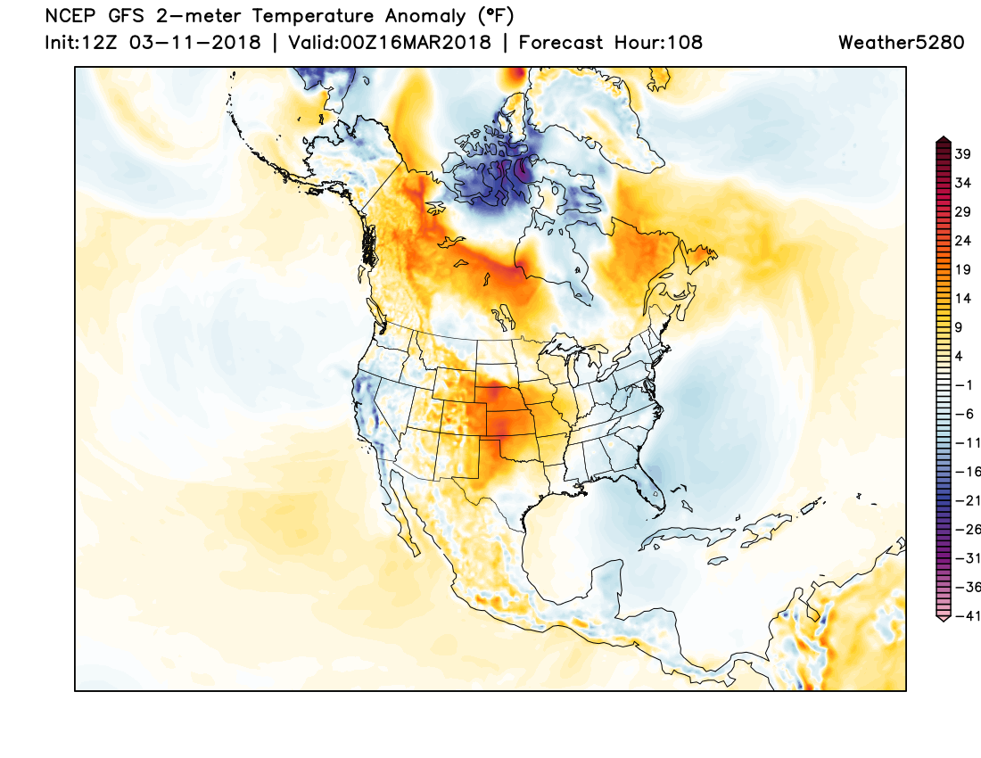
I can't really talk myself into saying much more about the upcoming week than that. Enjoy the spring time temperatures and please keep an eye out for heightened fire danger once more. Dry conditions + wind + warm this time of year can mean plenty of fire activity across the eastern half of the state.
Next weekend
Next weekend and into next week we start to see a bit more of an unsettled pattern emerge. Models show a large upper level low diving into the West to end the week, and eventually progressing across our region as well.
Unfortunately there's very little support thus far for this storm to take a favorable track for those of us east of the Rockies... but of course there's plenty of time for that to change. For now it looks like the most likely scenario is for the best energy to end up too far north as it spins over Colorado and eventually ejects northeast.
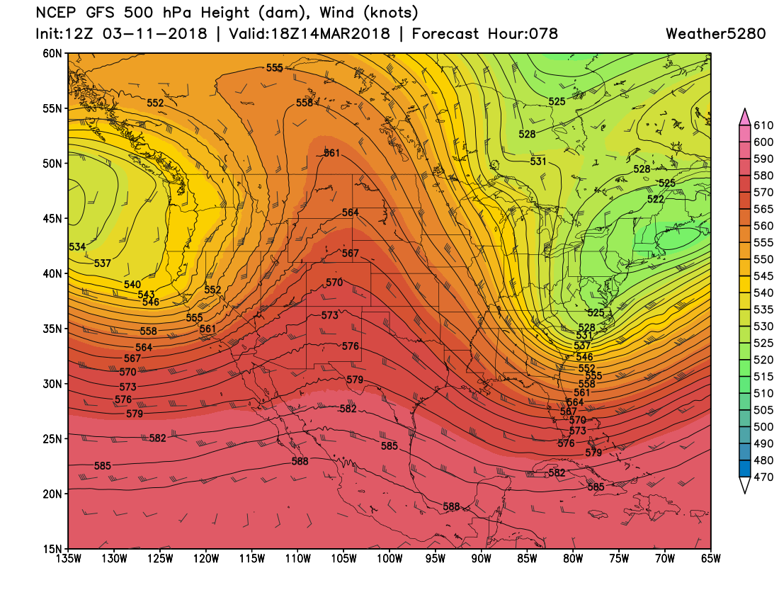
So, while the midweek ridge:
Is replaced by a nice looking trough late next weekend:
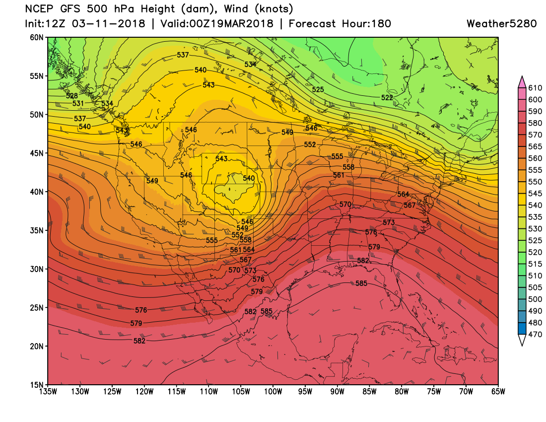
We'd need to see it dig a bit more for the Front Range to see a classic March upslope event. Right now... you really have to get creative to see how that happens. While we are seeing some swings in the models run-to-run, it's not been much, especially for this time of year and being so far out. Couple that with very little ensemble support for anything significant (GEFS and EURO shear out the energy pretty good as it comes across the Rockies), and well, you're left with only the hope something changes between now and then.
For now, plan on cooler weather for your Saint Patrick's Day weekend... but no classic March blizzards in the forecast for now. Might we see some snow by late next weekend? Certainly possible... but for now it looks like the best chance will end up in the mountains and well north/east of the greater metro areas. Something to keep an eye on.