March Ends on a Wintry Note

It almost seems fitting that now that spring has arrived it's finally feeling a bit like winter around here. While this March hasn't been all that snowy by March standards, some locales along the Front Range have done quite well this month. And fortunately, some that saw less snow managed to at least capitalize on some decent moisture.
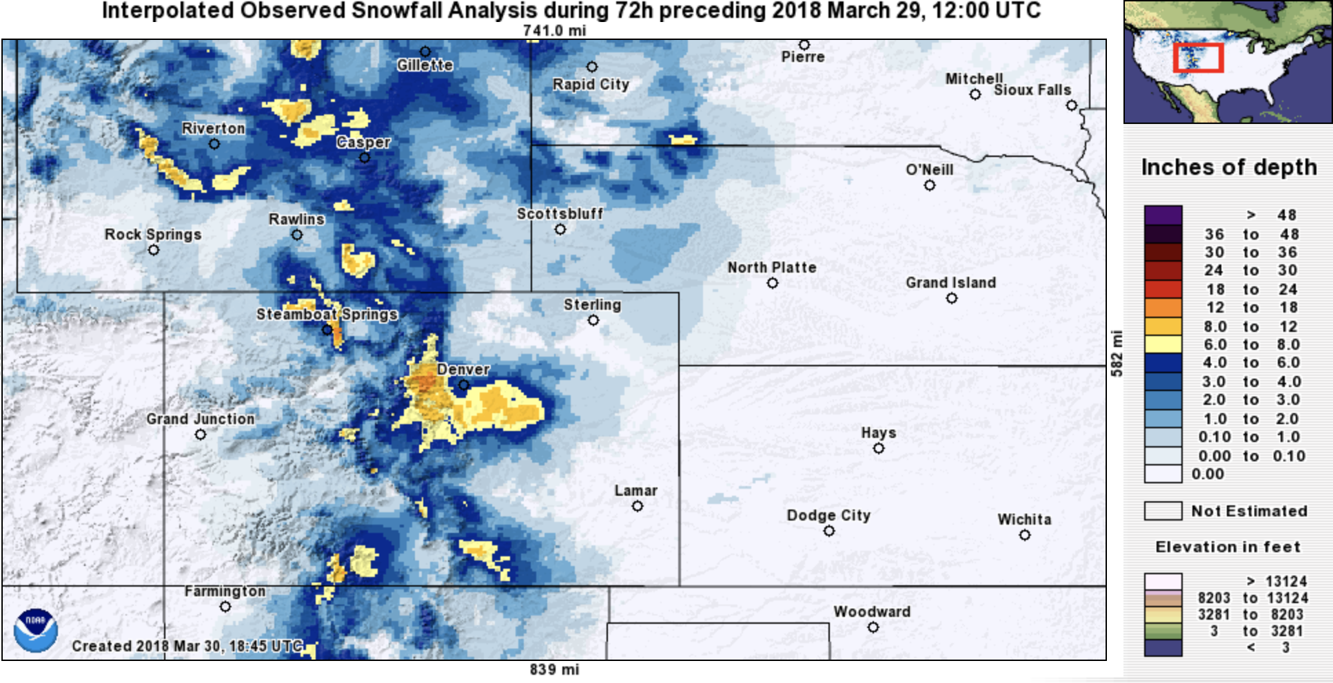
Snowfall this past week looked like the following – pretty quiet in the mountains, but some nice totals along the Front Range:
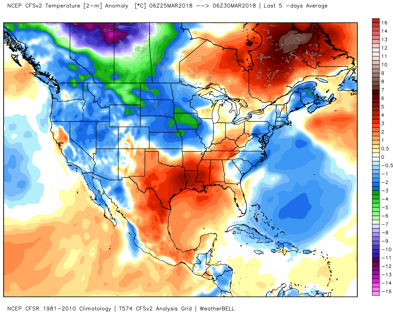
And temperatures over the last five days have been below average too:
Snowfall still well below average
Denver International Airport has logged just 4.8" of snow this month, well below the 11.4" we see on average. For precipitation, however, the airport has recorded 1.02" which is 0.18" above average for the month.
This brings Denver's season to date snowfall total to 24.2" –– WELL below the average of 46.5" we see by the end of March. As for precipitation, we've recorded 1.87" at DIA since January 1, where on average we see 1.66" year to date, so some positive news here, I suppose.
Week in review
This week proved interesting around here, but quieter weather appears in store for the weekend for most of us, the exception being perhaps across the northern metro area and northeast plains Saturday PM.
Our Monday system panned out more or less as expected, as did our Wednesday system with a few exceptions. While most of the urban corridor picked up just a coating of snow on Wednesday, a few areas southeast of Denver managed a quick 4 - 6" (😱) which certainly counts as over-performing.
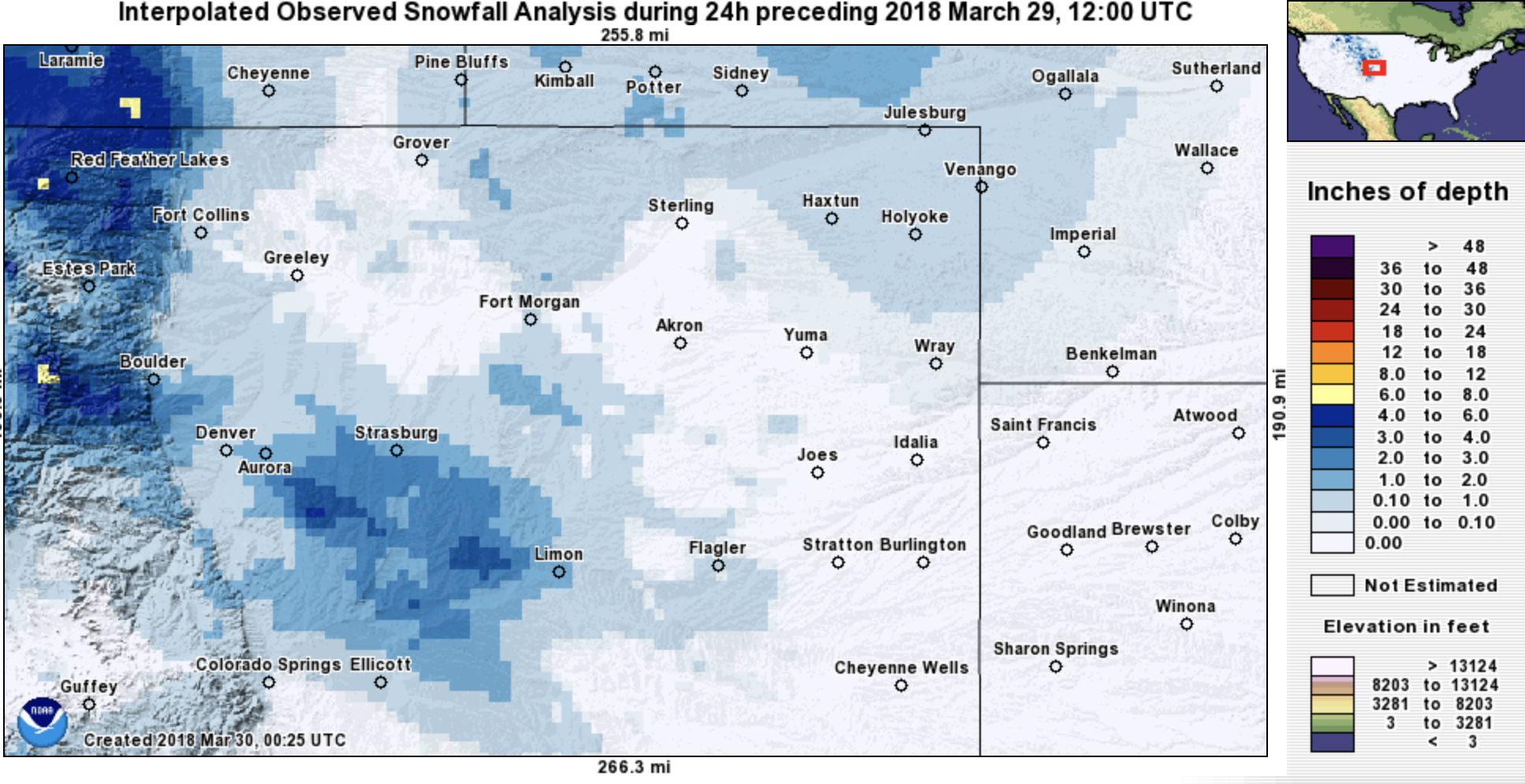
Wednesday's system was very impressive in many respects, one that likely would have resulted in a pretty active severe weather day had it come a month or so later. As it stands, those living southeast of Denver certainly were in for a treat... with the 24 hour snowfall totals map ending yesterday morning looking like this:
Looking to the weekend
This weekend looks quieter for most of us, but again we could see some rain and snow showers develop along the norther urban corridor Saturday afternoon and evening, extending east onto the plains Saturday night. For Denver and points south the probability of seeing and rain and snow this weekend is pretty low.
Additionally, we're likely to see some gusty winds tonight across the region, and again from time to time Saturday along with some cooler air.
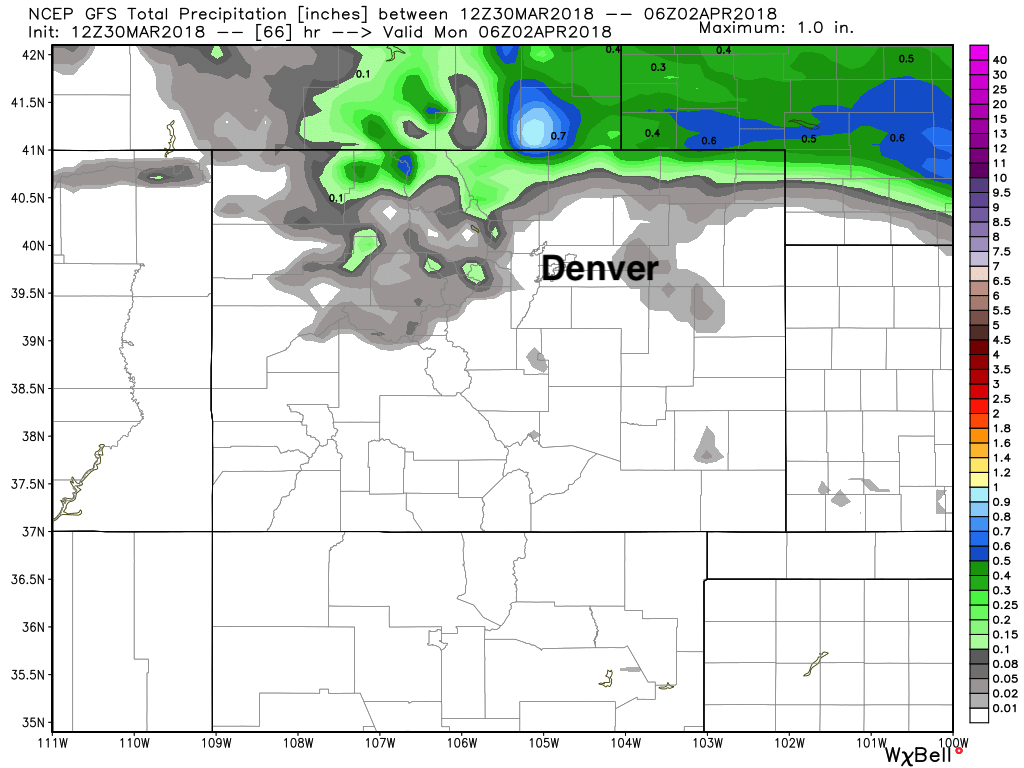
A look at the precipitation forecast from the GFS:
And the hi-res NAM:
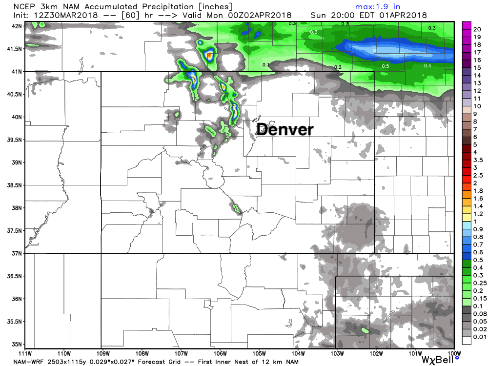
We see both are pretty dry for most of us this weekend, but not hard to imagine a stray shower or two impacting some of us on Saturday.
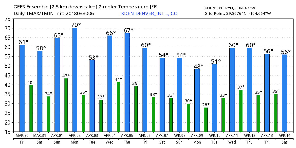
As for temperatures... we'll be pretty mild over the next several days, but we'll see some ups and downs as well. Today highs should top out in the 60s, slightly cooler for Saturday, before warming again Sunday. The GEFS temperature forecast for DIA shows nicely the up and downs we can expect over the coming days, with Monday for the time being looking like the warmest of the next five:
Next week it'll be April, and the beginning of Denver's second snowiest month on average. Medium range models are showing some cold around... with an active storm track to our north at the very least. We'll see what April 2018 has in store for us.