Thursday PM Update: Warmth Today Replaced With Chilly, Unsettled Weather Friday

As we discussed in yesterday's Insider update, the first of several systems to impact our region over the next 10 - 15 days is moving into western Colorado this afternoon, and will bring cooler temperatures and a chance of rain and snow to eastern Colorado for your Friday.
For the northern urban corridor this next system will mainly translate to wind today, then chilly temperatures with rain and snow showers on Friday. The greatest threat for accumulating snow will likely miss most of the metro area, though a coating to 1" will be possible.
To our west, a Winter Weather Advisory is in effect for the north and north-central mountains where 3 - 7" (locally up to 1 foot) of snow is expected to fall tonight through Friday. If you are trying to get to the hills early for the weekend, please plan on winter driving conditions tonight and Friday west of Denver.
As the storm tracks east on Friday we expect heavier snow to develop east of Denver as well. A Blizzard Warning is in effect for portions of the far northeast plains from early Friday morning through 6am Saturday, where 3 - 7" of snow could combine with very strong winds (gusts to 65mph) and create blizzard conditions. Best to avoid travel along I-76 northeast of Denver on Friday if possible.
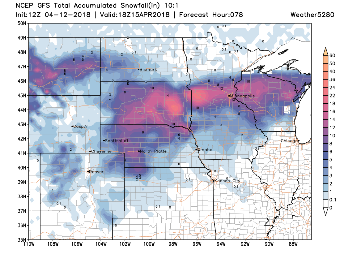
This is a potent spring storm, but the track is just a bit too far north for significant rain or snow along the northern urban corridor. The forecast from the GFS below shows the low developing across northeast Colorado early Friday then moving east/northeast along the Kansas/Nebraska state line during the day Friday and Saturday.
This will lead to some big time snow across the high plains Friday and Saturday, with upwards of 15" (to accompany the wind) expected before this system clears late in the weekend:
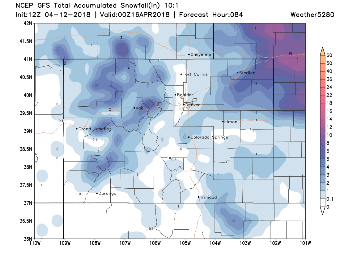
Closer to home we see totals much lower along the urban corridor, with the Palmer Divide seeing the best chance at a few inches on the back side of this system as it pushes east. Denver, Boulder, Fort Collins should see <1" of snow unless something changes, with heavier totals across Washington, Logan, Yuma, Sedgwick, and Phillips counties expected:
Snow burst potential
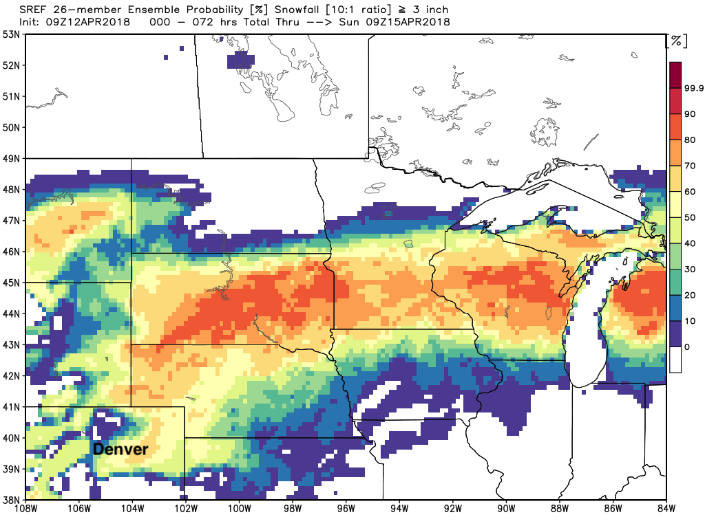
Greatest potential for a few inches of snow closer to the Denver metro area may end up being on the south side of town, and across the Palmer Divide. Not a huge amount of support for it, but some short range models suggest the potential for a nice burst of snow Friday, which would be capable of producing 2 - 4" in spots. The SREF is most bullish with this potential, with decent probabilities for some accumulation on the south/southeast side of Denver. Areas like Parker, Castle Pines, Perry Park, Franktown, and Elizabeth will see the greatest chance at this "boom" with stiff northerly/northwesterly winds kicking in Friday and Friday evening.
Again, most data suggests little to no accumulation along the Front Range, but a quick burst here or there could change that for a few locales. Something to watch for tomorrow, but main story will be the drop in temperatures, wind, and only scattered showers.
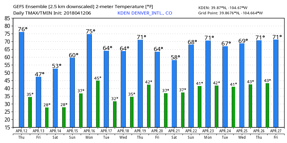
As the system clears late Friday temperatures will cool into the upper 20s along the Front Range Friday night into Saturday. Highs in Denver Friday are expected to be in the low to mid 40s with those rain and snow showers, with gradual warming in place for the weekend. By Monday we should be back in the 70s, before the next system arrives and cools us down by Tuesday: