Tuesday PM Update: Wind and High Fire Danger Today, Late Week Storm Update

The first of two systems this week is swinging through northern Colorado this afternoon and is making its presence felt in the form of strong winds and high fire danger across eastern Colorado. Red Flag Warnings and High Wind Warnings will stick with us through about 9pm tonight before conditions start to improve.
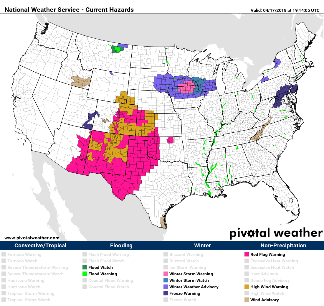
The core of the storm system is missing north, leaving those of us east of the mountains without much precipitation to speak of, just wind... so... much... wind.
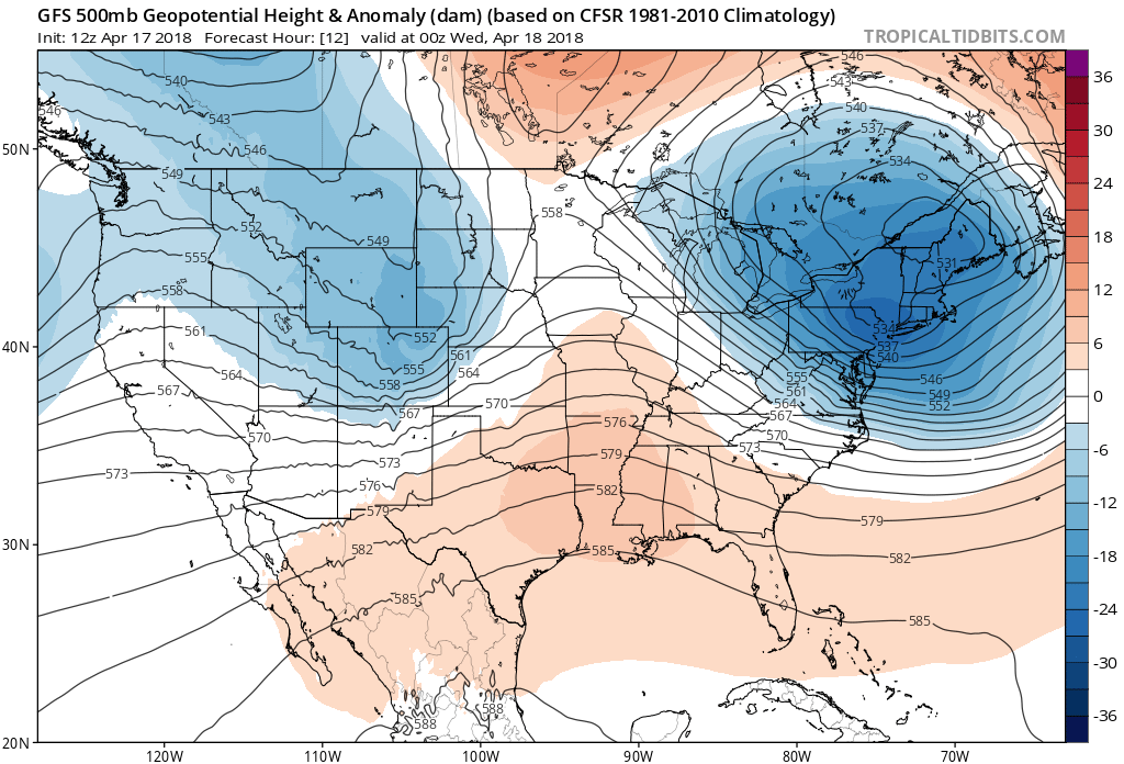
After today, our focus shifts towards late week. We're still tracking a large, cutoff low that will impact our weather from Thursday PM into the early weekend. As we discussed in our Insider update yesterday, the storm has trended a bit warmer and a bit further south than models were indicating on Sunday.
Overall, however, we're still in the ballpark for a good track for rain and snow across most of eastern Colorado, including the Front Range. The system will be moisture-loaded, so wherever its eventual impacts end up felt most should see some pretty great rain and snow from this event. It could be, unfortunately, that the best precipitation ends up south and east of here if latest trends are any indication.
The implications of the two trends mentioned above would have a number of consequences should they continue... For one, we've seen models back off from heavy snowfall totals at lower elevations, confining most of the accumulating snow to the foothills, mountains, and western Palmer Divide. A cold front due to arrive late Friday could help cool us enough Friday night for some snow at lower elevations... but the column shows a profile iffy at best below 5,500 feet or so. Those western suburbs, and foothill communities at the moment look to see the best chance for accumulating snow, with more of a questionable profile for Denver proper.
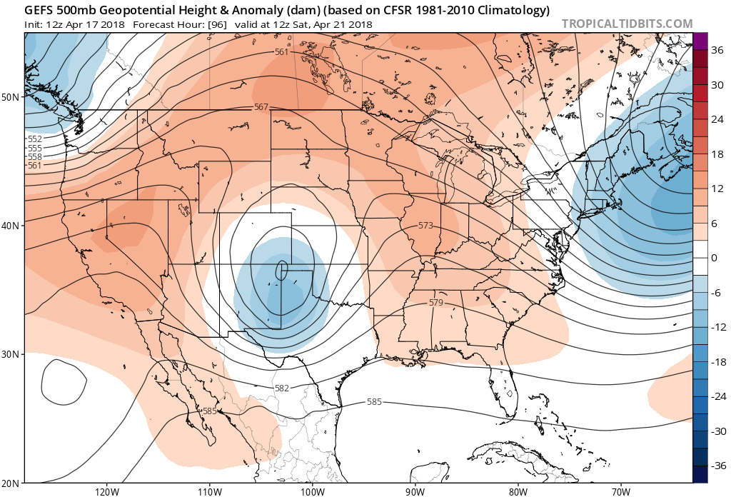
We've also seen QPF (precipitation forecasts) at times take big hits across northeast Colorado, as models show that southern bias coupled with a very broad rotation as the low moves (close!) but perhaps south of the "sweet spot" for northeast Colorado:
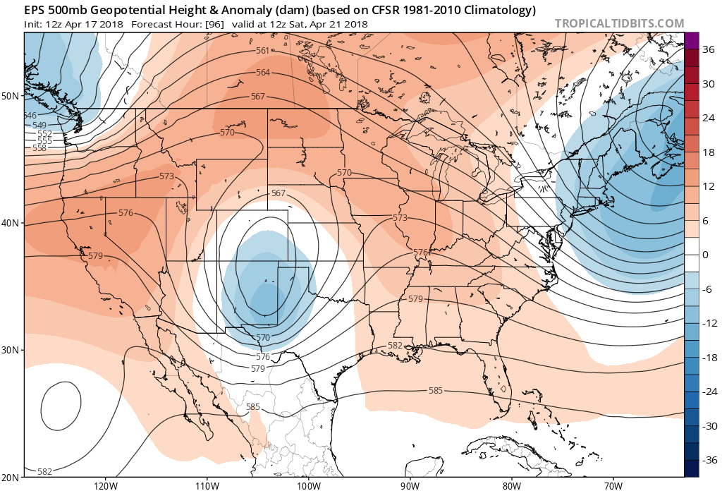
The latest EURO shows an even broader circulation... with a lot of that energy now digging pretty far south as it moves east Saturday night:
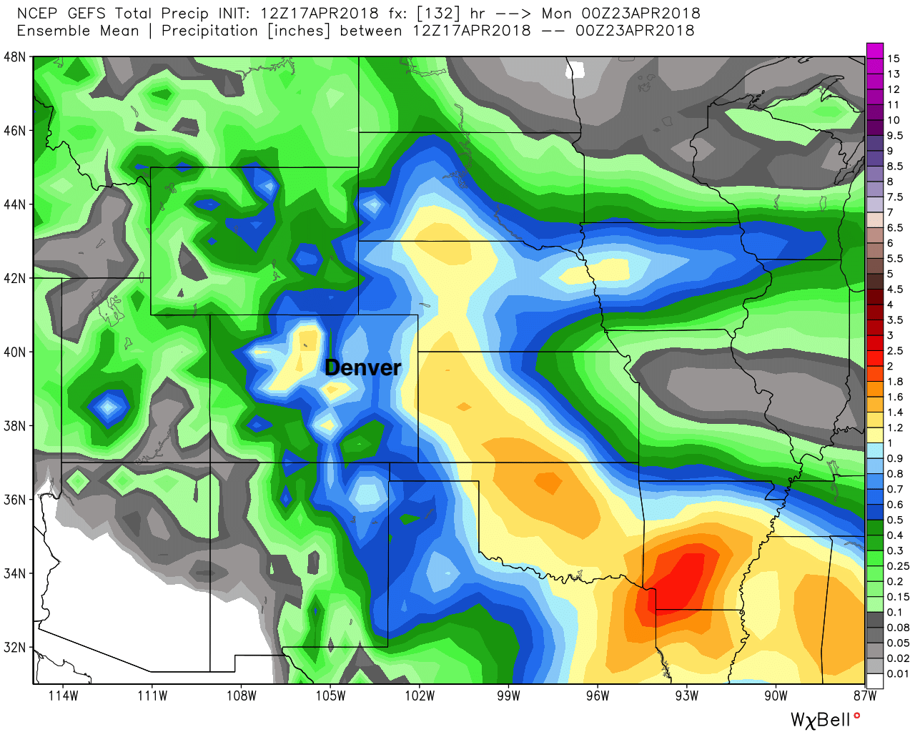
So, while the GEFS mean precipitation forecast still shows upwards of 0.5" for almost all of eastern Colorado (>1" maxes):
The EURO shows that southern lean, and perhaps some downsloping off the Front Range?
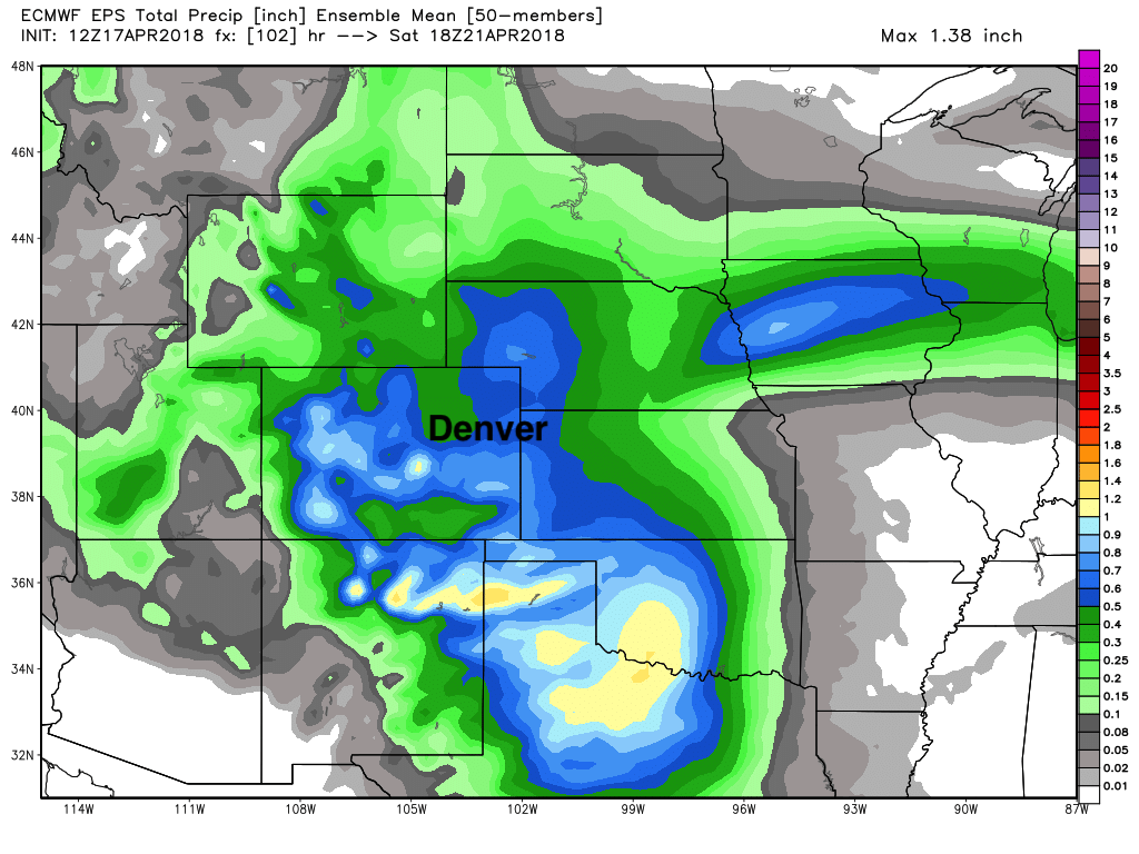
Both ensembles show a line of heavier precipitation well east of the Front Range, which is likely indicative of some heavy convection associated with this system across far eastern Colorado and western Kansas. Often enough we see this as another indicator that moisture will get robbed from the urban corridor, especially in cases where the low gets a little too south and broad for moisture to make it all the way back to the Rockies up north.
Bottomline: Still a system that needs to be watched over the next few days. It's likely we see some heavy snowfall at higher elevations to the west of I-25, and at least areas of heavy rainfall across the plains. Big questions that remain are... where does that rain snow line set up, and does the low continue to sag too far south for high-end precipitation totals along the northern urban corridor. I suspect we see some movement still in the track of that low, but I'm not overly thrilled with the means today for Denver/Boulder/Fort Collins. The moisture, however, will be welcome wherever it falls. As we are seeing today... we NEED it! More updates to come.