Wednesday PM Update: Rain and Snow on the Way for Much of Colorado

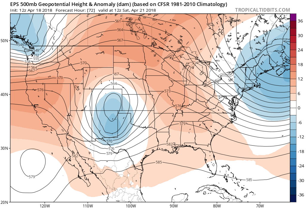
Thankfully yesterday's wind event has moved on. Our focus now is on the Thursday PM through Saturday PM timeframe, as a large upper level low is set to track across southern Colorado and deliver rain and snow to much of the state during this period.
Overall we have decent agreement in how this storm will progress, and for maybe the first time this season the storm hasn't completely fallen apart as it approaches. The low will move into the Great Basin on Thursday, and track into the Four Corners Friday morning. Rain and snow will develop in the Front Range mountains overnight Thursday into Friday, with rain pushing onto the plains sometime Friday morning into Friday afternoon.
The best chance for rain and snow along the I-25 urban corridor will from Friday afternoon through Saturday morning as the low progresses across southern Colorado on into southeast Colorado by early Saturday. Conditions will improve through the day Saturday, with the storm pushing well east of the state Saturday night.
The position of the low early Saturday is a good one for good moisture across eastern Colorado:
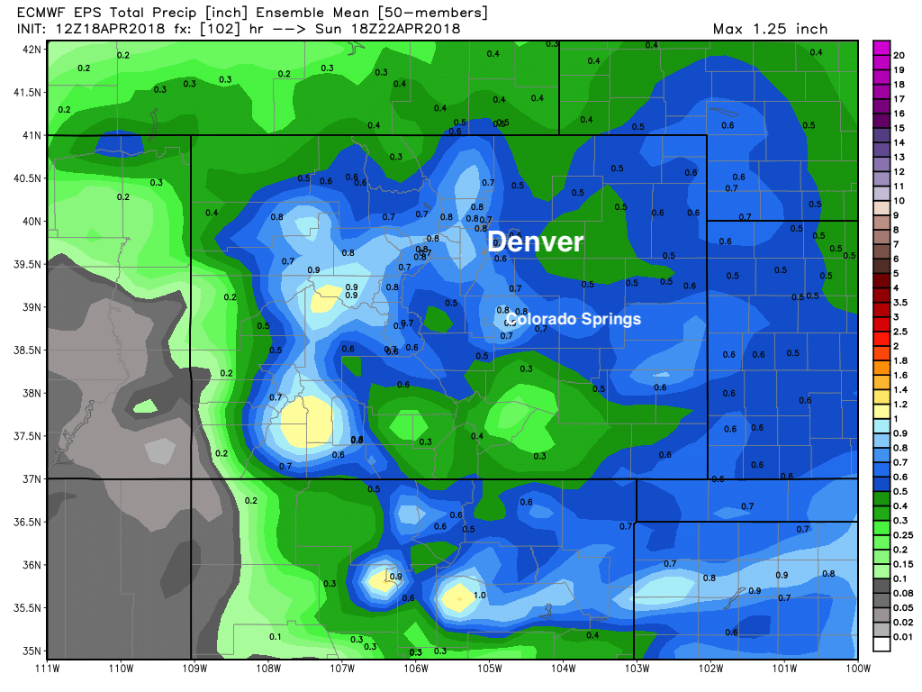
Latest QPF fields from various models show some sporadic coverage, indicative of the remaining uncertainty in the details, and the convective activity associated with this system. It's safe to assume there will be some haves and have nots with this system, depending on exactly how things progress.
That said, the EURO ensemble mean precipitation forecast shows pretty nice coverage for good moisture... and while any particular neighborhood may not fair as well, overall it looks like a good 0.5" - 1.0" of liquid across Colorado from this event, with locally higher (and lower) totals possible:
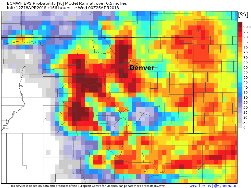
With probabilities for 0.5" of precipitation or more in the 70 - 90% for the region:
Rain vs snow
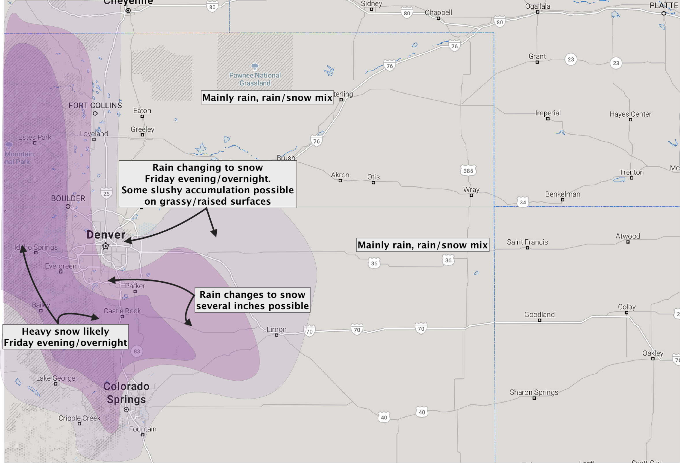
Who sees rain vs snow remains a very difficult question. Models remain pretty warm overall, but often under do cooling. At any rain, latest data would support more rain than snow across the plains with this system. Along and west of I-25 will be the main area to watch for that changeover to occur Friday evening and overnight into Saturday.
Areas favored to see rain change to snow and likely some slushy accumulation (perhaps several inches in spots) would be... northern Colorado Springs, Monument, Castle Rock, Denver's southern suburbs (Highlands Ranch, Parker), Golden, Boulder, and again areas west of Loveland and Fort Collins.
For Denver... at the moment it looks like much of the precipitation falls as rain, though we could cool enough Friday night for snow as well – with main accumulation potential being on raised surfaces (grass, cars, overpasses). The GFS has surface temperatures in the mid 30s before dawn on Saturday, while the EURO is closer to freezing; the column borderline for snow formation. Odds are GFS is too warm – but even with the colder solutions, accumulation will be hit and miss under about 5,500 feet.
As of today our snowfall potential map looks something like this:
As for impacts: Look for tough travel conditions in the mountains beginning Thursday night as the system pushes into the state. Friday will be a wet drive across most of Colorado, with rain (heavy at times) at lower elevations during the day Friday and snow up high. Friday evening we start to see more snow mixing in at lower elevations, with that changeover occurring for many Front Range communities by Friday night.
Worst of the travel will likely be west of Denver heading into the high country along I-70 Friday/Friday night, and again south of the city between Denver and Colorado Springs. If you can get your travel done before midday Friday or postpone until later in the day Saturday, it may be best to do so.
The system clears during the day Saturday, with dry and warming conditions returning for your Sunday.