The State of the Atmosphere: Sunday, April 22, 2018

Well, an epic storm it was not, but great to see some moisture around here, and it made for a cozy Saturday to boot. The system that brought us rain and snow on Friday and Saturday is now long gone, leaving in its wake a beautiful, warm, April afternoon across eastern Colorado.
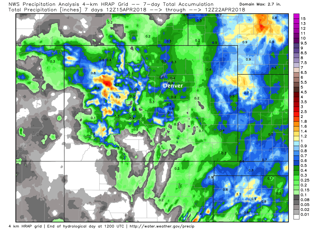
Precipitation totals from this event ranged from 0.3" to 0.6", with none of the higher end QPF solutions proving right. Out east we saw some heavier precipitation on Friday which helped boost numbers, as well as some pretty great moisture for portions of western Colorado over the last week as well:
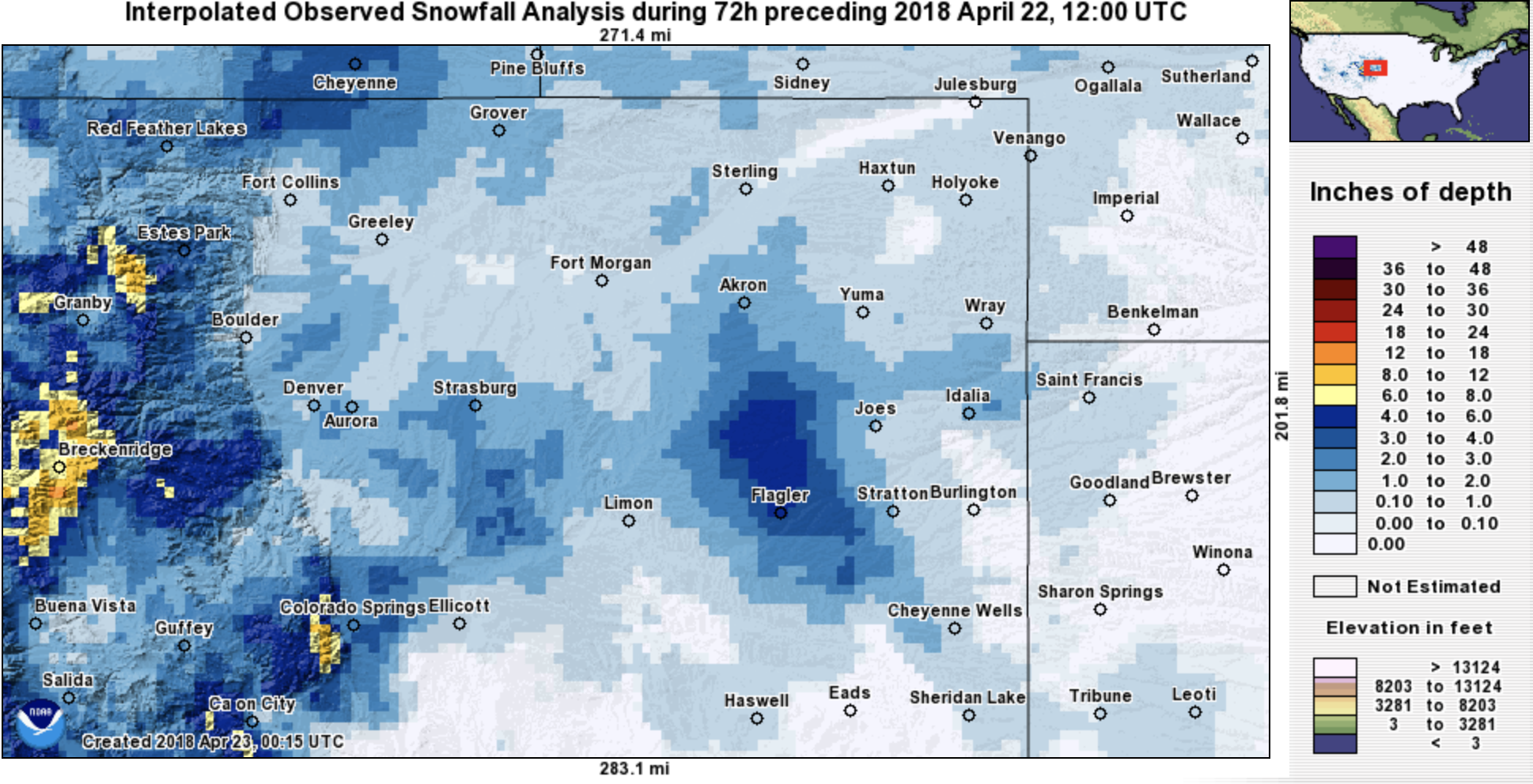
Snowfall totals were rather ho-hum. We managed about 1" of slush early Saturday morning, with the Colorado Springs region taking the cake with several 4 - 5" totals on raised surfaces down that way. Our foothills and western Palmer Divide locations were no doubt a bust, with just a few pockets for 4 - 6" totals, but many other locales measuring in (much?) lower than that. Here are the snowfall totals from the last three days across the region:
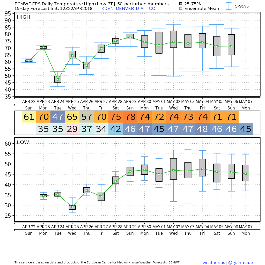
The week ahead will feature the main weather event toward the beginning of the week rather than the end for a change of pace.
Monday will be beautiful and warm (low 70s for Denver) before a quick shot of cooler air and perhaps a bit of rain and snow move in later in the day Monday and for your Tuesday.
Precipitation between Monday PM and Tuesday night won't add up to a whole lot, but don't be caught off guard by rain and snow showers in this period. The European ensemble forecast shows just a tenth or two of precip across the plains, with perhaps some heavier totals west of Denver.
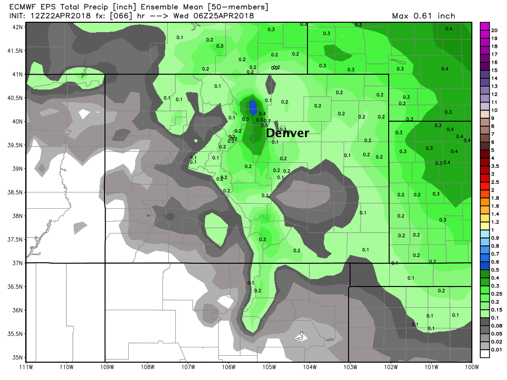
Similarly it won't produce widespread heavy snow, but a a few areas that see heavier snow showers Monday night into Tuesday could pick up a quick 1 - 3" of snow, mainly in the Foothills west of Denver and across the Palmer Divide. The EURO mean is unimpressive:
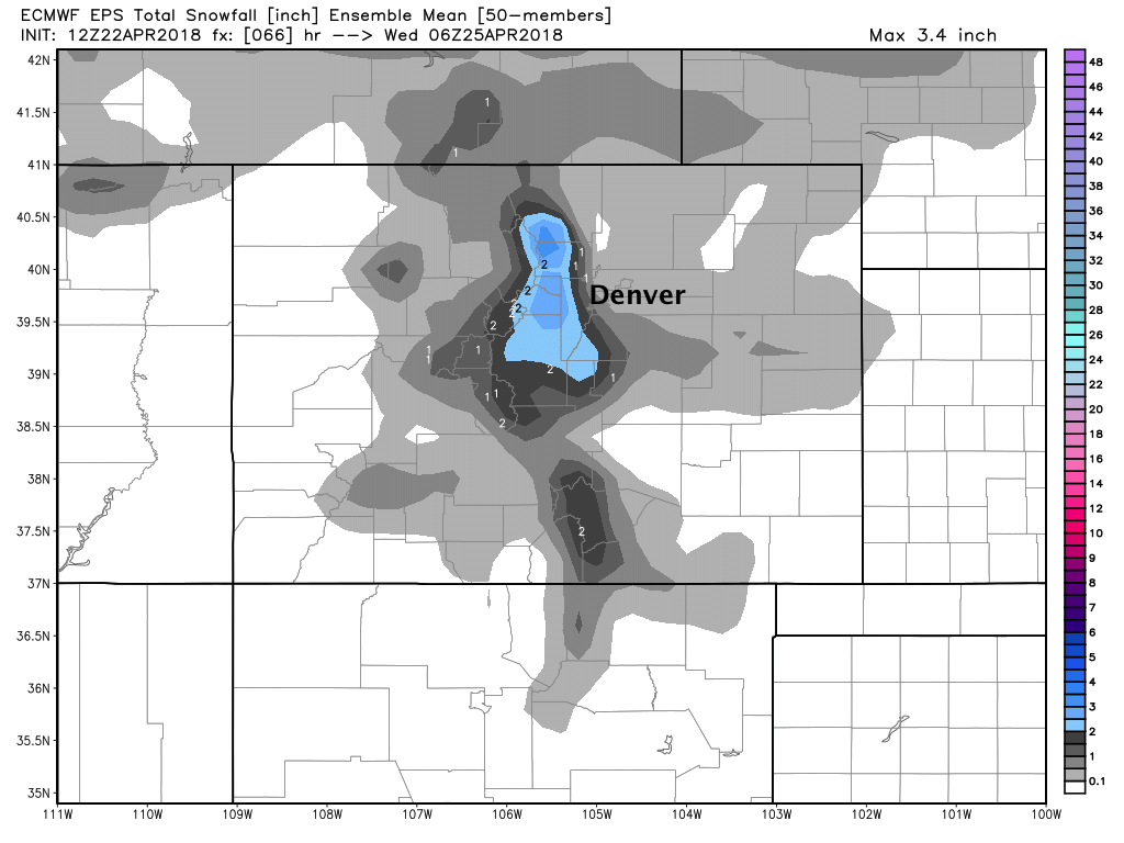
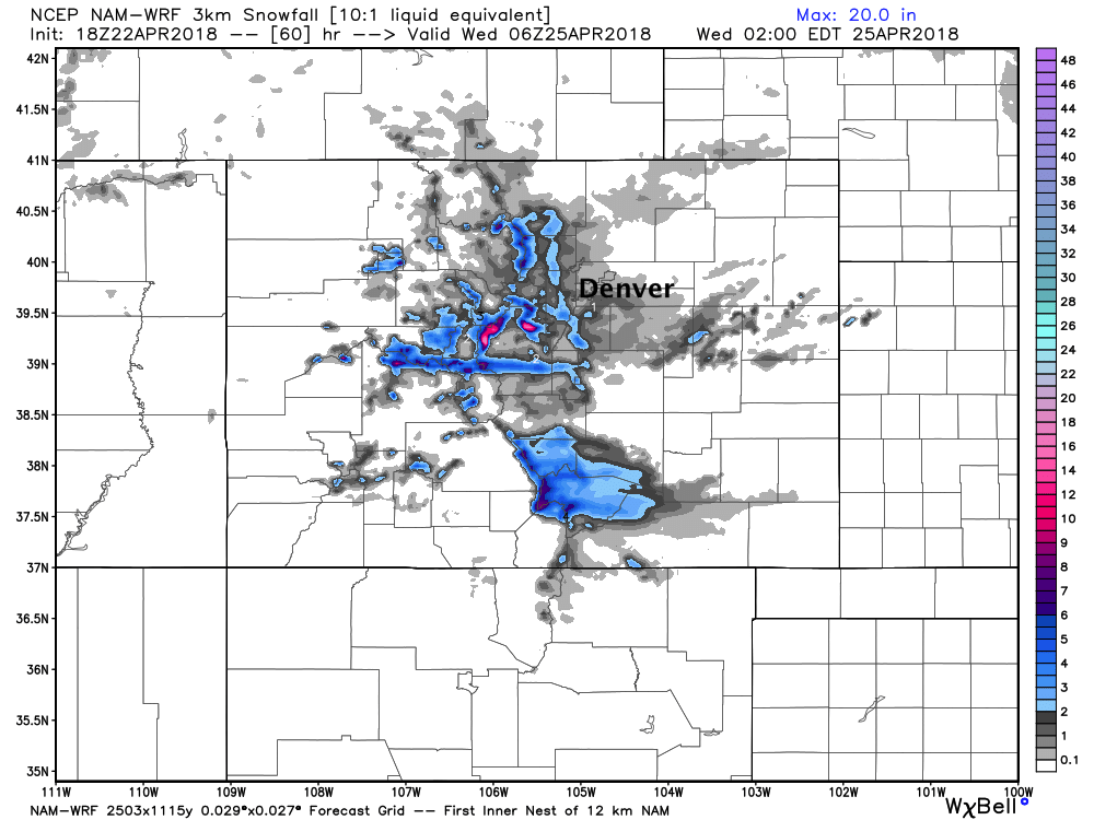
If we look at the high-res NAM we see a few areas around Denver with a 2 - 3" snow (mainly over 6k feet), but most locations won't see much if any at all:
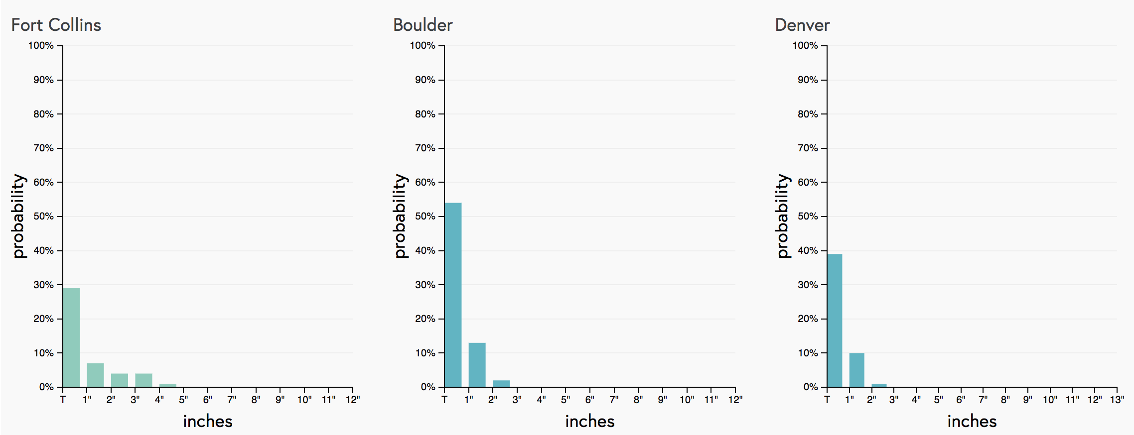
And finally, a look at our Gambler Charts shows pretty low probabilities for anything over an inch as well:
Bigger story will likely be the chilly day Tuesday. After highs in the 70s Monday, 40s with those lingering showers on Tuesday will feel quite cold. Again, I don't think snow will be a big deal with this system... but will cold temperatures Monday night and Tuesday morning, there could be pockets of ice for your Tuesday morning commute.
The good news is, it won't last long. By Wednesday highs will rebound into the 60s, with low 70s in the forecast by next weekend. The temperature forecast looks pretty nice from the EURO once we get passed Tuesday: