The State of the Atmosphere: Sunday, April 29, 2018

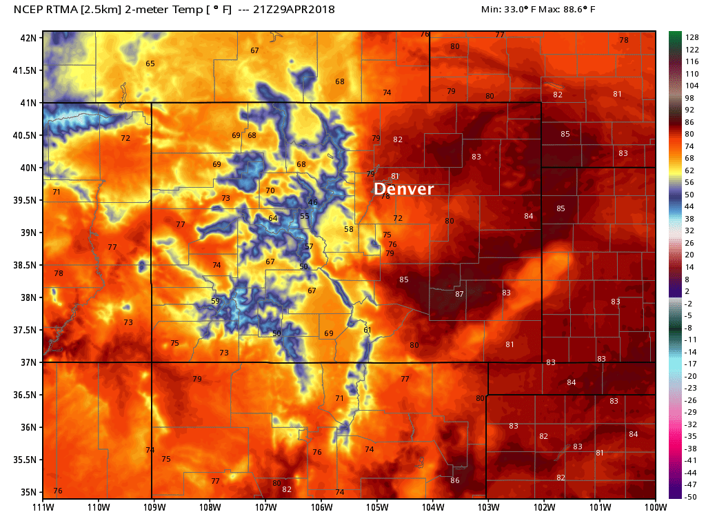
What a way to round out the last weekend of April. According to the National Weather Service in Boulder, the high at Denver International Airport topped out at 83°F this afternoon, tying the previous record for the date set in 1948. The average high for April 29th in Denver is 65°F.
The week ahead
The week ahead starts quite warm as well. We should be a few degrees cooler in Denver Monday than today, with MOS guidance showing highs topping out in the 74 - 76°F range in the city. Still, well above average for temperatures and only a slight chance of showers late in the day.
Tuesday we shave another 10 degrees or so off of that high with a better chance of showers and storms. Wednesday and Thursday will be similar, with highs near 60 and that chance of showers and storms across northeast Colorado before temperatures warm once more by Friday.
For some, this week's rains won't be a big deal. For others, some beneficial moisture is on the way. Greatest probabilities for rain across eastern Colorado (and dare I say snow for some) will be over the northern Front Range and far northeast plains. Tuesday through Wednesday night will be quite unsettled for many locations, especially along the northern I-25 urban corridor.
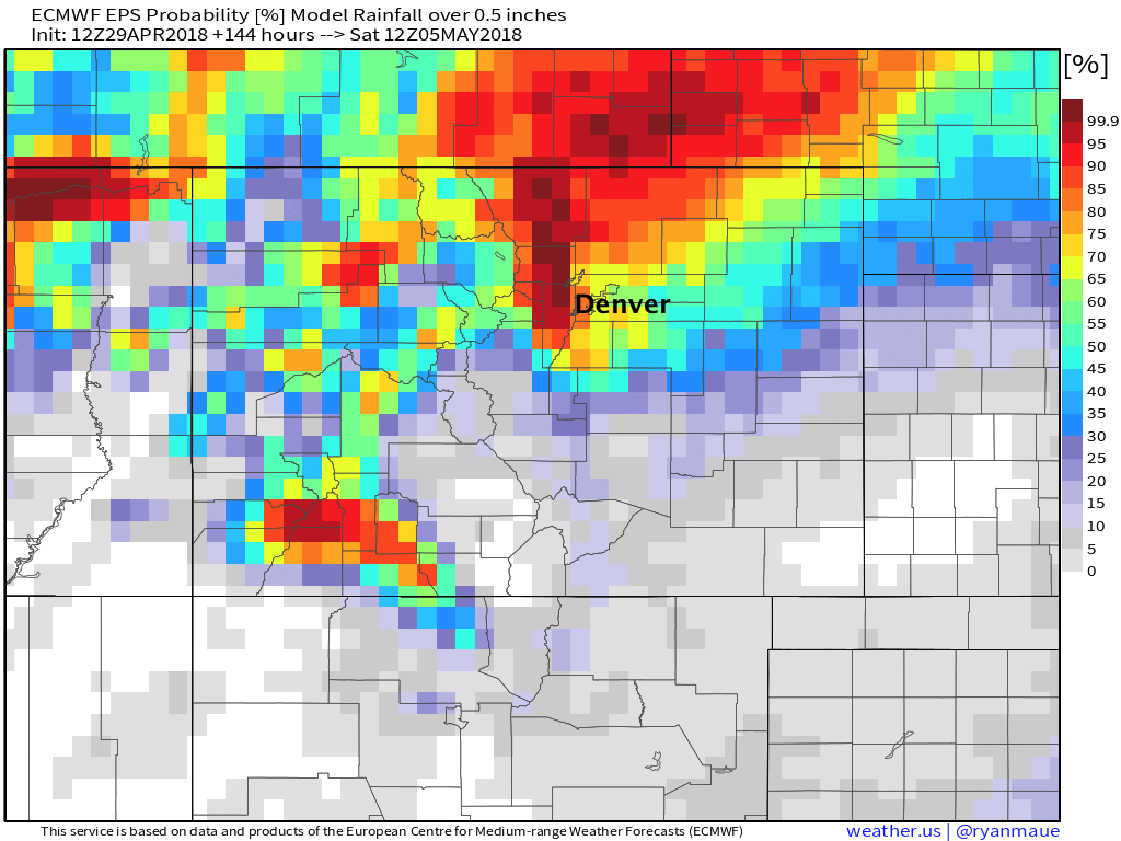
The EURO ensemble shows probabilities for greater than 0.5" of liquid through Friday at >65% for the Denver metro area and northern Front Range. But, as you can see, those probabilities drop off considerably as you head south/southeast of Denver:
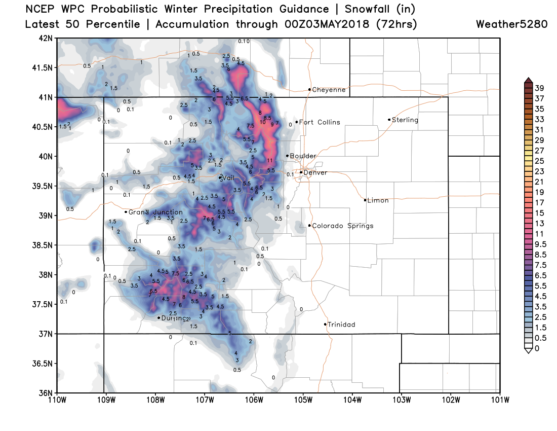
Temperatures look too warm for snow at lower elevations this go around. Immediate foothill communities west of Denver, and perhaps even parts of the western Palmer Divide could see some flakes mix in – mainly Tuesday night and Wednesday night, but little accumulation is expected at this time. If you live in the Front Range mountains look for some good snowfall during the middle of the week. As you can see in the forecast below, snow accumulation should be limited to higher elevations with this event:
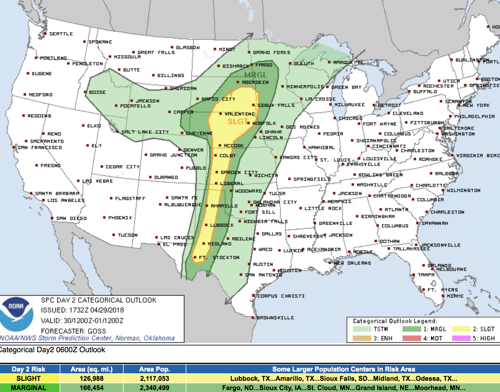
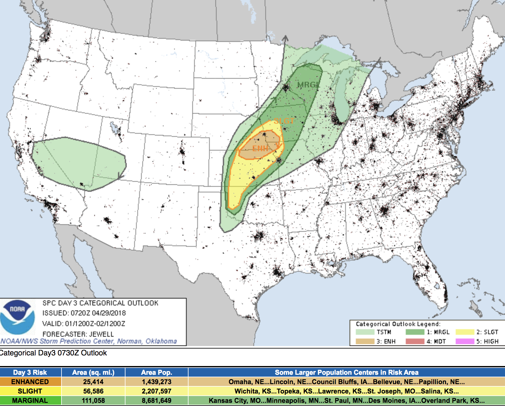
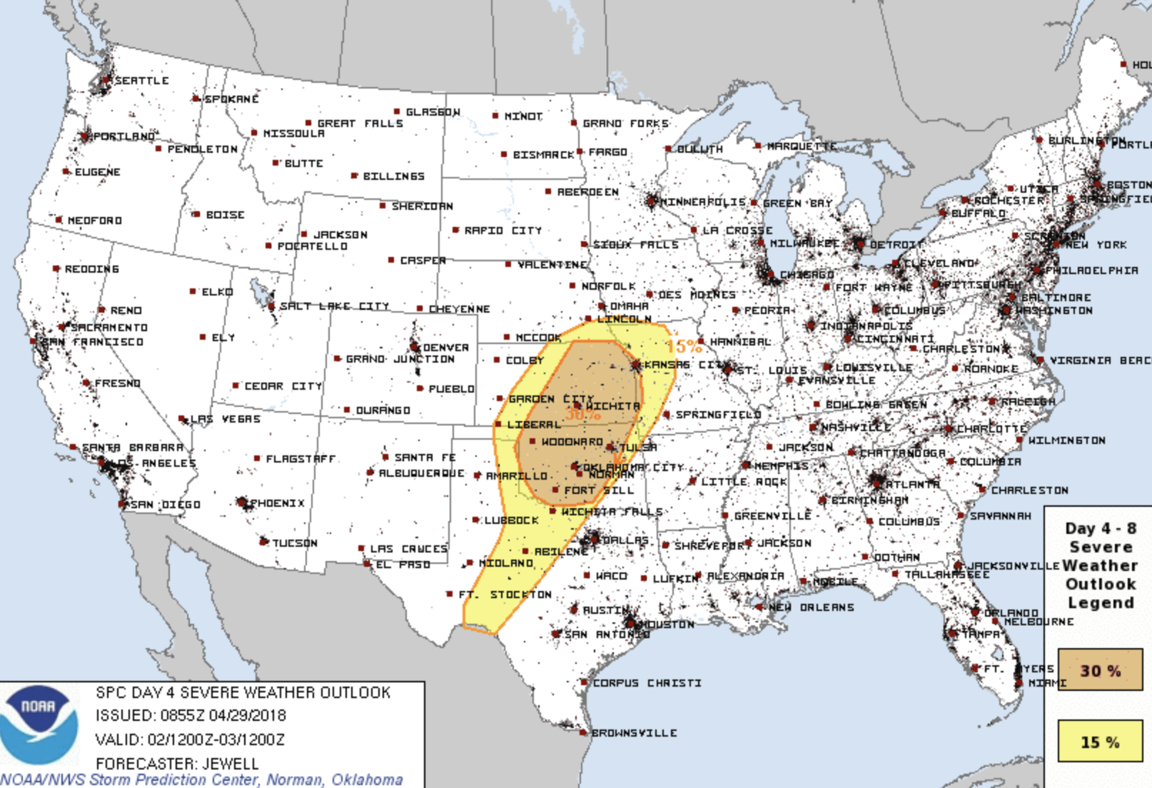
Wednesday and Wednesday night look to be the best chance for showers across northeast Colorado as the low moves across the state. We expect the greatest severe threat to be well east of us through the the week, with the severe weather threat focused over the middle of the country through the week, in perhaps a significant severe weather outbreak on the way:
Monday's severe weather threat
Tuesday
Wednesday
In short, a few unsettled days on the way to start May. Tuesday PM through Thursday morning look to be the best chance to see rain showers, with Wednesday looking to be the coolest/most unsettled day of the week. The severe threat should remain low for Colorado, and most snowfall activity should remain confined to the high country. By Friday temperatures should warm back to near 70 (perhaps low 70s) in Denver with drying conditions.
We'll take the moisture! Let us know how you do, and of course, we'll offer updates as needed as we track our next system moving in from the west.