The State of the Atmosphere: Monday, May 21, 2018

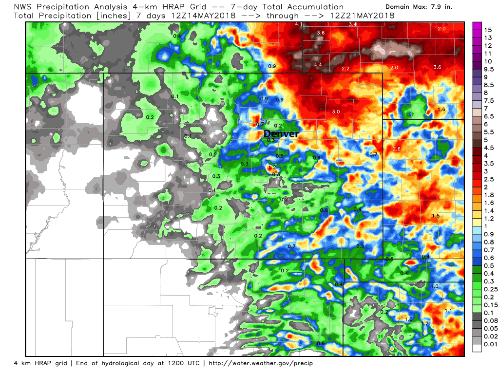
Well, plenty of clouds to go around this weekend... but certainly not everyone received great rainfall. Denver and its immediate suburbs largely missed out, with the west side being the exception to that in some cases.
The Boulder area saw some heavy rain on Thursday, with a storm delivering some hail and heavy rain to portions of the western Denver suburbs and northwester metro area on Thursday as well. Colorado Springs, Fort Collins vicinity, and the northeast plains all made out pretty well as well over the last week as you can see below. Denver proper? Not so much.
The week ahead
The theme for the week ahead will be a return of warm weather after a chilly weekend. While showers and storms are in the forecast many of the days, no organized systems like we've seen in recent weeks are on the table to bring either widespread rain chances or cold air.
This should equate to a mostly quiet week. Afternoon showers and storms will be possible across the state, but those will mostly be of the isolated variety for the Front Range.
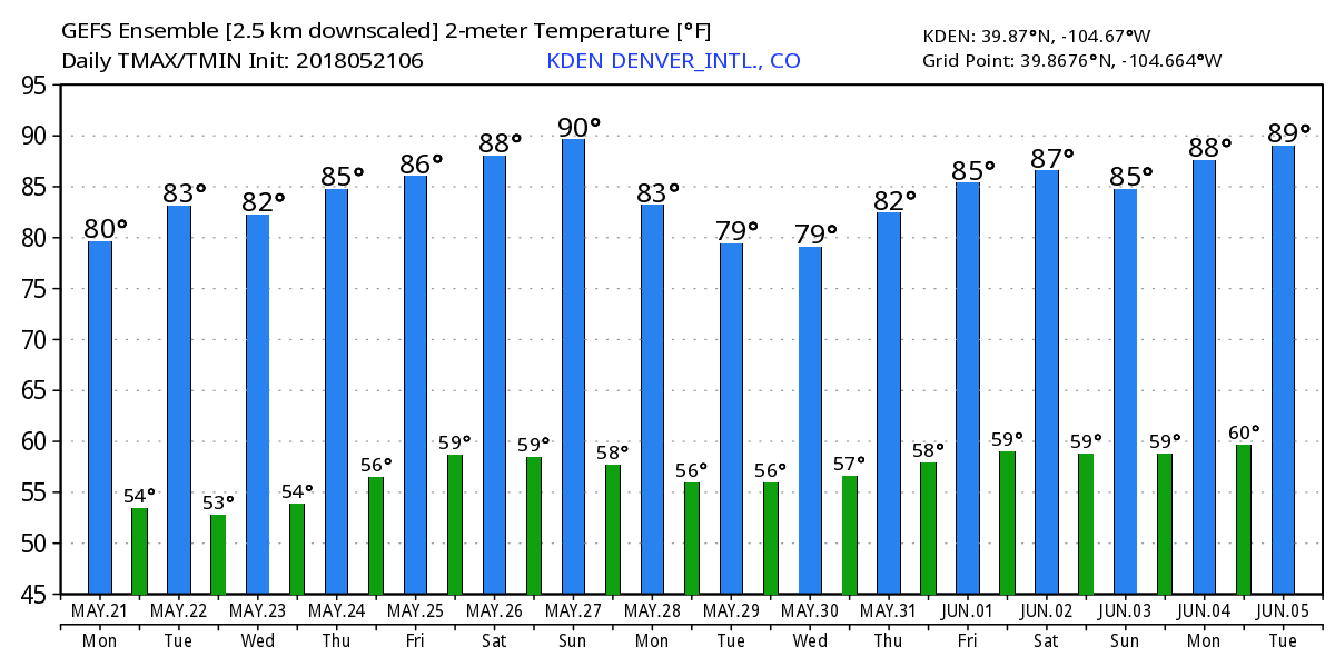
MOS guidance has highs in Denver near 80°F the next few days, with upper 80s to near 90°F by later this week and this weekend.
The EURO is running a few degrees cooler than this overall with its 2 meter temperature forecast but looks pleasantly warm nonetheless. The GEFS is in good agreement, with highs in the 80s and overnight lows in the 50s for the next week:
As for precipitation... hard to get too excited about prospects this week overall. Could see a few days produce some nice storms at higher elevations, but we expect most areas east of the mountains to stay on the dry side into next weekend. A dry line will set up over the eastern plains over the next several days which may help initiate some stronger storms east of the metro areas from time to time... but again, not a huge amount of support for organized moisture delivery.
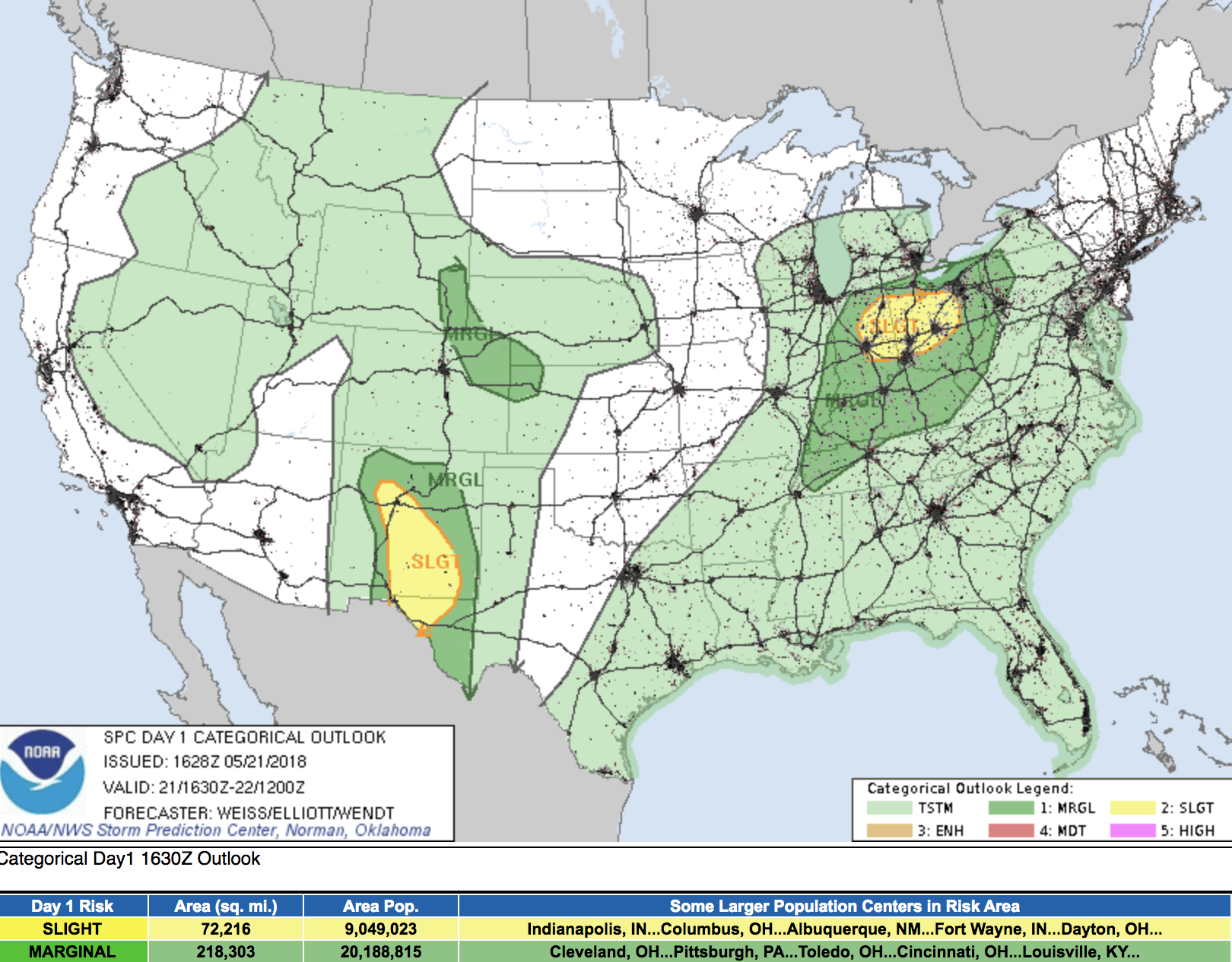
The SPC a Marginal Risk for severe storms across the northeast plain today, and I suspect we'll see that several times this week. While storm chances may be on the more isolated side, any that do develop will be capable of gusty winds and hail. Again, that threat is mainly east of the urban corridor:
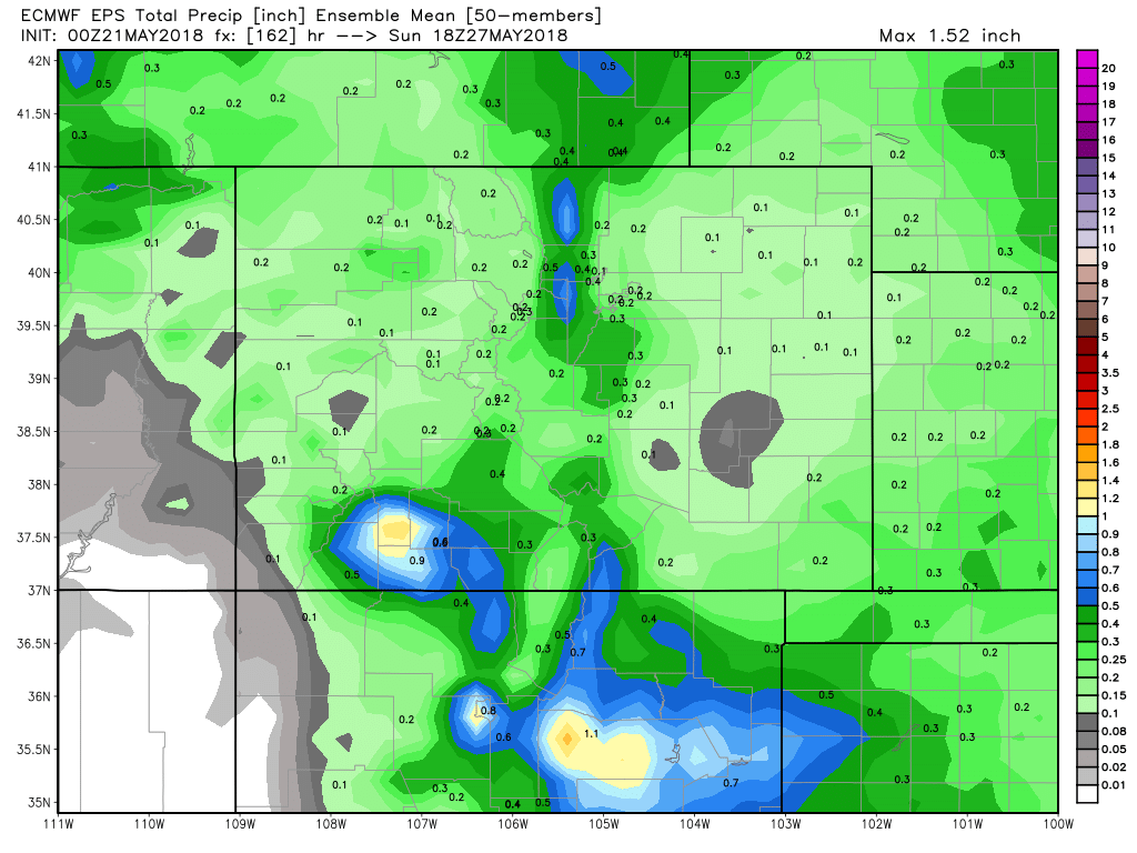
The EURO precipitation forecast through next Saturday shows the best chance for precipitation up along the Front Range mountains, with some QPF showing up in the grids across northeast Colorado, but not convincingly so.
That said, thunderstorm development is very fluid, so if one manages to develop over you – of course that forecast ends up looking quite a bit different. Best to plan on at least the chance of afternoon storms each day as to not be caught off guard, but know the overall probabilities are on the lower side this week.
As always, we'll keep an eye on things as the week progresses. Sometimes storm chances can sneak up on you as outflow from dying storms and pesky short waves can help initiate storm activity in the short term which would be hard to pin down at range. So best to keep an eye on the forecast, enjoy the warm weather, and hope we can luck out on a storm or two over the coming week!