High fire danger holds on to end week, but rain on the way?

As we've discussed several times in recent weeks, we're tracking a shift in the pattern as we head into the middle and latter half of the month. Guidance continues to suggest this to be true – even as fire danger remains quite high across the region through the end of the week.
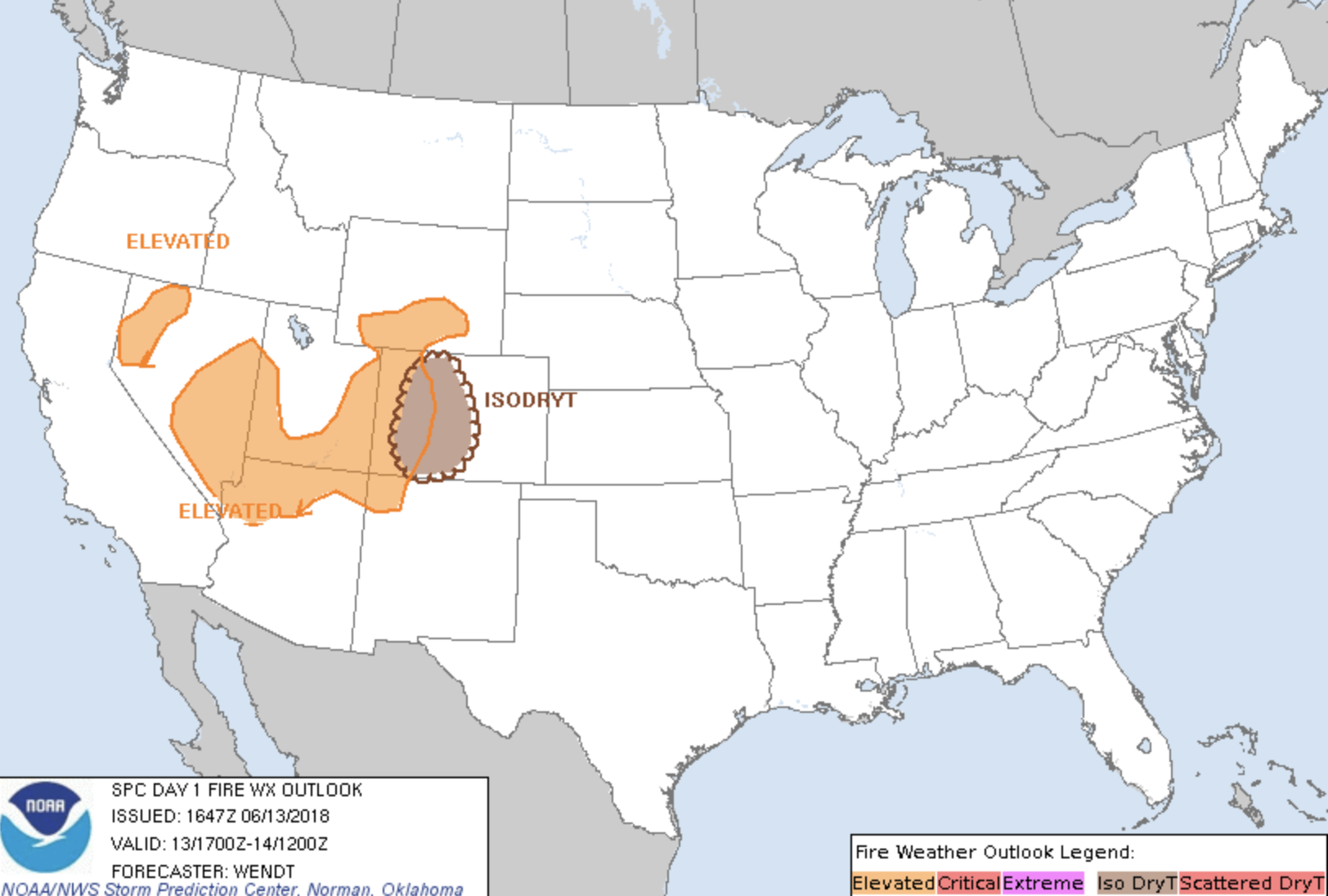
Day 1 fire outlook:
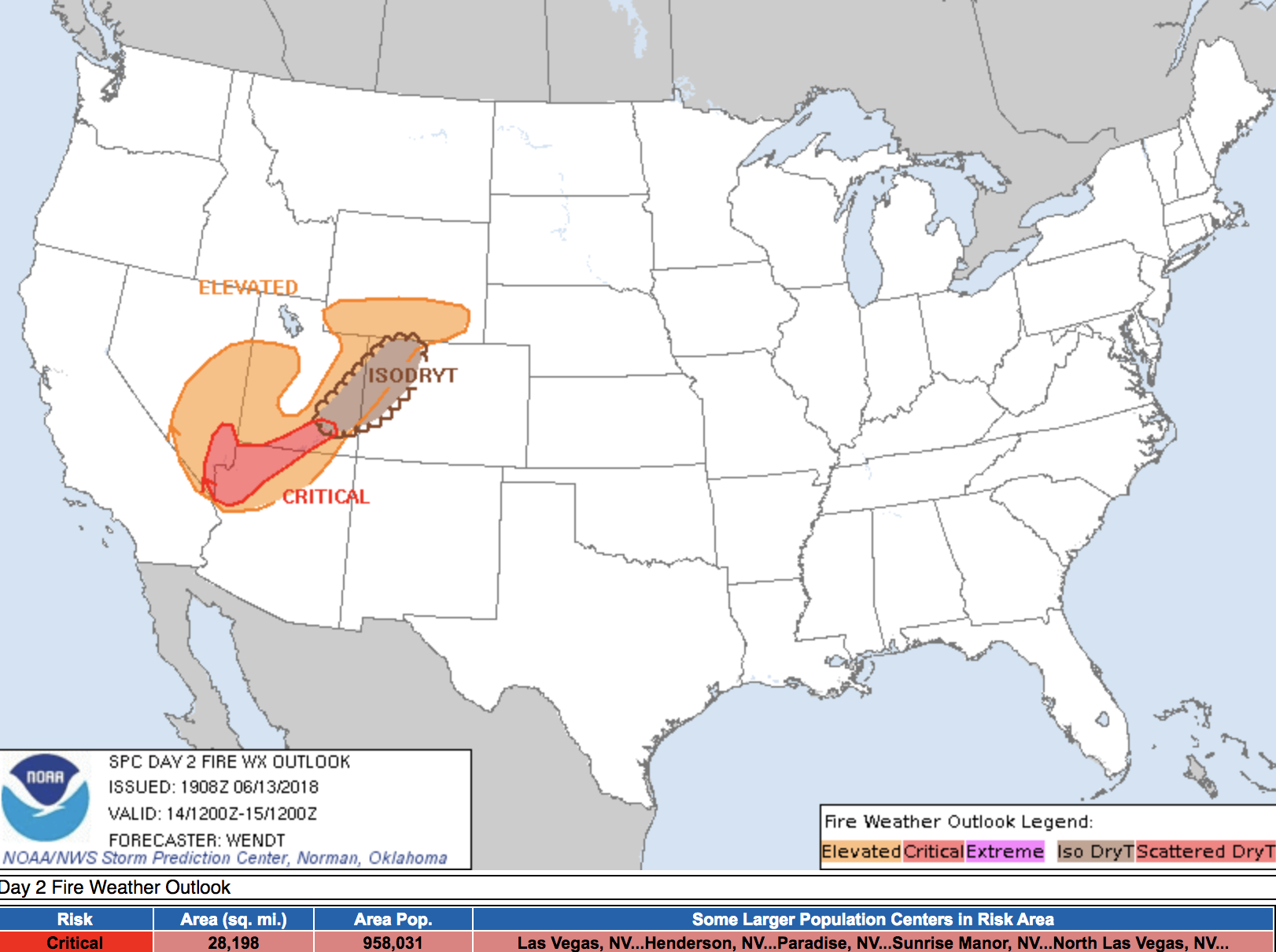
Day 2 fire outlook:
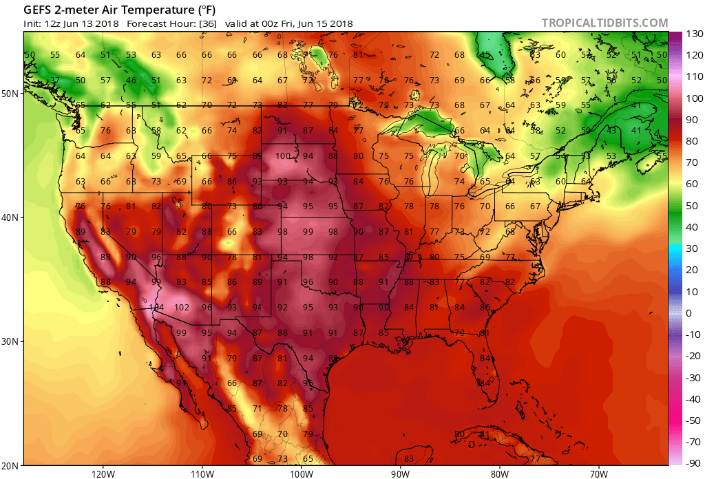
Temperatures will end the week quite warm. Look for highs in the mid 90s to near 100 degrees across the plains states on Thursday before cooling gradually works its way in for the weekend:
By Saturday we really start to see moisture begin to move into the southwest, which should help increase storm chances across the region. For Colorado, Saturday storm chances likely remain on the lower side for eastern Colorado, with those better storm chances shaping up for the western half of the state – though I wouldn't rule out any storm activity from say Friday PM on through next week across the plains.
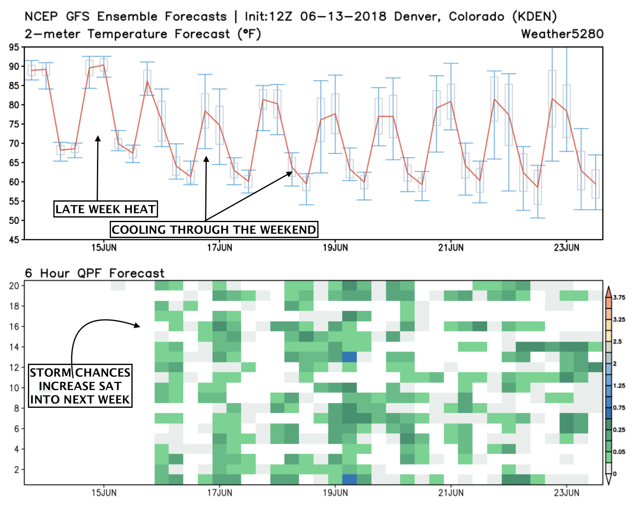
A look at the GEFS forecast shows this nicely... The top graph shows temperatures over the next 10 days. The red line is the mean forecast of the 21 member ensemble, and shows a clear downward trend after Thursday. The bottom chart shows each ensemble's 6 hour precipitation forecast (represented by a green/blue square). Note a lot of variation between the members on when/how much moisture we see... but overall an active look:
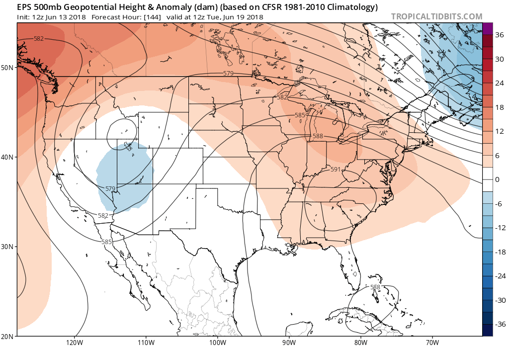
If we look at the 500mb forecast for early next week, we see a low pressure to the west of Colorado, and high pressure shifting well to the east. This will be the dominant pattern for some days, and will act as a conveyor belt for moisture out of the Gulf into the Four Corner States and High Plains:
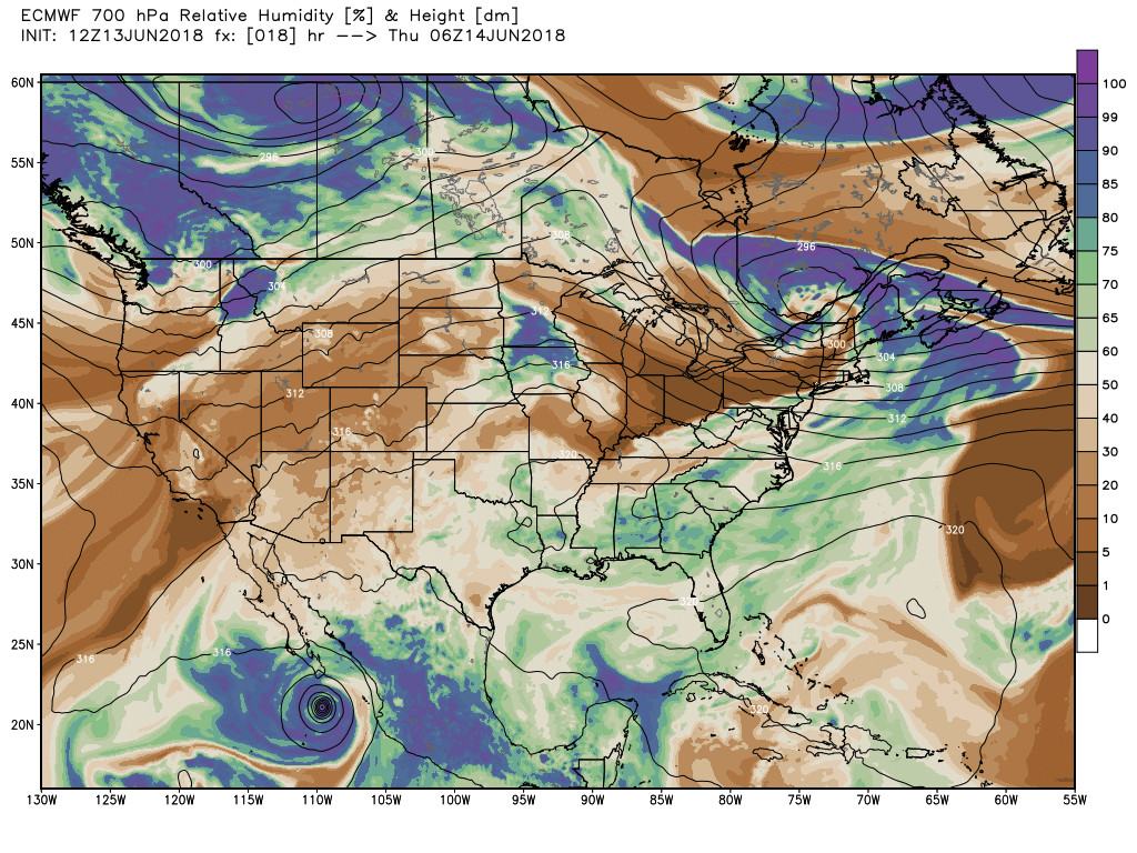
If we look at 700mb, we see ridging well established over the country on Thursday, and with that lots off dry air (browns) over the southwest and plains.
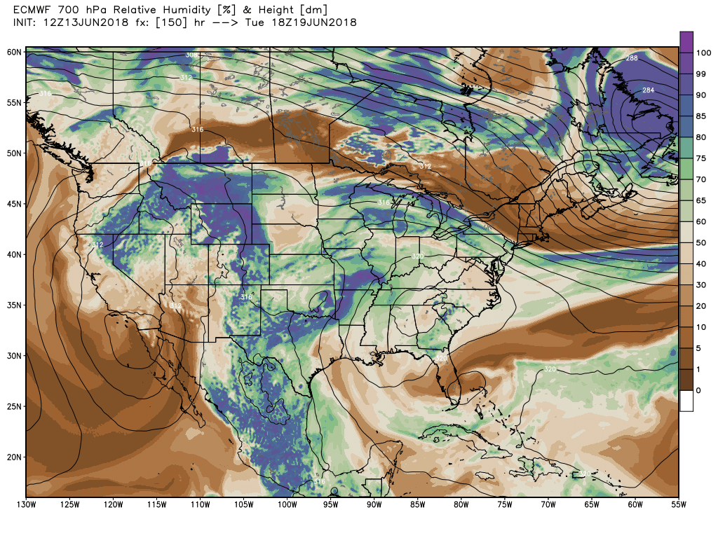
By Tuesday, we see an area of low pressure over the southwest working with that high pressure in the southeast to usher that humid air up across New Mexico, Texas, and on into Colorado and the northern plains states:
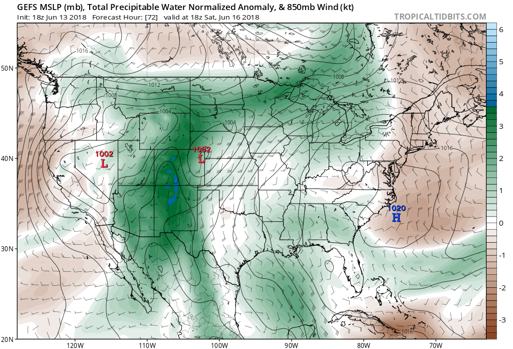
And in turn, highly anomalous precipitable water (PWAT) values return to the state this weekend – first influenced by once hurricane Bud, then next week by a strong southerly fetch from the Gulf of Mexico:
With plenty of moisture availability, look for those storm chances each and every day – at least Saturday through mid to late week next week. The best chance for rain across eastern Colorado at this time looks to be early next week... but there's still a decent amount of wobbling in the data.
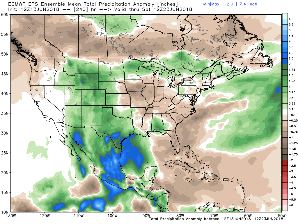
Generally speaking, a wetter than average period on the way for many locations across the greater region. The EURO ensemble forecast shows positive precipitation anomalies over the next 10 days (with of course plenty of variation at a finer scale), but a reasonable look overall.
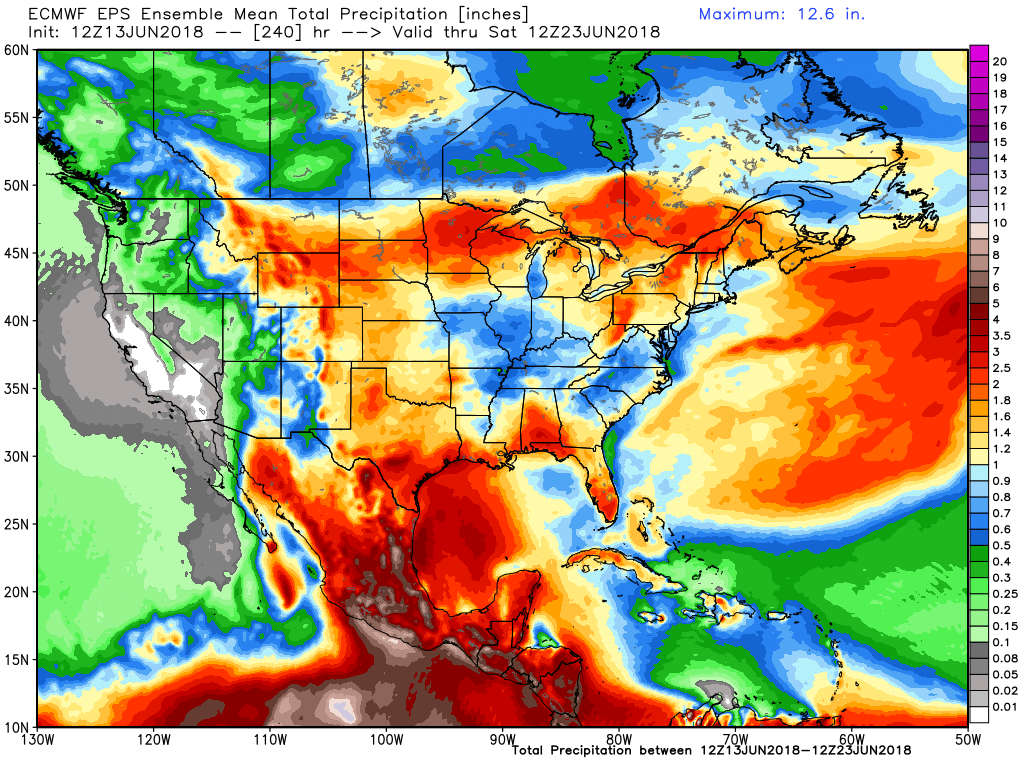
Needless to say, too early to get into detail on how much rain any given location will see. But looking at the 10-day mean rainfall forecast from the EURO ensemble, it's certainly promising looking for meaningful rainfall across the entire region. Of course at this point we'll take anything we can get:
Of note: Texas will likely be dealing with some flooding this weekend, especially along the coast. Closer to home we'll likely be dealing with flash flooding concerns where recent fire burn scars exist. Please stay weather aware as our pattern begins its shift this weekend.