Friday PM Update: Storm Chances Increase Through the Weekend, Continue Next Week

Well, the long-advertised change in our weather pattern appears on track. Rain chances should gradually increase through the weekend, with a good chance of showers and storms in the forecast from Sunday through much of next week – as well as a nice cool down to boot.
Today was another hot one. Highs topped out in the mid 90s downtown before afternoon clouds and isolated storms worked to cool us down a few degrees in the last hour or so. While Saturday still looks warm with MOS guidance topping Denver out in the 87 - 90°F range, we should be a bit cooler than today, with a better chance of storms as well.
The trend continues Sunday, with an even better chance of showers and storms and another 5 - 10 degrees (perhaps more?) shaved off the afternoon highs, with most recent guidance showing highs topping out in the mid 70s across northeast Colorado. The chance of rain will be from 40 - 60% on Sunday, with a good push of moisture moving over northeast Colorado during the day.
Highs will stay in the 70s to begin next week, with those rain chances continuing.
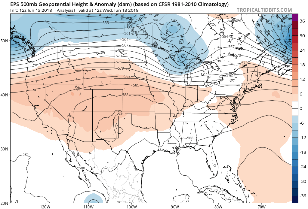
There will be a number of features at play to deliver this pattern change and better rain chances over the coming week. First, we see the ridge that's in place right now over the middle of the country...
... shift east, with a large area of low pressure dropping into the Great Basin:
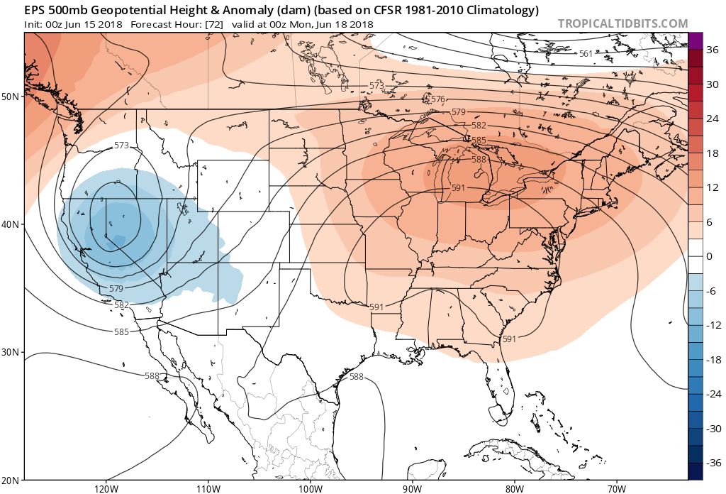
These two features together will act to pull moisture out of the eastern Pacific and Gulf of Mexico and deliver moisture-rich air to the plains states, including Colorado.
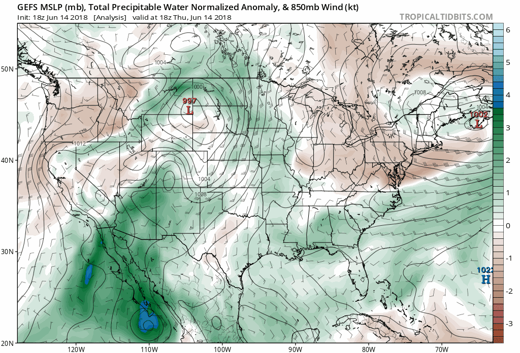
There's also been a lot of talk about hurricane Bud's influence on our weather as well. And, while it's true we will see some impacts from this tropical storm, that will mainly be this weekend. Take a look at the GEFS precipitable water forecast from today through Sunday. That blue "blob" that moves up out of the Baja and then across Colorado is that super moist air associated with Bud that will help deliver heavy rain to parts of the state this weekend. In fact, there are already Flash Flood Watches in effect for southwest Colorado, with greatest flooding concern around recent burn scars.
By early next week we continue to see anomalous PWAT values across the region, but the main moisture fetch shifts to the Gulf. This pattern will work to deliver heavy rain to the Texas coast, continuing north into eastern Colorado and the northern high plains.
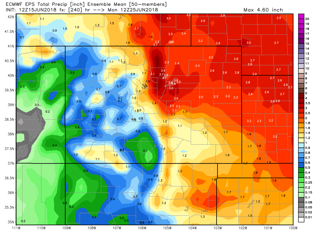
The most recent EURO ensemble mean forecast shows above average precipitation forecast for all of Colorado over the next 10 days, with the brunt of that perhaps setting up for northeast Colorado and the Front Range (blues):
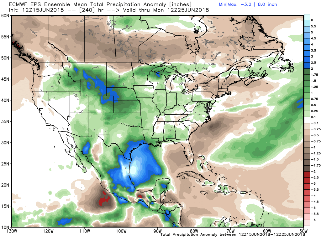
Just HOW much rain we'll see over the next week+ is a bit in question. Expect to see wide ranging totals (if you end up under a heavier storm or not), but several inches will be possible through the period as our weather pattern remains active.
For now, it looks like Sunday through Tuesday will be the best chances for rain in Denver, and also the coolest temperatures as well. By the middle half of next week we see highs warm into the 80s again, with storm chances remaining, through maybe not as widespread.
While there's not doubt (and justifiably so) a I'll believe it when I see it attitude in the air, hard not to like the look of 1 - 4" of liquid across much of the state in the EURO mean over the next 10 days. Do your rain dances, folks!
Please keep us posted on what rain you see! And as always, you can find our latest daily forecast here.