Monday AM Update: Storm Chances Return Today, Some Will Turn Severe

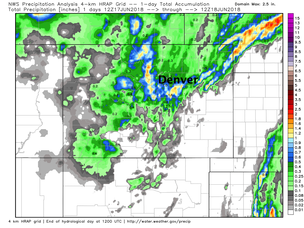
Well... it's a bit like pulling teeth getting it to rain around here, but we managed to extract some beneficial moisture over the weekend in some locations. On Saturday the best precipitation was focus north/northeast of Denver, with yesterday's rain focused in the Front Range foothills and Palmer Divide. At our station in Denver we picked up 0.47" of liquid Sunday, with light drizzle continuing this morning. Here are the 24 hours rainfall totals from across the state:
The storm chances stick with us through mid week before a couple of drier days are forecast to end the work week. Today's storm coverage may not be as great as yesterday, but storms that do develop may become severe.
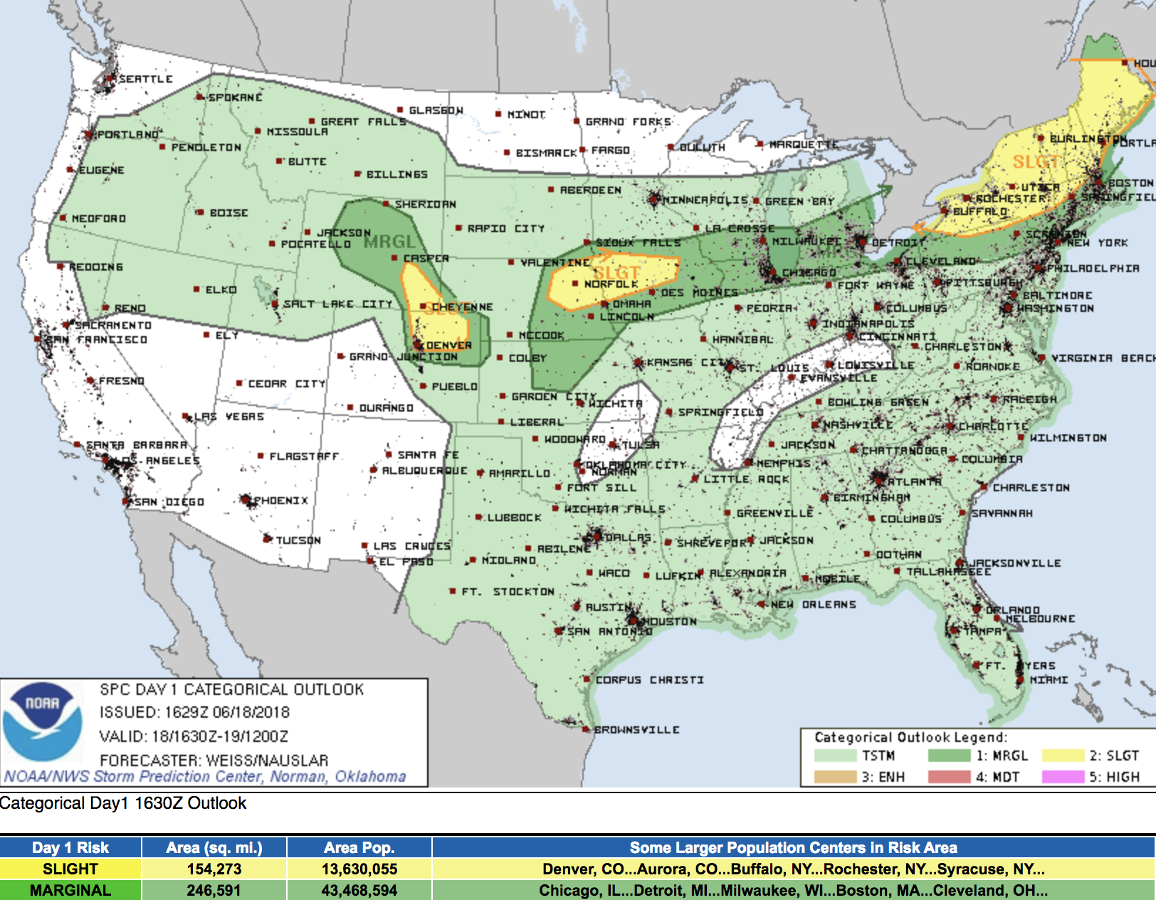
The SPC has a Slight Risk for severe storms across northeast Colorado, including Denver. Storms that develop this afternoon will be capable of producing large hail, damaging winds, and tornadoes. Here's the morning outlook from the SPC, with the yellow showing the area of greatest concern for severe storms today – mainly along and east of I-25 from the Palmer Divide north:
Biggest question in my mind today is if we can get these storms to fire. Temperatures this morning have been chilly, and we'll need some of these clouds to break up to allow for sufficient heating if we're going to get severe storms to develop. Latest satellite imagery shows clouds lifting off the Palmer, so we should see warming in the next few hours across the region. Current forecast is for highs to climb to near 80F by early/mid afternoon, with storms developing by mid to late afternoon near Denver, then rapidly moving east across the plains.
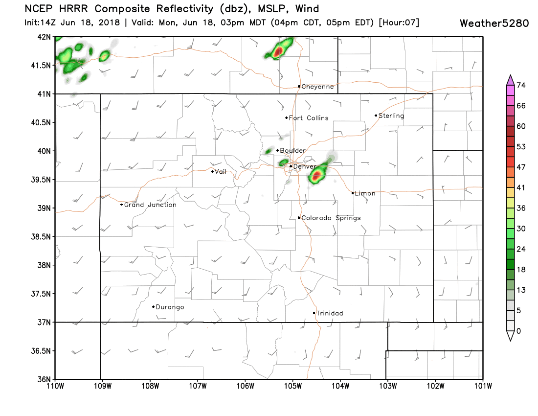
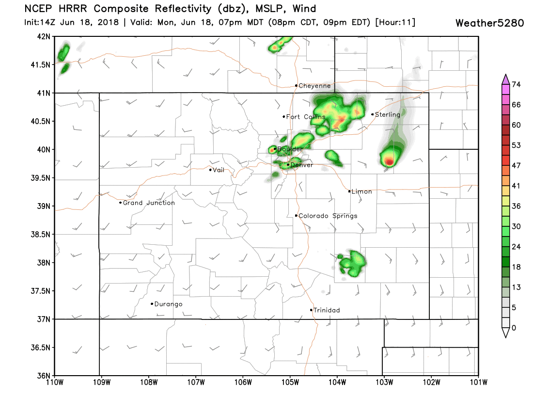
The latest HRRR shows storms firing over the Palmer around 2 - 3pm:
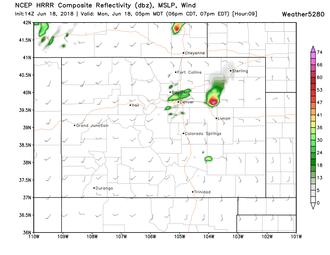
With showers and storms developing behind it across the metro area through early evening:
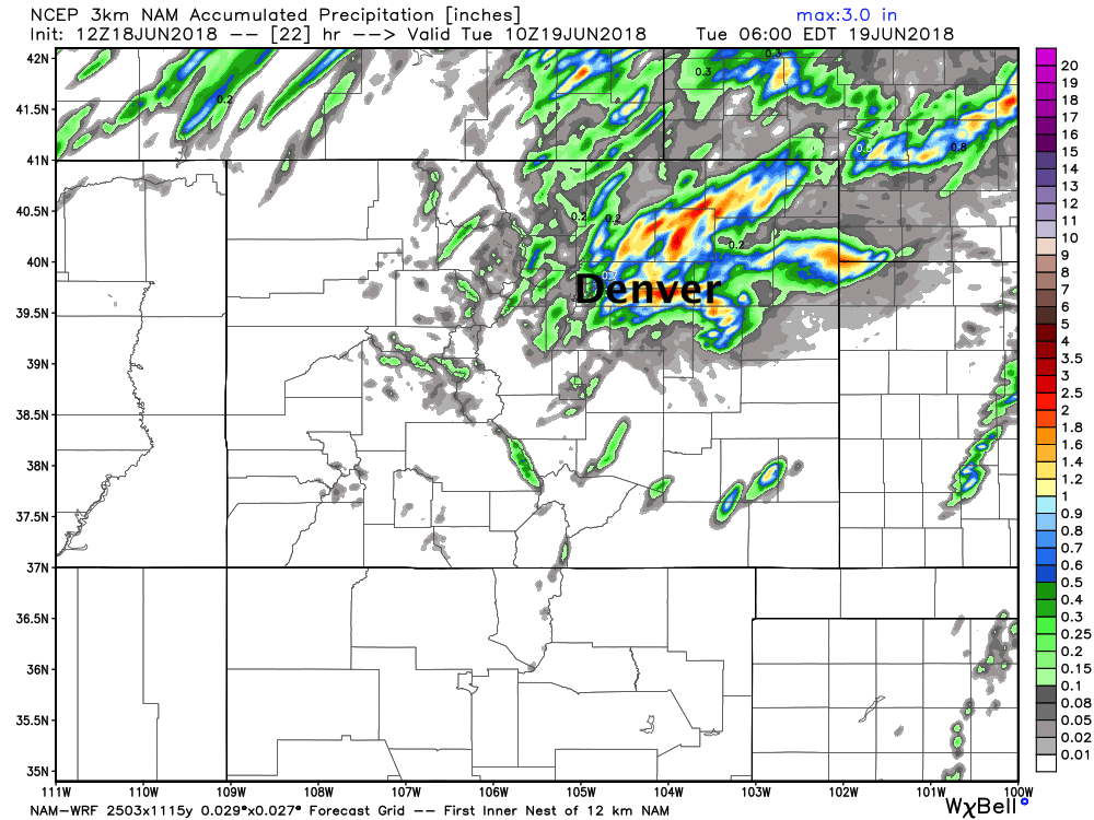
As for how much rain to expect? Well, all depends on if you end up under one of these storms or not. Again, coverage likely won't be as great as yesterday, so many folks won't see rain today. However, where we do see storms, rain will be heavy – with upwards of 1" possible under the stronger cells. Here's the latest 3km NAM forecast showing pockets of heavy rain across northeast Colorado through Tuesday night... the greatest potential appears to be setting up along and east of I-25:
Tuesday again brings the chance of rain to northeast Colorado, as well as another day of cooler temperatures – likely cooler than today, with highs in the low to mid 70s for your Tuesday.
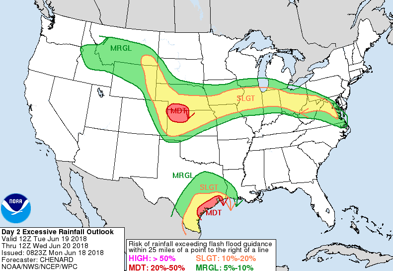
Tuesday again will feature the chance for heavy rain, especially across the eastern plains where flash flooding will be a concern:
Along the Front Range storm chances will be in the 30 - 40% range both Tuesday and Wednesday before we dry things out a bit for Thursday and Friday. Hard to have too much confidence in how much rain any given location will see... but where we do see storms develop in the coming days good moisture will be possible:
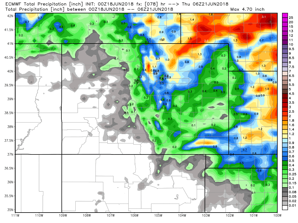
With other areas no doubt being left wanting more.
Overall a much more pleasant week on tap as far as temperatures go, with highs in the 70s and 80s throughout. Current guidance has Friday being the warmest day of the week with highs near 90F in Denver, with a slightly better chance of storms for your weekend and highs in the low 80s.
Please stay weather aware today, and of course... tell it to rain!