Thursday Pm Update: Storm Chances off and on Through the Weekend

What a shift in the pattern we've seen this week across northeast Colorado after roasting through the first half of June. As promised, those cooler temperatures were accompanied by some beneficial moisture (more so some places than others), and unfortunately some hefty hail stones as well.
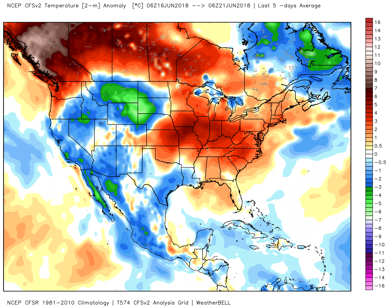
After starting the month WELL above average in the temperature department, the last five days have been below average across northeast Colorado:
We picked up 1" of rain at our station in downtown Denver over the last few days as well, with many areas across the northeast corner of the state and far eastern plains recording upwards of 1" (in a few cases quite a bit more!):
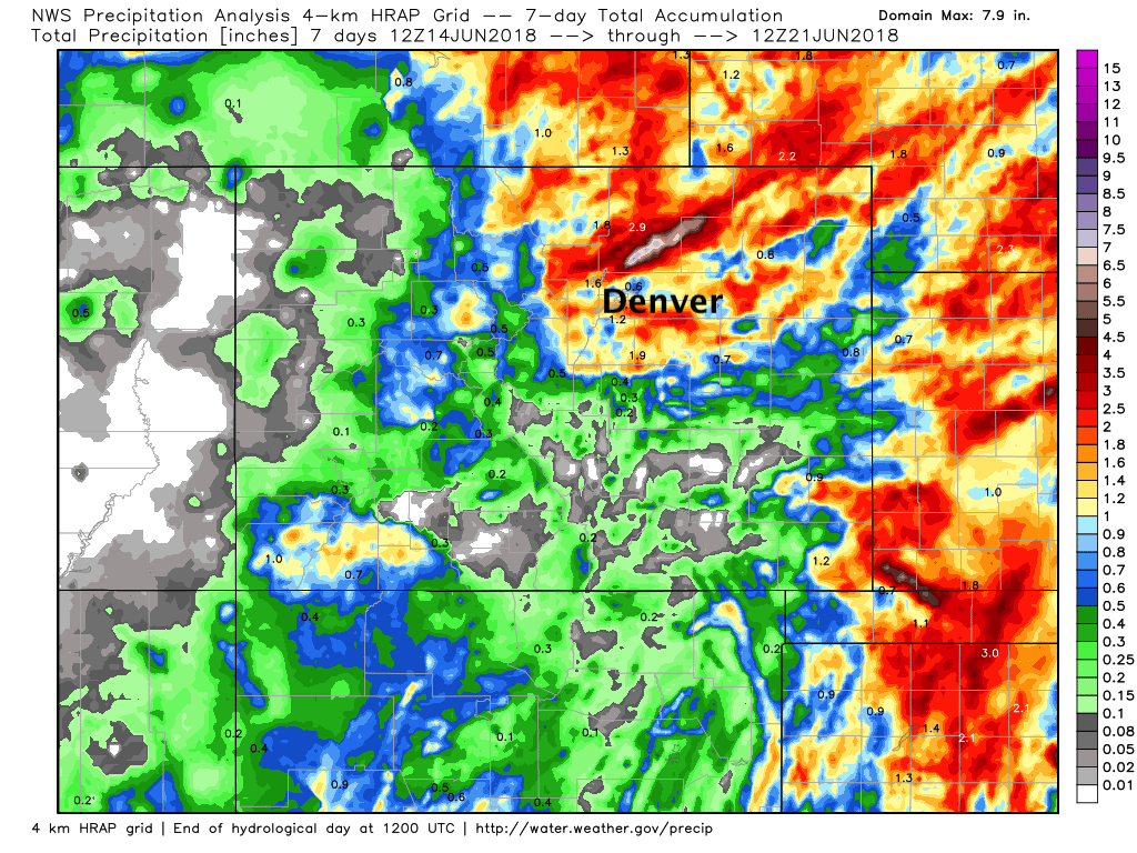
Of course the nature of summer storms is that they often deliver that heavy rainfall over a very concentrated area – nearly impossible to forecast accurately at any timescale. So, if you ended up a mile north or south of any number of these storms you're likely disappointed in your rainfall totals this week... but overall, a great looking seven day rainfall totals map above.
Here's a look at the severe storms that rolled through on Tuesday, with the streaks of damaging hail (right) as evidence of the strong super cells that developed along the Front Range and moved east across the plains, as well as the relatively narrow path these storms carve:
Busy day with several supercells coming off of the Rockies into the High Plains. Here’s how MRMS severe products tracked the storms. pic.twitter.com/YwmKl6Ay76
— Matt Mahalik (@MahalikWx) June 20, 2018
Things have quieted a bit now... but we will continue to see better storm chances over the next few weeks than we saw during the first half of the month. For the next week or so this is especially true for the far eastern plains, with perhaps some drier days closer to the Front Range.
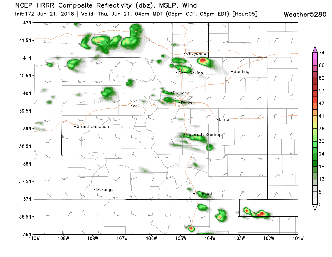
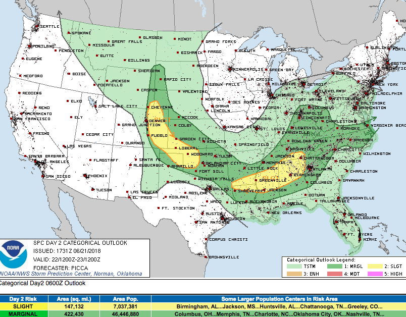
With that we'll see the threat of severe storms from time to time as well. While the SPC has a Marginal Risk for severe storms over the urban corridor this afternoon, the risk is pretty low – especially for the Denver area (a better chance of storms further north toward Fort Collins and Greeley), with better chances north for storm development. That said, a brief gusty storm should not be ruled out... with the latest HRRR showing those isolated storms along the Front Range during the mid to late afternoon hours:
Tomorrow conditions will be a bit more favorable for those stronger storms, but the primary threat should be just east of the metro areas (yellow). Of course we can't rule out storms developing a bit further west than currently anticipated – so please stay weather aware on Friday. Hail, damaging winds, and perhaps a tornado will be possible with the stronger storms on Friday.
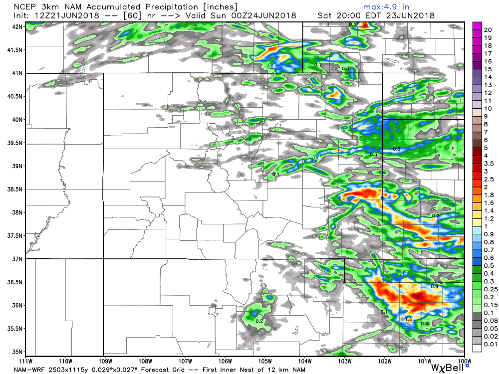
As for moisture... if you happen to see a storm today or Friday you could pick up a quick 1/2" to 1"+ of rain in a short time, but otherwise expect to stay mostly dry. Greatest storm coverage (especially Friday) looks to be across the eastern plains, with storms more isolated in nature closer to the mountains:
More of the same for your weekend, with Saturday looking like the drier of the two days at this time. Latest guidance suggest Sunday may see the best chance of storms across the urban corridor of the next several, so keep an eye on that.
As for temperatures? MOS guidance has highs in the low to mid 80s for your Friday and Saturday, with temperatures cooling a bit with those better storm chances Sunday and Monday, with the latest GFS MOS showing highs in the upper 70s to near 80 for both days. By the middle part of next week temperatures may try to climb back into the 90s, but we'll see how things look for next week in this week's SOTA.