Brief Reprieve from the Heat

Another hot one across the state today before a big cool down for your Saturday. Temperatures have already climbed into the low 90s here before noon Friday, ahead of a cold front nosing into northeast Colorado which should help keep us a good 8 - 12 degrees cooler than yesterday (depending on your location) though still hot across the region.
Temperatures last hour were in the mid to upper 80s around the Denver area, but note the wind shift and cooler temperatures across northeast plains which should push through Denver midday:
Saturday brings with it another cold front, and with it a great cool down after our record heat yesterday. Highs Saturday are forecast to be in the 70s for Denver, with overnight lows in the low 50s. Remarkably, the NAM MOS has lows in the mid to upper 40s for Denver Sunday morning... which would be close to the record low of 46°F for the date. While it's like running too cold (low 50s seems more reasonable), certainly indicative of the big change on the way after yesterday's 105° heat!
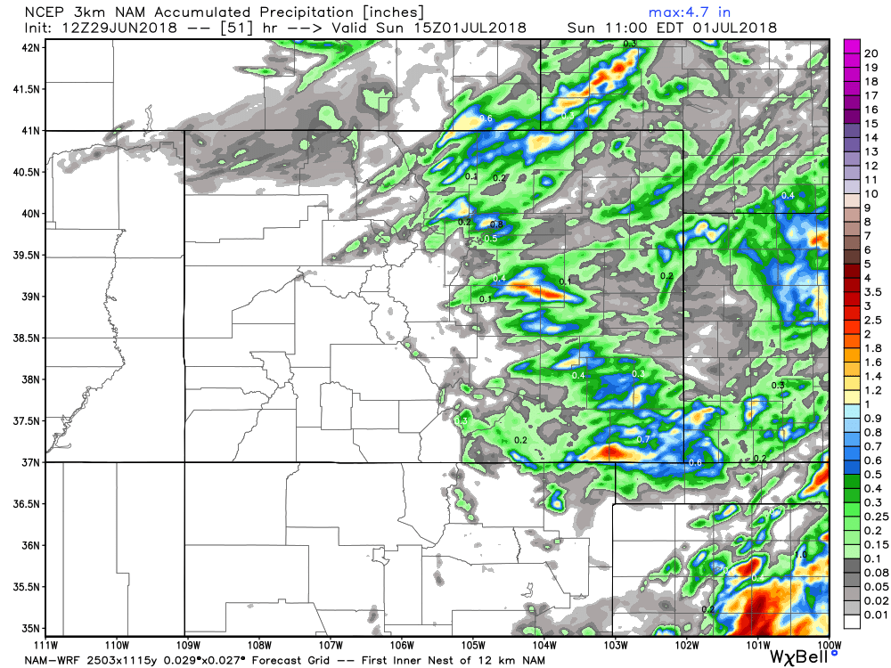
With the cooler weather Saturday look for a better chance of storms as well. Storm chances will be in the 40 - 50% range on Saturday for northeast Colorado (so pretty good), with a few storms capable of producing heavy rain. The GFS is least bullish (keeps best pops over the far eastern plains), but the NAM and EURO show some decent storm activity along the urban corridor, with a few storms capable of producing >1" of rain. Here's the 3km NAM which shows the widely scattered storms potential for your Saturday, with pockets of heavy rain (haves and have nots etc):
The cool weather and chance of rain will be quick hitting. By Sunday highs will be back near 90 in Denver, with mostly dry conditions expected. Not a bad way to start July.