The State of the Atmosphere: Sunday, July 1st, 2018

For a time of year when the state of the atmosphere can be quite mundane, this past week certainly had it's ups and downs. From heat bursts, to record heat, to yesterday's dramatic cool down... the week had something for everyone it seems.
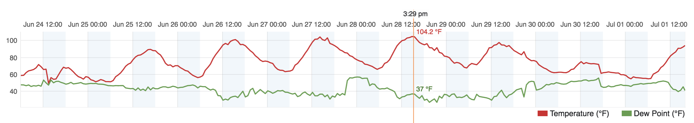
Here's a look at temperatures over the last week. Plenty of heat to go around (104°F at our station on Thursday), shouldered by two dramatically cooler days on both weekends:
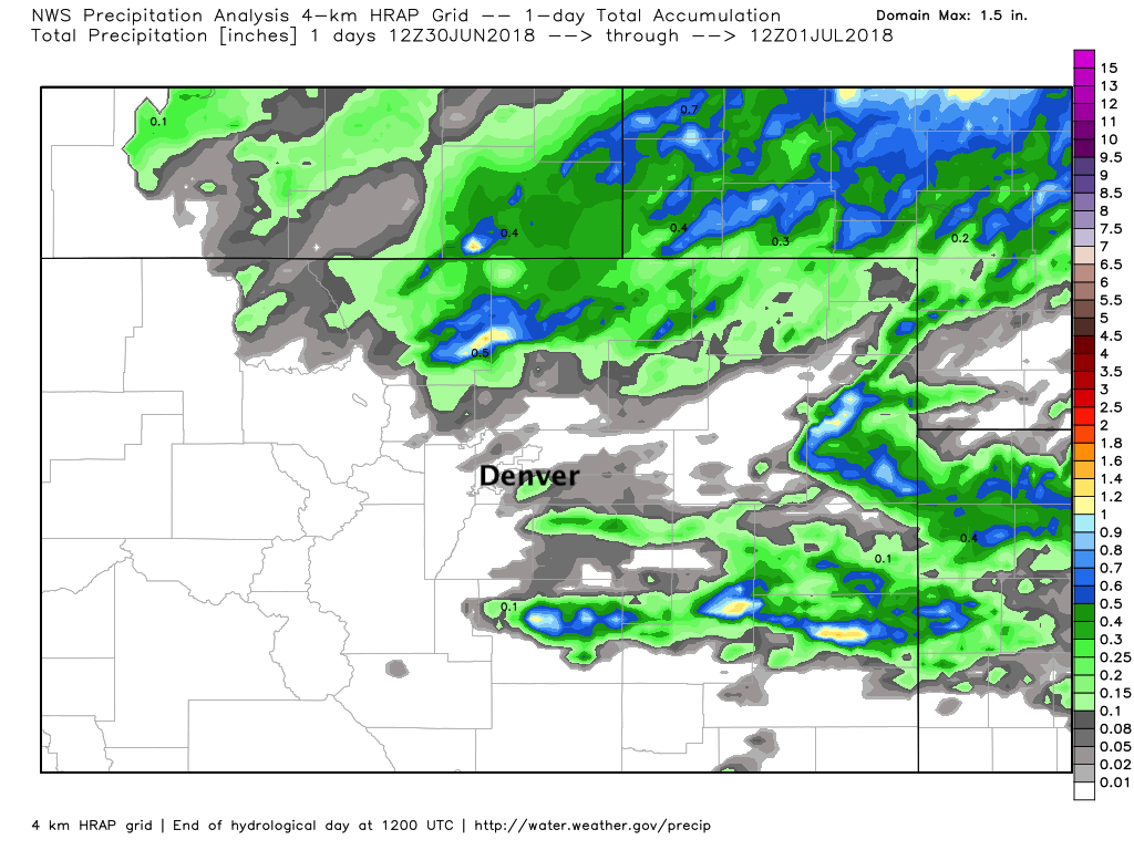
While some areas did manage some rain on Saturday along with those cooler temperatures, the Denver metro largely did not. Up north we saw some good storm activity, and with that some 1"+ storm totals... but as you can see, it was not for all:
This means Denver ended the month of June with both above average temperatures (a whopping +5°F above average in fact), and a notable 1.55" below average for precipitation (though much of the city fared better). Not exactly unexpected at this point, but of course disappointing nonetheless.
The week ahead
Speaking of mundane, I suppose that will be a pretty good word for the week ahead as well. Temperatures will be warm (90s most days) and while storm chances will come and go, with not a whole lot of reason to be excited for rain this week either.
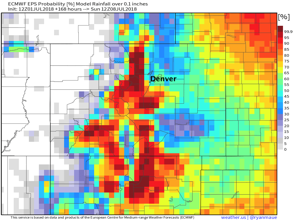
Probabilities for more than a tenth of an inch of precipitation through the week look like this (not bad I guess):
But for a half inch or more, those drop off dramatically:
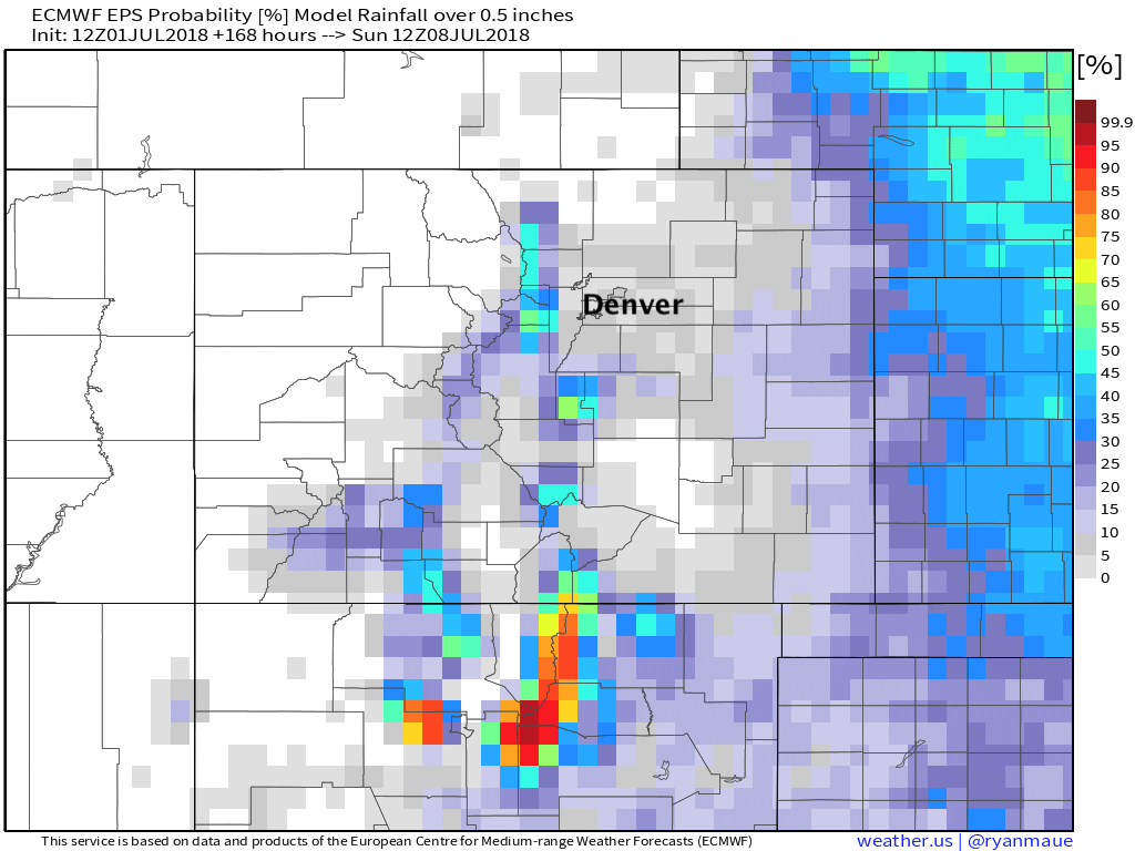
Of course this won't do a great job at picking out any single storm, but shows overall not a very wet look to the week. There WILL be some moisture around mid week, so those storm chances certainly won't be zero.
The best chance of storms looks to be Wednesday and Thursday at this time, so keep this in mind for your July 4th BBQs – you'll want to at least keep an eye on the forecast and sky as the week progresses.
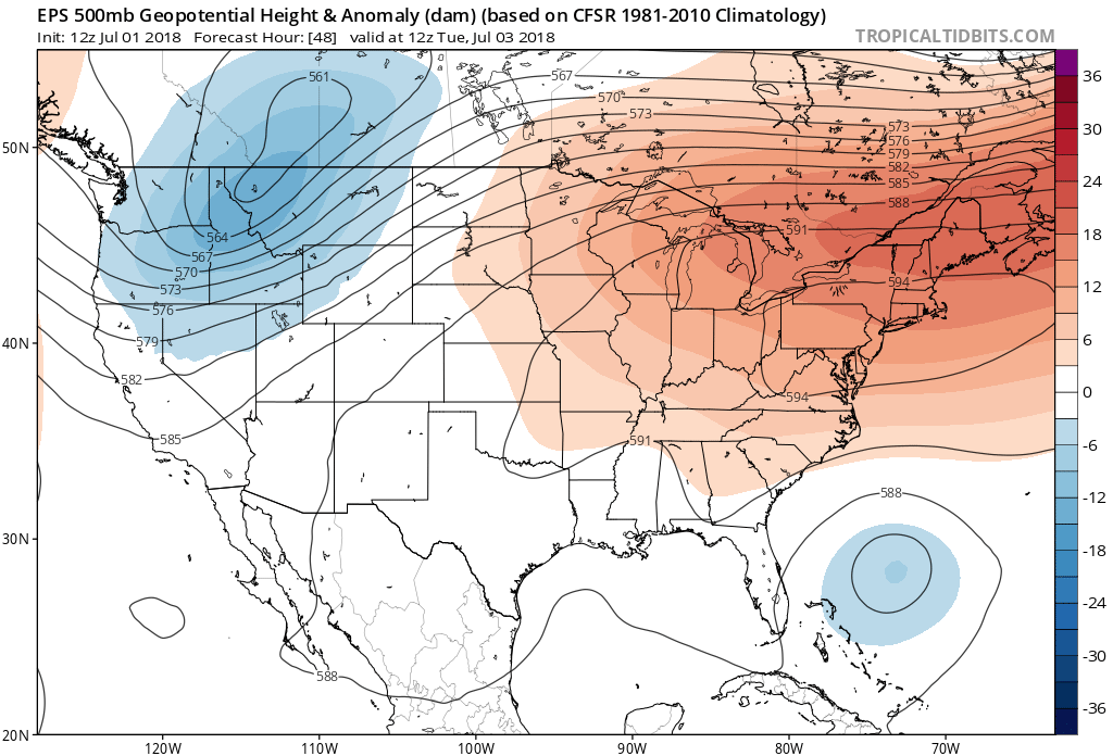
A large area of high pressure starts the week well to the east of us with a disturbance pushing through the intermountain west on Tuesday:
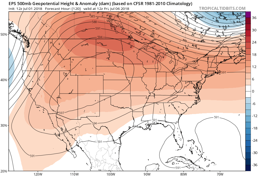
As the week progresses that ridging shifts west over the high plains and really takes over by Friday:
The front Tuesday (if you want to call it that) will keep temperatures down a few degrees with those better storm chances for Wednesday and Thursday as well, but not much. NAM MOS keeps highs in the low to mid 90s for the 4th, while the GFS drops Denver into the upper 80s. Thursday at the moment looks like the coolest day of the week (GFS with 82... but methinks that too cool) before the heat builds back in for the weekend.
With the kind of ridging being painted in the models for next weekend expect highs back in the mid to upper 90s with likely drier conditions on the way as well. Let's hope we can sneak a storm or two out this week before that happens.
More on the long range outlook for July and August coming for our Insiders tomorrow. Stay cool!