The State of the Atmosphere: Sunday, July 8th, 2018

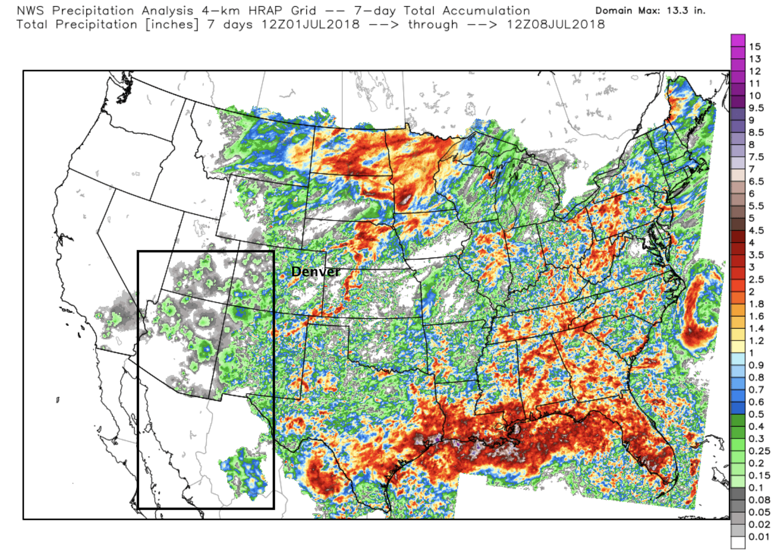
While we saw pockets of good moisture along the Front Range over the last week, the monsoon remained elusive. It's easy to see this when looking at the precipitation pattern over the last seven days, with some rain falling over Arizona, western New Mexico and western Colorado... but not much:
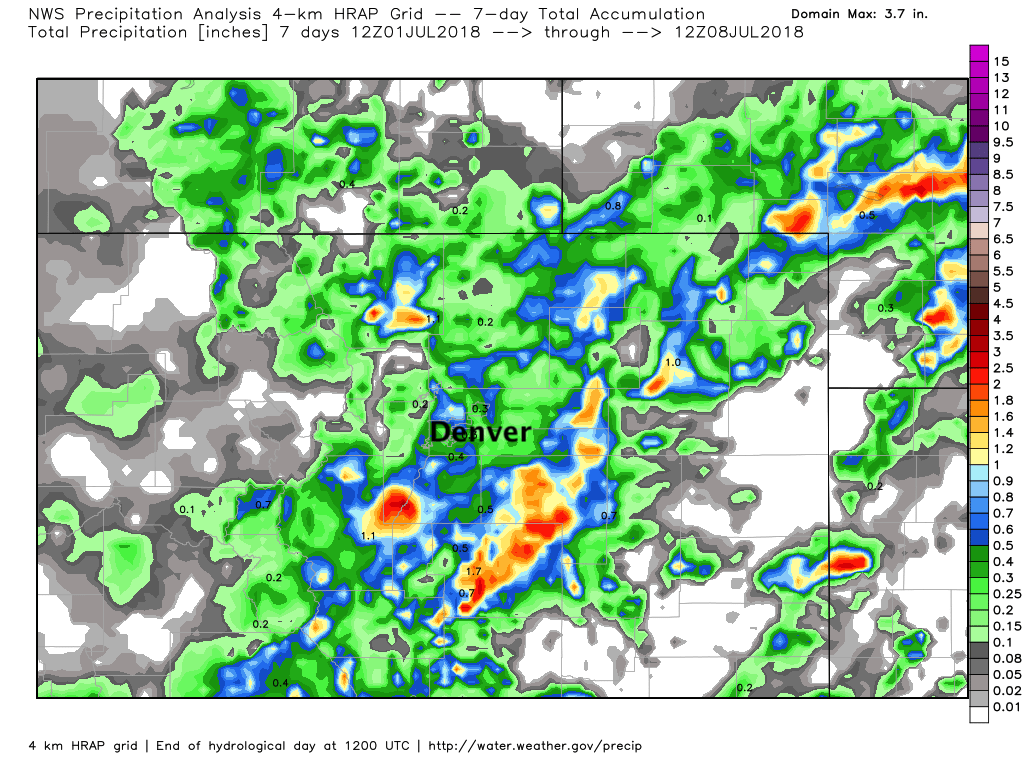
Closer to home, we see some good seven day totals in spots – namely from the rain we saw move through on Thursday. While it largely missed Denver proper, areas north and west of Fort Collins, and again across the southwest foothills and Palmer Divide saw some great totals this week:
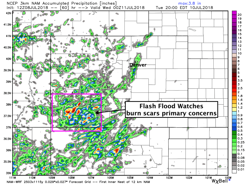
Over the next few weeks we should start start to see more-typical rainfall pattern for this time of year as the monsoon kicks in and we see better moisture delivering to the parched southwest United States. In fact, we're already seeing some Flash Flood Watches in effect today for southwest Colorado (namely the 416 Fire Burn Scar in Northwest La Plata County) –– something I think we'll being seeing quite a bit more of over the southwest in the coming days and weeks.
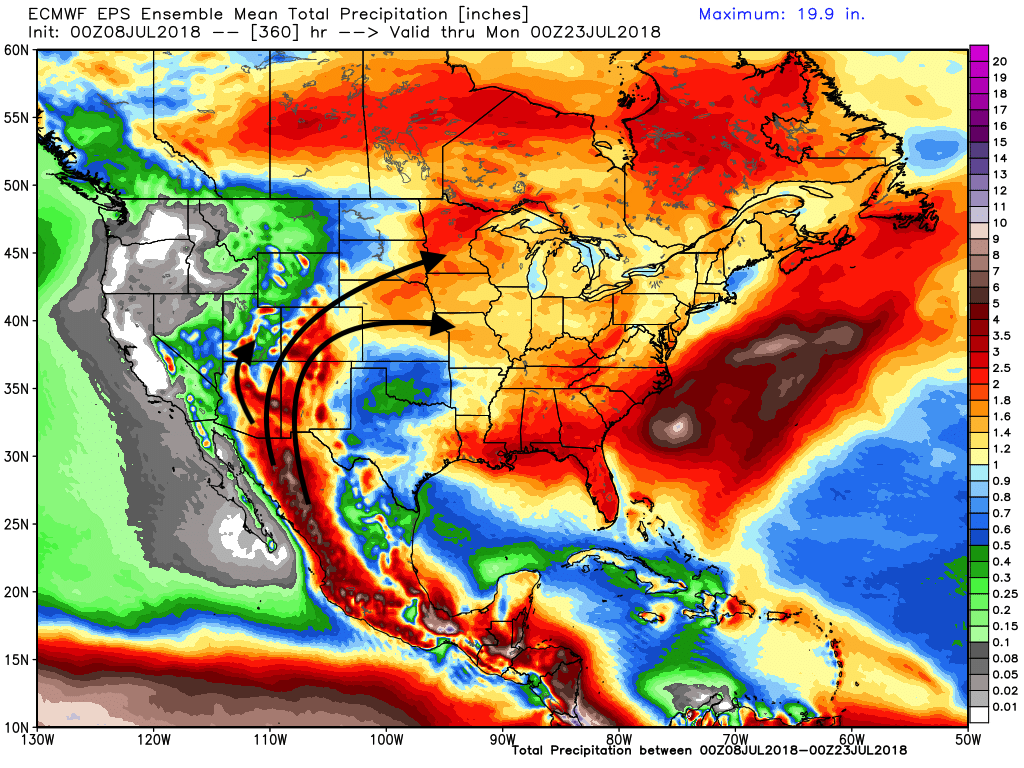
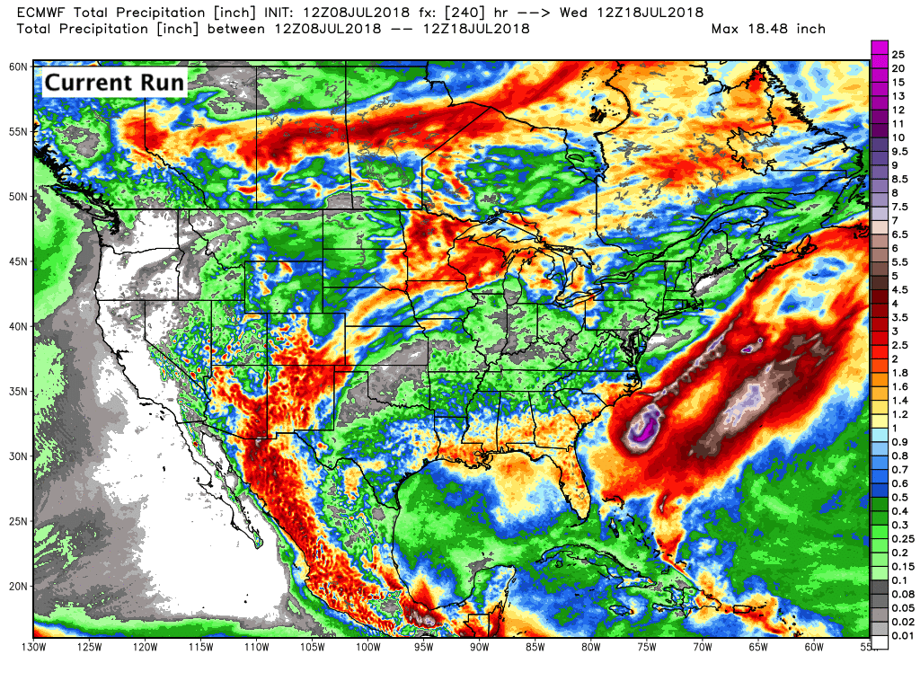
If we take a high level look at the next 15 days or so we see a notable shift in the precipitation pattern across the U.S., with the monsoon really coming alive across the southwest, then fueling storm complexes across the central and eastern United States. Here's the 15 day EURO ensemble mean precipitation forecast – expect this to cause flooding concerns at times across areas currently hit hardest by drought:
High level probabilities to match as well, with the next seven days showing the creep of monsoonal moisture into Arizona, New Mexico, Utah, and Colorado:
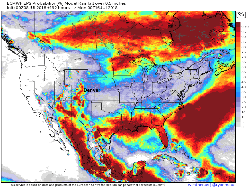
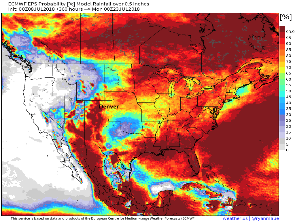
Eventually boosting probabilities across the entire region for >0.5" liquid over the next two weeks:
The week ahead
The devil, of course, is in the details. All this monsoon talk means nothing if you end up with nothing in your back yard. Confidence is greatest that we see that monsoon moisture push into the mountains of Colorado over the next two weeks – and of course this is where we need it most. A failed monsoon, or worse, lightning but no rain would be awful news for the seemingly endless fires that continue to pop up across the state this summer.
It's almost impossible to say who ends up with how much rain over the next two weeks. There are many factors at play, and so each wave of tropical moisture will need to be considered by itself. That said, the pattern will promote periods of storms across the state, so there is hope.
The hot streak continues for northeast Colorado to start the work week, with highs in the mid to upper 90s for Denver through Wednesday, and low storm chances. Greatest moisture over the next two days is expected over southwest Colorado, with little activity beyond that:
By Thursday we see ridging shift east a bit and allow for better moisture transport into eastern Colorado. We should see a "cold front" drop temperatures a few degrees for Thursday as well.
Reminder: You can find current temperatures and daily forecast here.
A better chance of storms for the Front Range looks to remain in the forecast through next weekend as well, though details remain vague. At times it looks like we could see good storm activity –– PWAT values are expected climb once more, with dew points climbing back into the 50s and 60s across the plains. For now will just mention the increased storm chances by late week, but wait to follow up with details. Plenty of dry models runs still coming in for northeast Colorado through next weekend, but we know how well the globals handled last week's rain.
In the end, we are really tied to the ebb and flow of the tropical moisture driven by the monsoon. This is especially true the further north and east you get from SE Arizona and SW New Mexico – i.e. northeast Colorado where even a great monsoon may not pan out well locally. Take a look at the 10 day forecast from the EURO last night compared to this afternoon:
The "current run" (this afternoon) shows Denver and most of northeast Colorado all but DRY over the next 10 days... while last night's run forced that tropical moisture just slightly further north with greater coverage for our region. In both cases, beneficial moisture for our southern and central mountains –– so hope exists, indeed.
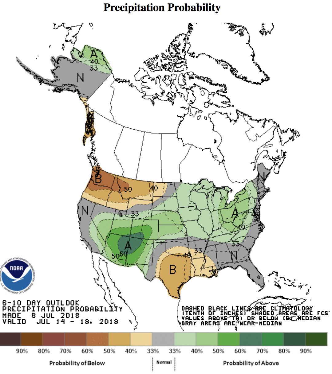
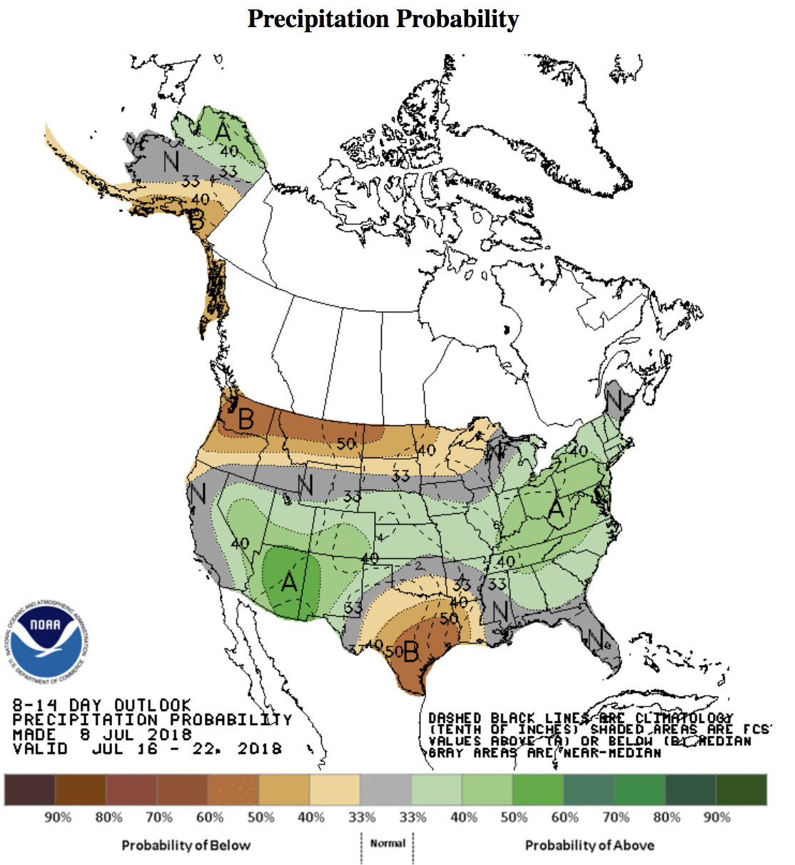
Finally, here's the 6 - 10 day precipitation outlook from the CPC (top) and 8 - 14 day outlook (below). Probabilities for above average precipitation might be a bit higher than I would put for northeast Colorado... but I'll take it.
Let's remember now where the worst drought conditions are in the country right now:
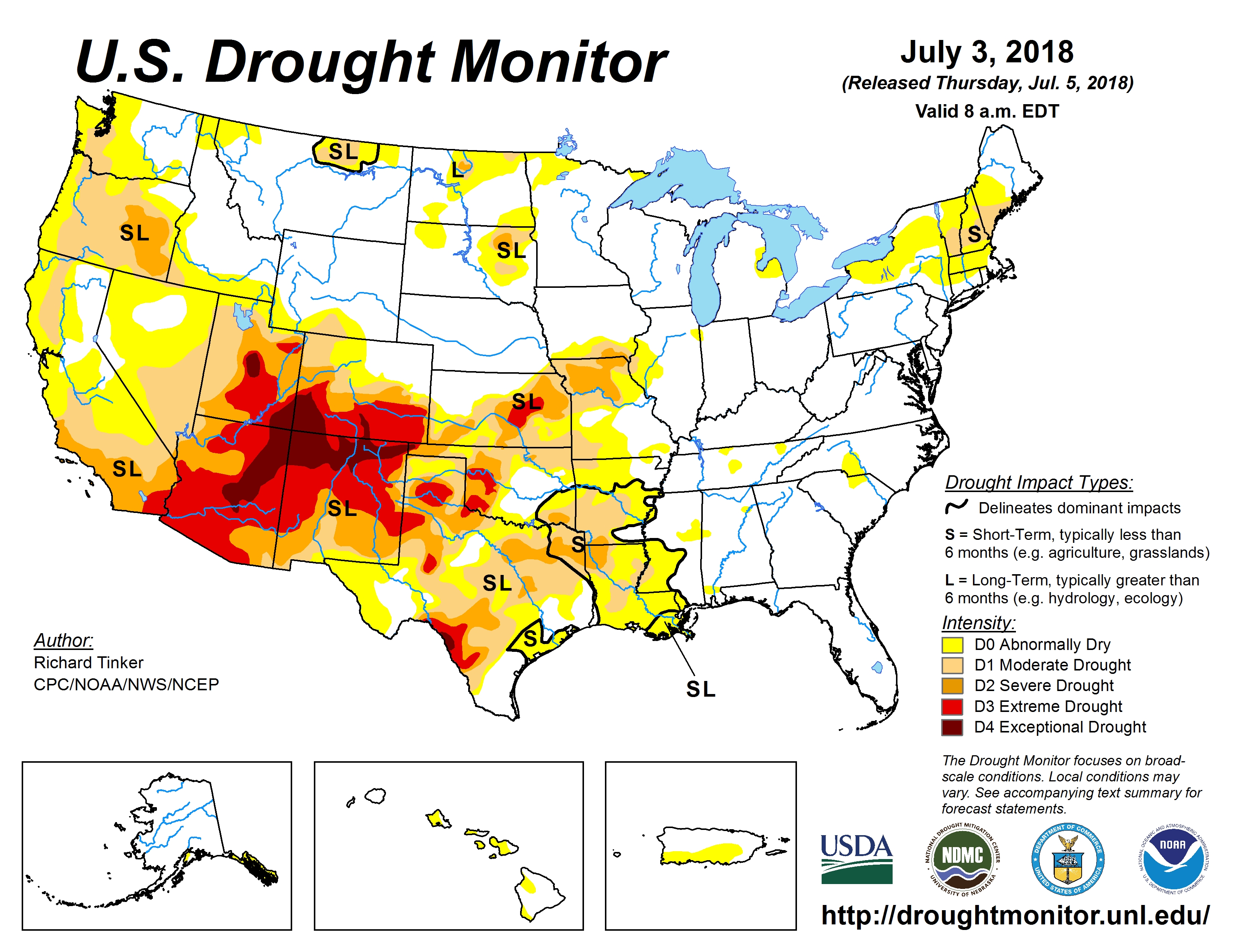
We talk a lot here about how drought feeds drought. It'll take a lot of work to overcome the severe drought plaguing the Four Corners region, and while the up coming weeks may not be able to overcome the drought it's certainly a better outlook than we've seen in some time. Here's to hoping.