The State of the Atmosphere: Monday, August 20th, 2018

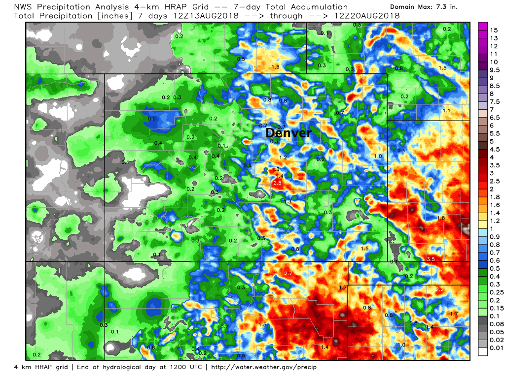
Even with some dry days mixed in, seven day rainfall totals across eastern Colorado once again look quite nice for many locations.
Denver's biggest rain came Saturday night, when we picked up nearly a half inch at our station south of downtown. Others saw upwards of 1" along the urban corridor Saturday between the two rounds of rain that moved through ahead of Sunday's cool off.
Month to date temperatures continue to run below average across eastern Colorado as well (-0.9°F officially for Denver), with greatest anomalies just east of the I-25 corridor. As you can see, the center of the cool over the last 20 days has been focused across the eastern plains of Colorado, Kansas, and Oklahoma –– with the intermountain west and New England running quite warm month-to-date:

This morning was especially cool, with DIA tying the daily record low of 46°F, previously set in 1939. We were a couple of degrees warmer in town (bottoming out at 50°F at our station this morning), but a late summer chill was certainly in the air.
The week ahead
More of the same, really, for the week ahead. The week starts cool, then gradually warms into the weekend. MOS guidance has highs in the upper 70s today for Denver today, low 70s Tuesday, then gradually warming to near 90°F by Friday.
Best rain chances for the metro area this week at this time appear to be Tuesday. Rain chances appear best Tuesday evening for for Denver, with the GEFS ensemble in good agreement here. Drying and warming is also quite evident for the remainder of the work week:
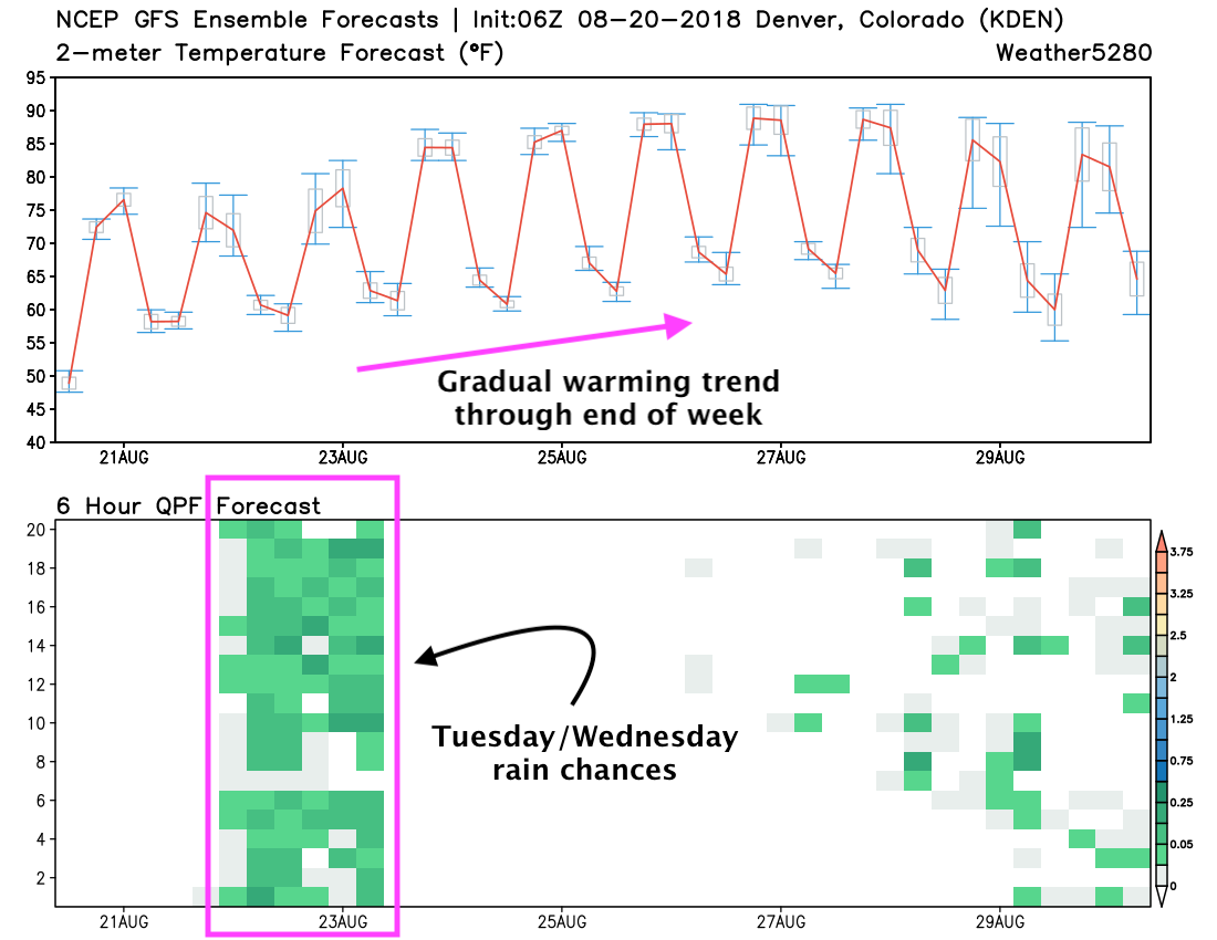
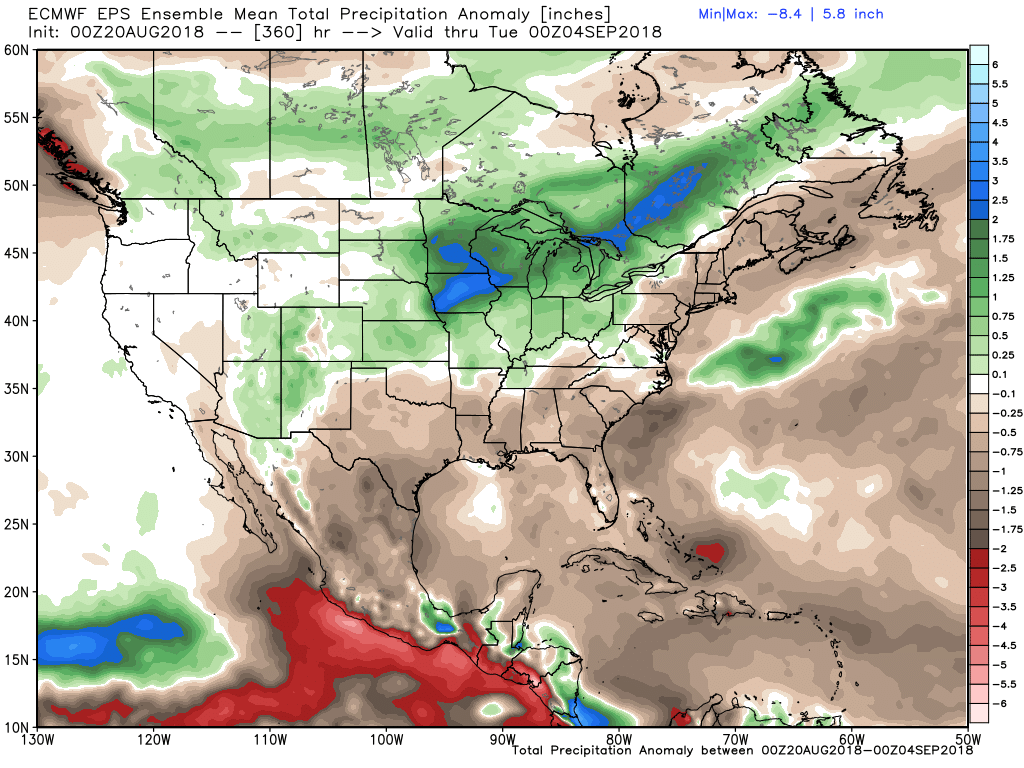
We'll go with 30 - 50% rain chances for the greater metro area Tuesday, and 10 - 20% chances for Wednesday. Worth noting the EURO is pretty dry east of the foothills both days, but the NAM/GFS are both pretty wet... and the EURO has struggled with recent rain events. At the same rate, its ensemble continues to show average to above average precipitation through the remainder of the month across the region, so keep it coming!
The other concern this week will be the periodic smoke that we'll have to contend with. Today may be one of the smokier days across the region, but likely not the only smoky day. The latest HRRR shows near-surface smoke pushed against the mountains throughout the day by easterly winds, but gradually thinning out tonight:

Keep an eye on the sky next next few days, then enjoy some nice warm late-summer days and cool nights to round out the week!