Snowfall Totals, Bitter Cold, and The Week Ahead

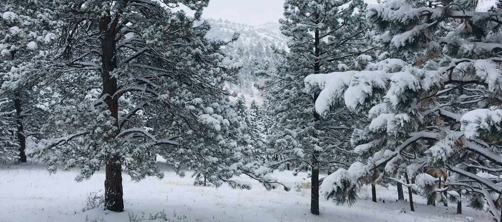
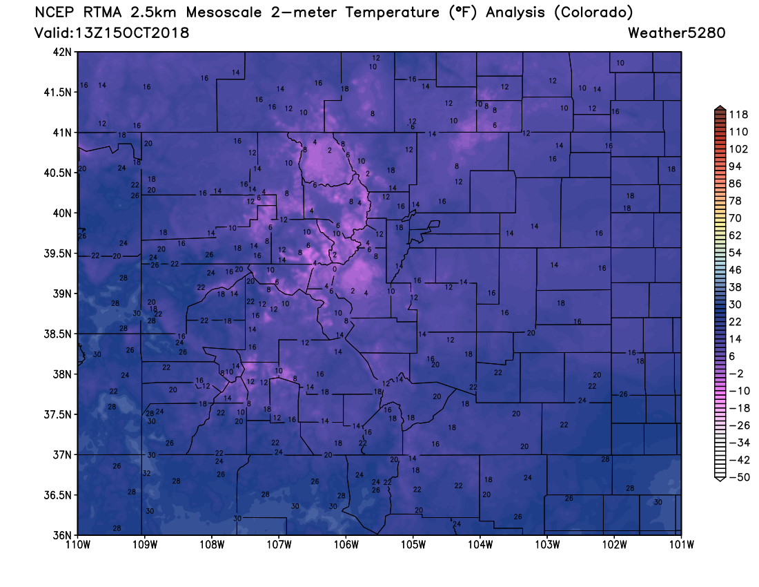
Our early season snow has come and gone. In its wake, bitter cold. We bottomed out at 19°F this morning at our station in Denver, matching the official overnight low at Denver International Airport. This is a new record low for the date.
Below is a look at the temperatures across the state this morning. Looks more like the heart of winter than mid October:
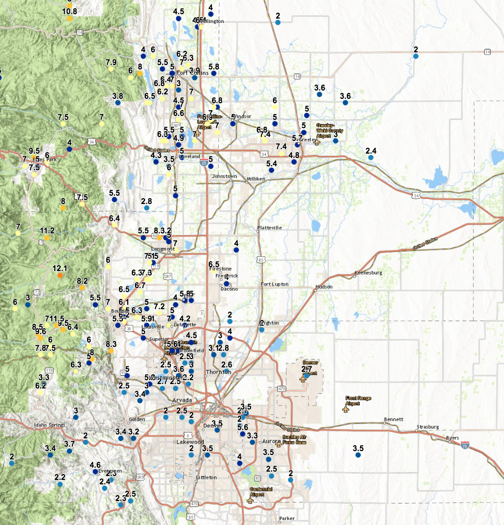
Denver picked up 2.7" of snow on Sunday. Somewhat shockingly, this is the most snow Denver's seen in a single day since February 19th (H/T Chris Bianchi). That's remarkable given March and April are two of Denver's snowiest months, and speaks volumes to just how much of a snow-drought the city has been in the last two seasons.
At our station on the south side of downtown we picked up 3.0" on the nose (forecast was 2 - 5"). The greatest totals, as expected, ended up north of Denver, with many 6 - 8" readings coming in from the Fort Collins, Longmont, and Boulder areas. Further south totals were more hit and miss. A few persistent snow bands set up Sunday morning from Denver south, but they didn't move much before dissipating. If you ended up under one you likely saw some good snow, if not –– likely a forecast bust. For example, south of Castle Rock we see a few 6" reports, but closer to the city only 2" in some cases. We had 3 - 6" across the Palmer.
Unfortunately the NOAA interpolated snowfall map continues to run a few days behind. Instead, here are some raw totals shared from the National Weather Service in Boulder, with an interactive version located here.
The week ahead
Not a lot to say about the coming week, actually. Temperatures will gradually warm through the weekend, with little to no precipitation in the foreseeable future. If you wondered what happened to fall, here it comes!
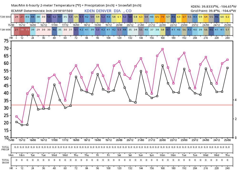
MOS guidances lines up pretty nicely with EURO forecast above. Highs in Denver today will be in the 40s, 50s for tomorrow, and warming into the 60s for Thursday, Friday, and the weekend. Highs by Sunday may near the 70 degree mark once more. For lows, look for temperatures below freezing the next night or two, before "warming" into the 30s to near 40 for overnight lows as we head toward the weekend.