The State of the Atmosphere: Sunday, October 21, 2018

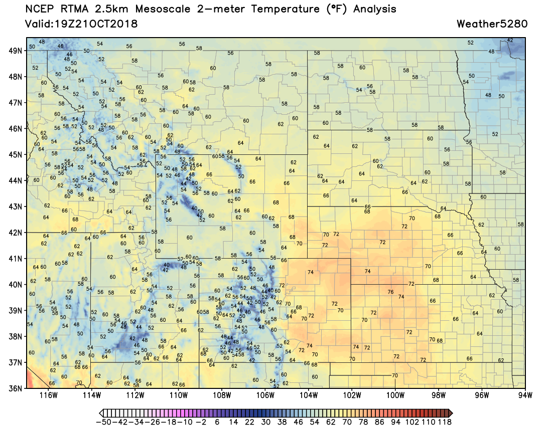
Hard to imagine that a week ago today we were dealing with snow and record cold. Highs today have climbed well into the 70s across the plains, with plentiful October sun shining across the state.
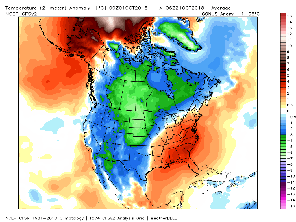
Through the first 20 days of the month temperatures are running well below average across the western two thirds of the country. The coldest temperature departures from average are running across the northern high plains, including much of eastern Colorado. Denver is running -5.8°F below average for the month, which is quite a flip from the 4.4°F above average we saw in September.
While today was quite warm, the week ahead looks to be closer to average for the most part. It's likely that the month ends up below average in the temperature department for Denver, with no real heat expected over the next 10 days. We could see another 70 degree day or two, but nothing sustained, with most days looking to be near average (low 60s), to slightly above average over the next week+. I don't hate the 2-meter temperature forecast from the EURO below through the week, with that 53 you see at the tail end indicative of what could be our next impactful weather system to end the month.
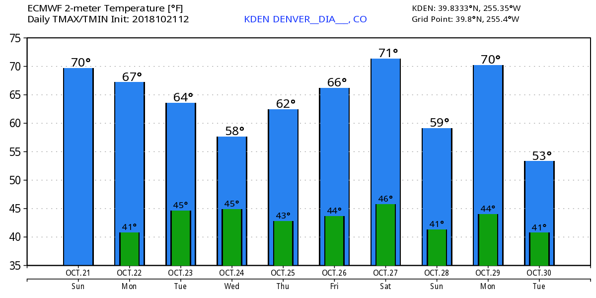
For this week, the coolest day is likely Wednesday, though some models indicate Tuesday won't be a whole lot warmer. Even so, upper 50s to low 60s should be doable both days, which puts us only slightly below average for this time of year. Not too bad.
This will also correspond with our best chance of precipitation this week. Right now not looking like a huge deal across northeast Colorado, but some 20 to 30% rain chances are likely mainly Tuesday night –– perhaps lingering into Wednesday.
I can't bring myself to get all that excited about our rain chances here in town, but point is, don't be caught off be some showers and cooler temperatures Tuesday into Wednesday. Greatest rain chances (and snow for that matter) will be across extreme southern Colorado, with most of the northern half of the state remaining on the dry-side this week. Here's the ECMWF mean precipitation forecast through Friday evening:
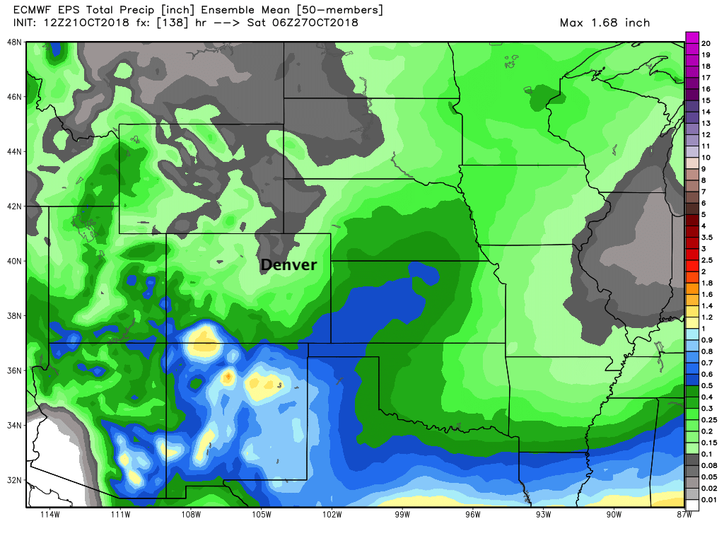
I suppose if the disturbance tracking to our south this week ends up a bit further north we'd need to tweak the going forecast a bit, but for now I don't see a whole lot of concern here. Will go with a mention of showers, and slightly cooler temperatures and call it good.
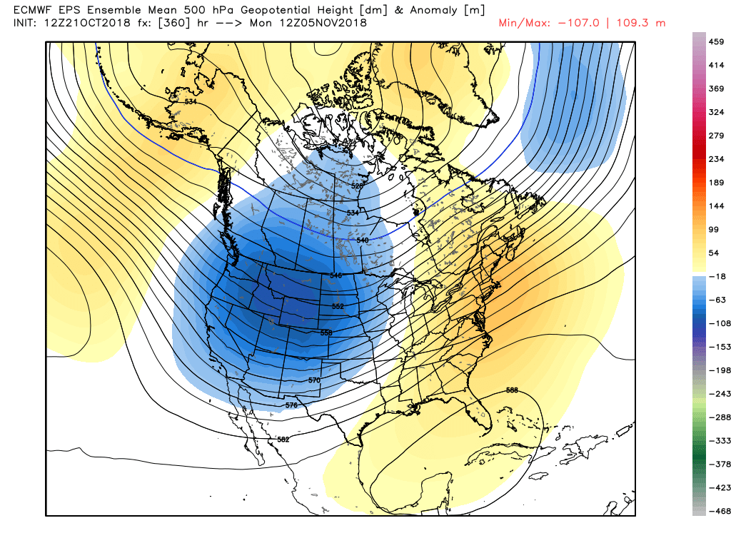
Looking ahead a little bit... not this week but the following appears to offer the next best chance for mountain snow and perhaps some more active weather across the plains as well. Quite a ways out, but let's keep one eye on the Tuesday/Wednesday (Halloween!) timeframe next week, and see how things evolve. The EURO tries to bring a little something through around the 30th...
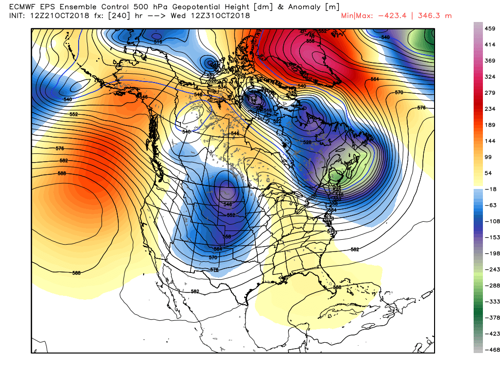
Then parks the trough in the west to start November. How about that.