Near 80 Degrees Today for Denver, but Rain and Snow in the Forecast Tomorrow

Get out and enjoy the afternoon if you can. Temperatures are nearing the 80 degree mark in Denver this early afternoon, but are set to take a tumble as we head into Tuesday. Latest guidance has highs in Denver topping out in the mid 40s tomorrow, some 30 to 35 degrees colder than today.
Along with the drop in temperatures will come a chance of rain and snow. While certainly colder than today, this system doesn't actually look all that cold for time time of year. With that, we expect to see some rain vs snow at lower elevations during the day Tuesday, and where snow does fall quite a bit of melting to occur as well. As it stands, it looks like the bulk of the heaviest precipitation moves through the Denver area before temperatures dip below freezing late Tuesday night.
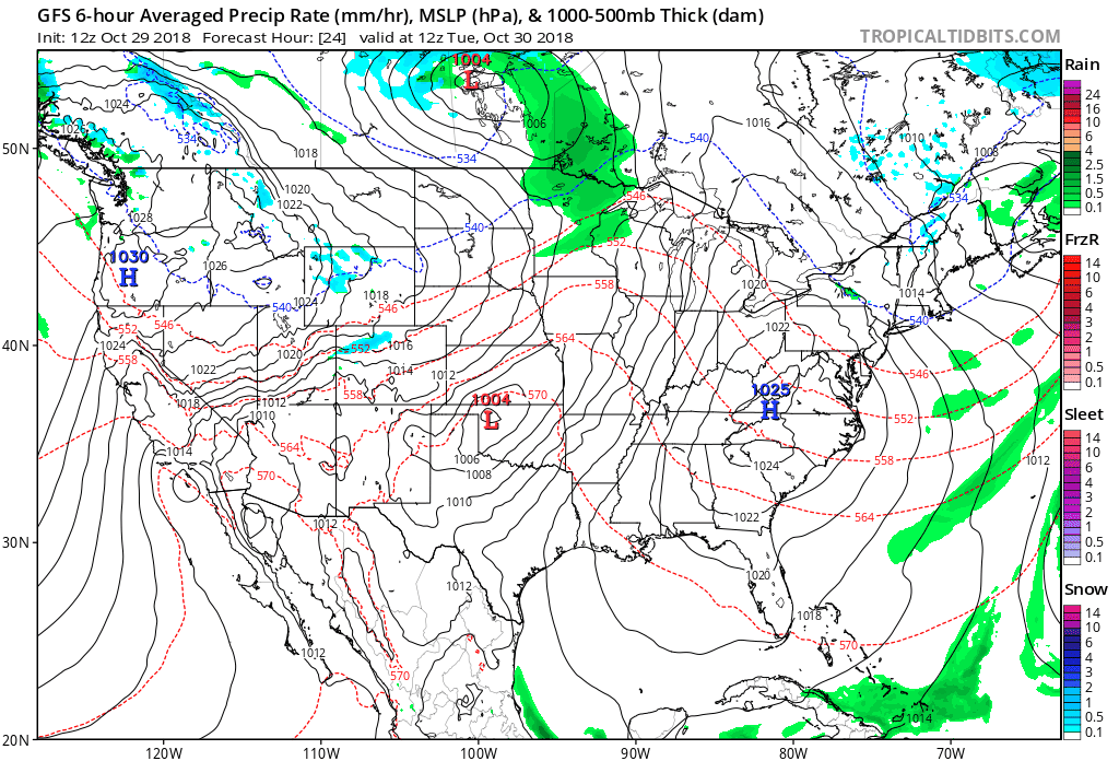
Storm track and temperatures both argue the greatest impacts for the event to occur in the foothills west of Denver, and across the Palmer Divide. Despite some models showing some more robust snowfall totals for Denver proper (today's EURO has 4 - 5" of snow for Denver) we think this is overdone for the city given temperatures. Instead we'll go with 1 - 3" downtown (much of that on raised/grassy surfaces) and 2 - 5" on the west/south side, with greatest totals as you head up in elevation (i.e. Surrey Ridge). It continues to look like those north of I-70 will largely miss much of the snowfall activity (at least accumulating), with most of the precipitation up north expected during the day Tuesday and temperatures near 40 degrees with warm surfaces.
With that, below is our snowfall forecast for Tuesday through Tuesday night. We expect the heaviest snowfall to occur across the western Palmer Divide, where travel could be quite tricky Tuesday evening. A Winter Weather Advisory has been issued for this area as well, going into effect at noon Tuesday, extending through early Wednesday morning.
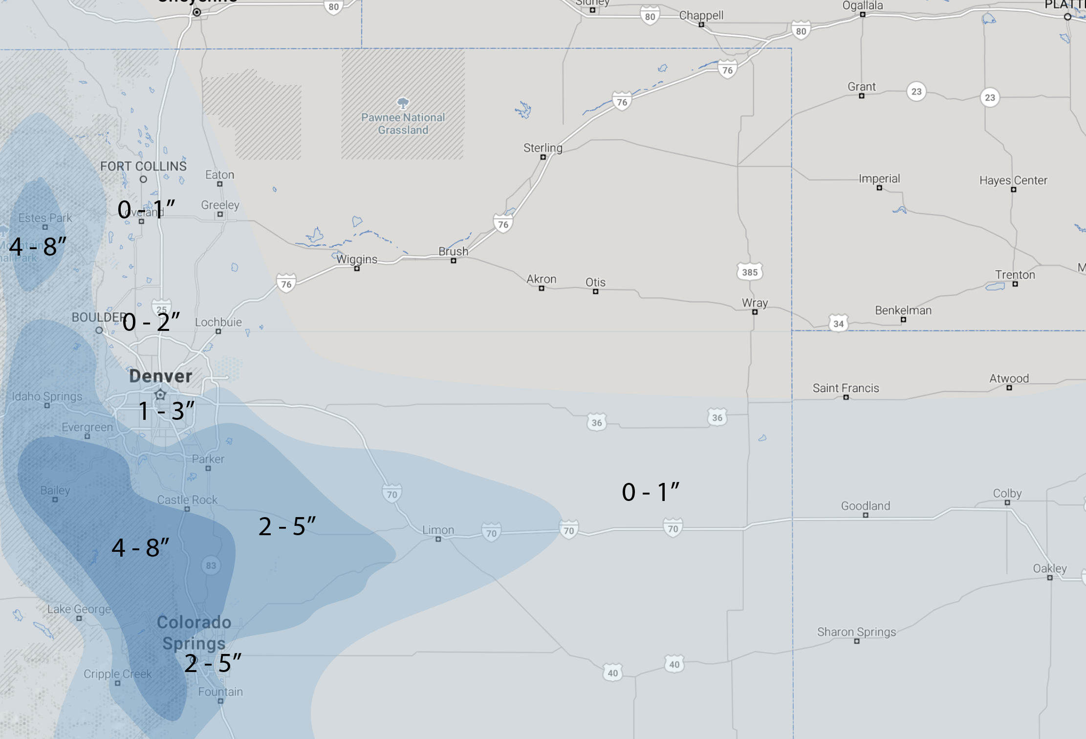
This system offers slightly better setup for Colorado Springs than Denver. We will go with 2 - 5" for the Springs, with much of that occurring on raised (grassy) surfaces. We expect quite a bit of melting to occur in the city, as again temperatures aren't all that cold with this system. On the west and north side of the Springs temperatures will be a bit cooler as you go up in elevation, which could support a some higher totals in a few locales.
Timing and impacts
Rain and snow showers will develop across northern Colorado early Tuesday morning, with coverage gradually spreading south through the day. Foothill communities will likely see mostly snow during the day even with the warm-ish temperatures, but much of the I-25 urban corridor will see precipitation in the form of rain/mix during the day. By later Tuesday afternoon and Tuesday evening any rain should changeover to snow. Denver's best chance at accumulation looks to be between say 4pm and midnight, before the heaviest precipitation sags south Tuesday night.
Roads will likely be okay during the day Tuesday in the cities. If you're traveling west into the foothills, or between Denver and Colorado Springs across the Palmer, that may be a different story. Here we'd expect both the Tuesday evening commute, and certainly the Wednesday morning commute to be impacted be slushy/icy roads. While city roads may be okay –– if you're coming in to Denver Wednesday morning over Surrey Ridge, you'll likely want to give yourself some extra time.
Same is true for Colorado Springs. Perhaps some impacts to the drive Tuesday evening, but the main ice/slush concern will be with the Wednesday morning commute, especially on the west/north sides of town.
Rain and snow should move south early Wednesday morning, leading to a chilly but mostly dry Halloween. Look for highs in the 40s for Denver/Colorado Springs on Wednesday, perhaps near 50 across northern Colorado, dropping into the 30s for Wednesday night under partly cloudy skies.