Storm Recap and a (Mostly?) Quiet End to The Week

A whole lot of not much snow for Denver last night as temperatures never quite cooperated with this event. While we did see the moisture as forecast, it was in the wrong form for the city, and this hurt our forecast in Denver. Elsewhere, we did well, though temperatures sure did their best to make that difficult.
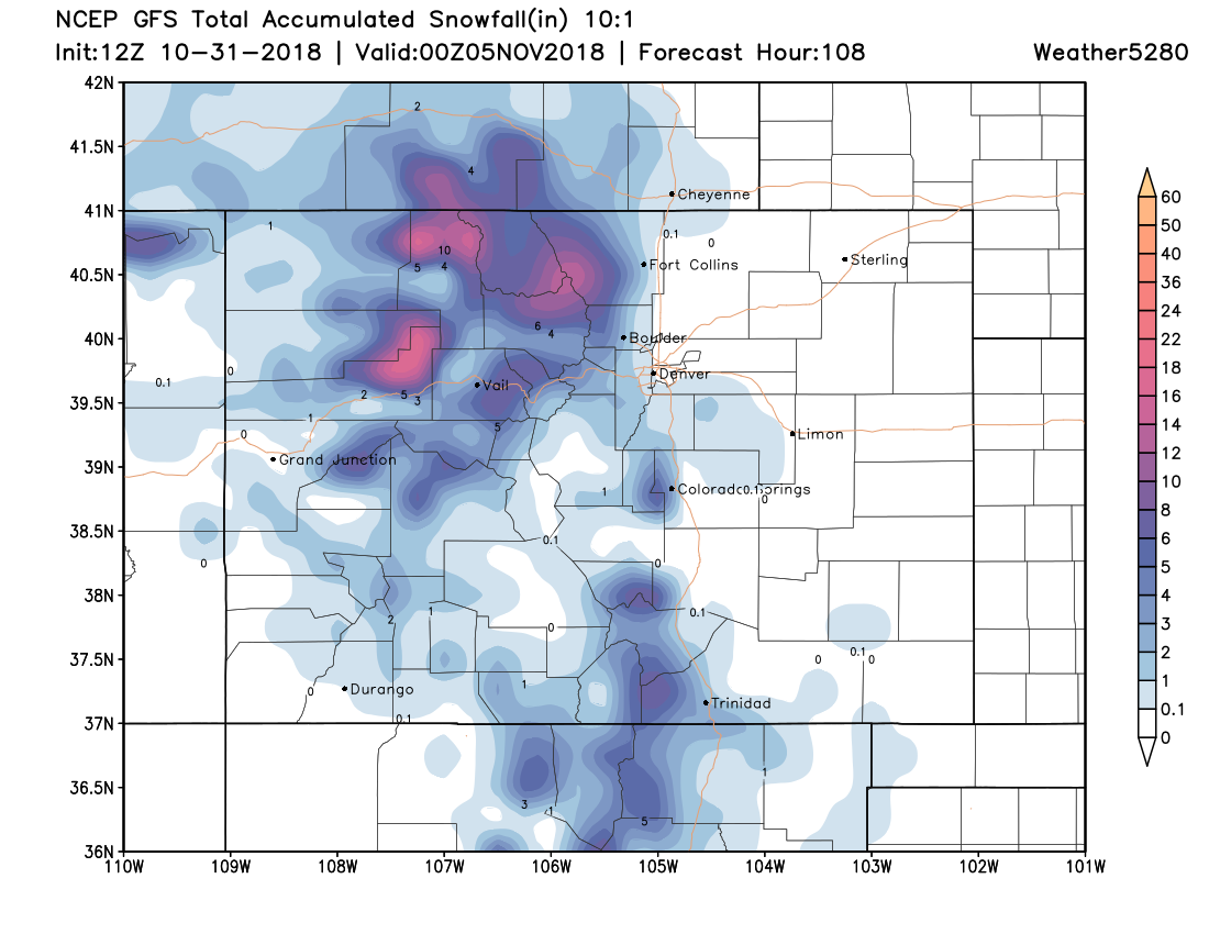
Our initial forecast we drew up Monday morning would have done much better. In it, we had Denver in the 0 - 2" range, as temperatures, melting, etc were a huge concern from the onset with this forecast. Ultimately, we pulled the 1 - 3" and 2 - 5" totals north 10 to 15 miles, which proved in error. But, staring a 3 - 6" ensemble mean forecast from the EURO in the face, and a decent look for enhanced upslope Tuesday evening for Denver we hedged slightly higher for those totals in town –– all for naught.
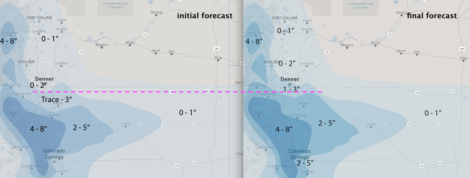
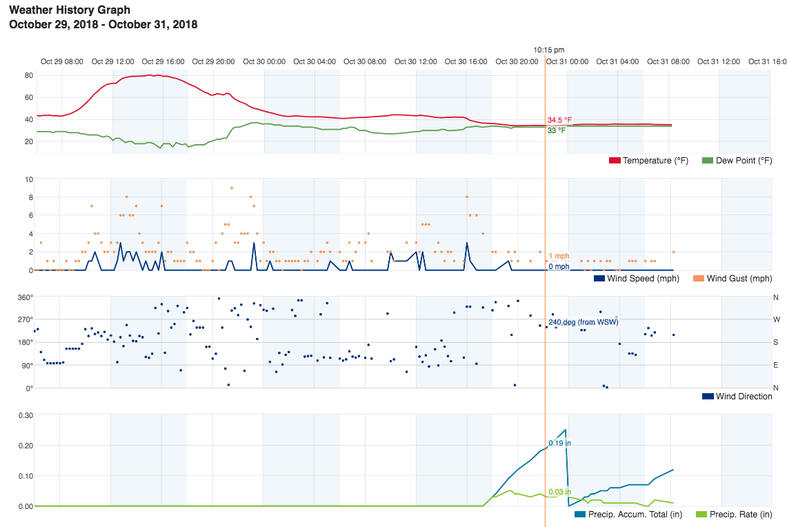
It just never quite cooled enough in Denver. Our station hit 34°F and flat-lined Tuesday evening, with the dew point never dipping below 33°F. The difference a few miles south at slightly higher elevation wasn't much... but some 31°F dews, and temperatures still in the 33 - 34°F range was enough to get it done. In Castle Pines, which saw about 3" of snow, local weather stations show temperatures dropping to 31/27 Tuesday evening, which while in some ways isn't all that dramatically colder than Denver, was just enough to support that heavier snowfall.
Checking out web cams this morning it looks like from about Dry Creek south saw that grassy accumulation, right about where our initial Trace - 3" line was. In Castle Rock reports from 3 - 5" (mainly on raised surfaces) were common, with a pretty good forecast overall across the Palmer and points south. You can explorer more snowfall reports here
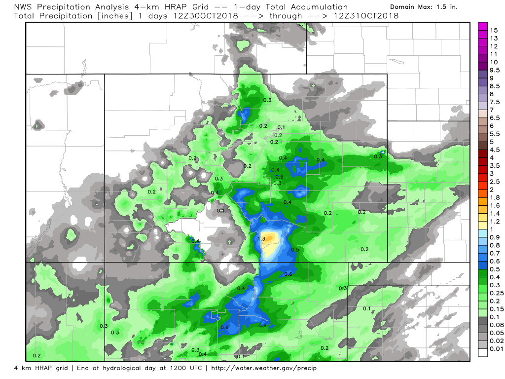
So, are we disappointed in the lack of snow in Denver? Absolutely. But I think overall we couched the forecast well, and I can't say I'm entirely shocked at the outcome. The good news is, we still managed some good moisture from the storm –– our station received 0.37" of liquid over the last 24 hours (imagine if that were snow! 🙃), with some areas south/southeast nearing 1" of liquid from this storm. Here are some rough precipitation totals through 12z this morning from the last day across Colorado:
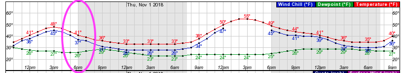
Looking ahead a bit... today remains chilly, but will be dry with that sunshine returning. The hourly planner shows highs climbing into the upper 40s by mid afternoon, but dropping into the low 40s and windchills in the 30s as folks head out trick or treating, so bundle up!
We'll see snow off and on across the northern mountains to end the week. By late Friday and Saturday we may see some of those rain/snow showers spill off the mountains across the urban corridor as well. Not looking like a huge deal at all down low, but we'll keep an eye on things as that northwest flow can play tricks. The GFS certainly likes some good mountain snow through Sunday, we'll take it: