After a Mild Saturday, a Cold Veterans Day with a Chance of Snow

Get out and enjoy the day if you can, as high temperatures will climb into the mid to upper 50s across the area before the next blast of cold air arrives tonight. Overnight lows will dip into the lower 20s in Denver, and likely stay below (or close to) freezing through Monday. MOS guidance from the GFS and NAM have highs in the upper 20s both Sunday and Monday in Denver, with our forecast topping out around 30°F both days, and overnight lows in the teens.
Along with the cold air will come that chance of snow. Not a huge storm by any means, but it certainly looks more promising for snowfall along the urban corridor compared to the "event" earlier this week. Rain and snow showers will be on the increase after about 6pm tonight across the northern urban corridor, with Denver's chance for snow increasing as we head toward midnight. Denver's best window for accumulating snow likely comes Sunday morning, before snow showers gradually taper off through the day. The chance of snow/light snow showers will be in the forecast through Sunday night for Denver.
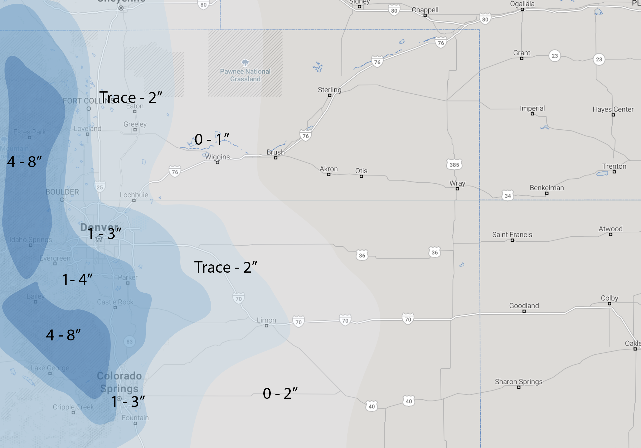
Snowfall forecast
As for how much snow? Well, as we said, not a huge storm, but trends have definitely been up over the last day or so, and with that a couple inches will certainly be possible for many locales –– especially with the cold air in place, and relatively long duration of that snow chance.
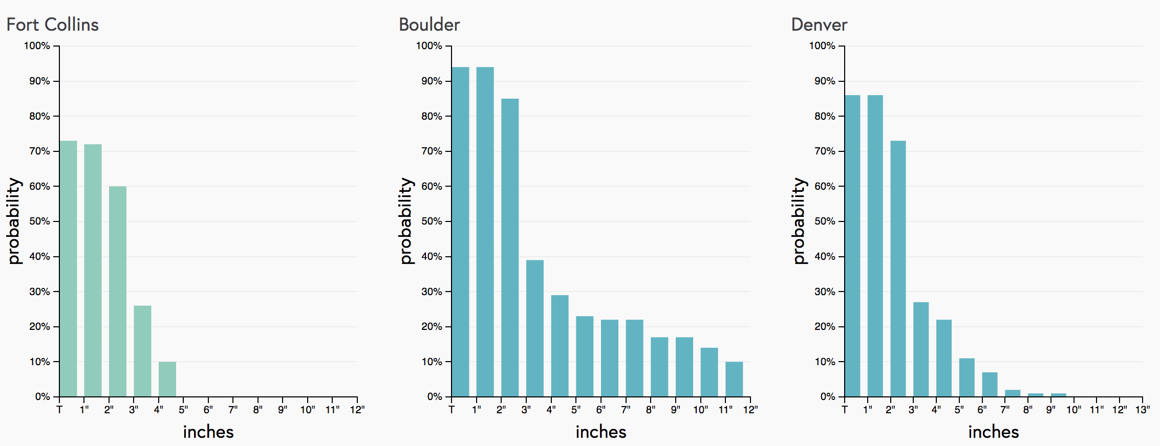
A look at our snowfall gambler charts this morning shows Denver and Boulder with pretty good odds to pick up 2" of snow through Sunday night, but probabilities dropping off considerably for more than that. In Boulder, the possibility of a "boom" scenario is better than for Denver, with odds for >6" sitting at about 20% this morning. Fort Collins sees a similar look, though probabilities are generally lower. If you live west of Fort Collins the odds are likely a bit higher than if you live in and east of town.
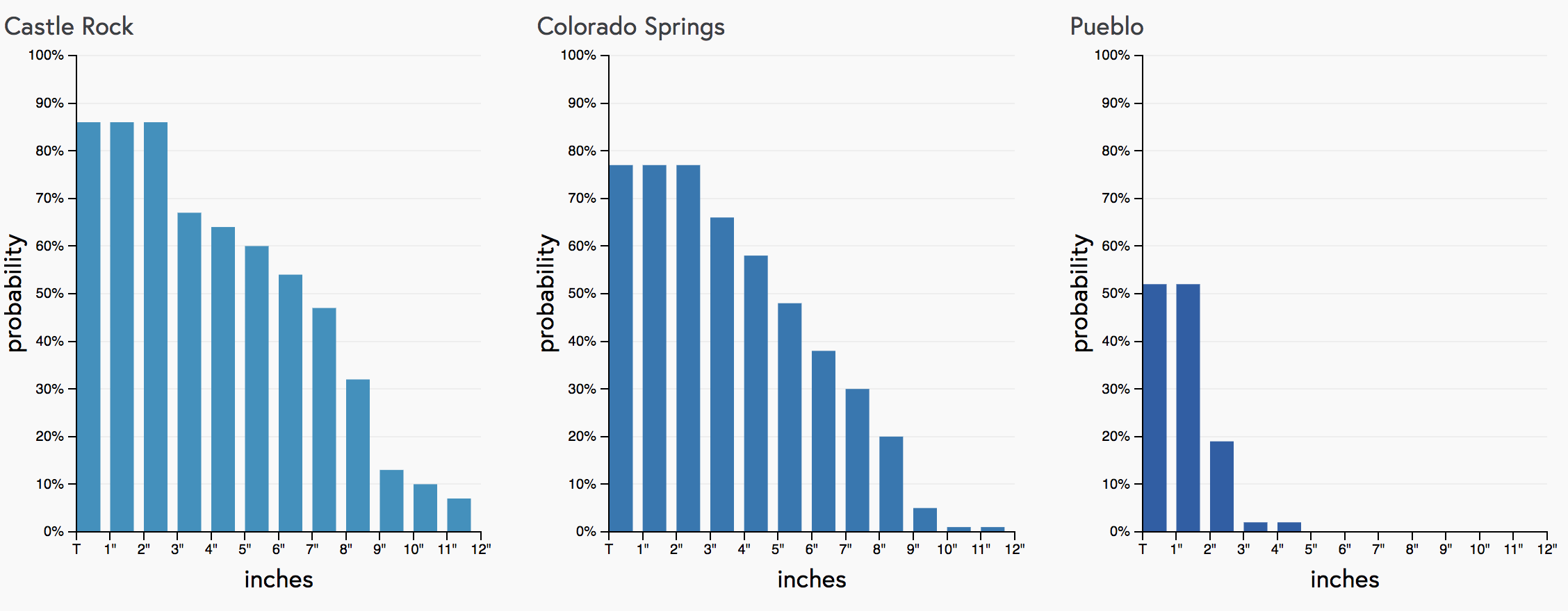
We've seen models bump snow potential up across the board over the last 12 hours or so. It'll be interesting to see if that trend continues today, or the bottom falls out as it often does. For the Palmer Divide the probabilities are certainly up this morning, with Castle Rock's odds of seeing >3" looking pretty good right now. The Colorado Springs gambler is likely weighted a bit high given grid resolution, with odds in the city proper being lower than indicated here, with better odds west and northwest of the city center:
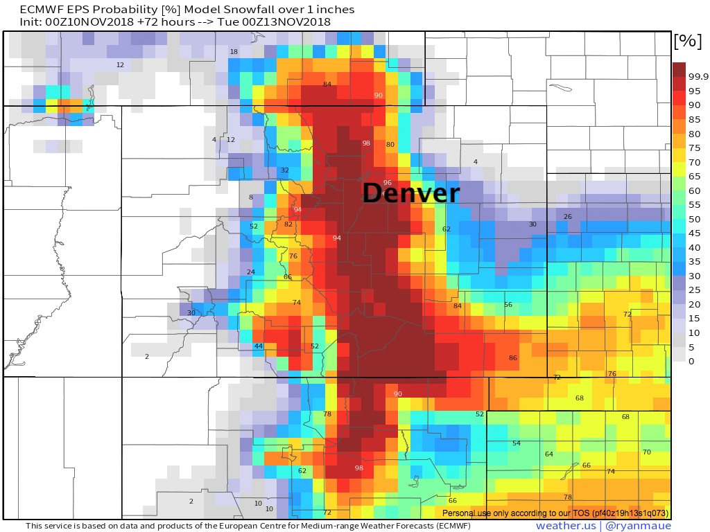
If we look at probabilities from the EURO, we see similar numbers. Good odds for >1" of snow for most of us:
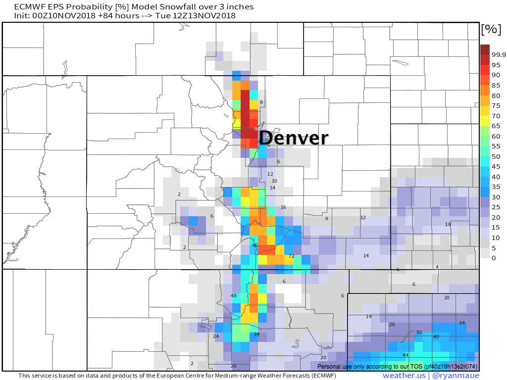
...but dropping off considerably for >3":
Part of the question is how long the snow showers stick around. A few models keep light snow in the forecast off and on into Monday morning, which would help pad totals to be sure. Models generally overdo storm duration... so we'll see, but will keep that chance of snow in the forecast starting tonight and continuing into Sunday night. Again, best chance for Denver at this time looks to be Sunday morning.
Our snowfall forecast is below. Generally looking at 1 - 3" along the I-25 urban corridor, with 1 - 4" (perhaps a few 5" totals on the west side?), and 4 - 8" for the Front Range mountains where a Winter Weather Advisory is in place. Fort Collins will have in the Trace - 2" range (1 - 3" west), Denver will be 1 - 3" (1 - 4" west), and Colorado Springs also 1 - 3" (with 1 - 4" north and west. Castle Rock remains a big question... We'll leave in the 1 - 4" range, but some 3 - 6" totals across the western Palmer does not seem unreasonable.
Considerations
This will be one of our colder systems of the season, and with it snowfall ratios will be on the high end. This could help totals for a few locations, even where snowfall is generally light.
Despite most models bumping up snowfall totals this morning, probabilities for higher end totals remain on the low side. We'll see if this is a trend that continues today, or of models adjust. If it's not a blip, quite possible a few areas see totals at the high end or slightly higher than we have forecast. If we see data level off or even back off a bit... our forecast should work out well.
Either way, with a good chance of snow on the way (even if light) and cold air pushing through after a mild day, look for some trouble spots on the roads along the Front Range and adjacent communities from tonight through Sunday night. Snow will begin to the north later this evening, then gradually move south across southern Colorado through the day Sunday. Snow chances diminish across the northern urban corridor Sunday night, but will continue into Monday morning for those across the southeast plains.
Monday will be cold, but generally dry. Highs rebound for Tuesday, with a good looking warming trend on the way for mid week next week.