Wednesday PM Update: Heavy Mountain Snow On Way
Heavy snowfall, more than 3 feet in some places, is headed to Colorado's mountains by Sunday. The activity actually starts Thanksgiving with the arrival of our next system.
That system is sitting over the Western US tonight, set to arrive tomorrow. Let's take a look at each day's precipitation totals. This first image is the total from 5 pm Wednesday to 5 pm Thanksgiving. The second is 5 pm Thanksgiving to 5 pm Friday, and so on through Sunday evening.
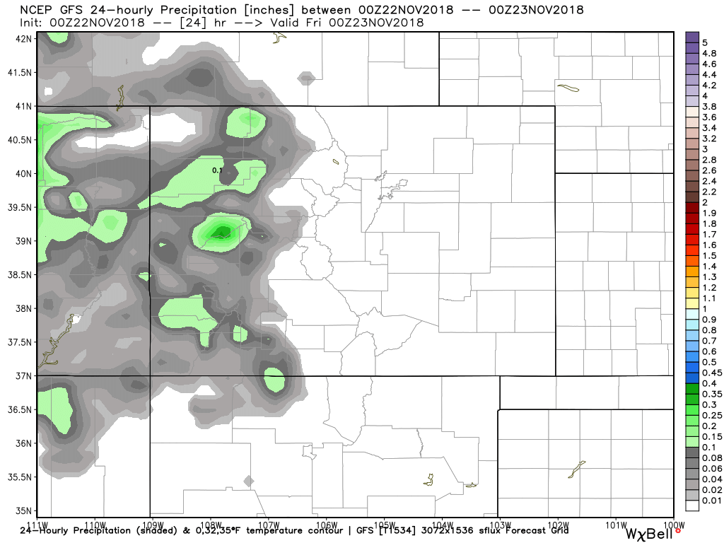
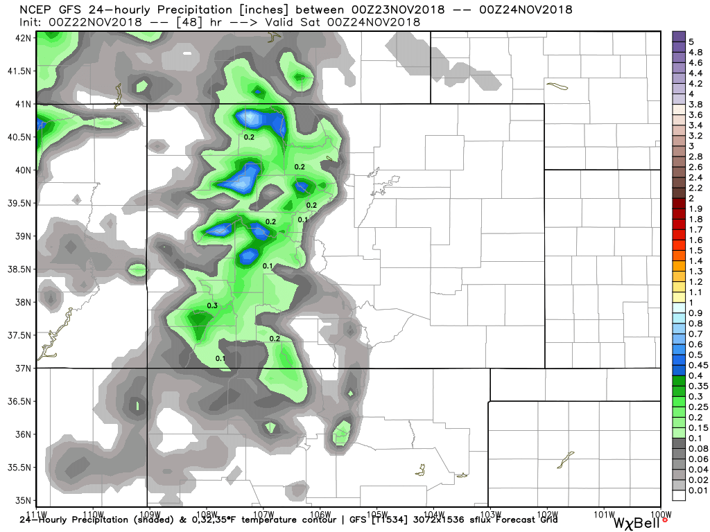
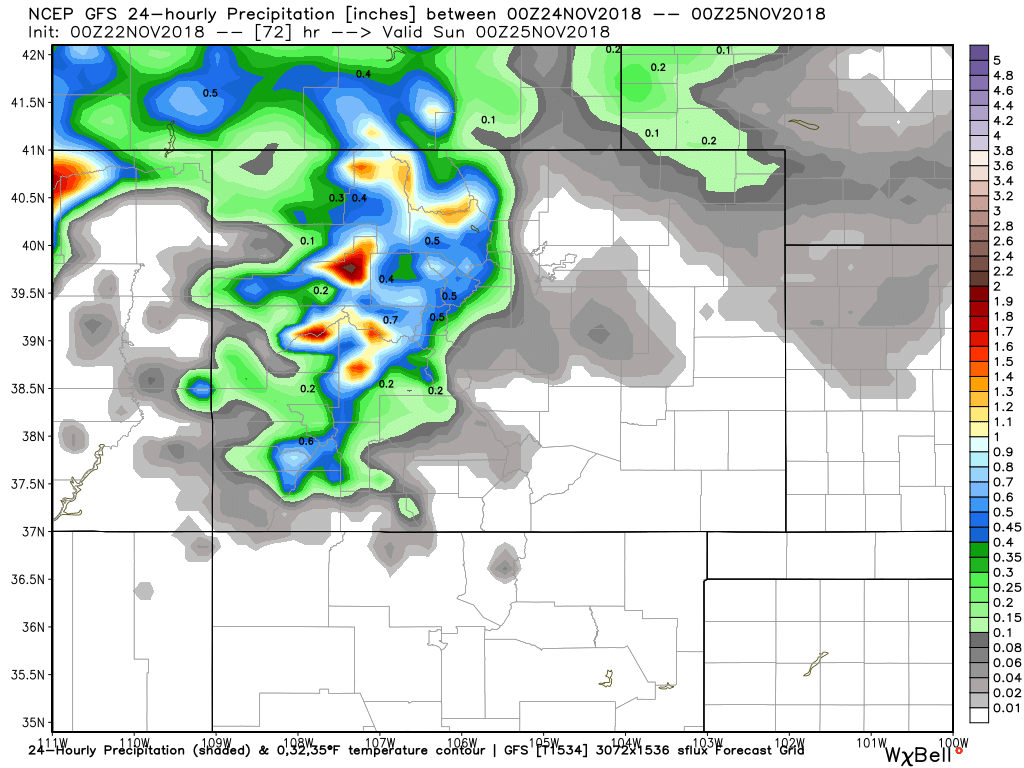
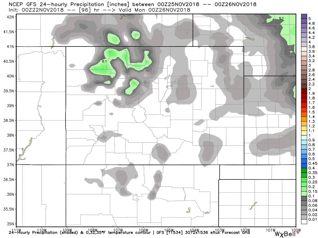
You can see the biggest day for action will be Saturday.
In the end, we will have some snowfall totals looking like this on the low-end. I say low-end because this projection assumes a 10:1 snowfall ratio but the actual will be closer to 15 to 20:1 which will mean another 50% to 100% of what's shown here:
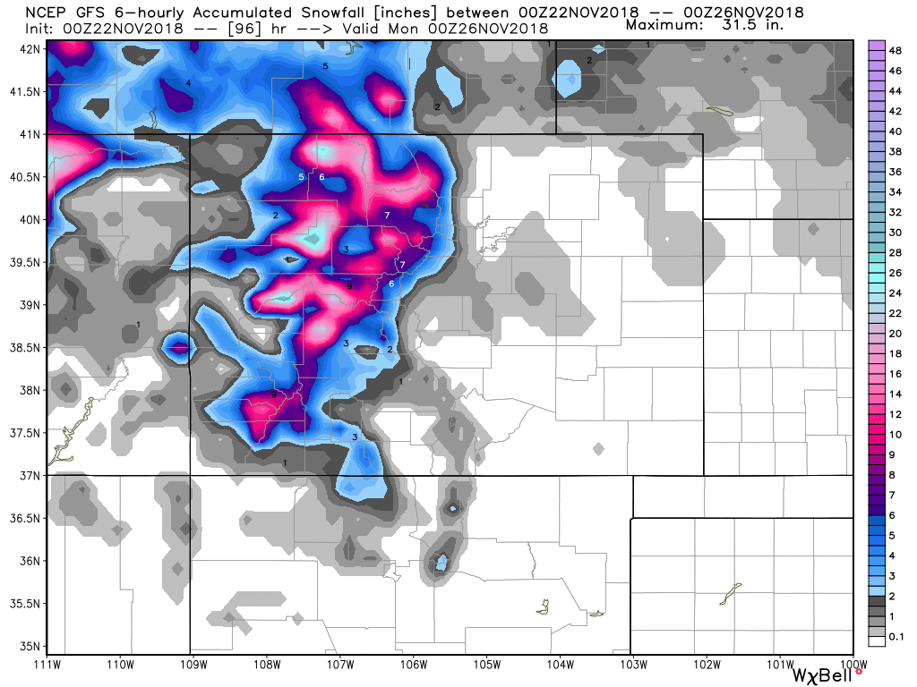
And what's that slight coverage surrounding Denver? Well, it is possible the Front Range catches some rain and snow Saturday. However, this isn't quite the setup to see widespread snowfall down here; systems like these leave most of the water on the Divide and west of.
What will Denver see? Or, should we say feel... The clouds will increase Thanksgiving with highs near 60°. A breeze from Thanksgiving evening will turn into a strong wind Friday with highs in the 50s. Saturday has the chance for rain/snow if any of that moisture can escape the mountains; colder regardless with highs in the 40s. Sunday will see the system clear and highs near 40°.
We will provide an update Friday should the system look more than a glancing blow. Until then, have a terrific Thanksgiving. If you are in the mountains, enjoy all that snow on the way!