Wednesday PM Update: A Chilly and Unsettled End of Week and Weekend

We're continuing to track changes to our weather as we end the week and head into the weekend. Today's mild weather will slowly be replaced by colder air and precipitation chances across the state. The mountains stand to see the best snowfall over the coming days, with a slightly more complex forecast ahead for the urban corridor and eastern plains.
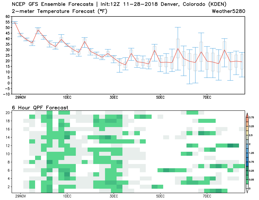
Taking a look at the GEFS (GFS ensemble) package, we see the cool down ahead, as well as an increase in precipitation chances (denoted by green blocks on bottom chart) as we head into Thursday, Friday, and the weekend. The GEFS is indicating two clusters of greater precipitation chances for the Denver area –– Friday into Friday night, then Sunday evening into Monday. Neither look all that impressive from an ensemble point of view.
The setup
We are tracking two systems that will impact our weather over the coming five days or so. At this time, it looks like greatest impacts will be felt in the mountains and perhaps far northeast plains, with a less favorable track from both systems to deliver much snow for the urban corridor. The devil is in the details, however, and there's reason to believe a chance for accumulating snow in Denver from one or both systems is not off the table.
The first system moves into the Great Basin early Friday. This will bring a southwesterly flow to the high country, and with that we should see a steady increase of snowfall coverage for the mountains from Thursday evening through Friday as the system progresses east.
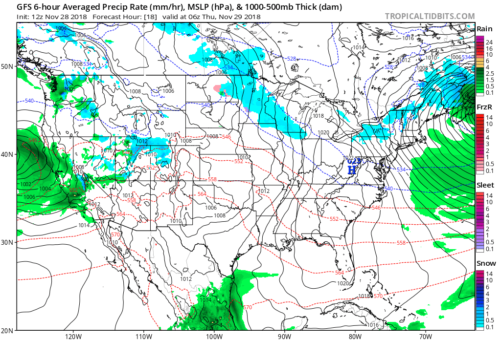
The animation above goes from Thursday morning through Saturday night. We see that storm come onshore in central California, with a surface low moving through the Great Basin on Thursday and Friday, eventually moving into eastern Colorado and on into the high plains Friday evening and Saturday. You'll notice as well that snow is forecast over the eastern plains by Friday evening, but a general lack of it right along the Front Range. This is due to anticipated northwesterly winds (downsloping) that is forecast to limit snowfall (perhaps not completely) for the urban corridor on Friday and Saturday.
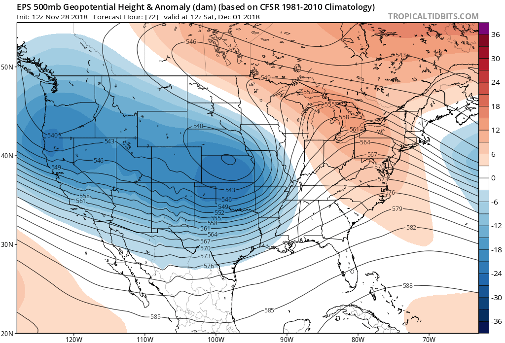
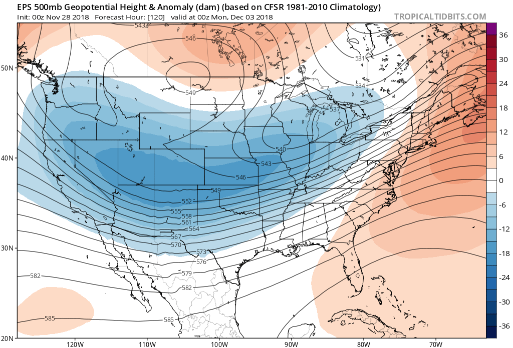
By Saturday morning the EURO has this trough negatively tilted and strengthening east of Colorado. Should this solution be correct, look for a big time snow event across the northern high plains, with perhaps some of that heavier snow/wind sneaking into the northeast corner of Colorado as well. Again, impacts will likely be more cold/wind along the Front Range rather than snow with this particular track. Here is the EURO 500mb forecast for early Saturday. Note the trailing trough over northern California as well.
This will be our next weather maker due in Sunday into Monday. Here's where models continue to diverge, with the GFS still hanging onto the idea we'll see some good snow coverage across eastern Colorado. The GFS (below top) continues to try and develop a decent looking trough in the Four Corners region by Sunday afternoon, while the EURO (below bottom) is weaker with the energy and far more progressive.
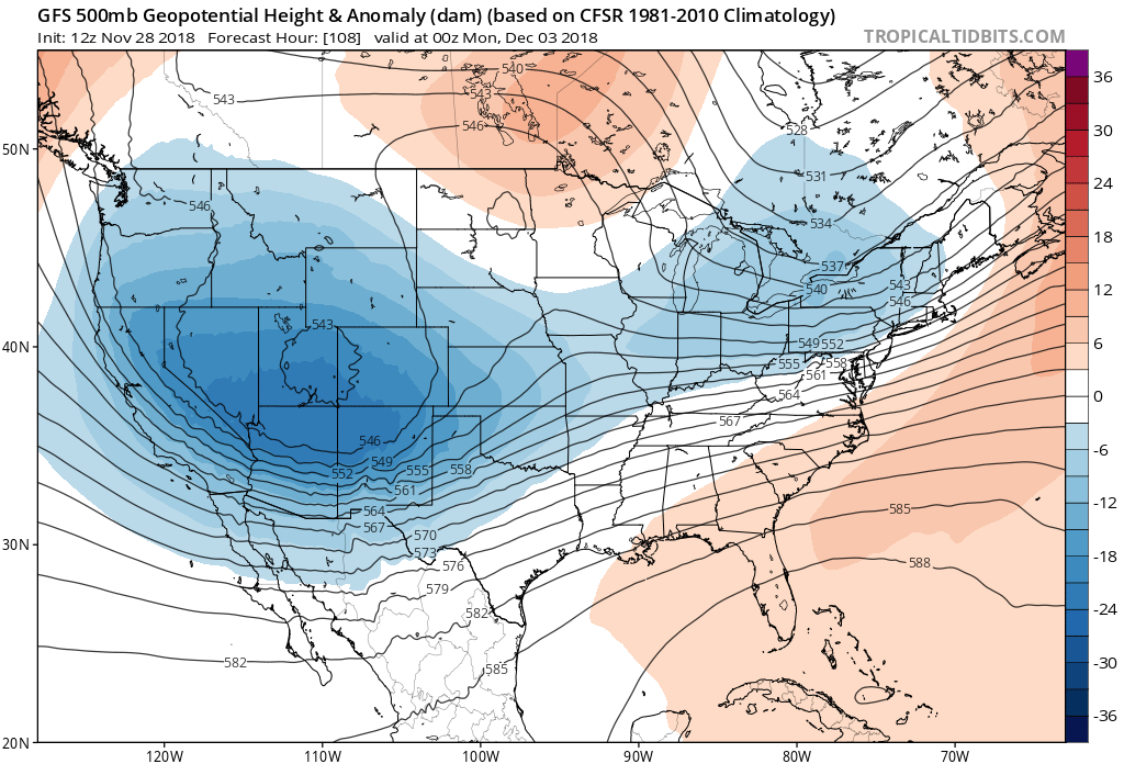
With that we see better snowfall from the GFS as compared to the EURO as we have for several days snow. Even still, I'd caution against getting to excited about the GFS as it's not at all clear that it has a good handle on things. One glaring issue we see from the operational GFS is great snowfall coverage being produced by the model for Sunday evening/night, but very little in the way of upslope if we look at the sounding for that time. Something doesn't add up. It shows a very saturated column, but only sporadic and at best light easterly winds near the surface.
For now, we'll focus on the Thursday through Saturday forecast, and see if better agreement comes into play for Sunday and Monday before getting too attached to any given scenario.
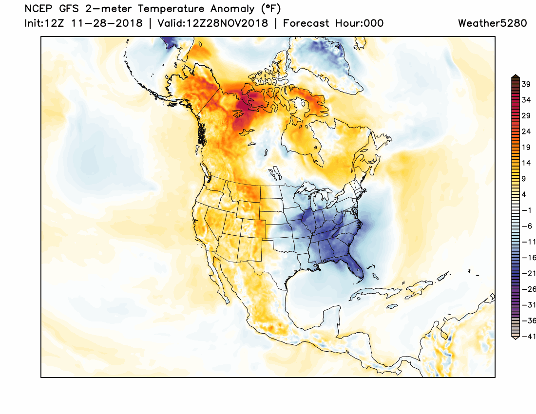
Snow or no snow along the urban corridor the models agree on two things: another round of good mountain snow on the way as we head into the latter half of the week and weekend, and a much chillier airmass in place to end the week (likely extending into next week) as well. Here's the 12z GFS two meter temperature forecast showing all those warm yellows and reds (we're sitting in the low 60s today in Denver!) slowly being replaced by blues and purples as we head into the weekend and next week:
Planning forecast
As always, you can find our daily forecasts here. In summary, here's how we see the coming days playing out:
Thursday will feature another day of mild weather across the area, with highs in the 50s for Denver. Some moisture around Thursday night, but not expecting much in the way or precipitation at this time.
Friday will cool into the 40s for highs in Denver with rain and snow showers around. Again, we expect downsloping to really limit snowfall potential in Denver from this first system, but we'll keep an eye on things. If you're heading west, expect snowy conditions in the mountains. If you're heading northeast of Denver, we could see some snow develop especially late in the day across the northeast plains as well.
Saturday will again be chilly with highs in the 40s. At this time we expect any snow on the backside of the low east of Colorado to mainly impact the far northeast plains, with perhaps a chilly wind to contend with along the Front Range.
Sunday will be a wait and see. It could be we see another reinforcing shot of cold air and a better chance of light snow by Sunday evening across northeast Colorado, but not enough agreement in the data to be too sure on much at this time.