Friday PM Update: A Chilly and Unsettled Weekend on the Way

A brief update this afternoon as we head into a chilly, unsettled, but likely a mostly uneventful weather weekend.
We'll be tracking rain and snow showers through the remainder of the evening and overnight across Colorado. A few areas are already seeing that moisture this afternoon, especially north and west of Denver.
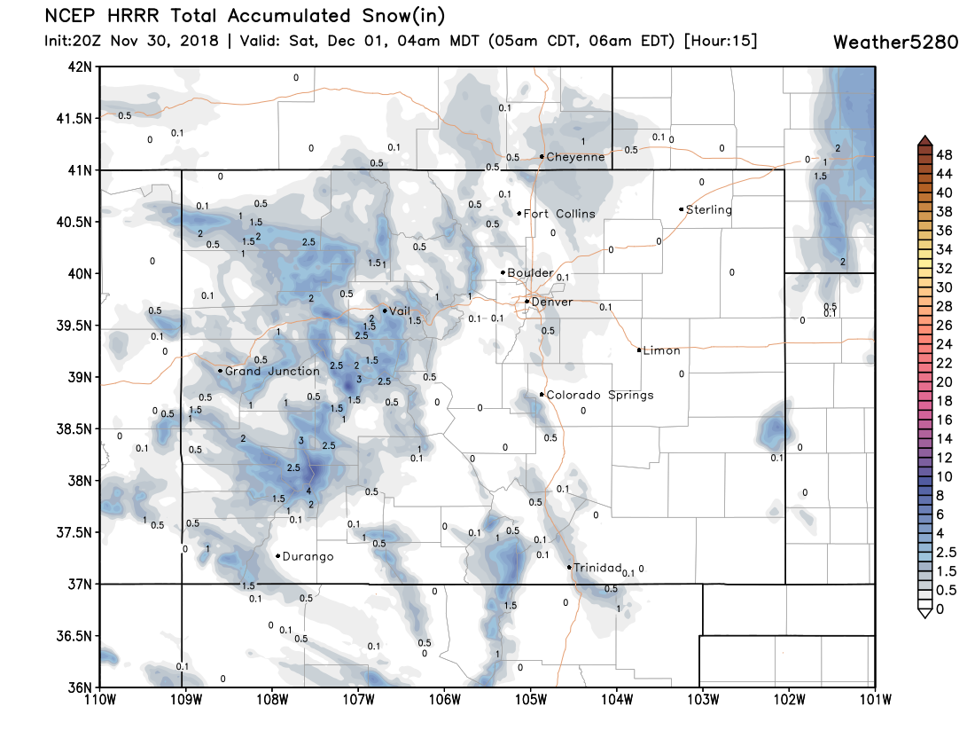
Most of the snow shower activity along the Front Range isn't expected to be all that impressive, but a few areas could picked up some light (Trace - 3"?) accumulation under a localized snow band, with many areas not seeing anything accumulate at all. The latest HRRR confirms this idea, showing pockets of 0.5" to 1" of snow through 4am Saturday morning across northeast Colorado, keeping most of the meaningful accumulation confined to the high country through tonight:
Of course, a half inch or inch of snow at the wrong time can cause traffic troubles. If you happen across a heavier snow band this evening, please exercise caution on the roads.
In addition to the snow, we may see some rain and mixing across the plains this evening as temperatures continue to cool. Along the Front Range showers that have already developed appear to be mostly snow, but any mixing that occurs this evening could of course add to those icy trouble spots.
In short, very hit and miss for the wintry weather tonight, but please don't be caught off guard!
Saturday and Sunday
Saturday looks chilly but mostly dry for the urban corridor. The NAM has highs in the mid 40s for Denver, with the GFS topping us out at 50 degrees Saturday afternoon. Overall not bad, but of course cooler than we were for much of the week.
Our next disturbance pushes through on Sunday. Again, this is not looking like a huge deal at this time... but we're likely to see some more light snow across the area by late Sunday morning into Sunday night.
Somewhat ironically after the GFS spent the week forecasting a huge snowfall for Sunday/Monday, the EURO is actually the most bullish for snow of all the models I've looked at now. The high-res NAM shows just another 0.5" to 1" across the urban corridor, with the GFS in that ballpark as well.
The control run from the EURO shows a few 2 - 3" totals, mainly on the west side of town and up into Broomfield and Boulder Sunday night, with its ensemble closer to the 1 - 2" range. Again, even with the high end totals not a huge snow-maker, but something we'll be watching for the weekend. If it's going to be cold... we may as well squeak a few light snow events out of it, eh?
Speaking of cold... Sunday and Monday continue to look just that. MOS guidance has highs near freezing on Sunday, and perhaps a few degrees colder for your Monday depending on how strong a push of cold air we see associated with that snow chance on Sunday. We'll be slow to warm up next week with current guidance keeping us in the 30s and 40s for much of the week.
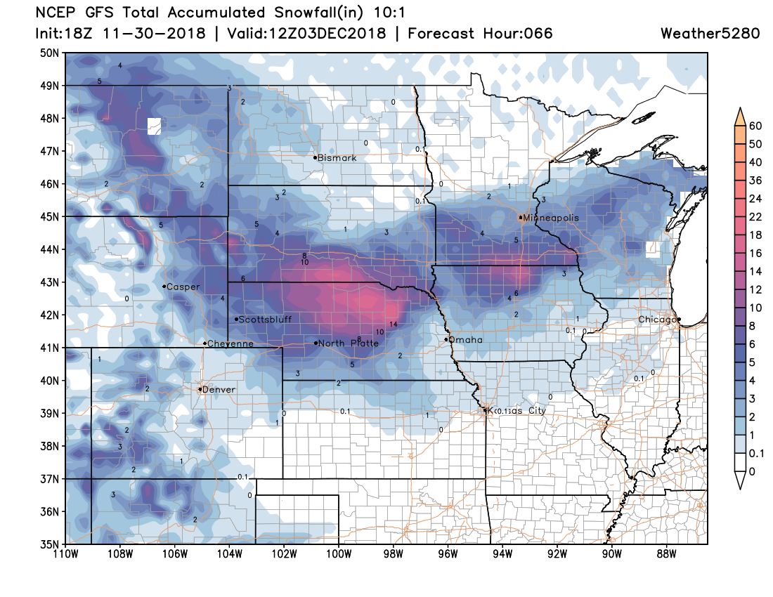
A broader look at the snowfall over the weekend continues to show the threat of heavier mountain snowfall, and perhaps some of that heavier snowfall sneaking its way into northeast Colorado on the backside of these intensifying lows. A look at the GFS snowfall forecast through early Monday morning shows this... a pretty good snow storm on the way for much of Nebraska and points east/northeast, with some of that wrapping back into the northeast corner of the state:
Stay warm, stay safe on the roads, and stay tuned. We'll be keeping an eye on Sunday and offer updates as needed this weekend.