Snowy and Cold Weekend Ahead, Latest Forecast

11pm Friday Update: We made some adjustments to the snowfall forecast, mainly for Colorado Springs. You can find the latest map here.
Previous discussion...
The big changes to our weather we've been discussing all week arrive in just hours to the Front Range. We'll have a chance of snow (heavy at times!) in the forecast for the I-25 corridor from tonight through Sunday, with some areas likely to see some appreciable accumulation by the time all is said and done.
A Winter Storm Watch goes into effect from late tonight through Saturday night. It's likely we'll see this upgraded to Winter Storm Warnings and Advisories today.
Timing and impacts
The best chance of snow tonight will be across the northern urban corridor, with a lower chance for those snow bands to make it into the Denver area, but a chance nonetheless.
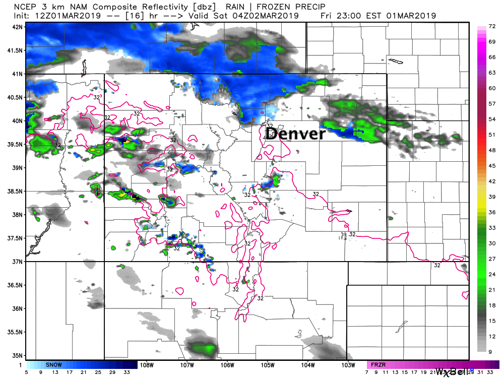
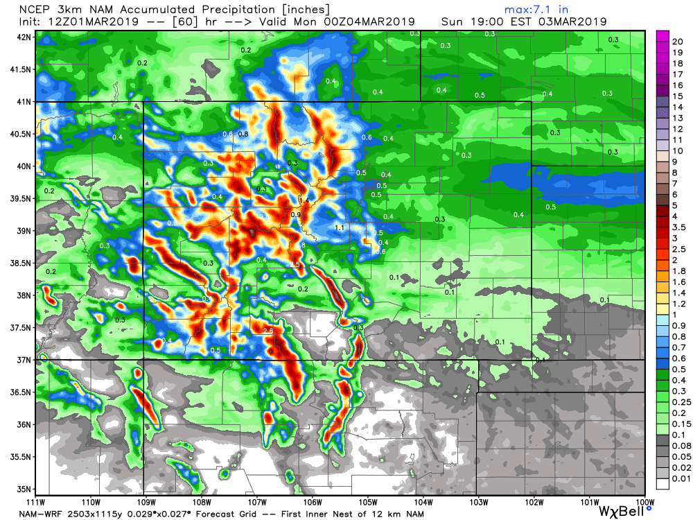
Some models show snow developing across portions of northern Colorado by late this evening –– here's the 3km NAM model showing snow for the Fort Collins area and Cheyenne Ridge by 8 - 9pm today, but again, less shower activity south into Denver and points south. Banded snowfall will continue off and on through the night for the northern urban corridor, before we likely see a pause in the action for a few hours early Saturday morning.
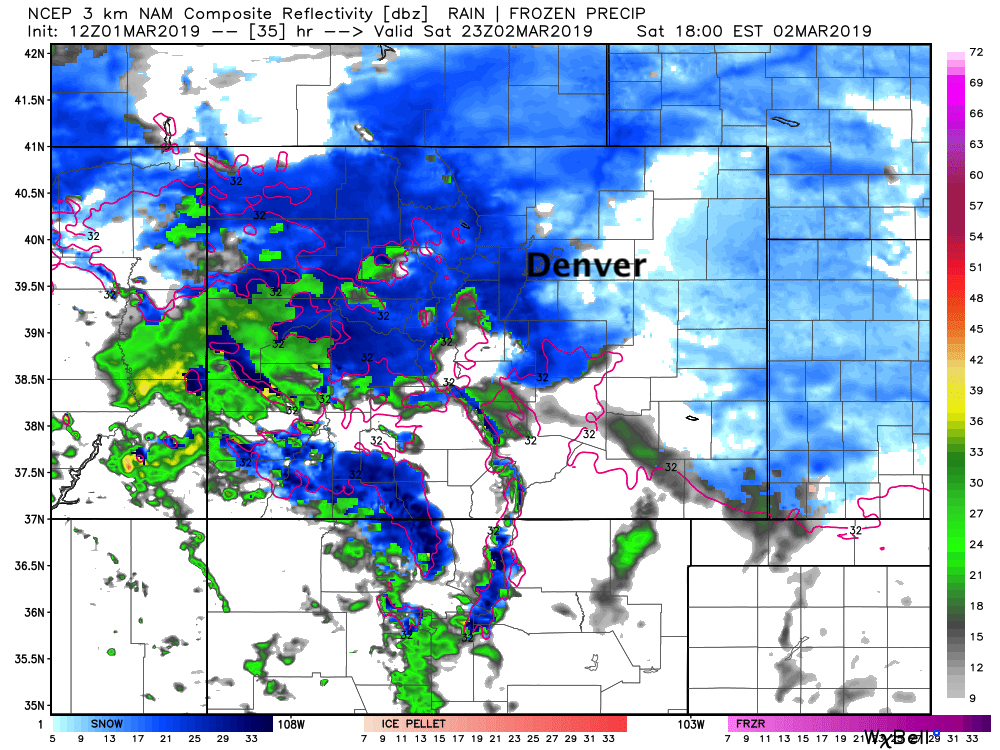
Saturday morning into midday we see snow redevelop along the Front Range and become more widespread through the afternoon and evening. Here's the same model's forecast for Saturday afternoon. Snow up and down the urban corridor. Of note (and we've stressed this in previous posts), the heaviest snow through the weekend is expected to fall along and WEST of I-25, with lighter totals as you move east away from the foothills. Here you can see the radar depicting this well, heavier snow (darker blue) west, lighter blue and less coverage east:
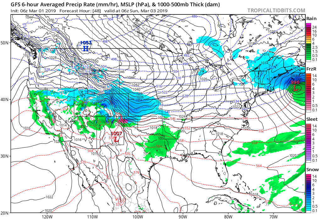
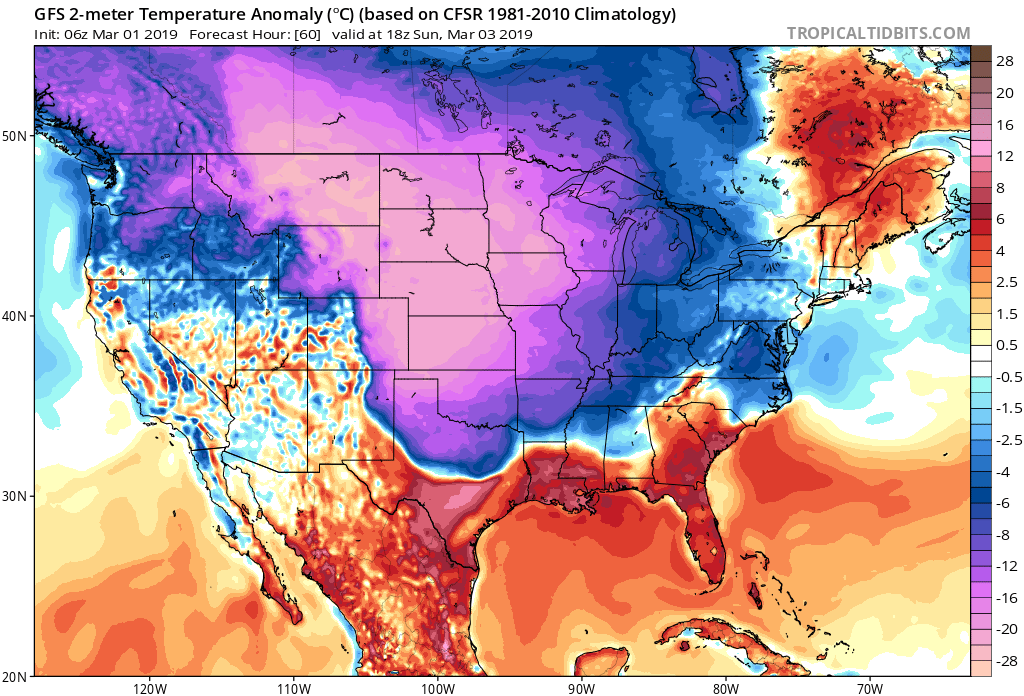
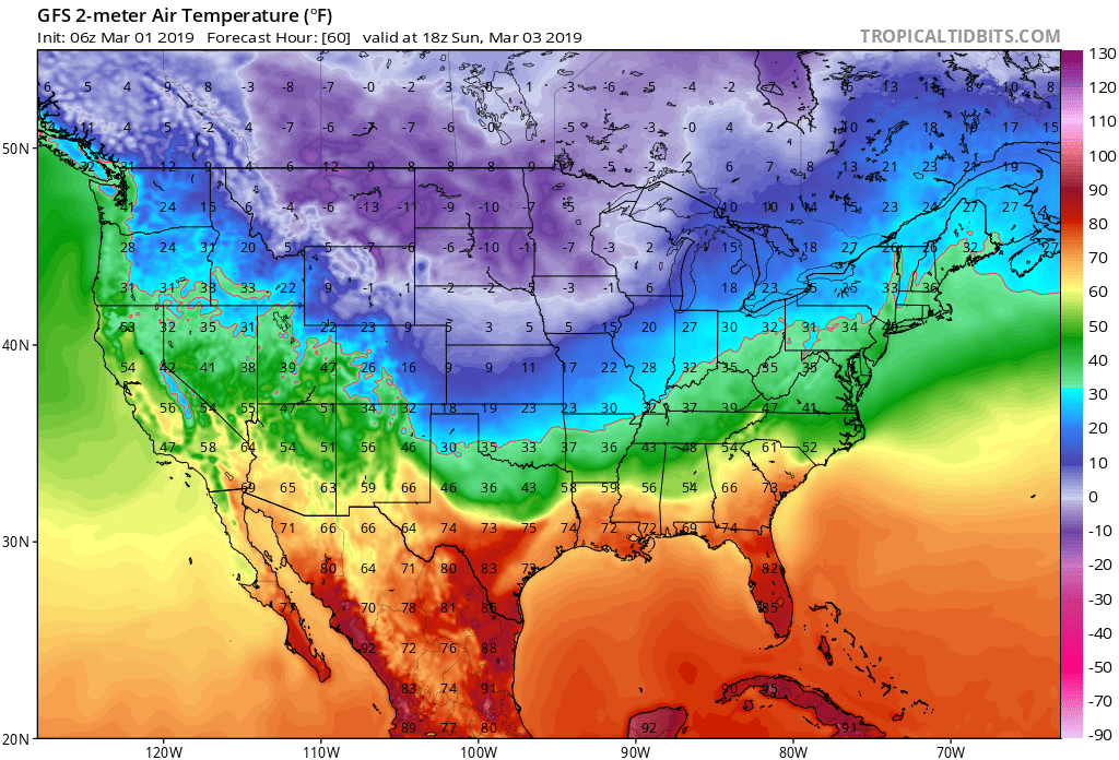
For impacts, expect tough travel conditions across most of Colorado through the weekend. We'll see HEAVY mountain snow, and at times HEAVY snow pushing east across the I-25 urban corridor from tonight into Sunday. Temperatures will only drop as the weekend progresses. Highs will be near freezing for Saturday, but dropping through the day. Saturday night into Sunday we'll see lows in the single digits for most of Northeast Colorado, with highs only in the teens on Sunday. Temperatures across the middle of the country will be WELL below average with single digits and teens for Northeast Colorado, but highs below 0 for much of the northern tier:
Snowfall Totals
The same model (3km NAM) we showed above shows some very healthy snowfall totals for the region. If we look at its precipitation forecast, we see totals through Sunday afternoon of 0.3 to 0.8" from the Wyoming state line down I-25 through Colorado Springs. With ratios likely averaging 20:1 (lower to start event, very high by Sunday) this implies we'll see totals from 6 - 16" along and west of I-25 through Sunday.
This sits pretty well with our forecast. Again, this is for tonight through Sunday, so a long duration event. Here's what we're thinking:
- Fort Collins: 6 - 12"
- Boulder: 8 - 12"
- Golden: 6 - 12"
- Denver: 5 - 10"
- Castle Rock: 5 - 10"
- Colorado Springs: 2 - 6"
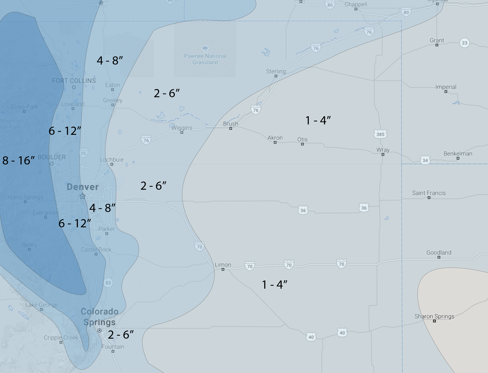
With our forecast map as follows:
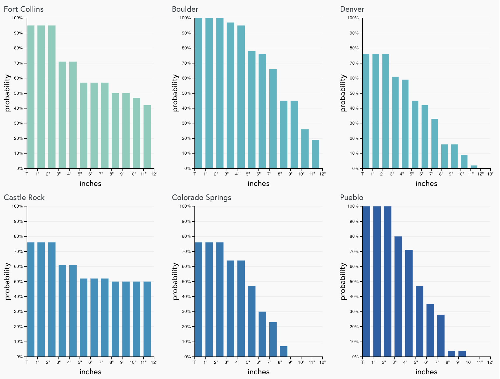
And here are our latest gamblers. For Denver we see those probabilities are a bit lower... this is mainly due to the east/west gradient we keep discussing –– DIA is likely to see less snow than western Denver:
We'll see how things evolve as the weekend progresses and offer updates as needed. Most data suggests snow really starts to dissipate Sunday, but a few keep those snow showers in the forecast into Sunday night. We'll see. Needless to say, a high impact event on the way for many of us this weekend, so if you can avoid travel please do. Temperatures will be COLD, and snow will be HEAVY at times, so best to stay in and stay warm if at all possible.
Stay tuned.