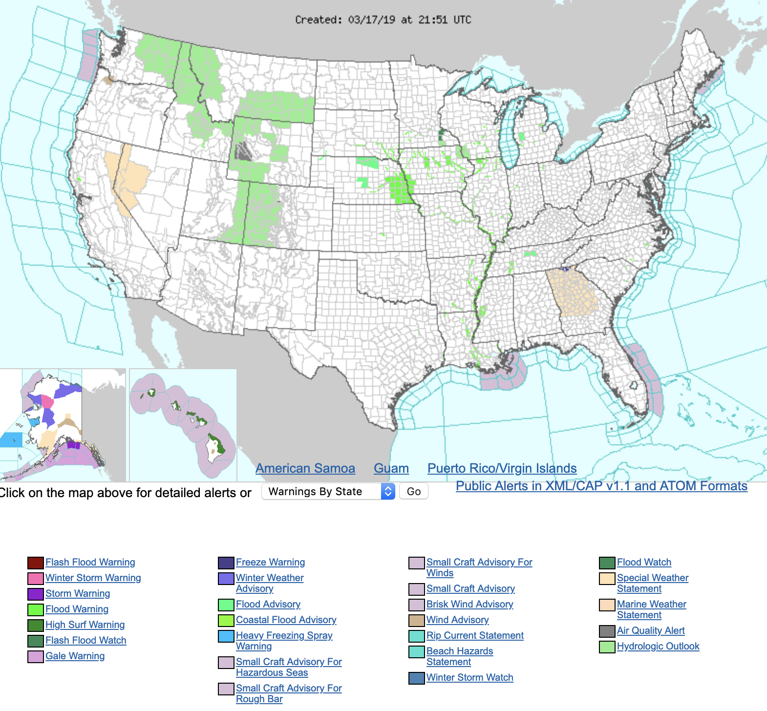
A Flooding Disaster on the High Plains

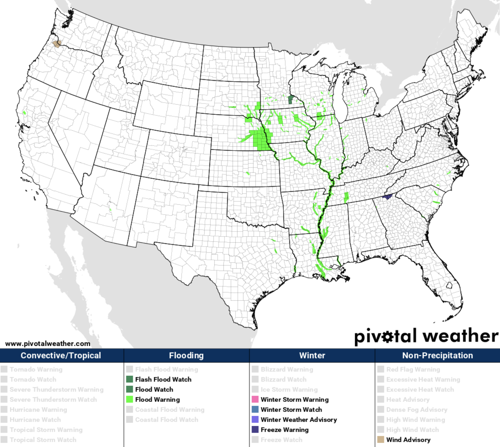
Virtually the only hazards issued by the National Weather Service today across the contiguous United States are Flood Warnings.
Nebraska and Iowa have been hit particularly hard by flooding following last week's "bomb cyclone", a historic storm which delivered heavy snow and rain to the Plains States, following what has been a cold end to the winter for the region.
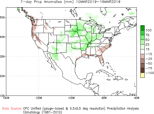
Seven day precipitation anomalies show just how wet it's been for the heart of the country, with some of the greatest anomalies focused over Nebraska, South Dakota, Minnesota, and Iowa:
Flooding is often an issue this time or year across the middle of the country as snow and ice begin to melt. This last week, a combination of warmer temperatures, a ground frozen solid after a very cold February, and an unusually strong storm led to flooding not seen in a half century or more across portions of Nebraska, Iowa, and South Dakota.
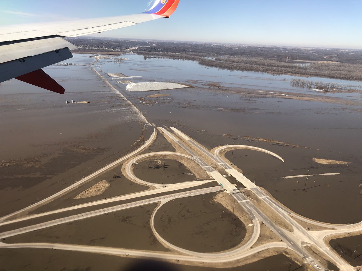
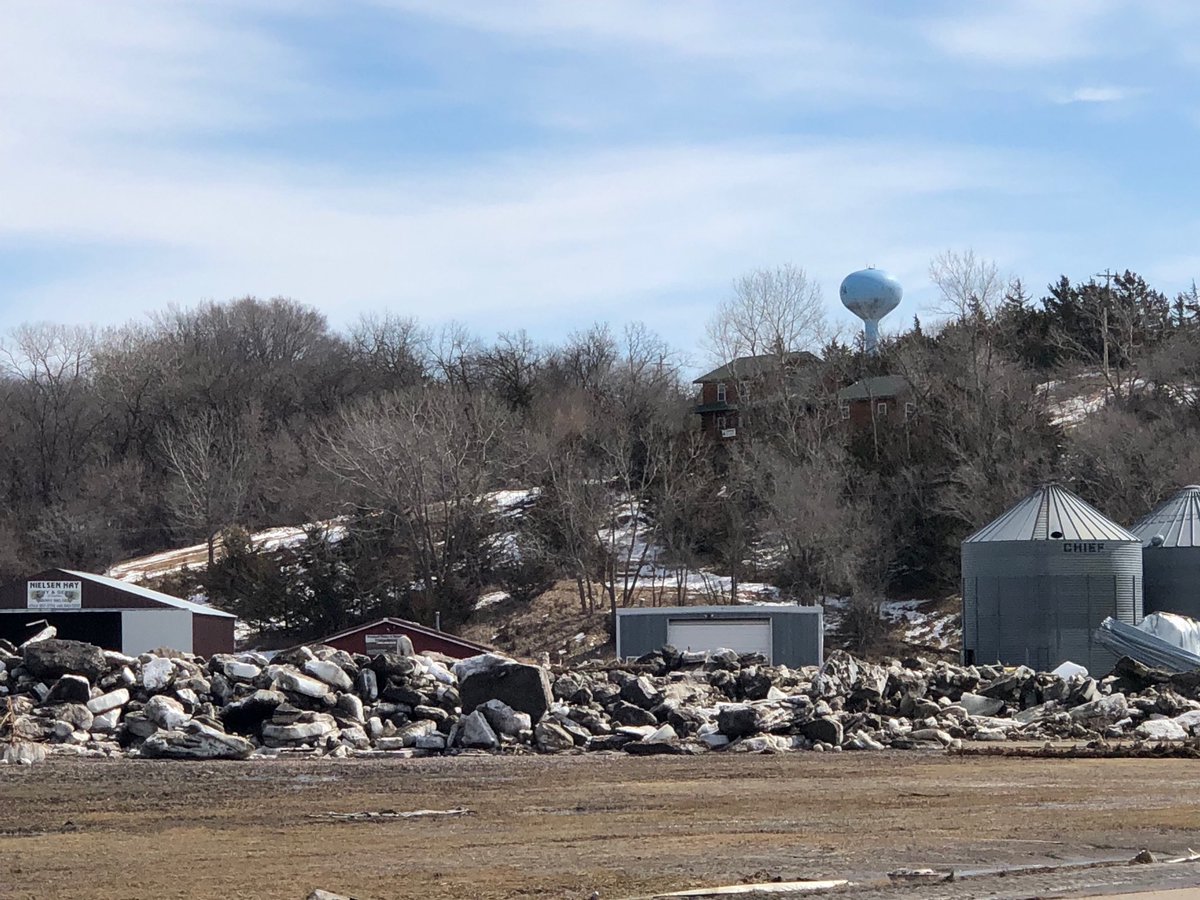
In addition to the large volume of water filling rivers and streams across the High Plains, large chunks of ice breaking down after a cold winter not only act to damn water (ice jams) where it shouldn't be, but also are causing a tremendous amount of damage themselves. Here are some images of the destructive flooding that is ongoing in Nebraska and Iowa today:
This before/after from #GOES16 band 3 illustrates the significant ongoing river #flooding in eastern Nebraska and western Iowa. (Water largely absorbs 0.86 µm solar radiation and land largely reflects it, hence the dark/light water/land contrast) pic.twitter.com/A0ufLuy5uI
— Dan Lindsey (@DanLindsey77) March 16, 2019
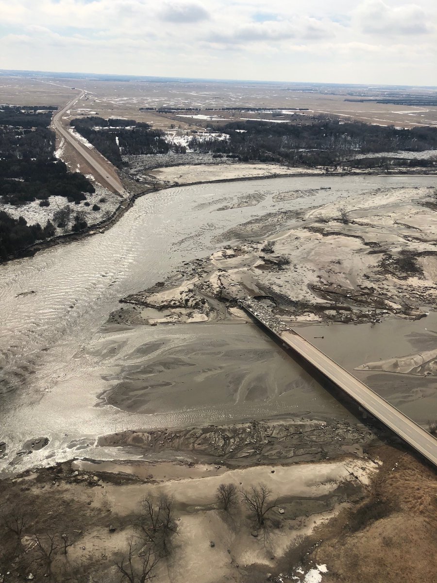
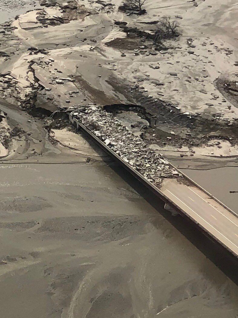
While many bridges have been completely destroyed by the floods, for some that haven't the remain impassable nonetheless as they are covered with ice feet deep and debris:
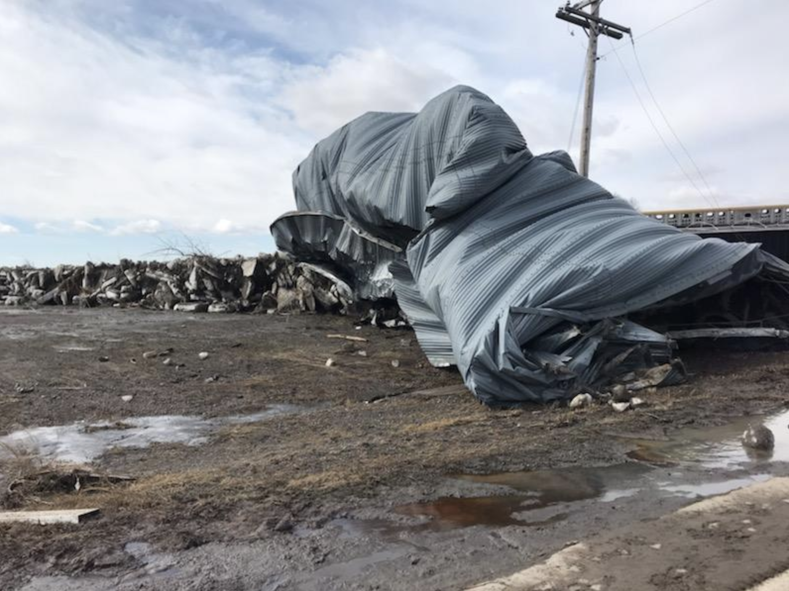
The Nebraska State Patrol shared this image showing how destructive the water and ice has been on otherwise sturdy metal grain bins:
And more incredible video footage of the ice that has taken over farmland adjacent to these flooded rivers:
Ended up with about 50 acres worth of these in the hay meadow. Probably have them till June. Some are 3+ foot thick and big enough you could hold a square dance on. #nebraskaflooding pic.twitter.com/LkSufNbmAU
— Jared Jaixen (@jaredjaixen) March 15, 2019
Flooding remains an ongoing issue, with both Nebraska and Iowa issuing state of emergency and disaster declarations to help in both the immediate response to the ongoing issues, but also in eventual rebuilding that will need to take place.
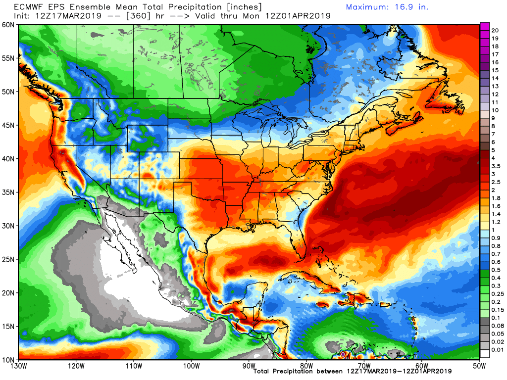
A look ahead shows above average precipitation forecast for southern Nebraska over the next 15 days, but perhaps a drier pattern setting up for points north as the southern storm track continues to be most active:
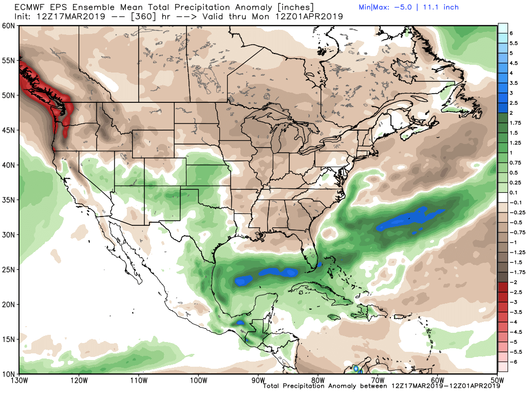
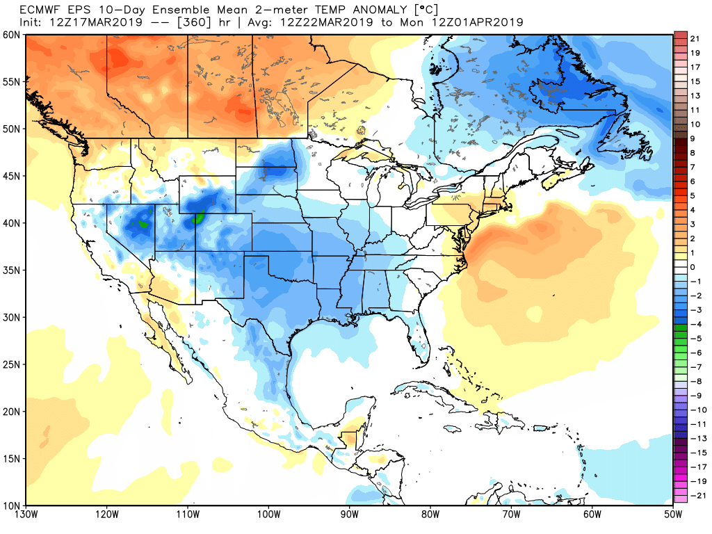
Temperatures are forecast to remain near average or below average through the remainder of the month as well which acts as a blessing and a curse. Of course warmer weather for those suffering from current floods is welcome, but a cooler weather pattern will perhaps slow some of the ice melt we saw last week to round out the month:
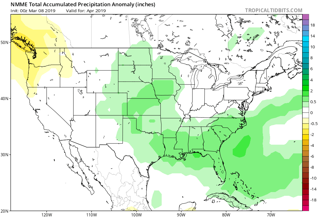
Long term we expect wet weather to continue for the Plains as we head deeper into spring. We've long called for this to be the case on Weather5280 Insider, and now we see more and more climate models begin to agree. Here's the latest NMME forecast for April, showing above average precipitation for the Plains in April:
And plenty of green showing up on the NWS hazard map across the intermountain west, where we're likely to see an active snow melt flood/high river season with many mountain basins running well above average after recent snows: