A Good Chance of Snow Tonight, But How Much?

We continue to track the chance of snow later today and overnight across Northeast Colorado. It looks like most areas will see some snow, with impacts varying greatly depending on temperatures in-your-back-yard, and elevation. Generally speaking, it looks like the potential for a 1 - 4" across the Northeast Plains, with perhaps pockets of 4 - 8" (or more?) for higher elevations west of I-25 and south of Denver across the Western Palmer Divide.
This is a low confidence forecast. Temperatures will be an issue, and there remains a huge amount of variation between the modeling with just how much moisture we'll have to work with as well. Melting, compaction, you-name-it will all play funny games with snowfall totals from this system.
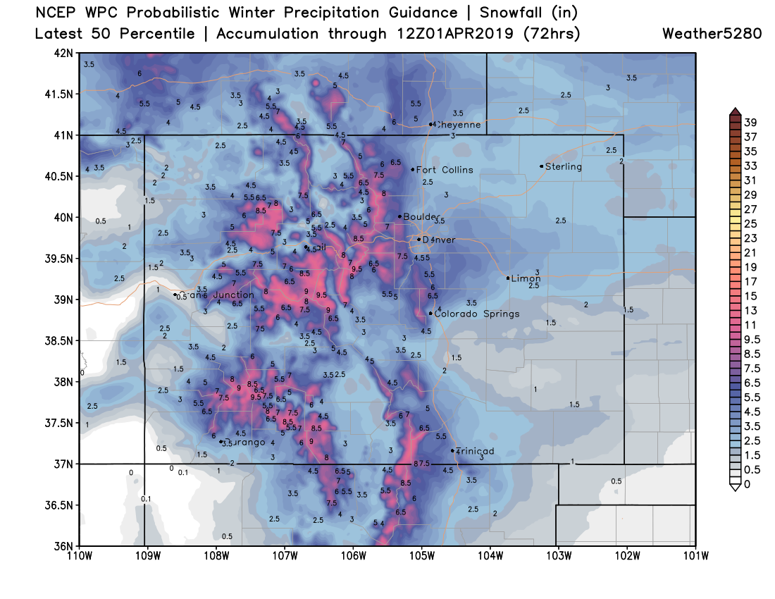
This product from the WPC I think shows the high-end potential with this event. 2 - 5" along the northern urban corridor (Denver, Loveland, Fort Collins), 4 - 8" for areas south of Denver (Castle Rock, Elizabeth, Parker), with perhaps some areas seeing upwards of 8" in the foothills west of Denver. It also happens to look a lot like the European model has looked for several days now, so I wouldn't exactly discount the potential here:
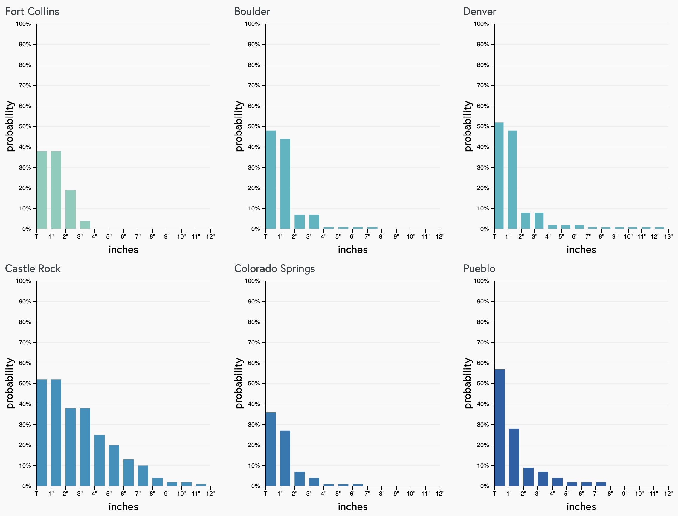
Our gamblers are less bullish. Here we see very little support for accumulating snow in most Front Range cities, with Castle Rock (elevation!) showing the best potential for several inches of snow tonight:
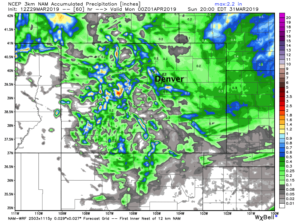
A look at some of the models shows how hit-and-miss this might end up being. Both for snow accumulation, but precipitation as a whole. The 3km NAM shows generally light precipitation, but a few pockets of 0.8 to 1"+ QPF in and around Denver:
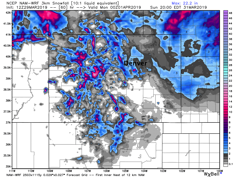
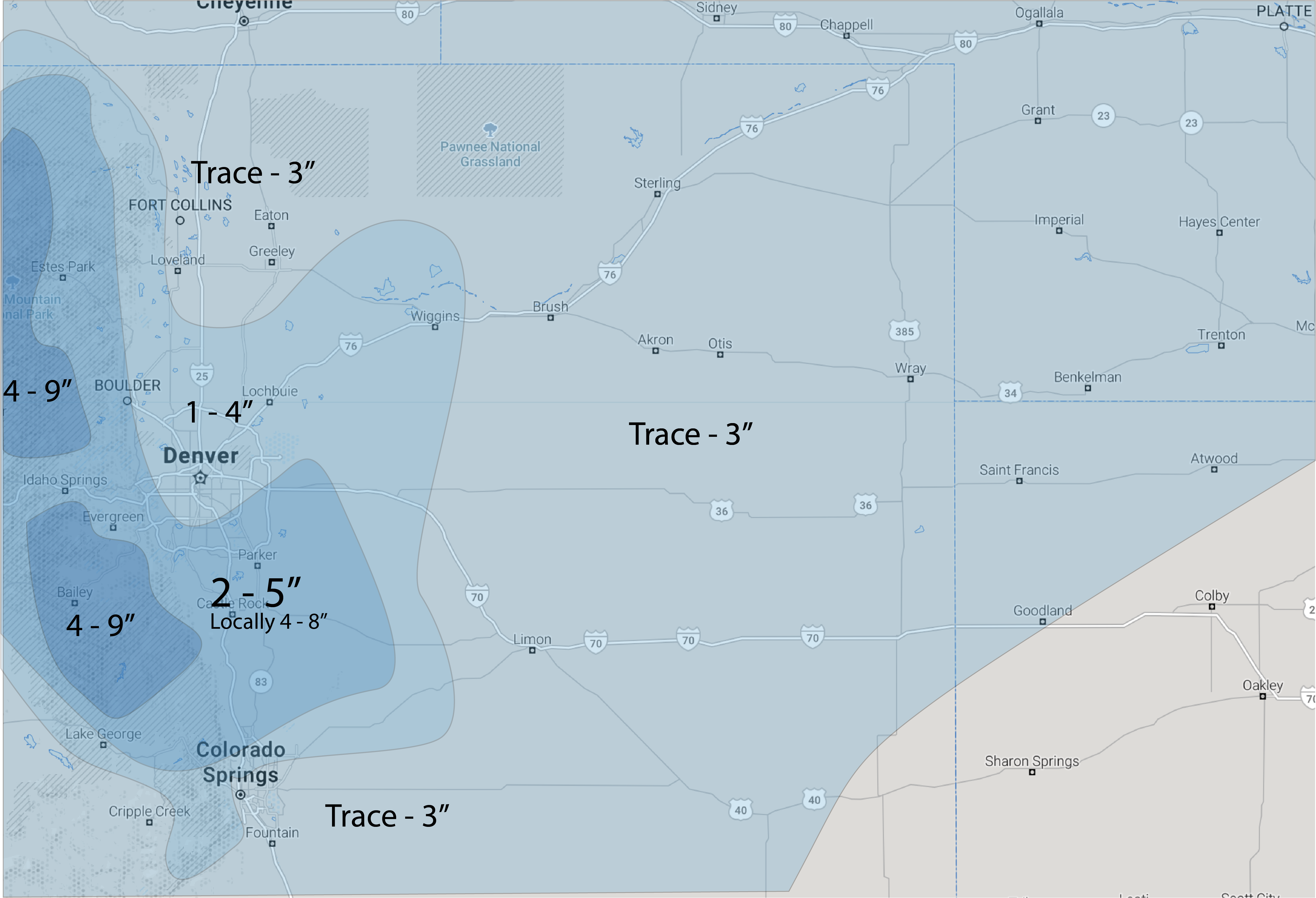
This equates to many areas seeing just a Trace of snow, but others seeing upwards of 5" or so –– over a pretty short distance:
So, while we think this will be one of the haves and have-nots, it's a bit hard to communicate that in a forecast map. We'll go ahead and broad-brush areas in the map below, but know within each zone we're likely to see quite a bit of variation. In the end, a good chance of snow, likely some accumulation, and an otherwise chilly and damp night ahead:
In summary:
- Trace - 3" for Fort Collins area
- 1 - 4" For Denver downtown and northern suburbs
- 2 - 5" Boulder (some boom potential here)
- 2 - 5" southern, southwestern, and southeastern Denver suburbs
- 2 - 5" Western Palmer Divide with 4 - 8" possible should trend toward more snow continues
- Trace - 3" Colorado Springs, with greatest snow potential on the north side
Timing and impacts
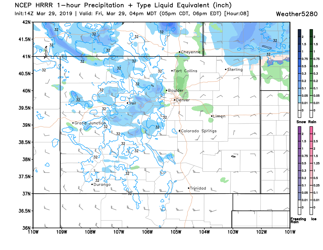
The latest short term high-res HRRR model shows showers pushing across Northeast Colorado this afternoon, general in the form of rain –– perhaps some mixing –– but the snow holding off until later this evening.
Here's its forecast for 4pm this afternoon, some good mountain snow, showers for the plains, and heaver snow north of Colorado across Wyoming and Nebraska:
It has snow pushing into Northern Colorado by 7 or 8pm, with some good snow forecast in the Fort Collins area around 9pm:
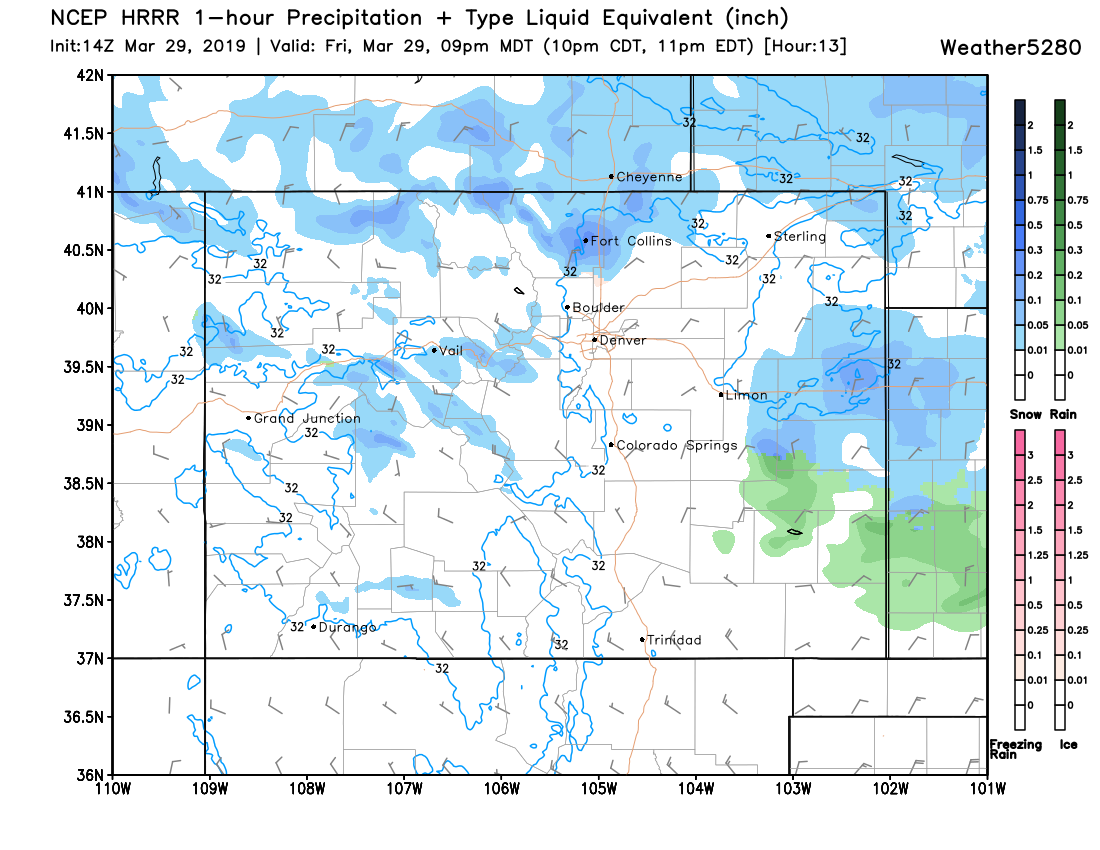
By 11pm we see the snow pushing south into Denver, with pockets of heavy wet snow across the entire northern urban corridor:
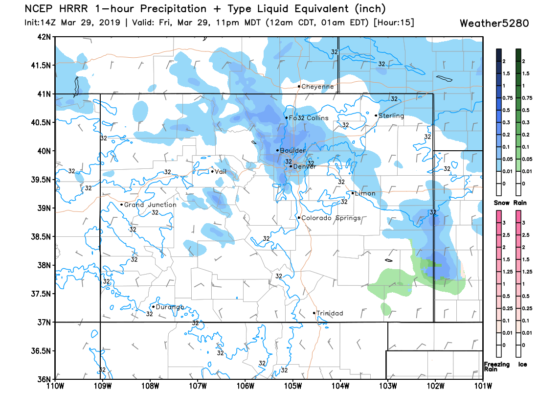
For Colorado Springs the snowfall potential is lower. If you live on the north side of the Springs your potential for a burst of snow (perhaps a few quick inches of slushy accumulation is a bit higher. Timing for the Palmer/South looks to be around midnight or perhaps after for the arrival of the snow tonight.
This is just one model's forecast on timing but looks in decent agreement with current observations and other models as well. I will say the onset of precipitation is usually quicker than models indicate... so perhaps we see the timeline above moved ahead and hour or two –– and if so, do not be surprised by this.
For impacts, I'd expect some slow-going on the roadways tonight under the heavier snow showers. Temperatures aren't forecast to be all that cold (near freezing for most of the duration of the snow in Denver tonight), so tough call on accumulation obviously, but also impacts on roads. Because the bulk of the snow is forecast to come overnight, I'd expect greater road impacts as a heavy wet snow, even if not terribly cold, and slush up the roadways pretty quickly around here.
By early Saturday morning, even as the snow comes to an end, temperatures will dip into the upper 20s. This will lead to icing on the roadways, so if your plans take you out of the house tomorrow morning give yourself some extra time on the roads.
Snow comes to an end fo the northern urban corridor early Saturday, with lingering showers coming to an end across the Palmer by mid to late morning Saturday. A chilly Saturday forecast for eastern Colorado Saturday with highs only around 40 for Denver. More sun on Sunday, but still cool with highs in the 40s to near 50 for Denver.
As always, keep us posted as to conditions at your place in the comments below!