The State of the Atmosphere: Monday, April 1st, 2019
We will cover a couple of things in this week's SOTA. First, a storm recap from Friday/Saturday and second, a look at this week's forecast.
First.
Our forecast from Friday ended up working out quite well, with nice snow for along the Front Range to wrap up what was a cool and wet March for the region.
Our station picked up 2.1" of snow Friday night, while Denver officially recorded 1.5" of snow at Denver International Airport. Both comfortably within the 1 - 4" forecast, and some good moisture.
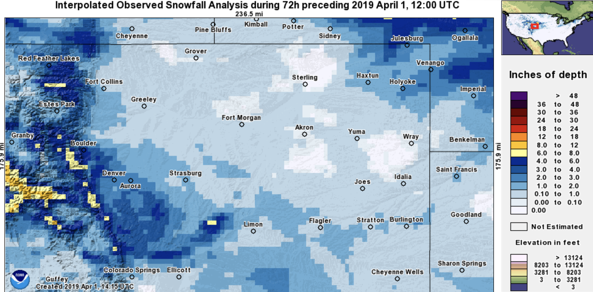
Areas to Denver's west and south did a bit better, with 3.0" for the Castle Rock area, and some 4 - 8" totals for elevations on Denver's west side and up into the immediate foothills:
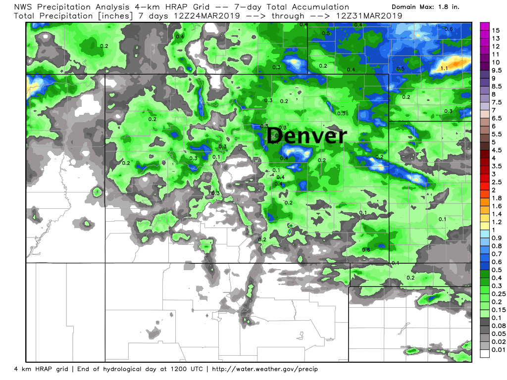
Seven-day precipitation totals shows where the focus of Friday night's storm was –– with a few areas seeing upwards of 1" of precipitation over the last week across the Palmer Divide and far Eastern Plains:
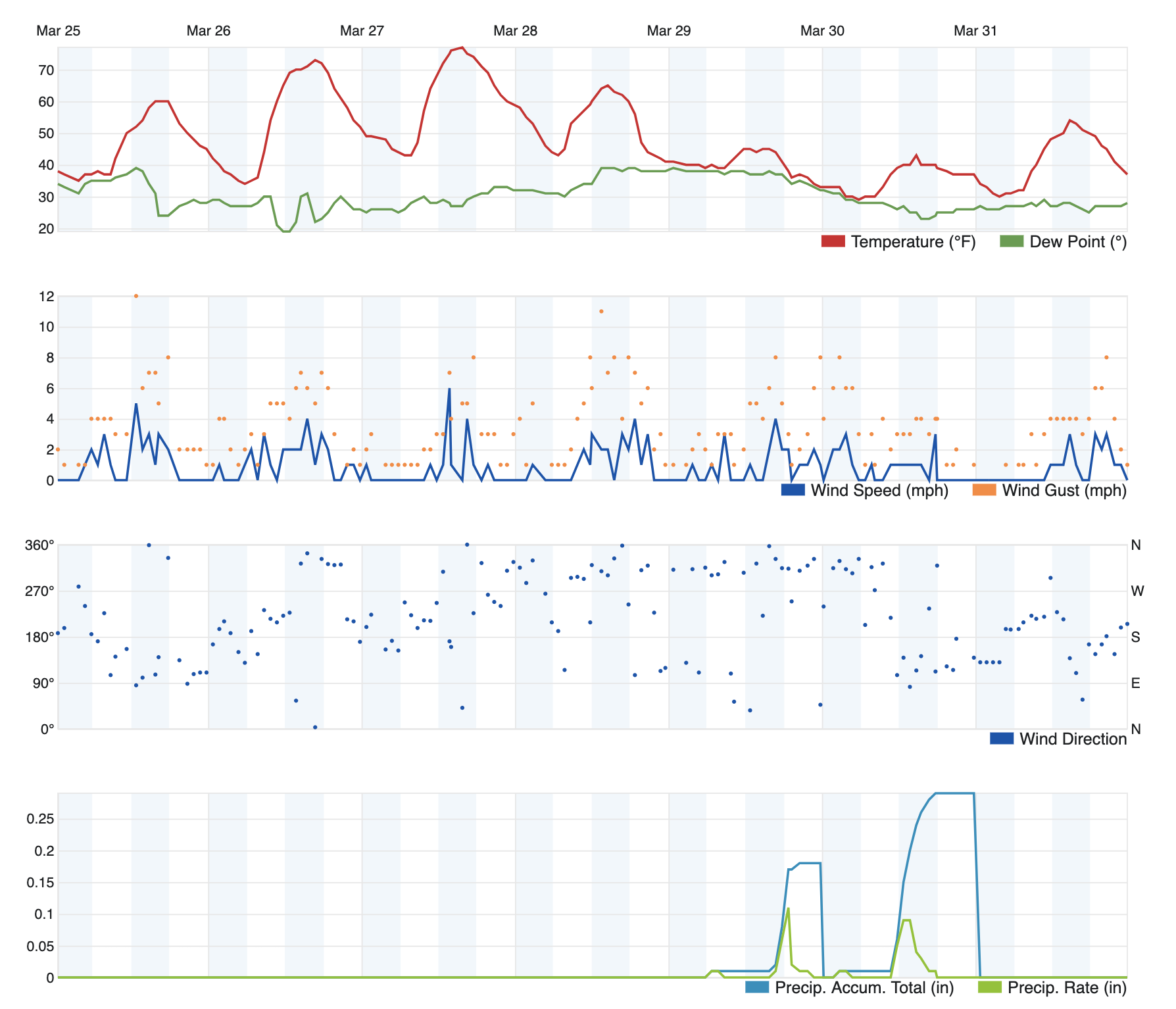
Our station in Denver picked up 0.47" of liquid (rain and snow) between Thursday night and Saturday morning, for a monthly total of 1.69" in March:
DIA picked up 1.39" of precipitation in March, which is 0.47" above average for the month. The airport also reported 12.9" which bests the long-term average of 11.4" of snow in March and marks the second month in a row Denver recorded above average snowfall –– the first time this has happened in over two years.
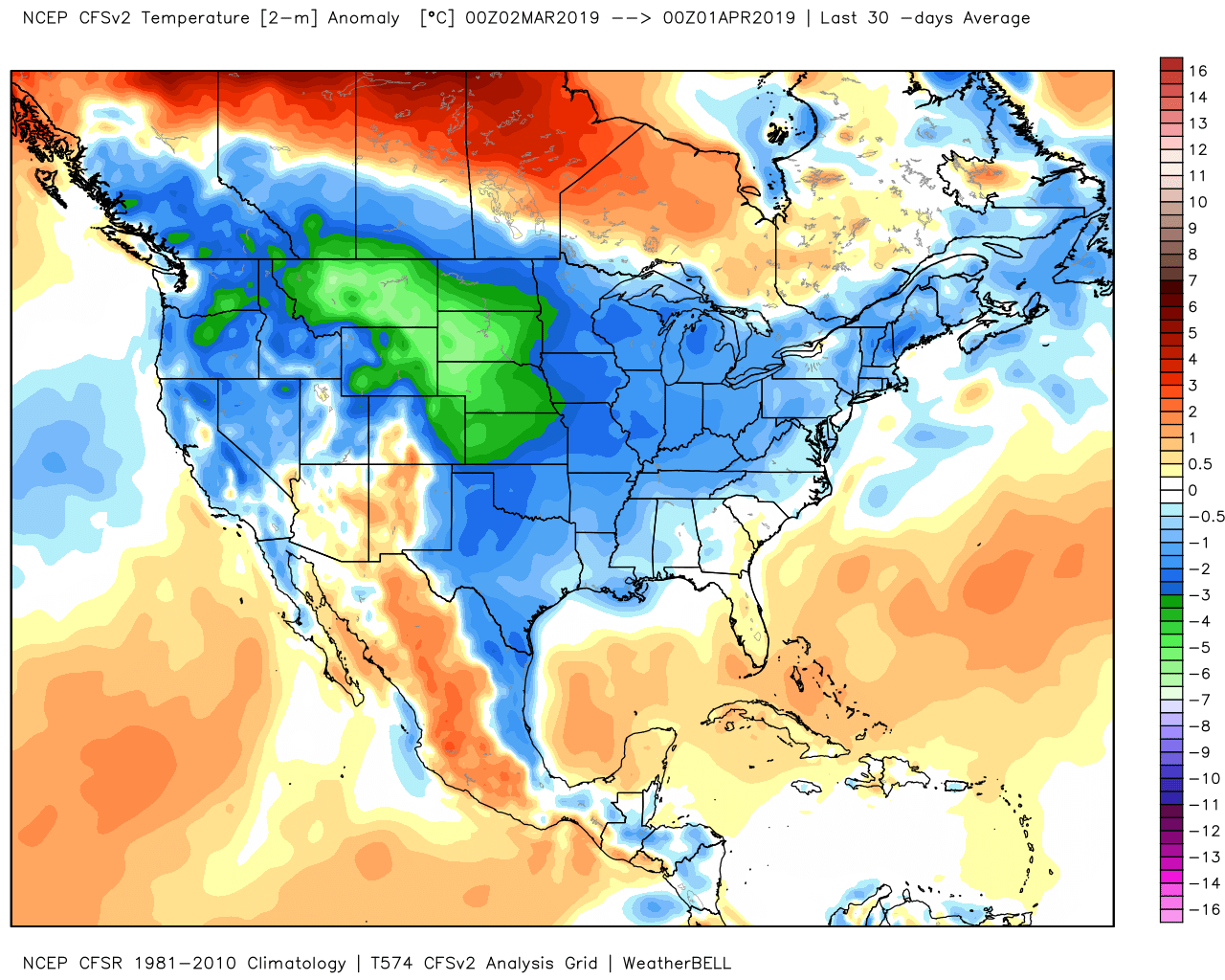
For temperatures, Denver ended March with a mean temperature of 35.1°F, which is a notable 5.3°F below average. The last 30 days have been quite chilly across most of the region, in fact, with the coldest anomalies focused over eastern Colorado and the High Plains in March. For your Insiders, you'll recall this looks a LOT like the CFS temperature forecast from February.
The week ahead
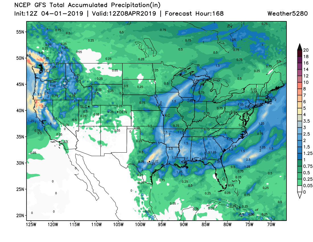
A couple of troughs will be swinging through the region this week and next. Right now, these appear to bring rain chances to Denver, Fort Collins, and the Springs and snow to parts of the mountains. Taking a generalized look at the precipitation coming in the next week we can take a look at the GFS model run of Monday morning running through the first week of April:
Of that total precipitation, there will be some snow. Let's take a generalized look at the total snowfall for the next week:
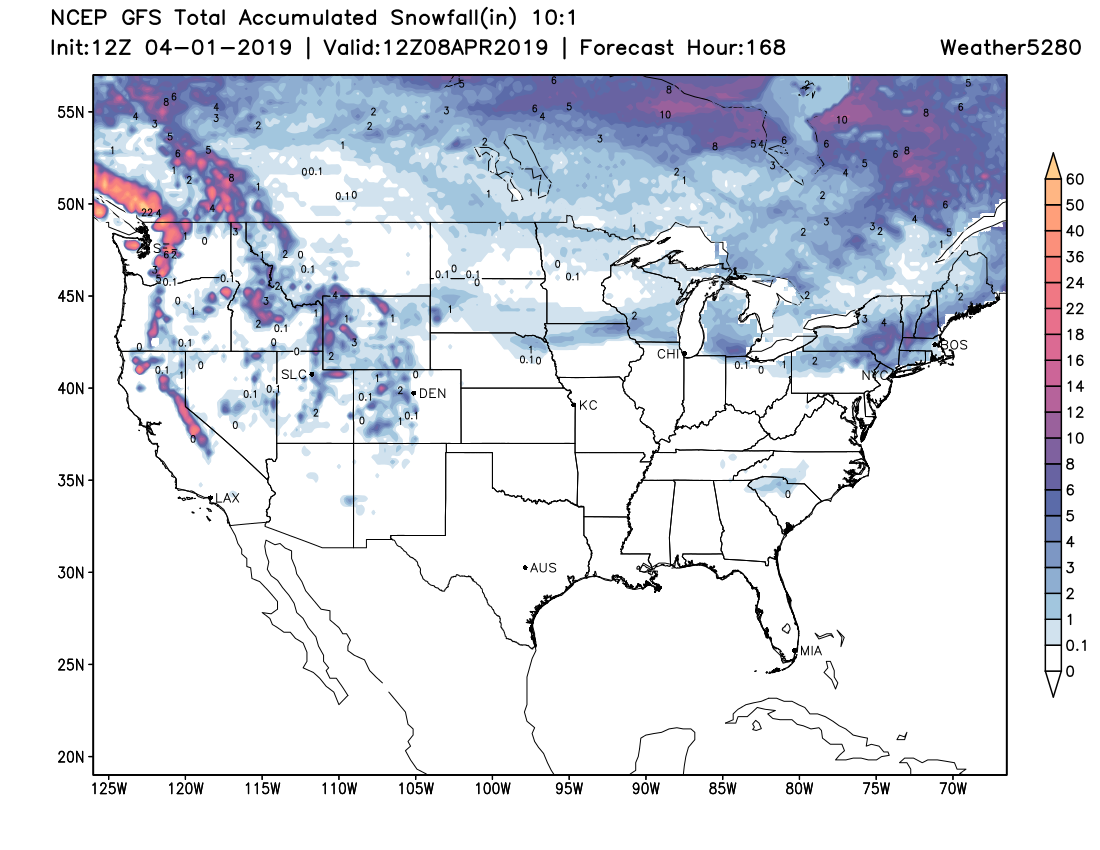
Comparing the two, you get a good sense that most areas of the country are talking rain chances this week with fewer areas talking snow. The Colorado mountains will be one of the areas that will see some snow over the next week.
For the metro areas, rain chance number one arrives late Tuesday and lasts through late Wednesday. Any of this moisture that falls overnight does have a chance of changing to or mixing with snow. Some accumulation would be possible (especially for elevated terrain), albeit light –– and this is something for a future update if needed.
Off and on rain/snow chances are possible throughout the weekend ahead, too.
At this point, these events during the next seven days look like low-impact events as our temperatures are staying warm enough to prevent much snow or ice forming on the roads.
Speaking of temperatures:
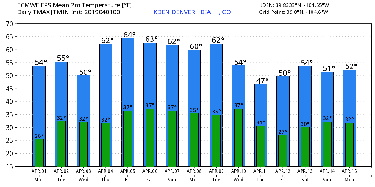
The European modeling shows Wednesday's dip in temperatures with the rain chance but then warms for the end of the week and the weekend ahead. Perhaps next Wednesday and Thursday we could feel a sharper drop in temperatures. NOTE this particular European modeling has been running ~2 to 5º too cool in its forecast versus our observations. I point that out because you may be eyeing Friday's forecast for the Rockies home opener, in actuality we will be getting close to 70ºF for that game.
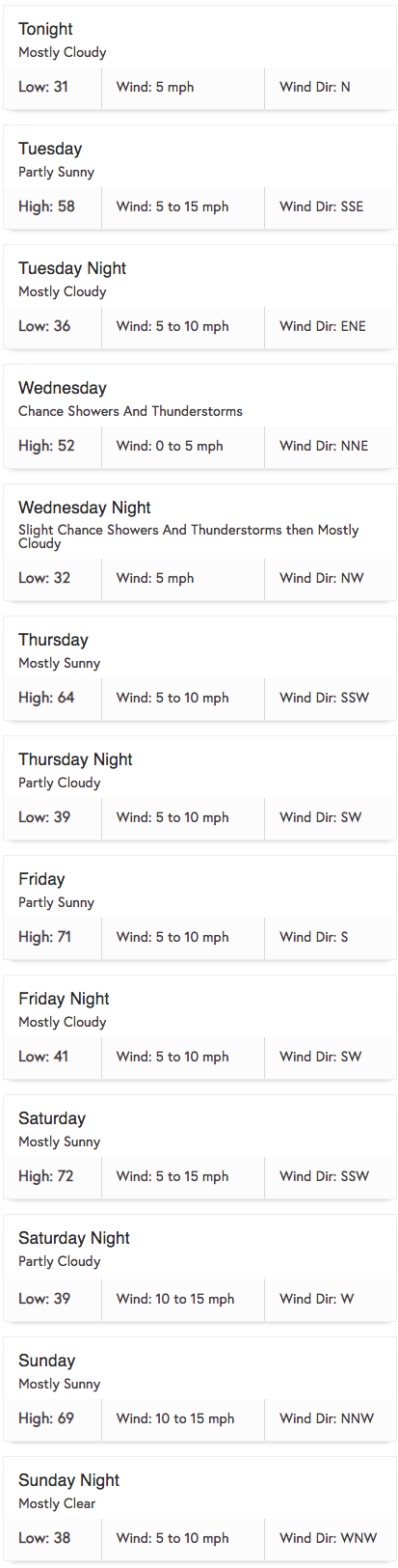
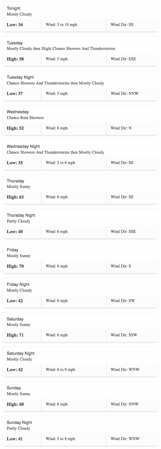
The Denver forecast for the week:
The Colorado Springs forecast for the week: